

Round Craigs Cairn viewed from SE (Yardstick for Scale).


Visited 28.09.22
Round Craigs Cairn is located on a natural knoll c. 50 yards SE of an elongated crag on Round Craigs Summit. The round cairn measures c. 10 yards in diameter and 1 yard high. The perimeter has an intermittent outer kerb of stones less than 1 foot high. Within the cairn there is a discontinuous inner kerb of small earth-fast stones measuring c. 10 feet in diameter and up to 0.5 feet high. The centre of the cairn is a shallow hollow which has been robbed of loose stones.
Round Craigs Cairn is listed as Canmore ID 64354 (go to Links).


Mackilston N Cairn on Canmore
Visited 28.09.22
Mackilston N Cairn is a robbed-out grassy round cairn in pastureland c. 4 miles N of St John’s Town of Dalry. It measures c. 12 yards in diameter and up to 1 foot high. Mackilston S Cairn, a higher mound lies c. 50 yards S. Both cairns are described in Canmore ID 64275 (go to Links).


Mackilston S Cairn viewed from SE (Yardstick for Scale).

Visited 28.09.22
Mackilston S Cairn is a robbed-out grassy round cairn in pastureland c. 4 miles N of St John’s Town of Dalry. It measures c. 14 yards in diameter and 4 feet high. Mackilston N Cairn, a much-reduced grassy mound lies c. 50 yards N. Both cairns are described in Canmore ID 64275 (go to Links).
Mackilston S Cairn on Canmore
Directions to Cairn Pat Hillfort:
Take the A77 heading S out of Stranraer. Turn right for Portpatrick c. 1.5 miles from Stranraer. Stay on the A77 through Lochans for c. 2 miles to reach a concrete road signed as a Path to Cairnpat. You can drive c. 0.3 miles up the road to park at a water tank. The road deteriorates from here, so it is advisable to walk the final 0.5 miles N to Cairn Pat Hillfort.
Cairn Pat Hillfort on Canmore
Visited 02.10.22
There was a hillfort on the summit of Cairn Pat, a natural defensive stronghold rising to 182m above Sea Level. The hillfort has steep sides on the N, E & W flanks affording natural protection. There are intermittent traces of a double rampart defence round the perimeter of the hill giving further security to the occupiers. On the gentler slopes of the S flank there are traces of secondary and tertiary ramparts. The oval enclosure measures c. 130 yards N-S & 110 yards E-W. Cairn Pat hill is now dominated by a tall antenna and radio station building, erected on the centre of the enclosure. A track from the S cuts through the SE Arc of the ramparts leading to Cairn Pat Radio Station. An OS Trig Point c. 20 yards N of the antenna is the only other feature within the enclosure. Canmore ID 60559 (go to Links) provides a fuller description of Cairn Pat Hillfort.

Stroanfreggan Craig Hillfort viewed from NE, along Stroanfreggan Craig ridge.


Mound on W Arc of Treswallock Downs N Cairn.
Treswallock Downs N Cairn on Cornwall & Scilly HER
Visited 11.09.22
Treswallock Downs N Cairn (SX11837838) is a grassy mound bisected by the path to Alex Tor. It is almost entirely robbed of stones leaving a round footprint of irregular grassy mounds measuring up to c. 12 yards in diameter & 2.5 feet high. Treswallock Downs N Cairn is listed as Cornwall & Scilly HER Number: 1970.40 (go to Links).

Treswallock Downs Central Ring Cairn viewed from N.

Treswallock Downs Central Ring Cairn viewed from E.

Treswallock Downs Central Ring Cairn viewed from S.

Treswallock Downs Central Ring Cairn viewed from W.
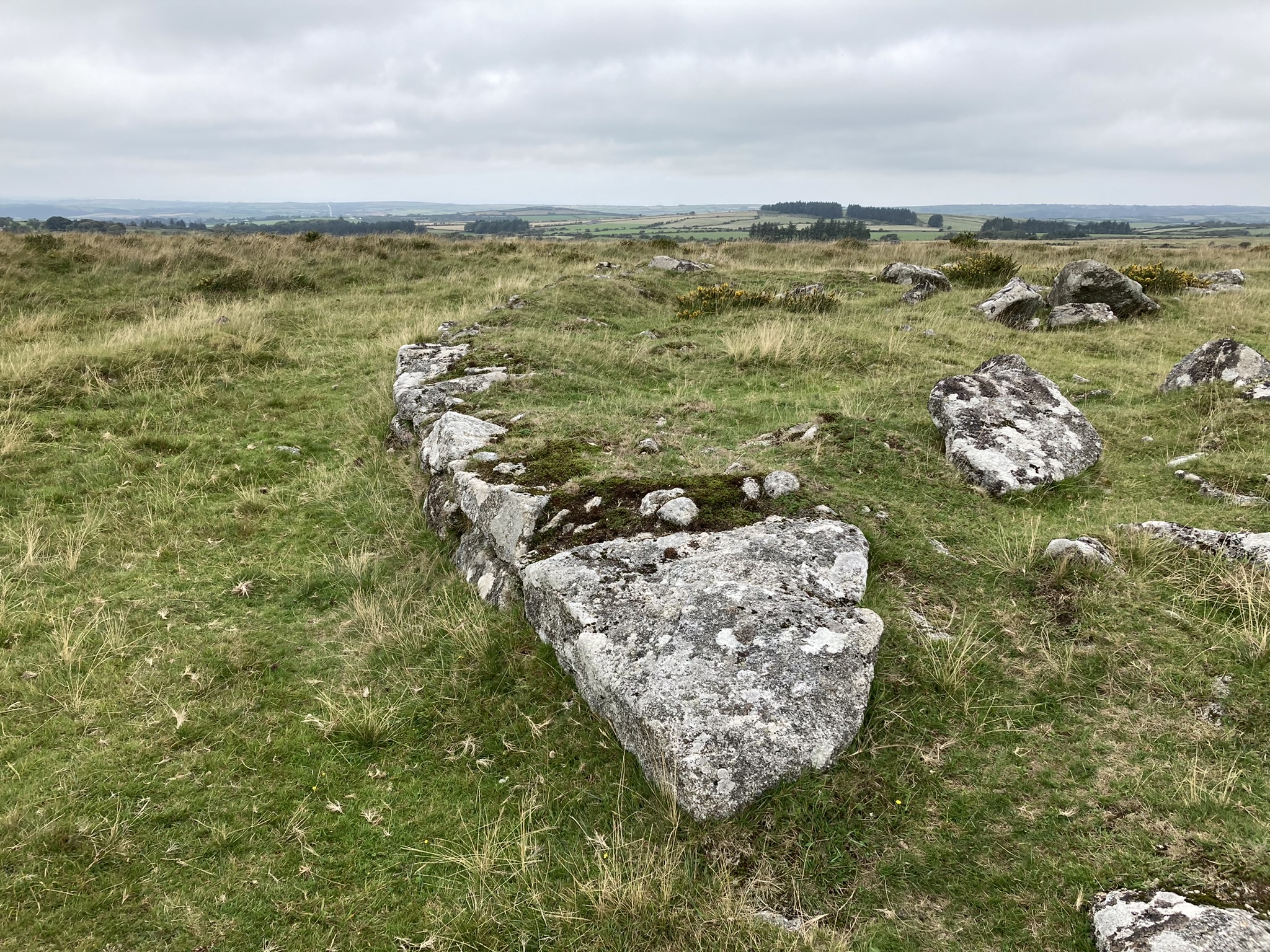
S Arc of Outer Kerb of Treswallock Downs Central Ring Cairn

Stacked Stones on SE Outer Kerb of Treswallock Downs Central Ring Cairn.

E Arc of Inner Kerb of Treswallock Downs Central Ring Cairn.
Treswallock Downs Central Ring Cairn on Cornwall & Scilly HER
Visited 11.09.22
Treswallock Downs Central Ring Cairn (SX11717816) is constructed on a round platform measuring c. 22 yards in diameter & 1 foot high. It has an Outer Kerb, best preserved in the S Arc, measuring c. 17 yards in diameter and 1 foot high. There is an intermittent Inner Kerb of Standing Stones up to c. 2 feet high 2 yards within the Outer Kerb. A continuous Arc of the Inner Kerb can be traced in the E Arc of Treswallock Downs Central Ring Cairn. Large stones lie scattered in the centre of the cairn, probably as a result of stone robbing. Cornwall & Scilly HER Number: 1970.30 (go to Links) give a full description of Treswallock Downs Central Ring Cairn.


