bawn79

bawn79

All posts 351-400 of 2,021 posts

Claidh Dubh

The Claidh Dubh is a linear earthwork of approximately 22.5km in length.

Its first mention in literature was in 1846 the earthwork"is a remarkable ditch which runs westerly from Cappoquin, into the couny of Cork, how far is uncertain. This the Irish call Clee-Duff, and give several uncetain and improbable reasons for this work. As it extends through the plain along the sides of the mountains, it is conjectureed that this was no other than a fence or boundary made to preserve their cattle against Wolves, which coming down from the mountains made frequent havock among them; and this seems the most probable cause why this entrenchment was cast up”. (Ballyhoura Hills Project)

However it is thought that townlands / parish / land divisions do stop on either side of the earthwork and this division dates back in written record to 12th century.

The following link dates the earthworks construction to prior to 100AD and this date links to to other earthworks in Ireland such as the Black Pigs Dyke up North.

excavations.ie/Pages/Details.php?Year=&County=Cork&id=6087

My own impressions of the sections I located was that if this is a linear earthwork then there may be other such earthworks left undiscovered as to me it was indistinguishable from other sections of ditch around it.

Image of Claidh Dubh (Dyke) by bawn79

Claidh Dubh

Dyke

Another section looking west, to me this looks like any other boundary wall in ireland but the map says its part of the Cliadh Dubh.

Image credit: Bawn79 © 2011
Image of Claidh Dubh (Dyke) by bawn79

Claidh Dubh

Dyke

I wasnt that convinced about the Cliadh Dubh until I seen this part of it, it clearly cuts through the landscape here, Ive added a red line to highlight it.

Image credit: Bawn79 © 2011

Caherdrinny

As the Ballyhoura Survey says the most prominent feature of this hillfort is the ruins of the castle in its centre. Those who travelled the old N8 will probably remember this castle as a landmark between Mitchelstown and Ferymoy. Now on the new M8 its much more difficult to see.
The height of the fort is 210m and it doesnt really dominate the surrounding area.
It encompasses an area of 12ha and is 470m east-west annd 330m north south. The rampart is quite clear to the eastern side (where I walked up from) but trickier to follow through scrub on the other sides.

Castlegale

This hillfort is right on the limerick/cork border. A road runs along the northern slopes of the Darragh Hills. There is a signpost for Castlegale hillfort where you can park at the entrance of the forestry track. I went the wrong (but interesting) way climbing over the hill and approaching from the south but you could follow the track east and approach from the north.
Approaching from the south I came upon what looks like the remains of a megalithic tomb built into a stone boundary wall.
The hillfort itself using a natural knoll of rock which gives it cliff faces to the north. There is a double rampart to the south and a single one to the north.
It is known locally as ‘the citadel’.
Seemingly it was heavily forested when the Ballyhoura Hills project surveyed it but the trees must recently been cut.
“The enclosed area is 13,799m2 (1.4ha) and the fort measures 138m (externally) from the northern to southern ramparts; and the interior id 109m (north-south) by 114m (east-west)”

Ive tried to put up an aerial view from Google Earth but this is a fuzzy area on the ireland map.

Castlegale

This standing stone marks the gap in the southern ramparts of the hillfort. It is referred to in the Ballyhoura project as a standing stone.

Castlegale

This cairn stands on top of Castlegale hillfort. The Ballyhoura Hills project refers to it that “it is possible that it was a prehistoric burial cairn, given the spread of stone strewn around the hilltop and the occurrence of similar cairns in locations such as Carntigherna and on the Galty Mountains.”

It is also meant to be the remains of a tower built by the Castle Oliver estate and when the owners of the estate reputedly flew a flag from the tower when in residence.

Id follow what the Ballyhoura project says, that it is likely to have been a reused prehistoric cairn.

Folklore

Carntigherna
Cairn(s)

From the information board

“Around 3000 years ago cairns, “mound of stones” were erected to mark the burial place of important individuals. This bronze age cairn is one of a number, which occupy prominent positions on the hilltops of the Nagle Mountains, stretching westwards from Fermoy to Mallow.

The cairn has been much abused over time. During World War I the British Army built an observation bunker inside it and the Irish Army did likewise during World War II. 100 years ago the cairn was twice as high as it is now and in 1832 “several hundred tons of stone” were taken from the cairn to build a nearby boundary wall. In the process the workmen disturbed a double-compartmented cist (stone grave). Inside were two bronze-age earthenware vessels, containing the cremated remains of at least one individual. One of the vessels was broken by workmen to see if there was treasure insidem the whereabouts of the other remains unknown.

According to legend, Cormac Mac Airt, High King of Ireland in the 3rd Century AD arrived in Munster to demand tribute. When Cormac’s army was fiercely resisted by the Munstermen, his Scottish druids cast spells over the land so that the wells, dried up and both man and beast suffered.

The Munster King, Fiachaidh Muilleathan, appealed for help to the infamous druid, Mogh Ruith, who cast spells so strong that Cormac’s army retreated in disarray and confusion. When the druid came to claim his reward “two thirty hundreds of the fairest land in Munster” – he choose the Blackwater Valley, the ancient land of the Caoilli. The druid Mogh Ruith is said to be buried under the cairn on Corrin Hill.

According to legend a fable cow, the Druimionn, used to graze the slopes of Corrin producing milk to feed Giants. A mysterious quadruped, called the Lon, used to waylay the magic cow in the marshes at the foot of the hill and take her milk. The giants tried in vain to capture and kill the Lon but eventually they summoned the hero, Finn MacCool and his famous hound Bran. Bran tracked the Lon to its lair and finally killed it after a savage fight.

Another legend relates that long ago the king of Fermoy had a son whose death by drowning was foretold. He decided to build a castle on top of the hill to house the boy and keep him safe from rivers and lakes. One day, while the castle was being built, the young prince walked by a barrel of water that was left there by the builders. He had never before seen his reflection and peered into the barrel for a closer look. When the King turned around he found his young son drowned, face down, in the barrel. He cursed the place and abandoned work on the castle.”

Carntigherna

This cairn is on top of a prominent hill just outside the town of fermoy in Co. Cork. Anyone taking the M8 from Dublin to Cork will probably have noticed its prominent cross while passing.

This seems to be another Christainised hill in Ireland. The hill is home to this huge cross on top and a “stations of the cross” walk. A sign-post on the way up to the hill reads that “stations” take place every friday morning on the hill still.

Along with the stations this hill has some great walks and now seems to be widely utilised by walkers, dog-walkers and there were some guys getting ready to go moutain biking as I was leaving.

I had an older version of the OS map without the M8 on it and so finding the correct route up was a little trickier. Basically the road to the main car-park is south of the two roundabouts up onto the M8 using an overpass of the M8 (If that makes any sense)

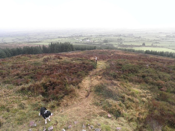
The walk from the car-park to the cairn on top is about 20 mins. I went left up the hill (which is shorter and I think follows the “station” route) rather than right which takes you on a longer walk to the top.

The cairn on top is very impressive, I from The Ballyhoura Hills Project it measures 40m (east-west) by 26m (north-south) and height 4m. Seemingly it is much robbed with its stones being used for a boundary around the hill and the cross itself which was built to commemorate the 19th century of JC’s death.

It was also excavated in the 1830s when they found a cist within. It was a double-compartmented cist which contained pottery vessels. The cist was found after moving hundreds of tons of stone. One chamber contained fragments of a vessel for food and the other ashes. There current location is unknown.

A WWII lookout post or bunker was also built into it.

Castleleiny

I remember seeing this in that book by Geraldine Stout on the Ely O’Caroll area and it was described as a barrow. The OS map describes it as a barrow but then when you go to the Norht Tipp Arch inventory it is described as a ringfort.

What can I say except it is just outside of Templemore and easily viewable from the road. The ditch of the barrow is easily discernible.

Coumroe

This stone circle is only a few miles from where I grew up and yet the first time I visited was only last sunday.
I knew about it since I got interested in megaliths but from the few pictures I had seen, it didnt seem worth visiting. However after seeing it in the stone I think I was very wrong.

I dont know if the picture does it justice but the circle could be very easily made out in the snow conditions showing the east west axis of the circle.
Its tricky enough to find in the plantation but for me that was half of the fun. Its weird but the tree plantation around it gave the circle a sense of otherworld-ness.

Castlefarm

This is one of Limericks “Megabarrows” along with Rathanny, Coolalough and Ballinscaula. The barrow must be about 10-15m in diameter.
Finding it is quiet easy it just north (2 1/2km) of the town of Hospital and right on the side of a small boreen.

Cooneen

From the North Tipp Arch Inventory

“Kerb Circle (Possible) Situated on a poorly drained E facing slope in an upland area overlooking the Nenagh river valley to the SE. The site consists of a circular area (diam 9.1n N-s; 10.3m E-W) defined by 10 low orthostats with a possible entrance gap (Wth 1.9m) at N where two of the largest stones survive. The stones range 0.4-0.9m L 0.10-0.15m and 0.2-0.7m H. The grass covered interior has evidence of several slabs barely protruding above the surface”

This was my second time looking for this site. I followed the GPS this to the grid ref in the Inventory and did a good scout around the area.
It really doesnt look like much, there are a few stones barely protruding above the surface in a very marshy area.
It may save someone going looking for it, on the other hand maybe the Grid Ref is wrong.

Rathra

This hillfort is a couple of miles from Castlerea in Roscommon. The “fort” has 4 ditches and has two mounds within it. They are thought to be bronze age burial mounds and as such Rathra is thought to be a ritual monument. The is another huge mound to the east (which for some reason I didnt take a photo of) which is a possible passage mound.
It is a highly impressive monument and difficult to photograph but well worth a visit. There is a sign into the field where it stands and a stile so there doesnt seem to be any problem with access.
I also saw a very unusual stone within the complex. This stone looked to me like a cross between a sile na gig and a bullaun stone. What is even of more interest was the unusual fossil in one “leg” of it. I wonder was this some kind of inaugeration stone and if anyone has any more information on it.

Some links to further info on Rathra.

books.google.ie/books?id=PNDdQvdFQfsC&pg=PA140&dq=rathra&hl=en&ei=Tx8qTbSCGZKzhAec1tzDAg&sa=X&oi=book_result&ct=result&resnum=6&ved=0CD0Q6AEwBQ#v=onepage&q=rathra&f=false

books.google.ie/books?id=LAvsu0vr-vMC&pg=PA238&dq=rathra&hl=en&ei=wiQqTb75LtSJhQffn7zoAQ&sa=X&oi=book_result&ct=result&resnum=1&ved=0CCQQ6AEwAA#v=onepage&q=rathra&f=false

Image of Rathra (Hillfort) by bawn79

Rathra

Hillfort

This stone has an unusual fossil in the bottom left and also looks somewhere between a bullaun stone and a sile na gig.

Image credit: Bawn79 © 2011