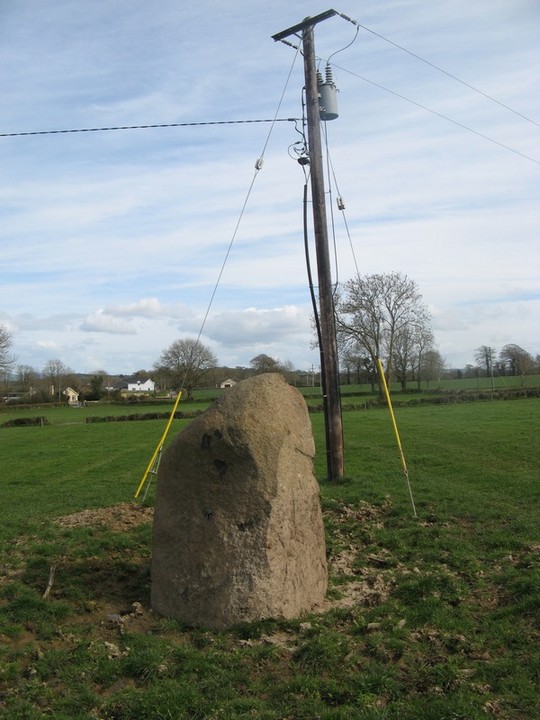
This shows up as a henge on www.Archaeology.ie , dont know much else about it except that. On inspecting it looks a lot more like a normal ring-fort. I couldnt see any sign of an internal ditch but in fairness it was very overgrown. Might be worth a look in winter when the grass has died back a bit. It is located about 4 kms north west of Listowel. You can easily park next to a graveyard which is right beside it.

bawn79

What looks like a man-made rectangular hole in this cap-stone.
Image credit: Bawn 79

The mound with Sliabh na mBan in the background.
Image credit: Bawn79 © 2009
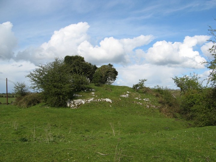
Mullach Inneona was the inauguration site of the kings of An Deise Thuaiscirt from time immemorial until the coming of the Normans. According to legend, Aonghus Nad-fraoich, King of Cashel, granted the territory of Uibh Eoghain and Uibh Fhathaidh (Iffa and Offa E. & W.) to the Deise, as a reward for expelling the Osraige from the area. They gave their name, An Deise Thuaiscirt, to the newly acquired territory. It is related that St. Patrick came to Inneoin to fast against the king, Ledhan, because he had refused to accept baptism from St. Declan. Declan came to Inneoin to meet Patrick. They deposed Ledhan, appointed Feargal MacCormaic in his place, blessed him and proclaimed him chieftan. The Declan and Fergal gave a large area of land to Patrick in which there was a clear fountain, since known as St Patricks Well, which was to belong to Patrick’s successors forever. The last king of An Deisc Thuaiscirt was Maolsheachlainn Faolain. In 1159 he made a grant of land to the Cistercian Monastery of Inis Leamhnachta. With the coming of the Normans in 1160, he gradually lost power and his death in 1205 signalled the end of the Deise Kingdom. Thus ended the reign of Mullach Inneona as an inaugeration site, where for centuries was enacted one of the oldest rituals in Europe, the wedding of the lawful king to the goddess of the place.
When taking a short-cut around Clonmel I spotted this unusual sign. Not sure what it was I read it and called back when it was dryer to view the site. It appears to be a natural mound that was used for the inaugeration of the Deise kings.
What I found interesting was the info boards reference to the “wedding of the lawful king to the goddess of the place” and also the clear views from this area to Sliabh na mBan.

Ended up heading to this low boring mound by accident by mistake thinking it was the more impressive mound of Carn Mhic Tail.
Carleton Jones book on the burren believes that this is a medieval inaugeration site for the O’Connors and O’Loughlins. He says that “Carn Mhic Tail is named after Tailm the ancestor of both Conchobhar and Locklainn, and it was considered the burial place of Tail”. He does go on to say that many medieval inaugeration sites reused ancient burial mounds so as to legitimise their rule.
In this case I would think it would have to be a burial mound of some kind. It is a huge cairn, could be 10-12m high. No idea what diameter.
It is easy enough to get to, it is close to the little village of Kilshanny, dont try to cross the Derreen river to get to it, drive around to the opposite side by the road and it is only about two fields walk from the road in.
This was one of the most amazing barrows I have ever seen. Ive never seen one holding its water in such a tidy and aesthically pleasing way. Looking at the main ring-barrow here it does add to the argument that some barrow/monuments may have used water features to make them more dramatic. I think in this case you will agree it does look pretty impressive.
I presume that the water doesnt stay here year round. This barrow is located alongside a path that can be accessed by driving up the hill to the right coming from the ferry (towards Doonagore tower house). There is a warning sign for dangerous cliffs and this barrow are pretty close to the path/cliffs. You can get a view down to the axe factory from here.
The other two are about 300m farther to the east.
This standing stone is up on a hill beside what i believe is O’Connors pub (cant be sure of that).
As you can see from the picture a bullock was rearing its head behind so I didnt go all the way up to see it.
Carleton Jones book on the burren gives it only as a probable standing stone. His reasoning being that it can be clearly seen from Doolin House, the old MacNamara residence and that it may be a folly. In support of this is the fact that it is not marked on the OS Map as a standing stone. I suppose without excavation it will be impossible to know for sure.
I would never have heard of this except for the book by Carleton Jones “The Burren and the Aran Islands”
He gives a ref from the Journal of the Limerick Field Club 1905 “Flakes, hammer-stones and broken axes were lying about the place in a very instructive way. The axes were probably broken in the process of manufacture and through away as useless” and shows drawings of the artifacts found.
He thinks that it may have been a stone axe quarrying site during the Neolithic and possibly into the early Bronze Age.
He goes on to mention that a beach is a boundary area which the neolithic people may have seen as sacred, the boundary between the sea and the land. This place was doubly so because this sacred area also naturally produced axe heads.
It is easy to find over to the left from the aran islands ferry at doolin and makes a nice walk. The ferry area was a hive of activity but no one seems to walk over here at all. The sea rolled stones would seem to make natural axe heads.
I recently purchased “The Burren and the Aran Islands” by Carleton Jones and had been meaning to have a look at some of the sites around Doolin in West Clare.
Im not that familiar with court tombs but this one looks to be fairly ruined with only half of one of the kerbs of the court remaining. It is interesting though in that as Carleton Jones states in his books on court tombs that they seem to be monuments that are hidden away in the landscape. This court tomb follows this pattern and is reasonably difficult to pick out and doesnt seem to take in any obvious views.
To find it take a cul-de-sac down towards a camp site and stop at the sign for “Beware of Bull”.
There seems to be a good few beefy looking bullocks around so I would be careful what field you stubble into here.
I have give 10 digit GPS ref because it is difficult enough to spot with all the rock here and the bushes.
There seems to be a few large boulders strewn around it and you would wonder whether they had any bearing on its location?


Note the unusual walls built from the sides of the cairn.
Image credit: Bawn79 © 2009


Wide view to get an idea of the size of the cairn in comparison to the houses.
Image credit: Bawn79 © 2009


Second ring-barrow not as much water being held in this one.
Image credit: Bawn79 © 2009


The standing stone and its guardian.
Image credit: Bawn79 © 2009

The Axe Factory Beach
Image credit: Bawn79 © 2009

Looking out to sea over a large boulder on the landscape. The tomb doesnt seem to really take in any views out to the sea.
Image credit: Bawn79 © 2009
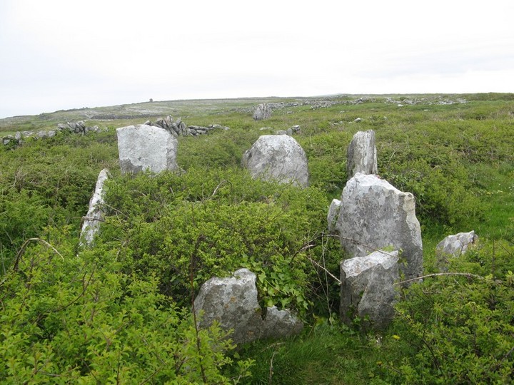
The “tomb” part of the court tomb looking northwards.
Image credit: Bawn79 © 2009


The setting of the court tomb. Cliffs of Doolin to the south.
Image credit: Bawn79 © 2009
The main cairn on top of Knockma is huge, easily up there in size with Queen Maeves Cairn on Knocknaree.
Its very difficult to see with the trees around it and does call into question how some hill-top cairns would have been visible if foliage began to encroach.
Its also a welcome change from having to climb over ditches and rivers as there is a path all the way up to the cairn. There is a parking area on the north side of the hill and the walk up to it seems to very well used.
Although funnily enough the cairns themselves arent easily viewed from the path. So either you need to go up here when the trees dont have leaves or else bring a GPS.
There are amazing views to the south and west with many interesting mountain ranges.
There is a second smaller cairn which seems to have been modified into a defensive structure.

The second cairn on top of Knockma, it looks like it has been modified for defensive purposes.
Image credit: Bawn79 © 2009


“It is sited on low lying ground near a turlough (an intermittent lake) which was the general location favoured by portal tomb builders”
Tipperary History & Society – William Nolan & Thomas G. McGrath
While taking a spin in the Glen of Aherlow I found a sign to Rock an Tarbh, being curious to what it was I took a walk over and found this odd looking rock feature that looks a little like a bull.
Im not sure if this has any folklore attached to it or how new the name is but it would be interesting to find out whether it has an ancient pedigree.


Kilfinnane Motte is thought to originally date from the early medieval period where it was a seat of the Kings of Munster. To me where it is located suggests it may have a much earlier date and may have been reused a number of times.
The bronze age complex of Cush is only 3 kms away.
The mound itself is 10m high and situated within the town of Kilfinnane. The three ditches around it are an unusual feature.

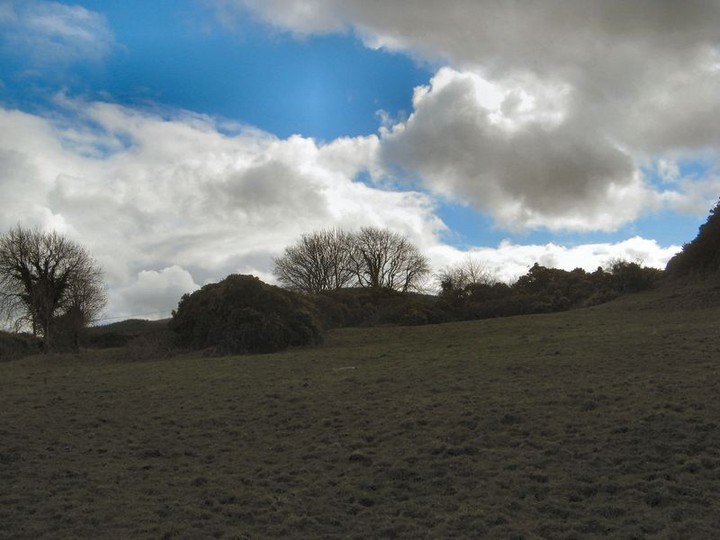

This is a rather sorry looking standing stone that is marked on the OS Map. However Ive seen many others that arent marked that look more convincing than this one. It is about 500mm high and only a few metres from a ringfort.


I found this possible standing stone when I went back to photograph the stone at Skahard.
This stone is even more impressive and if genunine is a real corker.
Its over 2.5m and from one side looks like a thin slender standing stone and from the other more of a behemoth.
It is situated on a hill near the school of Bohermore just on the outskirts of Limerick City.
Both standing stones in the area are intervisible from a ring-fort as can be viewed in one of the pics.
For some reason this stone is named as a “stone circle”
The 25” 1840s map shows this as a Legaun with no mention of a circle.
I noticed this possible standing stone while trying to find a short-cut into Limerick during the snow back in March.
Not 100% that it is a standing stone but it is a big hunk of rock that is standing. Not too much of this kind of thing in what is prime farm land.
It is about 1.75m high and is behind an old and newly built house.
There are electrical lines running over it and I wonder is the damage to it something to do with that because it seems pretty recent.
Just outside the town of Pallasgreen on the left hand side travelling towards Limerick is this possible standing stone. It is not marked on the local OS map.
The fact that their is a blackthorn bush growing on it would suggest some fairy folklore to the local populace.
It is situated on the low slopes of Cnoc Greine.