CianMcLiam

CianMcLiam

All posts expand_more 951-1,000 of 1,041 posts
Image of Carrowkeel – Cairn G (Passage Grave) by CianMcLiam

Carrowkeel — Cairn G

Passage Grave

Summer sunset shining through the light box into the rear of the chamber, just before 10pm on the 2nd July 2005. Because the passage is so short Cairn G is not nearly as accurate as Newgrange or even Loughcrew Cairn T which have longer passages. This means a good sunset two or three weeks before or after the Summer Solstice will be quite similar to the main event.

Image credit: Ken Williams

Ardgroom Outward

This is a beautiful circle and the stones look as ancient as they should do, covered with a thick layer of lichen. Some stones are very human like in stature and shape and get really creepy when it darkens.

It rained heavily while I was here and I was very glad a stone causeway of sorts has been laid to take you to the wooden step-over that brings you into the field with the stones. Its still a bit boggy in wet conditions but could be a lot worse. Unlike some sites the locals (landowner?) seem to encourage visitors, there is a little purple sign to point you in the right direction as its not immediately obvious which is the best way to get to it.

The views are spectacular, even in mist and drizzle, the fog blowing over the mountains above adding to the epic-like feel.

No photos this time though.

Poulnabrone

As you can see in some of the photos above there is now a rope around the small cairn with a little sign ironically asking people to respect the moument. There was some small scale building work going on near the gate to the tomb at the roadside last time I was here and I had the horrible feeling they were building a turnstile or something to ‘manage’ visitors. Turns out its going to be a small wall probably with a plaque and some info on it. Or maybe a stall for selling “Mum went to Poulnabrone and all I got was this lousy T-Shirt made by a six year old in the Far East” type stuff.

While I was here I met some genuine bone fide idiots: two were dancing around it on one leg in their bermuda shorts making ‘pow wow wow wow’ noises and another was asserting to the older folk that sacrificed animals were placed on top to please the sun god. Marvelous.

Image of Leana (Cl. 68) (Wedge Tomb) by CianMcLiam

Leana (Cl. 68)

Wedge Tomb

Looking from the rear of the chamber, straight through it and directly at Parknabinnia (Cl. 67) in the red box. I’ve blown up the original shot to be completly sure!

Image credit: Ken Williams

Clooneen

The extremely large Ballyganner tomb was the first visit today, this was the last, therefore I could appreciate the massive size of this with not too much of a comparison to the more visited site.

Its fairly easy to spot as you reach the top of the hill on the farmtrack, you can see the front edge of the huge capstone. As you get nearer though it dissapears from view and you have to keep your bearings to find it.

Its BIG! Probably second in size to BGS I. The capstone is in place but is either two seperate stones or has broken, the inside has cairn debris piled up. It now also has a large tree as a companion and it seems to be growing from the tombs rear end. In front is a small altar like outcrop.

Image of Parknabinnia (Cl. 67) (Wedge Tomb) by CianMcLiam

Parknabinnia (Cl. 67)

Wedge Tomb

Looking north at the tomb entrance through the odd notch that seems to be cut out of the centre stone in a three (possibly more) stone “alignment”. There is another large rounded boulder directly behind the notched stone, again in line with the tomb. Disclaimer: This is just an observation, most likely means nothing!

Image credit: Ken Williams

Parknabinnia (Cl. 67)

What a little gem this is, so close to the road too!

I noticed something interesting in the next field that got me excited, something I haven’t seen mentioned before anywhere. In the next field south of the tomb there is a set of large stones in a rough line very close to one another. The middle stone has a very clear U shaped groove in it and on each side is a large boulder. If you stand on the south end and look through the groove from where the south boulder is, your looking straight at the tomb above! If you look from the north end (from the tomb entrance direction) the groove points directly at a notch in the horizon where two hills meet. Very intriguing. This tomb, as has ben pointed out before, is unusually aligned north-south.

See the image above for a view looking northish at the tomb.

I spent quite some time here, scanning the tomb and scanning the countryside for something that would make the little red dots on the OS map make sense. Too many thornbushes and too little time..

Image of Cairn T (Passage Grave) by CianMcLiam

Cairn T

Passage Grave

There were quite a few people here today so some volunteers were comandeered to block the strong daylight coming in through the entrance which washed out previous photos.

Image credit: Ken Williams

Uragh

It should have been perfect! Such a beautiful little circle in an amazing landscape, at sunset...

Its easy to find as long as you dont take the left at the fork in the lane, its signposted well apart from here. The little honesty box really bemused the people who were leaving as I arrived, I gave the ‘subtley suggested’ donation of €2. From the other photos I assumed it was very high up on a mountain side but its on quite a low ridge compared to the surroundings. The waterfall in the photos above seems to be very weather dependent as I could not see it at all but I could make out its path down the mountainside.

There had been glorious sunshine all day so I was a bit dissapointed that it clouded over as I made my way across the soggy bog. When the sun did eventually come out, so did the flies, the most savage swarm of the little buggers I’ve ever had the misfortune of walking into. They were truly vicious, they got in everywhere, down my neck, and up my sleeves. I had to retreat to the car defiantly taking zoom shots from the top of the hill on the way back.

M3 through Tara gets the go-ahead from Minister

The Minister for the Environment, Dick Roche, has cleared the way for the construction of the M3 motorway by issuing directions to Meath County Council on how archaeological work is to be conducted.

Speaking at a press conference this afternoon, Mr Roche said that stringent conditions would apply.

Commenting on a controversial interchange one kilometre north of the Hill of Tara, the minister said the National Roads Authority was putting in an alternative lighting scheme and extensive landscaping.

He added that in order to protect the landscape around Tara he told Meath County Council to ensure that the new development plan protected the rural character and archaeological heritage of the area.

Given concerns that massive developments would take place along the new motorway, the minister said he would consider using his powers to direct the council to amend its plan if it was not up to standard.

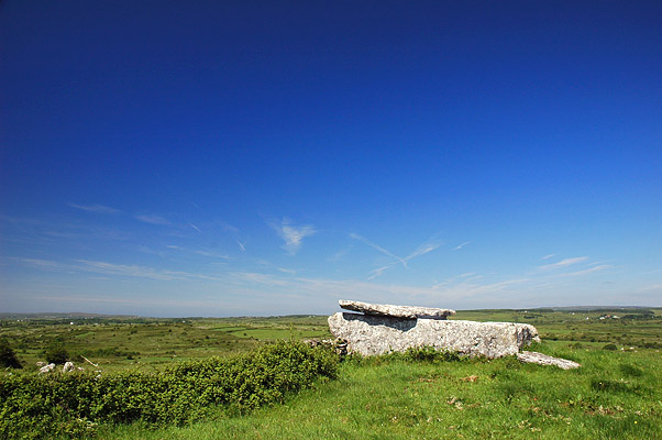
The controversial project was approved by An Bord Pleanála two years ago, but many archaeologists and historians have argued that part of Ireland’s most important heritage site will be destroyed.

The Director of the National Museum, Dr Pat Wallace, had submitted a report to the Environment Minister in which it is reported he opposed the routing and, in particular, an interchange north of the hill.

rte.ie/news/2005/0511/m3.html

Image of Ahaglaslin (Portal Tomb) by CianMcLiam

Ahaglaslin

Portal Tomb

The sun was right behind it so it was hard to get a decent photo from any angle except above it, here you can see the partially collapsed chamber and the ivy growing up the front topping the capstone with a fringe.

Image credit: Ken Williams (CianMcLiam)

Bohonagh

I don’t usually get odd twinges at most sites. Maybe it was just the fact that the portal stones were as tall as me, but walking through them felt like the feeling you get going through a police checkpoint.

The electric fence is too damn close, other than that this is a nice circle with some odd bits and pieces lying around outside it.

The southern part of the ridge it sits on is rapidly becomming engulfed in briars, hopefully someone in the locality keeps it in check.

Ahaglaslin

I nearly hit a ditch on the main road to Rosscarberry when I saw this clinging to the side of the valley. I wasn’t expecting it to be so near the road, in fact I thought I wouldn’t have time to go and find it at all. It ‘looks’ accessible from the road and with all the gorse and bracken removed from around it, it stuck out like a sore thumb.

After a few minutes knocking on the door of the farm and shouting into the various barns I gave up looking for permission and directions and made my way downhill. I probably went the hard way, figuring it would be easier to see looking up the ridge rather than down, there may be a path there somewhere but it was a pretty hairy climb up to it once I finally found it.

It is a very nice tomb, the chamber is too collapsed to climb inside though and it leans at a seemingly dangerous angle. It has two plate like stones lying horizontally on the backstones supporting the capstone, careful planning and practical construction most likely saved this tomb from total collapse.

A nice tomb with plenty of character.