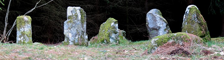
The two sighting stones viewed from the S.
Just over 1m high.
When the site was first examined, these two stones (and one other) were found on the ground and it was discovered that they fitted into two socket holes on the sighting platform.
The two sighting stones viewed from the S.
Just over 1m high.
When the site was first examined, these two stones (and one other) were found on the ground and it was discovered that they fitted into two socket holes on the sighting platform.

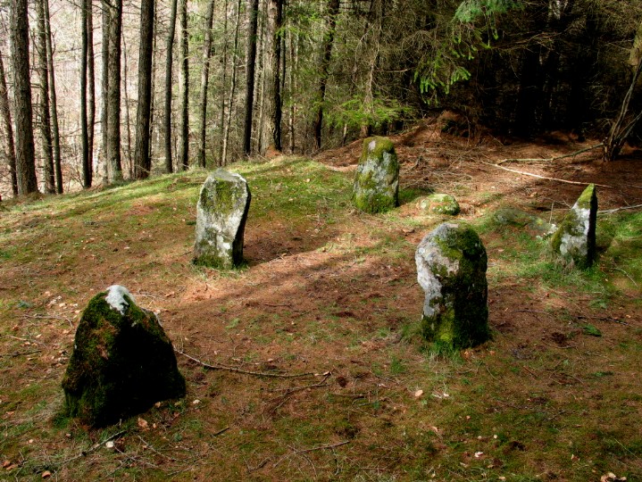
The viewing area for the main platform {B}.
This is a natural rock but standing behind it provides view over the platform and the sighting stones to the horizon.

View from the upper platform {A}.
The main viewing platform and the sighting stones can just be seen in the distance. In front of them is the viewing area.
The sunrise cannot be seen from. Quartz was found in the area and also a late 2nd millennium bce radio carbon date.

Site information board for platform.
Showing the main features of the platform area.


Standing stone near the lower car park.
1.8m high.

The Oak Bank stone {L} in the foreground.
Thought to have been a standing stone with its base at the left of the photo. However there is no evidence of the packing stones which would have been necessary to hold upright this 3.4m long stone.
A line from its supposed base to a cup mark on a rock 35m SW continues to a notch 1.5 Km distant in the direction of winter solstice sunset.

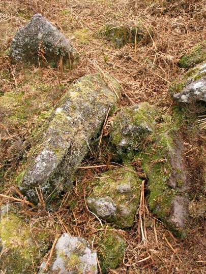
Cup-and-grooved rock {K}.
Part of the problem of this site is that the groove here does not correspond to any significant astromomical alignments.
Compare rock {J} on the next image.

Cup-and-grooved rock {J}. One end of this is oriented on a 1 Km distant notch with a declination close to zero degrees corresponding to the equinox sunset.

General view.
The entrance faces just N of E.
S of the entrance, one stone of the facade remains – 2.6m high and max 1.7m wide.
It is now difficult to distinguish the extent of the cairn amongst the landscape garden features. When excavated in the mid 50s, trenches were dug which suggested it was 34m long and at least 22m wide at the entrance.
Some evidence of activity in the forecourt. A pit containing 2,500 marine shells was found. A further 2,500 were found in the chamber.

The facade and the entrance.
The drystone walling is a modern reconstruction.
The entrance has a double set of portal stones. The outer pair has one surviving to 2.5m. The inner pair are about the same height as the chamber walls (2m).


The chamber.
4.2m long, around 1.6m wide and 2m deep.
Divided into three compartments by two septal stones. Human remains found in the central compartment.

The W dolmen.
Originally this stood here alone in a round cairn incorporating a wide V-shaped forecourt.
When the E dolmen was built, the long rectangular cairn incorporated this dolmen.


The E dolmen and the later of the two.
Two lines of stones extending from the W end (one running in line with the chamber and the other curved to the SE) indicate a possible forecourt area here also.

The cairn which was added when the E dolmen was built incorporating the earlier W dolmen (in the foreground).


General location and view of the cairn from NE.
This is a Clyde cairn 13.5m long and facing E. The only chamber visible is the axial one.
The approach along the forest track brings you to the left of the trees in the photo.

Looking W ie at the front of the cairn.
It is 8m wide at this end with a shallow facade more visible N of the axial chamber.
In this photo, the facade runs from the near-centre stone to the right. The chamber is immediately to the left.

From the NE. The facade stones can be seen running off to the left with the chamber stones at right angles to them.
The chamber from the W ie looking towards the entrance where the collapsed sidestones are.

A panorama of the front (E end) of the cairn in its setting. (2004)
It is 15.2m maximum width at this end.
To the right are the Loch Lomond hills.

The facade from the S. 2004
The width of the facade is about 11m and its depth about 3.4m.
The dry-stone walling between the facade orthostats, clearly seen in the mid 90s photo, has now largely fallen or is lost behind vegetation.

Forecourt and facade from the N – 2004.
The stone in the midle of the picture is 1.8m high and is one of the facade stones. It was re-erected in the early 60s and can be seen in its upright form in the mid 90s photo. It has now fallen again.
The stone in the foreground is 1.7m long and, when upright, would have been one of the endstones of the facade.

Portal stones – 2004.
The large stone on the right (N) is 1.7m high and is part of a pair of portals on that side. A pair also existed on the left but the front one has now gone.

Lateral chamber – 2004.
It sits about halfway up the cairn and is the only visible chamber in the structure.
Compared to the mid 90s photo, it is now barely visible due to vegetation growth.

Looking SE from the rear of the cairn over most of its 56m length.
You can see how close to the forest it is.
2004

This is the view as you approach the cairn from The Whangie. The forestry behind it is quite a distance away.
It is a Clyde cairn facing E. Its most visible feature are the two portal stones of the axial chamber. No evidence of any other chambers has been found.
The E end is 11.5m wide. There is no sign of any facade stones although the cairn material suggests a shallow forecourt.