This is a log of visits to various sites from a number of Ambient Rambles over the years, with a number of people. Mostly around the Yorkshire Dales and the Scottish Highlands.
The Witch’s Pool and Glen Elg Brocks
On a trip into the Highlands with Scott and Shaun in May 1998, we’d stayed with a guy called Geordie who was building his own house near Drumnadrochit, overlooking Loch Ness and were now making our way over west for a couple of nights in the Bothy at Glen Torridon.
Near Loch Arkaig we came across a waterfall near an old bridge, down what is known as the ‘Dark Mile’ that seemed like an ideal place to have a poke around. Shaun and I climbed the path at the side of the waterfall and found a wonderful spot at the top. The hillside stream enters a natural rock basin where the water bubbles and boils as if in a deep green cauldron. The water then tumbles over a short ledge and on to a big waterfall into the pool below. The rock around the basin has an amazing swirly, almost psychedelic stratification. Not a megalithic site as such, but I can’t imagine that this place went unnoticed and it must have had some pretty powerful associations in pre-history.
The folklore of the site tells that it got it’s name after the Camerons once chased a witch, in the form of a cat, over these falls to her death. But I suspect that the name originates from the time of Christianisation of Scotland and reflects it’s older pagan associations.
Carrying on northwards we took a diversion over Bealach Mam Ratagan with it’s stunning views over the Five Sisters of Kintail, down into Glen Elg. Near the old Red Coat Barracks and the ferry to Skye are two magnificently preserved Iron Age Brocks, Dun Telve and further down the glen, Dun Troddan.
Both brochs retain about a half of their walls up to about 25ft high and many of the steps and galleries within the walls. Dun Telve still has its entrance intact, which is pretty megalithic looking. They must have been pretty forbidding when they were complete and inhabited with people defending it!
Clava Cairns
Later the same year I returned to Geordie’s, this time with my old friend Carol and her two young lads. Before we made our way over to Glen Torridon, we went for an Ambient Ramble around Loch Ness. After appeasing the young ‘uns with a visit to Urquhart Castle (nice loch, nice ruins, but clipped and pruned to death and crawling with punters) we headed out to more remote areas to seek out the local pre-history.
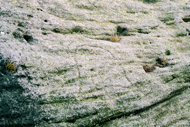
Trundling along we spotted signs for Corrimony Cairn in Glen Urquhart. A beautiful example of a Clava type cairn with a surrounding stone circle. When excavated in the 1950’s, many of the stones were found to be replacements and the outline of a crouched burial was found. There is also a cup marked slab which may have been part of the cist cover.
Onwards over to the eastern side of Loch Ness for a trundle over the higher moors. Skirting the edge of a plantation near Inverness, I spied a very obvious standing stone in the field. Gask is a Ring Cairn with most of the kerbstones still intact. Three standing stones remain from it’s circle, the largest being the one I had seen from the road, which is a massive flat slab about three meters high and the same wide. I liked this site as it hadn’t been trimmed or prettied up for visitors at all.
Next stop, the Balnuaran of Clava. Three of the many cairns in this area, situated in a wooded glade, with attendant stone circles. A beautiful spot, but we didn’t get long here as a coach-full of huge American tourists turned up and began to squeeze through the entrance, shattering the ambience of the place (I’ve never seen so much hardware in my life – video cameras, dicta-phones.... bet the BBC aren’t as well equipped as this lot!).
Also worth a visit just around the corner (while your there) is the Culloden Battlefield. Again, not a prehistoric site, but interesting non-the-less to see where it all came to an end. A very poignant place.
Ilkley Moor
Managed to fit a couple of trips onto the moor in with a couple of Ambient Rambles around the Dales, staying with friends at the study centre on Malham Tarn. The first being in Autumn 2000, my first time back on the moor for nine years, with a quick stomp up to the Twelve Apostles. I was disappointed to find that a couple of stones had fallen since my last visit. A thin pointed stone at the north eastern point of the circle that had leaned perilously a few years ago, had now completely fallen and lays partially embedded on the ground. Also, a low, flat stone that had stood on it’s longest edge had fallen and been re-erected nearby on it’s short edge. Many of the stones that had lain loose had been propped up with small rocks.
Upon leaving the circle and making our way back down the boardwalk, a plane circling Leeds/Bradford Airport skimmed low over the top of the moor and turned up into sky above us. Quite a sight!!
We returned to the dales the next spring, this time with Shaun along too, and fitted a day on Ilkley Moor in. I did my usual route over the moor – Cow n’ Calf, Haystack, Backstone Beck, Twelve Apostles, The Grubstones, Little Skirtfull, Idol Stone and the Pancake Stone.
While we approached the Grubstones, I notice some folk on a quadbike tearing up n’ down the moor. “Rich kids from Ilkley” I thought at first. We reached the gamekeeper’s hut and found the small path through the heather down to the Grubstones. No sooner had we reached the circle than I saw the quadbike twatting across the heather towards us. It was the flaming Gamekeeper!
“What you doin’ here” he shouted at us.
“Just looking at the circle mate” I replied.
“Keep t’fooking path. You’re disturbing the grouse”.
I pointed out that we’d quietly walked down a path disturbing nothing, whilst he’d just torn up about 20 yards of open heather with his four big wheels.... it didn’t go down well.
“If it were up to me I wouldn’t let no fookin’ c*nt up here”
“Good job it isn’t then!.... hang on a minute, you’ve just called us f*cking c*nts!”
And so it carried on until we walked off n’ left him to it. He got back on his bike with his two square-headed kids and rode off to find someone else to take a pop at. Sure enough, he was back ten minutes later to see if he could catch us in the circle! He became the winner of our first ‘Ambient Rambler’s Monumental Twat of the Week Award’!
So a word of warning to those who like to frequent Ikley Moor... if you see someone on a quadbike, avoid him n’ wait for him to sod off before you wander off the path.
Appletreewick
A bit of a flying visit this one as we were passing through Grassington. A hop over a rickety old dry-stone wall, scamper uphill a while and a bit of a search over scrubby, boulder strewn ground. A very small, low circle, not obvious until you’re right on top of it.... lots of sheep shit too.