
Cup-marked stone near the path.
Rock art doesn’t come much simpler than this.
Image credit: IH

Cup-marked stone near the path.
Rock art doesn’t come much simpler than this.

Looking south, the cultivation terraces on Headshaw Law are discernible in the background.

Looking to the east, there’s a Cairn and a settlement on the hill in the back ground.

Looking to the NW, the ‘nipple’ of Hownam Steeple to the left. The hole in the stone is just visible.

From the north, showing the Mound on which the stone stands.
On the far horizon, just to the left of the mound, is Long Knowe, a small hill behind which lies the Five Stanes circle.

Tallest stones of the southern circle. Other shots mysteriously vanished from memory card.

Tallest stone of the North circle, inexplicably cropped on the memory card.


Based on the sketch in Beckensall’s “Prehistoric Rockart in Northumberland”.
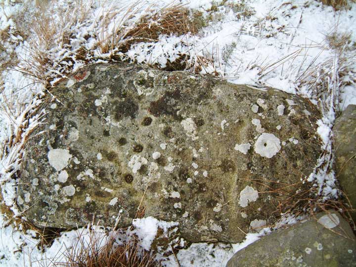
The lichen obscures all but the deepest cups (and those visited by rabbits)

Ridley Common stone circle remains, doing it’s best to hide.

View to the east, showing line of sight to Sewingshield Crags.


An unprepossessing circle, tucked away in a fold of an excellent landscape.


Peeled, revealed and re-hidden. But are they pre-historic or connected with the lead mining?

It was rather windy, and I didn’t have the bottle to climb right onto the top for a better pic.


Had this been there before the rest? Was it moved there? Is it just a gate post?


