

An extensive history of this site.
A small settlement with an abundance of neolithic and mesolithic cairns apparently in a good state of preservation.
All you needed to know about the site. Race you there!
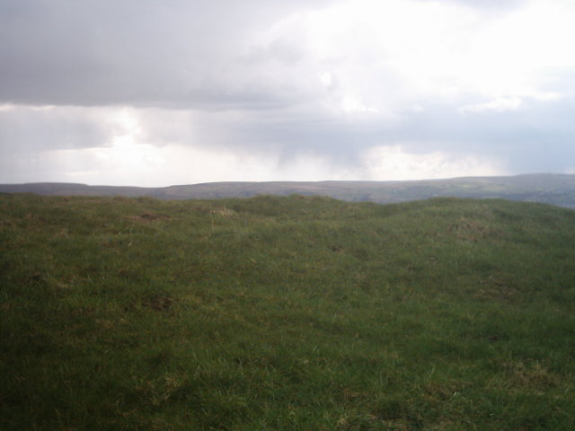
The daylight has now all but gone and I reached my final site of the day there’s the remains of two Bronze Age barrows here both uniquely different to each other ones on a circular raised embankment with a curb of stones the other dips down like a bowl barrow also with kerbstones and both have central depressions with stones in the centre there’s a structure in the field below which resembles a beacon but then again why is it below the hill I sit on? It could easily be seen from the Ringstones or Twist Castle and the hills around so maybe it is a beacon others may interpret it differently. My dog informs me that were hungry and we fed our lunch to the horses on Twist Hill its time to go and my perfect day ends.


I arrived at the Ringstones just a short walk from Worsthorne Stone Circle with its clearly discernable banks, ditches and avenues, im not quite sure what this was but am told its an old farmstead possibly late Bronze Age, early Iron Age which has more than likely been raided to make the stone walls round here it has two enclosures with avenues connecting both one leads away from the larger enclosure a good 40/50 metres into the field leading to hameldon pasture the other avenue leading into the next field to a smaller enclosure. Ive sketched a rough map to give some perspective. A nice little place to sit and gather your thoughts. I’m sat here looking towards twist hill knowing there’s another similliar farmstead up there and a bronze age barrow curiosity gets the better of me and I head off to Twist castle

Visited this site a couple of weeks ago and had a long chat with the Farmer on the adjacent land who wasn’t happy about me not getting permission for access to the site at first but was happy to see I hadn’t climbed through the hole in the wall which some idiots had made for easier access. The farmer also gave me some info about this site the henge type structure on top of the hill is actually known as Burwains Camp locally. Although it is on Shuttleworth pasture and the circle of stones at the bottom of the hill is known as Burwains stone circle although not a true stone circle.
So that is why the site name has been changed to reflect this.
I also visited this site yesterday got a couple more pictures of the low henge looking a little more obvious now the undergrowth has died back some more and at the circle the rubble bank has revealed itself to be mainly large fallen kerbstones covered with turf but now more discernable.

a close up of the turf covered stones which has now died back a lot more March 2004

A very sorry site this at the edge of a landfill, with a quietly sad ambience about it, 2 large fallen kerbstones are visible at first glance. On closer inspection and with a little kicking of the turf 3 more smaller stones are revealed. I cant believe a landfill was authorised here, this area is so rich in history I say a few words and apologise and move on to my next site. The ringstones
A nice little hike to the top of Twist Hill for me and my dog When we reached the summit were greeted by 5 very beautiful Shire horses who follow me around and share my sandwiches which was a lovely touch on this gorgeously sunny day.
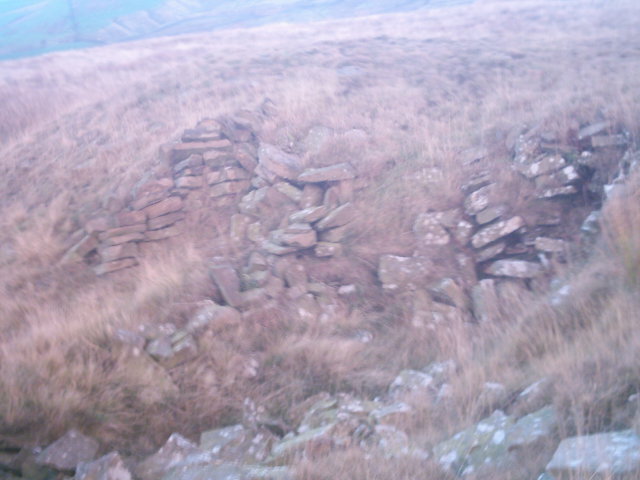
This is my first visit here and I certainly wasn’t disappointed it’s the Remains of another Farmstead mid to late Iron Age commanding excellent strategic views of the surrounding area it also overlooks an old sandstone quarry (which has got a little too close to the structure for my liking) and Swinden Reservoir I cant help but wonder what antiquities the reservoir has swallowed in its greed to quench our thirst. Twist castle is very peaceful consisting of two enclosures with more stone left than the ringstones and a couple of hundred yards away is a robbed and ruined Bronze Age barrow.
I sit here for a while being gently prodded by horse heads, my dogs a little unsure of the Horses so I decide to set off in search of Delf Hill Stone Circle

the remains of Twist castle on top of Twist hill are just visible slightly off center

twist castle in the background viewed from the Barrow in the foreground


some of the remains of Twist castle
After jumping a gate and sneaking over the back of a working quarry avoiding all manner of diggers workmen and industrial plants I hummed the Mission Impossible theme as I laughed to myself i’m on a mission and nothings going to stop me! I was just about to give up hope of finding the circle, when I stumbled right across it perched on top of Delf Hill at the back of the quarry by a wall and tractor tracks with fantastic views across the valley.
Its 5pm and the machinery has stopped. Finding this is my highlight of the day. A beautiful little circle with a central cist/depression an internal ditch and embankment with a ring of seven stones. I sat here for an hour and sketched the circle what a lovely place the grass all around is a very lush green it so peaceful here. On my way back from the circle as the light began to fade I came across a curiously carved boulder which was about 3 feet high at the bottom of the hill. I took a few snapshots and decided to take in Hambledon Pasture barrows before the light completely faded.

delf hill in all its glory (sausage dog optional)


The huge stone avenues leading to Barnscar note the smaller peak on the left this has the two huge circles on it plus a smaller one with a large pile of boulders
I’d been wanting to go to Barnscar for quite a while, apparently it was an entire city abandoned. Theres not many references to it and no photos i know of, so i set off to find it.
Its a bit of a trek to find it (to say the least!)and wasnt entirely convinced it was still there. Im so glad i was wrong wow! what a place!
Barnscar is situated on top of a small hill with two peaks on a plateau surrounded 360 degrees by much higher peaks, surreal mountains with the sea to the west an absolutely beautiful idylic location with no roads noise or buildings to disturb the serenity.
The approach to the plateau itself is a fantastic array of stone avenues follow these upto the hill and on top are just inumerable cairns buildings and roundhouses. theres more stone avenues up there too walls that seem to surround the city and on the most northerly peak of the hill there is two much larger circular structures one being roughly 20 metres in diameter the other slightly smaller. i also found a circle of 6 cairns on slightly more levelled ground. Ive no idea how far this place stretches as the shadows grew longer the light began to fade i had no more time to spend here today but i must come back here soon this place has blown me away. I left rather reluctantly feeling slightly nauseas by the hugeness of the site and the vibes here, on the way home i was greeted by 2 wild deer what a perfect day,fantastic!

not the best picture but gives you a rough idea of the kerbs looking west
This site is roughly 300 metres from the pikestones on a bearing of roughly north! (sorry guys i didnt have my compass!) but the grid location given is exact.
Its a low mound circular in shape 3-4 metres in diameter on the side of the hill with a complete set of kerbstones i beleive this is the ‘stone circle’ mentioned in the fieldnotes on the pikestones which ive been looking for, for quite a while now winter visits are definately worth the effort!


The fraction of left-handed people today is about the same as it was during the Ice Age, according to data from prehistoric handprints.
They were found in caves painted during the Upper Palaeolithic period, between 30,000 and 10,000 years ago.
Left-handedness may have conferred prehistoric man advantages, such as in combat, say the researchers.
The research is published in the February issue of the journal Biology Letters.
Evolutionary advantages
When Stone Age man produced their remarkable cave paintings they often left handprints on the walls produced by blowing pigments from one hand through a tube held by the other hand.
Charlotte Faurie and Michel Raymond at the University of Montpellier, France, deduced the prehistoric cave painters’ handedness by spraying paint against cave walls to see which hand they pressed against the wall, and therefore did not use for drawing.
Looking at 507 handprints from 26 caves in France and Spain, they deduced that 23% of them were right-handed, which indicated that they were made by left-handers.
In the general population today about 12% are left-handed, though populations vary considerably, between 3 and 30%.
Because handedness has a genetic component the researchers wondered why the proportion of left-handers should have remained so constant over 30,000 years – the age of the oldest cave studied.
They suggest that because left-handedness is relatively rare it provides certain advantages over those who are right-handed, such as in solo and group fighting.
The researchers say their findings add to the evidence that the evolutionary forces that cause right- and left-handedness are independent of culture.

a nice wide angle of all that now remains of the pikestones

Located on top of Twist Hill, although I’ve not visited this site yet I have viewed it through binoculars from Hambledon Pasture.
I also have an aerial photo of this site rectangular in shape it seems to be the same size and shape of the Ring Stones which are very close to this site (about 0.5km away) there’s also supposed to be an Iron Age barrow next to it. Hopefully I’ll visit soon.

a final shot of the mound known as little hameldon and marked on the o.s. maps with the same name


a close up of the T shaped depression hard to see in the long grass though!

the testpit cut into the T shaped depression

a closeup of the chamber in the previous picture

a wide angle shot of structure 1 on the previous picture

a rough sketch of the possible barrows on the west side of the plateau to give you a rough idea of the shape of these structures

After a visit to the Pikestones I read the noticeboard which informs you another chambered tomb was found in Lancashire (it doesn’t say where). I was pointed by others to two possible locations for the tomb the first being Black Coppice Chambered Cairn and the other possible site being this.
The mound is situated high on the plateau beneath the peak of Great Hameldon, close to the edge of a quarry, but far enough away to be independant of the quarrying activity. The mound is a ‘whale shaped mound’ about 5 metres high and about 60 foot long by 30 foot wide. At the western end is a small T shaped depression. The cross section is about 4 metres wide and goes quite deep in places. It’s been suggested that this could be the remains of a collapsed burial chamber. At the base of the T someone has cut a large rectangular test pit and there are three other test pits on this mound too, one on top, and two on the sides. I’d suggest these were dug by amateur treasure hunters as they’ve not been filled in afterwards.
On the western side of the plateau are two more mound like structures, different to this one, with rectangular chambers on the side. These are aligned with each other and I couldn’t say for certain wether they are modern or not.
Once again this is a bit of a climb but with great views to substitute this its worth the effort.
I climbed up here with relative ease against my better judgement in the ice and snow! My reasoning behind this was the structures would be a little clearer now the undergrowth had died back somewhat due to the colder weather (at least thats how I convinced myself that climbing up here was a sane thing to do).
As I said in my previous fieldnotes there’s lots to see here. I found the possible remains of a stone row, although you could probably imagine all sorts of alignments with the rocks and structures on top here. There’re many possible standing stones and four clearly banked circular structures with depressions in the middle surrounding the tomb, two of them having possibly fallen capstones. In the centre I also checked out the alignment of the tomb, which is alligned almost perfectly NW/SW.
Whatever you make of it up here the views are stunning and its a great place just to sit and contemplate.

a wider view of the tomb and the surrounding area