Dovedale Henge, outside the N bank, looking W into Dovedale and Dove Crag. 26/05/09.
Image credit: The Eternal
Dovedale Henge, outside the N bank, looking W into Dovedale and Dove Crag. 26/05/09.

Dovedale Henge, looking S across the interior from the N bank, with High Hartsop Dodd behind. 26/05/09.

Dovedale Henge. The low E bank, looking N to the “standing stones” of the N bank. 26/05/09.

Inside Dovedale Henge, looking W up Dovedale to Dove Crag. 26/05/09.

Dovedale Henge, from low down on High Hartsop Dodd, looking NE. 26/05/09.

Dovedale Henge, from High Hartsop Dodd, looking NE. 26/05/09.

Dovedale Henge and settlement in its landscape setting, viewed from Dove Crag, looking E. 26/05/09.


13/04/09. Viewed looking south-west. I thought an extra (poorer) photo or two might add to the understanding of the site. Overexposed, sorry, but that’s an automatic digital for you. I long for my dead Pentax Spotmatic.

13/04/09. Viewed looking north. I thought an extra (poorer) photo or two might add to the understanding of the site. Overexposed, sorry, but that’s an automatic digital for you. I long for my dead Pentax Spotmatic.

13/04/09. Viewed looking west. I thought an extra (poorer) photo or two might add to the understanding of the site. Overexposed, sorry, but that’s an automatic digital for you. I long for my dead Pentax Spotmatic.

13/04/09. Viewed looking west. I thought an extra (poorer) photo or two might add to the understanding of the site. Overexposed, sorry, but that’s an automatic digital for you. I long for my dead Pentax Spotmatic.

13/03/09.
The two Copt Howe boulders, with the Great Langdale valley beyond, and the Langdale Pikes, with their stone axe factories, beyond.

13/03/09. The ignored boulder on the right, with the one with the best rock art on the left. Behind are the Langdale Pikes, with the stone axe factory of Pike of Stickle on the left edge of them.

13/03/09.
The Langdale boulders. The ignored boulder, looking west. The small cup marks are visible, below and along the black stain, in a sort of vertical line, used by climbers as finger holds, whilst practicing moves at low level.

07/07/07. Beckstones in its landscape setting.
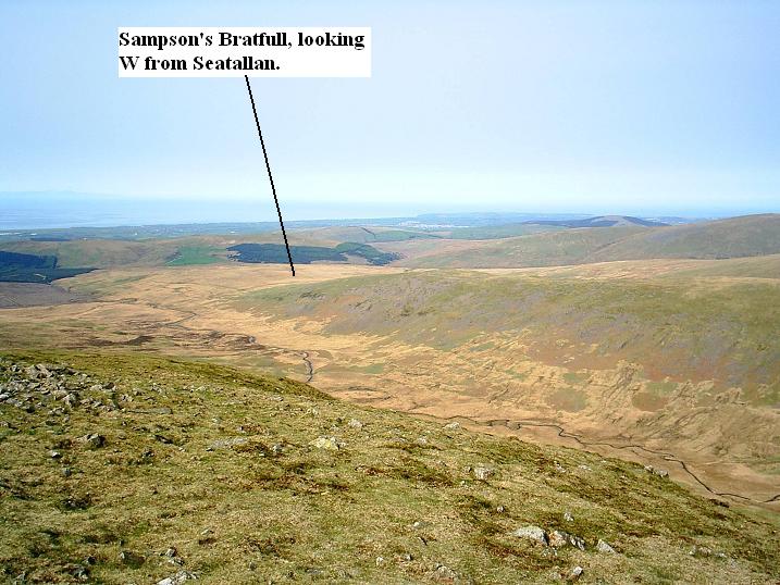
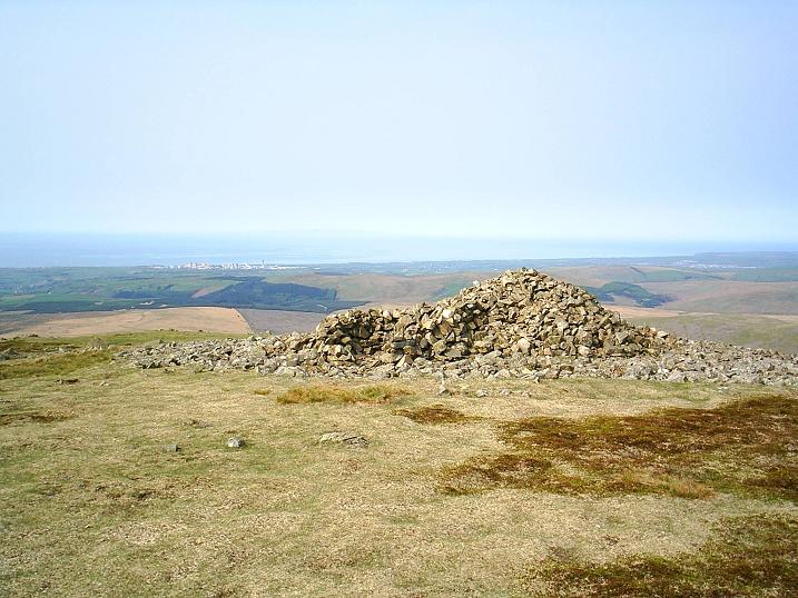
28/04/07. Sampson’s Bratfull in its landscape setting, looking W from Seatallan.

18/02/07 Carrock Fell hillfort, west wall, looking south-west up the River Caldew to Skiddaw.

18/02/07 Carrock Fell hillfort, looking east along the north wall.

18/02/07 Carrock Fell hillfort, south wall, looking south.

09/02/07 Looking north to Castle Crag, Shoulthwaite, Iron Age hillfort from Armboth Fell.

09/02/07 Castle Crag, Shoulthwaite, Iron Age hillfort, with its useful information sign. It’s a small place.

09/02/07 Castle Crag, Shoulthwaite, Iron Age Hillfort from the northern end of Shoulthwaite. Iron Crag is on the right.

24/12/06. A temperature inversion. Looking NE to Great Mell Fell from Dove Crag. Christmas came a day early. The shadow of Mr. The Eternal belies his 5’ 8.5” stature. And, yes, I am claiming the half-inch.

24/12/06 A temperature inversion, looking ENE to High Raise from Dove Crag. The air was so warm on the mountain tops, trapping the freezing air in the valleys. An indescribably beautiful day. Call it a Christmas pesent a day early.

04/11/06 High Raise Bronze Age cairn, looking SE. Harter Fell in the background. What a peaceful place, as I always find it. So different from Helvellyn across the valley.

04/11/06 High Raise Bronze Age cairn, looking south on a windy day. High Street lies behind, and the R*man road skirts the summit of High Raise a few yards to the west. Lonely, and lovely.

22/09/06 Stockdale Moor from the summit of Lank Rigg, looking SE.

22/09/06 Kinniside (Blakeley Raise) stone circle, in its landscape. Viewed looking W from Grike. Cleator Moor is the town behind.

22/09/06 Kinniside stone circle (Blakeley Raise) from above Blakeley Moss. I reckon this is the origin of the stones. The photo doesn’t show the extent of the stones, but suffice to say there’s nowhere else near with any stones. Looking W, with the town of Cleator Moor behind.

22/09/06 Blakeley Raise stone circle, looking NE.

22/09/06 Blakeley Raise stone circle, looking NW.

22/09/06 Blakeley Raise stone circle, inside looking SW.

22/09/06 Blakeley Raise stone circle, looking SW. The Cold Fell road behind.

11-03-06 Troutbeck Park cairn sites from the W side of Garburn Pass, looking N. Threshthwaite Mouth is the pass in the hills in the centre.

25-02-06 High Raise from Helvellyn, looking E. High Raise is part of the long R*man road of High Street. High street summit is the high point to the right of High Raise.
It’s a gratuitous photo, but what the Hell. What a day it was. Red Tarn is the inky pool on the lower left, with the arete of Striding Edge on the right. On the day I witnessed a near-death, as a walker slid down the icy slopes towards Thirlmere. The snow was iron-hard. Thankfully he got away with his life. Always take an ice-axe and crampons on the fells when snow is about – they were essential on this day, especially on the edges. The mountains can be unforgiving.

30-06-06 Floutern Cop from Grasmoor, looking W. Mellbreak is the fell with the pink scree, her beautiful feet washed by the pure Crummock Water. Life is sometimes too much, but places like this help you cope. The wind, the rain, the sun, the smell of the sweet mountain grasses, and the liquid call of the raven, cartwheeling across a troubled sky – all these things mean so much more than the monetary trappings of “life”...........and let’s not forget the prehistoric sites we love so much.

08-04-06 Crummock rock art site, viewed from Burnbank Fell, looking E. Loweswater is on the left, Crummock Water centre, and Mellbreak is the cloud-capped shoulder of fell on the right.

02-06-06 Castlerigg stone circle in its landscape setting. Viewed from High Rigg, looking N. The perfect prelude to Keswick Beer Festival, and a few jars with old friends.