Iron Age dwelling remains uncovered in Perthshire could cast “new light” on early Scottish history.
Archaeologists working near the village of Dunning found an Iron Age broch which has evidence of early contact between the Picts and the Roman Empire.
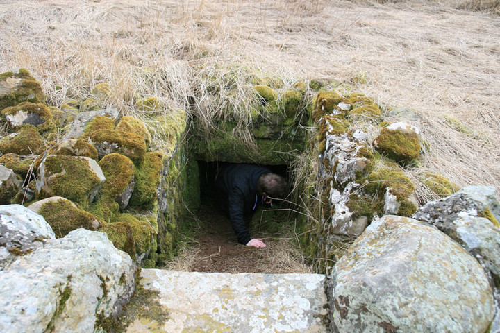
The broch – a drystone wall structure – is the first of its kind to be found in the Scottish lowlands for 100 years.
Evidence shows that the Roman dwelling was destroyed by fire and then probably reoccupied by a Pictish warlord.
It was uncovered by a team from the Strathearn Environs and Royal Forteviot (Serf) project.
Pictish power
Brochs were the preferred residence of the elite during Roman times. The team said the “exquisitely preserved” Dunning example was built at the top of a hill and offers a 360-degree views of the surrounding countryside.
It was also “massively fortified” with 5m (16.4ft) thick drystone walls.
It appears to have been destroyed by fire before the Picts built a palisaded fortress directly on top of the site.
Professor Stephen Driscoll, director of the Serf project, said: “There can be no doubt that we have located one of the major centres of Pictish power from the 1st and 2nd Centuries.
“The scale of the architecture is colossal and the tower-like structure would have visually dominated its surroundings.”
‘First contact‘
A wide range of Roman trade goods have been discovered in the broch, including a bronze patera, a glass vessel and an unusual lead bowl.
The Professor of Historical Archaeology at the University of Glasgow said it was “not unreasonable” to conclude the broch was the seat of a Celtic chieftain who collected luxury objects from the Roman world.
He added: “The artefacts are of particular interest as they date to the time of the first contact with the Roman world and offer numerous clues to how the Picts might have begun their interactions with the Roman Empire.”
Serf archaeologists believe the broch is the best example of an Iron Age Roman site being reoccupied by the Picts.
The excavation was directed by Dr Heather James, from Northlight Heritage, one of Serf’s partner organisations.
Major sponsorship for the project comes from the University of Glasgow, Historic Scotland, the British Academy and the Perth and Kinross Heritage Trust.
From the BBC