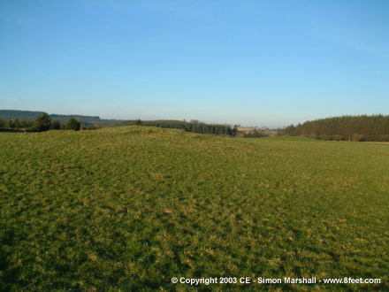
Kammer

Kammer

All posts 1,451-1,500 of 1,860 posts

Miscellaneous

The Gop
Cairn(s)

Here’s a paragraph from the Clwyd Powys Archaeological Trust Web site about Carn Gop, highlighting it’s Silbury like qualities:

The largest prehistoric monument in Wales is Gop Cairn, near Trelawnyd, Flintshire. The site measures 100m x 68m and is 12m high, and is of mostly stone construction. The cairn was partially excavated by Boyd Dawkins in 1886-7, when a shaft was dug in the centre down to the original ground level. However, despite these efforts no burials or finds were recovered.

Bronze Age Monument Vandalised

From an article on the BBC News Web site, published 10th February 2003:

The Bronze Age cairns at Dunkery Beacon on Exmoor have been daubed with pro-hunting graffiti and a viewpoint indicator has been damaged.

The words “no hunt-no deer” were sprayed over the cairns, between mid-afternoon on Sunday and early Monday morning.

More ...

Miscellaneous

Dunkery Beacon
Cairn(s)

I’ve not visited this site, but I understand that at 519 metres, Dunkery Beacon is the highest point on Exmoor (that’s 1,706 feet if you’re still using old money). The beacon is capped with two Bronze Age cairns.

Kammer x

Image of Cnoc Ceann a’Gharraidh (Stone Circle) by Kammer

Cnoc Ceann a’Gharraidh

Stone Circle

Taken July 1995: This stone looks like a prehistoric guitar! I don’t know whether it looked like this when it was erected, or whether it has been damaged since.

You can just make out the moon, which is very appropriate.

Image credit: Simon Marshall

Meini Gwyn

Visited 11th January 2003: At Meini Gwyn are three quartz standing stones, two relatively close to each and one further off in the garden of a nearby cottage. Of the three stones, two are fallen, the third (in the middle) is probably in it’s original position.

The two stones to the east are easy to see from the road (the fence is so poor that you could slip underneath it without any trouble...if you wanted to that is). To the east of the furthest stone are the (probable) remains of a cairn and a small tumulus, but you have to squint really hard to make them out.

The stone in the garden is only just visible from the road. I asked at the cottage to take a closer look, and the man who lives there was happy for me to go in and take a photo. He was keen that I shouldn’t be in the garden at the same time as his dog, but I never saw the beast, so I can only guess at how big it was (6ft tall with fangs etc). The stone has been planted around, and made into rather a fetching garden feature.

Thanks to Rhiannon for drawing this site to my attention in the first place.

Image of Meini Gwyn (Standing Stones) by Kammer

Meini Gwyn

Standing Stones

Taken 11th January 2003: Looking west from the roadside, with the middle stone in the foreground. The red arrow indicates where the westwern stone lies, just visible in the garden of the cottage called Dolgwm.

Image credit: Simon Marshall

Castell Bwa-Drain

The road from Ystumtuen to Bwa-Drain farm is gated, so by car it’s easier to approach from the north. Don’t be put off by the sign saying the road is private. I’ve checked with Ceredigion County Council, and this isn’t the case. You can park near the farm, although there’s not much space (make sure you leave enough room for farm traffic to get through).

The footpath that runs past the hillfort starts just to the west of the farm. You cross a strange little wooden bridge over the stream before going through a gate and along the edge of the field. At the corner of the field you’re supposed to stay to the north of the trees and keep to the west of the ruined farm house (called Pen-castell), but it’s well worth taking a peek at the ruin. It’s only a Nineteenth Century building, but its state of decay is fascinating (obviously, don’t go inside). After this you pass over a stile and you’re in the same field as the fort. The footpath goes to the east of the fort, so at this stage you have to deviate from it. You can’t miss the earthen banks of the fort, and there’s a gap in the defences orientated in your direction.

The views from the fort are spectacular, especially looking west down the Rheidol valley. You can see the sea, and Aberystwyth, without much difficulty. You can also make out Pendinas with the chimney-like monument on top of it. Look out for steam trains in the valley below you in the summer.

Miscellaneous

Plas Gogerddan

I pass these stones almost every day. They’re on private land belonging to IGER (the Institute of Grassland and Environmental Research). There’s no public right of way to them, but you can see them both from the A4159.

During the 1980s excavations around the easterly stone unearthed evidence to suggest that it had been moved, and a hole was found indicating it’s original location. At the same time evidence was found for post holes, suggesting a possible timber post alignment. In the same field as the eastern stone (to the south of the stone) is a bump that’s thought to be a ploughed down round barrow.

The earliest written record of the stones dates back to the eighteenth century, when they were used to mark the beginning and end of a race course. The road that now runs between them is relatively modern.

Loosely translated, ‘cerrig’ means ‘stones’ and ‘llwydion’ (the plural of llwyd) means ‘sacred’ or ‘grey’. This is one of three sites in the area that have words deriving from ‘llywd’ in their names, possibly indicating a tradition of sanctity that has survived down the centuries.

Maiden Bower Update – More Damage to Iron Age Site

From an article by David Prudames, published on the 24 Hour Museum Web site (www.24hourmuseum.org.uk) on 15th January 2003:

Vandals have inflicted further damage on the Maiden Bower Iron Age fort in Bedfordshire.

English Heritage carried out an initial investigation of the damaged site near Dunstable on January 8, but have since been informed by the police of more damage, apparently caused over the weekend.

The original attack is thought to have occurred before Christmas when vandals used a stolen mechanical digger to damage earthworks surrounding the Iron Age fort and cut a number of holes from its centre.

It is believed the damage was caused by off-road motorcyclists, who, according to local sources, have been using the site for some time.

More ...

Bodowyr

Visited September 2001: We were originally heading for Bryn Celli Ddu, but when we got there it still had Foot and Mouth signs up on the roadside warning not to go near it. We decided to see whether Bodowyr was accessible. William fell asleep in the car as we wound our way along the lanes between the two sites.

It wasn’t all that tricky to find Bodowyr, given that we only had a crappy road atlas with us. When we arrived we parked up right by the footpath, and decided to leave him in the car to snooze. The walk to the site is short, and relatively flat (no surprise there really, it is Anglesey). Bodowyr does look strange in it’s iron cage, but it was sunny, and we enjoyed just chilling out by the stones. I remember that it was good having some child free time to talk to each other (no offence meant Will).

Miscellaneous

Robin Hood and Little John
Standing Stones

Incidentally, the Robin Hood and Little John stones stand near Nene Park, which is known locally as Ferry Meadows (pronounced ‘fury’). The name Nene is pronounced locally as neen but in Northamptonshire it’s pronounced nen.

I wonder which of the stones is Robin Hood, and which one is Little John?

Kammer x

Image of Robin Hood and Little John (Standing Stones) by Kammer

Robin Hood and Little John

Standing Stones

Taken 25th January 2003: The stone to the west, with Ferry Meadows in the distance (referred to as Nene Park nower days). The River Nene is hidden from view on the other side of the boandary at the bottom of the field.

Image credit: Simon Marshall
Image of Robin Hood and Little John (Standing Stones) by Kammer

Robin Hood and Little John

Standing Stones

Taken 25th January 2003: Looking approximately east down the fence line of the field. The road is just on the other side of this fence (and a very broken excuse for a hedge). I stuck the red arrow in to indicate where the second stone is (it’s a bit camouflaged in the grass).

Image credit: Simon Marshall

Folklore

Robin Hood and Little John
Standing Stones

The Nene Park (aka Ferry Meadows) information board says:

One story maintains that they are draughts from arrows shot from Alwalton churchyard by Robin Hood and Little John; another claims that the stones, which are nicked in the tops like arrows, are a memorial to St Edmund who was killed by the Danes’ arrows. The most plausible explanation is perhaps that they mark a track to a crossing point on the River Nene, where the Abbot of Peterborough granted the Abbot of Bury toll-free passage for the stone being transported from the quarries at Barnack to build the Abbey of St Edmund.

Robin Hood and Little John

Visited 25th January 2003: Peterborough is a maze of dual carriageway. Without a map it took me while to find the road that runs near these stones. If you’re approaching on the A47(T) (guess what, it’s a dual carriageway) you can only get at the junction if you’re travelling west. Look out for a signpost for Castor, Ailsworth, Marholm and Golf Course. At the top of the slip road you need to turn left, then immediately left again down a little access road, so you’re heading east again. There’s a Nene Park information board on the corner. Keep on down this road and resist the temptation of parking until you the next information board (with some blurb about the stones on it).

There’s no public access to the stones, but you can get very close to them (or hop the fence). They are at the top of the field between the road and the River Nene (not right next to the river), but they’re a bit obscured by foliage if you’re standing on the road. From the information board walk west until you see a small crumbling concrete water main sign on your left (at least I think that’s what it is). The stones are directly adjacent to this sign, on the other side of the fence.

I’m a bit suspicious about the antiquity of the stones themselves. They’re both very square in cross section, and apparently there’s a theory that they date back to the Middle Ages. If they’re Bronze Age, they don’t look like anything else I’ve seen. Worth a visit if you’re stuck in Cambridgeshire and longing for some olde lumps of stone.

Gareg Hir

Visited 11th January: This was the last site we visited, and it was certainly the most beautiful. Access to Gareg Hir is very good, and you can see it from the road. The stone stands on the edge of a forestry plantation, and there’s a public footpath running very close to it. We parked in front of the metal gate that bars access to the forestry track, but this wouldn’t be ideal for a long visit.

The stone has a lot of modern carving on it (modern as in not prehistoric). There are also some interesting artificial looking horizontal groves on the north facing side of the stone. These may also be modern.

This is a fine stone by any standards, and well worth a visit.

Image of Silbury Hill (Artificial Mound) by Kammer

Silbury Hill

Artificial Mound

Taken in the late ‘90s (I think): This is Silbury Hill as seen on the approach from the north.

The photo was taken by my good friend Alice, with moral support from Richard (also a friend of great quality). They gave it to me as a birthday present last year. Thanks guys!

Image credit: Alice Goodenough

Crugiau Fach

Visited 11th January 2003: We were on our way to see Gareg Hir when we passed these two round barrows. As Alfie was demanding milk we stopped, and I decided to take a closer look. The barrows turned out to be bigger, and better defined than I’d expected. They’re both ploughed down, and I’m no expert on these things, so I’m not sure what type they originally were.

Crugiau Fâch are the two most accessible barrows in a reasonably large group (large by Carmarthenshire standards that is). Most of the others are in the surrounding forestry.

Miscellaneous

The Longstone Cove
Standing Stones

I can’t really improve on Julian’s directions to Adam and Eve (the ones he gives in the Modern Antiquarian book), so here they are:

At Beckhampton roundabout, take the A361 to Avebury and Swindon. After 200 yards , turn immediately left at ‘60s farm cottages and take the road straight on. Adam & Eve are in the field ahead.

As far as I can see there is no public access to the stones, but if there aren’t any crops in the field you could chance it and take a closer look.

Pentre Ynys

Visited 11th January 2003: There’s no public footpath to Pentre Ynys, but you can see the stone from the road.

When we visited, the gate to the field it sits in was wide open and there were no crops or livestock to avoid, so we decided to take closer look. I parked in the gateway opposite, and we were just at the stone when the farmer turned up at the gateway in an enormous tractor. Our car was stopping him from turning into the field, so feeling embarrassed (for parking badly and for going into the field without permission) I pegged it back to move the car. As it turned out the farmer was fine about us looking at the stone, and was just keen to get on with his muck spreading.

The stone itself looks a bit lost in the middle of the field. The surrounding ground has been quite badly eroded by cattle, and the stone has bird shit all over it (excuse my French), so it lacks glamour.

There’s another stone relatively nearby, but less accessible, called the Rhyd y Fwyalchen Stone (SN42942412). This stands to the south, on the other side of Nant Felys (like Pentre Ynys it’s marked on the Landranger). I’d imagine that the two stones are directly connected to each other and/or the river that runs between them.

Miscellaneous

Llwyn-on-Fach
Standing Stone / Menhir

I contacted Cambria Archaeology (Dyfed Archaeological Trust) to check up on their records for Llwyn-on-Fach, because nobody else seems to list it. They sent me a response by email, including this description of the stone by someone with the initials GW, alluding to metal rings fixed to the stone (no longer there):

It lies on level ground in pasture now used as a caravan site. An elongated, tapering stone 1.8m high and 0.6 x 0.3m across max, and leaning at an angle. Attached to it are broken metal rings for hanging a gate. It makes no sense as a gate-post in relation to modern field boundaries (which are unchanged since the 1st edition 25” map). It is very possibly on old gate-post re-erected in its present position as a pseudo standing stone.
GW. 1995.
The person who emailed this to me seemed more inclined to think that the stone might be a Bronze Age standing stone adapted for use as a gatepost, rather than a gatepost mistaken for a standing stone. Based on what I’ve seen I agree with him. It’s ridiculously large for a gatepost.

The Cambria Archaeology chap pointed out possible evidence for Bronze Age activity in the area from the local place names. The name of the nearby village Llaingarreglwyd translates as narrow strip of land of the grey stone and the name Ty Carn belonging to a nearby cottage means Cairn House.

Parc Garreg Lwyd

Visited 11th January 2003: Parc Garreg Lwyd is still standing, but only just. It leans alarmingly to the south. The stone is on private land with no public access across it, but you can get a good view of the stone from the road.

There’s enough space to park a car adjacent to the stone, but there’s a surprising amount of traffic running along here, so we didn’t stop for long. Parc Garreg Lwyd is marked on the Landranger, so it’s easy to find.