
Taken 20th June 2004: The eastern cairn, as viewed from the trig-point on the middle cairn. In the distance is the outlying Preseli peak of Frenni Fawr (of course cairn topped).
Image credit: Simon Marshall
Taken 20th June 2004: The eastern cairn, as viewed from the trig-point on the middle cairn. In the distance is the outlying Preseli peak of Frenni Fawr (of course cairn topped).

Taken 20th June 2004: The western cairn, as viewed standing on top of the trig-point on the middle cairn. In the distance is the distinctive shape of Carn Meini.

Taken 20th June 2004: The three enormous cairns viewed from the south east.

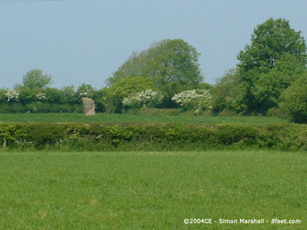
Taken 18th June 2004: Carreg Hir, looking approximately north east (but don’t quote me on that).

Taken 18th June 2004: The stone viewed from the south west (I think!).

Taken 18th June 2004: The stone from the north east, looking out towards the sunshine and the Carno valley (and the Trannon and Severn valleys beyond).

Taken 5th June 2004: The barrow as viewed from the north west.

Taken 5th June 2004: The barrows as viewed from the east.

Taken 2nd June 2004: JD standing by the stone for approximate scale.

Taken 23rd May 2004: Here’s the rocky outcrop that stands to the south east of the Mynydd Llangynderyrn chambers, as viewed from just east of the highest point on the ‘mountain’.
The red arrow indicates the location of the chambers.

Taken 23rd May 2004: The westerly chamber viewed from the south west (or thereabouts).

Taken 23rd May 2004: Here are the chambers viewed from the rocky outcrop just to the south east. The capstones are pretty clear (they’re the largest two lumps of rock).
Taken 23rd May 2004: Viewed from the road to the south east of the stone (the only viewpoint we could find).

Taken 23rd May 2004: Taken 23rd May 2004: Viewed from the road to the south east of the stone (the only viewpoint we could find). Apologies for the poor quality.

Taken 23rd May 2004: The top of Gwempa. Lovely isn’t it! This is taken from the north.

Taken 23rd May 2004: Gwempa viewed from the south west (approximately).

Taken 23rd May 2004: The stone viewed from the south.

Taken 23rd May 2004: Gwempa viewed from the west. There’s something tainting the ambience of this standing stone, and I can’t quite put my finger on what it is. Oh yes I remember now, it’s the enormous overhead power cables!

Taken 23rd May 2004: Gwempa viewed from the south west, with power cables overhead.

Taken 23rd May 2004: From the road to the north east of the stones. Only one of the stone pair can be seen. In the background is Llechdwnni, a 17th Century Manor House.

Taken 23rd May 2004: Apologies for the poor quality of this photo. It’s a close-up of the ‘stone pair’ that the NMR describes, taken from the road to the east of Meinillwydion.

Taken 23rd May 2004: The three stones visible from the road that runs to the east of Meinillwydion (indicated by the red arrows).

Taken 22nd May 2004: This shot is taken from the north east, where the road runs past the mansion house.
The red arrow indicates the standing stone, and in the distance is the Towy Estuary with Llansteffan Castle on the horizon.

Taken 22nd May 2004: It’s hard not to ‘lichen’ Is-Coed standing stone to the mansion on the hill.

Taken 22nd May 2004: Looking at the stone from the south east gives an idea how chunky it is.

Taken 22nd May 2004: Is-Coed viewed from the south west, with the beautifully ruinous Iscoed mansion in the background.

Taken 22nd May 2004: Maen Llwyd covered in manure.

Taken August 1997: One of the chambers inside the tomb.

Taken 2nd May 2004: The view from the road that winds down into Newport (Trefdraeth) from the direction of Bedd Morris.

Taken 2nd May 2004:


Taken 2nd May 2004: From (approximately) the east, the red arrows indicate the apparent boundaries of the site. The figures in the circle are Alfie, Lou and Will.

Taken 2nd May 2004: The north side of the circle.

Taken 2nd May 2004: From the north side of the circle, with the second entrance marked by the arrow. The bumps in the distance are Carn Edward.

Taken 2nd May 2004: On the north west side of the circle is the most obvious ‘entrance’. Here are Alfie, Lou and Will waiting for me to stop taking photos. Carn Edward is in the background.

Taken 2nd May 2004: The edge of Carn Llwyd VI Hut Circle with Carn Edward in the distance.

Taken 2nd May 2004: Looking up at Carn Llwyd VII Hut Circle from the south east (or thereabouts).

Taken 2nd May 2004: From approximately the north west.

Taken 2nd May 2004: Carn Llwyd IV taken from (approximately) the west, with Lou, Alfie and Will in shot.

Taken May 2nd 2004: Looking east, the cairn with Carn Ingli Camp behind it.

Taken May 2nd 2004: Looking down on some of the damage that’s been done to the cairn in modern times. Behind William is a circular enclosure, presumably made as a shelter from the cairn material. In the background are Lou and Alfie (Alfie asleep in the baby back-pack).

Taken May 2nd 2004: The cairn as viewed from the east. Not a very authentic profile for a round cairn.

Taken 29th August 2004: This is the same groove that Rivington Pike spotted, with my hand for scale. It certainly looks modern to me (the groove, not the hand).

May 2nd 2004: The hillfort as viewed from the west on the approach to Carn Briw.

May 2nd 2004: The main entrance to the fort with a random geezer for scale.

May 2nd 2004: The southern retaining wall where the rampart is penetrated by the main entrance to the fort. The drystone walling is presumably prehistoric.

Taken 2nd May 2004: Looking down over the eastern rampart from the south west corner. The pretty patterns are thought to be the remains of hut foundations and areas of cultivation.

Taken 2nd May 2004: From the south west end of the fort, looking north east along the western side of the rampart.

Taken Summer 1992: Rainbow over Bryn Celli Ddu.
I have very few recollections of this visit to Bryn Celli Ddu, which I guess was my second. I stumbled across this photo recently and thought I’d post it.

Taken 25thy May 2004: The stone as you’re likely to see it driving along the road (the red arrow isn’t a landmark by the way).