From the A90 just north of Brechin take the B966 through Edzell, amile or so past the town there is a road marked “Glenesk – Tarfside” heading north (left side of the road). Take this and follow the road for several miles (be warned, it’s pretty narrow so watch for oncoming traffic!). As the glen opens out you’ll see a sign for Colmeallie, park where convenient at the foot here, so as not to block the entrance, and walk up to the circle, which is to the left of the track. The man who lives at the cottage here is helpful and there’s no problem viewing the circle.
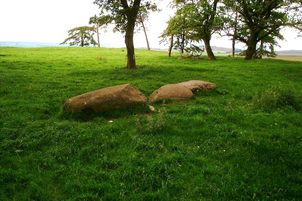
The circle itself is pretty disrupted. Only five stones remain upright, though a drawing I’ve seen from the 1950’s showed 6 upright at that time. It sits on a mound, and on investigation appears to have been two concentric circles at one time. Many stones are now recumbent, and others have been utilised in nearby dykes... It’s in a pretty stunning location though, and worth a look. ‘Dowsing’, for those of the ley line persuasion, shows that there is a pretty strong ‘focus’ near the centre of the circle – this was demonstrated to me by the resident of the cottage, who had been shown how to do it by a previous visitor to the site!


The circle looking towards the east – 4 hidden stones marked
Situated in the village of Murthly, accessed via the B9099 from Luncarty on the A9, the circle is in an area known as Druid’s Park (formerly Murthly Hospital). This circle lies 300 yards north east of the gate, in the private grounds of Druid’s Park House. Permission should be sought from the occupants before entering, although when I visited this was readily and cheerfully granted. The circle comprises 5 stones, in a sunken circular area approximately 10 metres in diameter. From gaps in the circle it appears that there may once have been 7 or 8 stones, but there is no trace of the others. This site stood in an open field until the construction of Murthly Hospital in 1863-4, when oaks were planted and an earth bank raised around the stones. Cinerary urns were found close to but not inside the circle during the 19th century. The area is now unfortunately heavily overgrown with rhododendrons, and although the primary stone, some 2m high, is easily visible, the others are quite hidden. They have been marked with white lines on one photograph.
Take the A929 north out of Dundee to Tealing. Follow the road due west past Balkemback farm on the left, until you see a house in a stand of trees on the right. Park just past this, and the circle is in the second field north. The site is described as an irregular setting of four stones, two fallen. They form a circle approximately 11m in diameter. The tallest stone is the south-eastern one, standing just over 1m in height, but the fallen south-western stone is 1.5m in length. The south-eastern stone has cup and cup-and-ring markings on the broad east and west faces.


SE view showing central fallen stone and remaining upright.
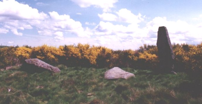
From Alyth, follow the B954 northwards past the Loch of Lintrathen over on the right, until the road forks at Dykend. Follow the B951 for approximately 2km until just before Pitmudie. Park at the side of the road, climb the fence into the wood on the north side of the road, and follow the fence as it zigzags uphill. At the second north-to-east junction, climb over the inner fence and head approximetely 50m north east, where you will soon see the upright stone amongst the broom. There are 3 stones, a large (3.5m) upright and 2 recumbent ones. It is easy to see that they were all originally upright, aligned on a south-west axis. Following the line south west points to the Kilry stone, and north east to the stones at Knowehead of Auldallan. Seriously spooky stuff, I’ll leave any conclusions to the ley line/magnetic/conspiracy theorists! Beautiful views of the scenery to the north of here, well worth a visit.


These stones are a bit off the beaten track. Knowehead of Auldallan Farm is north of Pitmudie on the B951. Find Pitmudie and turn north on the Balintore road (un-numbered). Drive up past the ruined Balintore Castle ( a real Brigadoon affair! ) and about 1/2 km along to the east is Knowehead of Auldallan Farm. Ask permission (readily granted when I called) and head down the fields, negotiating 2 gates. Always ask, as there are stock in the fields. The 2 stones are in a fenced-off area, one standing and the other recumbent. The farmer told me that the recumbent one had been pushed over many years ago by cattle rubbing against it! When standing, it must have been aligned with the other on an approximate SSW axis.


From Alyth take the B954 north until the road forks, signposted for Dykehead and Kilry. Follow this un-numbered road until you see Kilry School, a small building. There is a little cottage opposite, appropriately named “Standing Stone”. There’s not much in the way of parking here, and the road is very narrow. The stone is to the north side of the cottage down a private track – please ask before entering. It sits in a peaceful glade in the trees, and on the map, appears to be perfectly aligned with the Pitmudie Stone Row and the Auldallan Stones. You can’t see any one from the others, but try it on the map with a ruler.... Spooky! I’ll leave discussion of this coincidence to the believers in ley lines, etcetera.


This stone is situated near Alyth. Taking the A926 east from Alyth, through Ruthven and the village of Airlie, it is immediately visible to the right, highlighted against the sky. There is a convenient farm gate nearby, which can be parked in short term. The stone is over 2 metres high, and has no normal distinguishing marks (If you disregard the ruddy great bench-mark on the northern face...), but is quite dramatic as it leans to the south, illustrated in the picture I have posted.


Take the A929 north from Dundee towards Tealing. Turn off before Tealing at Tinkletap, and park in the yard (ask permission). Take the track north to the old shed, then west towards another track running SW/NE. 50 metres NE up this track the stones lie up on the left. This pair of stones is not very impressive, with no cup marks or rings visible, but the view from their location is fine.


Take the B952 east from Alyth until you encounter the small road leading east towards Airlie. About a kilometer along this road is Shanzie Farm, on your right. Drive past, park about 100 metres along on your left, at a field entrance (ensuring the farmer is not working in the field). Walk another 100 metres east, where a path can be seen between a stone dyke and an electric fence, leading uphill. The path is wide and easy to follow. Up the hill, there is a stile placed there by the farmer over the electric fence. The stone itself is unremarkable, with no cup or ring marks, but the view is excellent and well worth the little climb. All credit to the farmer at Shanzie, who has made access to the stone extremely easy, and is a very friendly and helpful gentleman. One oddity I did notice is that the Shanzie stone is at the western end of an ESE axis, with the Philpie stones the opposite (eastern) end. The Bruceton symbol stone lies almost exactly halfway between.


A small stone perched on a low hilltop, just off the A93 through Glenshee. About 5 miles south of Spittal of Glenshee is a small road which runs east towards Glenisla, signposted for Blacklunans. On a bend in the road about a mile in there is sufficient space to park – the stone itself can be glimpsed just on the small hilltop. Negotiate a couple of gates and it’s about a 50m walk up the hill to the top. No significant markings, but worth a look just for the views!
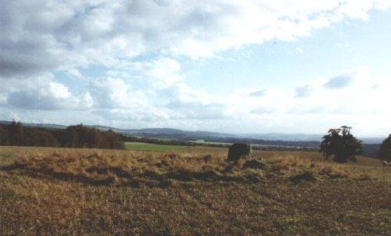
Not a lot to add to what’s been said below – I’ve added 3 photographs of various aspects of the stones around the site. I wasn’t sure what to make of the layout.


Take the A917 from St Andrews east towards Kingsbarns. About 500m before the village is a farm road running SSW. Turn in here, and about 300m in on the right side is a track running ENE parallel with the A917. Park here carefully, and proceed up the track until you see an open gate. The stone is in plain sight.
Approximately 2.4m tall, it is a thin slab with a pronounced tilt towards the south. I could discern no markings of any kind on it.


Leave the A9 at Bankfoot and follow the B867 through Waterloo up to the entrance to Muirheadston farm. Careful parking here will not obstruct the farm road, and the stones are in the centre of the field beside you. The eastern stone has a cross incised on the southern face, easily visible in the photograph.