ocifant

ocifant

All posts expand_more 201-250 of 505 posts

Sancreed Holy Well

5th October 2003

I took the approach from the telephone box opposite Sancreed Church, which had a sign advising that an alternative path was available 300yds up the road. The approach was long and narrow – no room for a wheelchair here. The path is quite clearly delineated, except for one point where stiles appear both in front, and to the right. I chose right, which was right! A short incline, and the well appeared in front of me. The first thing I saw was the ugly modern cross that’s been erected here. Climbing down into the well, I spotted the phosphorescence straight away, but it proved difficult to photograph. Sitting in the cracks on the far walls, it gave the impression of minute fairy grottoes, complete with lighting!

After 10 minutes or so, I began to feel uneasy, and had the start of a headache, so decided to leave. But before finally leaving I took a quick look at the remains of the small chapel just above the well. Only part of the walls remain, similar to, but in a worse condition than the chapel at Madron Well.

Leaving via the continuation of the footpath, after a short climb a stile led to the road, just around the corner from my starting point.

Alsia Holy Well

5th October 2003

After a false start, confused a little by the directions here, I found the stile easily enough. Park by the Alsia Farm entrance drive, and walk down (West) past the Mill. The stile is on the left, opposite what would be a parking place if not blocked off by stones. Climb up the stile steps and a totally unexpected view awaits. A pleasant meadow with a large informational sign leads to the far field boundary, where another small sign points to the (private) footpath leading to the well. Down the hill, the bracken and brambles open up on the right, and turning right into the brambles again reveals the rusty gate by the well.

Access: The initial stile is quite high, but the walk is reasonable across grassland. The return trip is uphill, and the stile can be tricky to return down to the road.

Sennen

5th October 2003

From opposite Sennen Church (with its couple of fine old crosses), a private road runs back toward the farm buildings. The footpath is shown as going up to the shed, but I’m not sure where it goes from there. I ventured over the locked gate, and around the back of the shed, startling a large fox in the process.

The stone, visible from the road when the foliage is low, is built into the field boundary wall, is covered in lichen, and I’d guess stands approx 3-4 metres tall. Being on private land, permission should really be sought, but there was no-one around during my brief visit, other than a herd of cows in the neighbouring field.

Men-An-Tol

5th October 2003

Having read the Cornwall Archaeological report from 1993 last night, I’m more convinced that this was a circle at some point in the past. On previous visits, I’d not noticed the buried stones, and the approach path from the track has what could possibly be a fallen (and now semi-buried) outlier across it. To me, this only adds weight to the theories.

The Fairy Well

4th October 2003

This place is seriously out of the way! Thanks are due to Goffik for his directions which led me straight there. This is not somewhere that someone who has a problem with heights (like me!) should go. Goffik’s directions state ‘take the left fork’. As the path clings limpet like to the side of a very high cliff, the only way I could see a left fork taking me was straight down. Luckily, the main path forked right and up, and the left fork consisted of just a few steps down to the well itself. There’s not much more than a thin covering of foliage stopping anyone falling off the cliff though, so I wouldn’t suggest visiting here in wet or windy weather.

Access: Not for the faint-hearted!

The Plague Market At Merrivale

3rd October 2003

Last time I was here, it was typically Dartmoor damp. This morning, it was typical Dartmoor sunshine, a glorious day!

I took my time walking the rows, circumnavigating the circle and outlier and I actually found the cracked cist this time – I’d totally missed it last time round.

An excellent place to stop on the moor whatever the weather.

Boscawen-Ûn

4th October 2003

I adore this place – I want to have its babies. The bracken was chest high, and I wasn’t sure how much I’d see of the circle today, but I needn’t have worried as the centre stone was easily viewed from the approach. When I was last here at this time last year, the stones were almost completely covered by the bracken, but some care has been taken this year to keep them clear. The sun shone, and the stones were all quite warm, apart from the large quartz stone, which was icy cold to the touch. Its magic worked on me once again, and I found it very difficult to leave. I daren’t look back as I finally left, in case I felt impelled to return.

Access: Difficult even in good conditions -it’s a tricky (though not long) walk from the road whichever direction you approach from. I’d suggest able bodied access only.

Fernworthy stone row (North)

3rd October 2003

The northern row gave me slightly less difficulty that the southern row, but many of the stones are extremely low indeed. The blocking stone stands a foot or so high and was the most recognisable to me, the grass being fairly rough and high during my visit.

Fernworthy Stone Row (South)

3rd October 2003

From the access track, several very low stones, barely poking above the earth were evident. Also apparent were several moss covered tree stumps, which confused the picture somewhat, as it was necessary to determine which were stones and which were stumps. It was quite tricky to make out the stone row, which didn’t seem that straight to me.

Fernworthy

Visited 3rd October 2003

Like Martin, we drove as far as possible along the approach road, past the official car park. The forest track heads off to the left from this point (don’t follow the footpath immediately ahead). The track rises steadily for a way (took me what felt like about 5-10 minutes, but with no watch it’s hard to say). Suddenly the clearing appeared to the right. Two large stones proclaimed the entrance, but I think they’re there to stop possible vehicles (which obviously use the track) from progressing further. The site opened up from this point on, everything being nicely laid out before me.

There was no fire damage evident within the circle, although there was a fire pit just outside of it. What was obvious to me, was the slant of the circle, with taller stones on the south progressing down to smaller ones on the northern side. I’d seen this effect before, during our trip to Ireland earlier this year. I don’t recall seeing this in other circles in this country, but then I don’t remember what I had for breakfast this morning!

Later: I saw this Frith photo which shows the site in 1907 – quite a difference!

Access: A fair uphill trek to get to the area of the sites. I wouldn’t want to push a wheelchair up here – it’s quite a bumpy path.

The Nine Stones of Winterbourne Abbas

Visited 3rd October 2003

Even at 7:30 in the morning, the A35 is a damn dangerous place! Parking on the wrong side of the road in the ‘makeshift layby’, I precariously made my way the 50 yards along the road to the small concrete bridge across the ditch to the oasis of calm that is the stones. Despite laying only feet from the roar of the traffic, I was surprised at how little it intruded upon the stones.

A ritual had obviously been performed here the previous evening, as a clear swept circle of leaves remained in the middle of the stones. Unfortunately, the light was all wrong for photographs, and I encountered the same difficulties in taking pictures that I had when trying to photograph the Hoar Stone at Enstone. All were out of focus, with a strong colour cast, despite using a monpod.

Access: Dodgy, even for the fully fit, due to the traffic hazard.

Miscellaneous

Mabe Church
Standing Stone / Menhir

From the EH Scheduled Monuments record:

The monument includes a prehistoric standing stone with a medieval cross incised on it, situated in the churchyard at Mabe in west Cornwall.

The stone, which is listed Grade II, is 1.85m high and 0.66m wide at the base tapering to 0.35m at the top. The principal faces are orientated north-south, and on the top of the north face is a small incised `Latin’ cross, probably added at sometime during the medieval period. On the east face the granite has naturally weathered along linear cracks, which has given the misleading impression that there is a further inscription or incised ornament on this stone.

The standing stone is set in a low mound and is considered to be in its
original location.

The Coffin Stone

About 25 yards south of the Countless Stones is a turn off. I precariously parked here and crossed the road to an entrance to a bridleway to see if I could see the Coffin Stone in it’s field. Luckily, the crop had been harvested, and the stone(s) stood proud of the field, in full sight. I didn’t approach the stones on this ocassion, being contented enough just to see them, and not wanting to encroach on what is obviously a cropping field. A couple of hundred yards further south is an entrance to Great Tottington Farm. I may ask here next time for permission to actually visit the stones.

There is also supposedly a circle, or ruined circle of stones (The Tottington Sarsens) at the head of the stream on the farm. It would be interesting to see if anything remains of this site/monument.

Cup and Saucer Stone

We popped in to have a look at this today, on our way back home from Birmingham, as it’s only a 5 minute drive from J11 on the M40.

Approaching Cropredy from the A361, just before the Cropredy Bridge is a large stone on the left hand side of the road. An information plaque proclaims it to be a boundary stone from the 15thC, but it looks and feels much older than that.

Anyway, continuing on, we came to a ‘T’ junction. We turned Right for no particular reason, and shortly spotted a road on the left marked ‘Cup and Saucer’. I swung in and the stone was there in front of us.

I’m not certain what to make of it, to be honest. It looks as if it should have an inscription carved on the ‘plinth’, for plinth it is. The base and ‘cup’ appears to be a single stone, but at the same time has obviously been extensively worked into its current font-like form. It’s hard to tell if the ‘spoon’ was ever actually a separate stone, or if the whole was carved from a single piece of stone.

Cup & Saucer? Mug & Spoon? Pestle & Mortar? I think the jury’s still out on this one...

Burnt Hill Dolmen

I failed to find this at the weekend.

The EH Monuments record describes the site thus:
“The site lies on a gentle south east facing slope at the north east corner of a small wood.
The portal dolmen has one large upright and one adjacent inclined stone, together with a number of smaller stones on the northern side of a roughly square depression which measures 3m across and 0.2m deep. The upright limestone block measures 1.54m long, 0.72m thick and stands 0.94m high above the present ground level. The inclined stone immediately to the east measures 1m long, c.1m wide and 0.5m thick. Surrounding the central depression is a circular bank of small stones which measures c.10m in overall diameter. The bank is 2m wide and stands 0.4m high to the south.”

I could see two possible candidates for the ‘small wood’, but couldn’t find a way through the hedge from the road (which is a bit of a racetrack!) I’ll have to leave this for someone more local to investigate further.

There is also a possible Long Barrow in the same vicinity, which is close to Chastleton Barrow Fort and the Goose Stones, so lots of evidence for this being an important centre at one time.

New Street Stone

Popped in here on Saturday to pay our respects. As Jane says, it’s almost totally hidden and you wouldn’t know it was there unless you were specifically looking for it.

“You didn’t see me, right?”

Lad Barrow

Visited this at the weekend, but not much to see, to be honest.

Parked at the bottom of the hill, there’s a parking area at the junction with the main road. Pleasant enough walk up the hill (the road is marked as no through route for motor vehicles) – very quiet, even the traffic noise was negligable, so very peaceful.

If you walk up the road and reach the pylons, you passed the barrow. It’s in a field to the left – no obvious way in and it’s in the middle of a cultivated field so I didn’t trespass to get to it at all. All that can be seen is an uncultivated ‘lump’, although there are apparently a couple of possible entrance stones to be seen.

There are good views all around. 2-300 yards difference in the location and it would be a different story though.

Figsbury Ring

I only spotted this on the way home as I took a wrong turning. Parking in a layby I looked across and thought “hello, what’s that?“. Checking the map, the opportunity was too good to miss, and we carefully made our way up the deeply rutted track to the even more deeply rutted car park.

As others have said, the ‘fort’ is impressive. I was totally unprepared for the inner ditch, and knew right away that this was special in some way. It’s a bit too ‘jagged’ for a proper henge ditch, to my mind, and looks a bit rough and ready.

Great views though, and a large and varied butterfly population.

South Baddesley Stone

South Baddesley is a small place: a church, a school and a few cottages. We parked in the church car park, a couple of hundred yards North off the Lymington-East End road.

I walked back down the lane to the junction, but could see no sign of a sarsen, even though the GPS said I was on the spot. There’s a small triangle of grass at a junction with a side lane, that would have been an ideal spot if the stone had been moved, but it was bare.

Sadly it looks as if this is no more (or is now recumbent in a ditch, covered by undergrowth)

Miscellaneous

Sturmer Barrow
Round Barrow(s)

Taken from the EH Scheduled Monument record:

A bowl barrow situated on a west facing slope overlooking the River Stour. The barrow is visible as an earthen mound which measures 48m in diameter and 2.5m high. Although no longer visible at ground level, a ditch, from which material was excavated during its construction, surrounds the mound. The ditch has become infilled but survives as a buried feature 2m wide.

This bowl barrow 500m north-west of Sturmer Hall is well preserved.

Miscellaneous

Swingate
Standing Stone / Menhir

Taken from the Monument Class Description for ‘Standing Stones’, available on the EH site:

“Standing stones might be confused with cattle rubbing stones and still remain usually in the centre of fields, such as at Swingate, Cornwall, although it is possible that some cattle rubbing stones are actually reused standing stones.”

From that, if you believe EH, it appears that this is in fact a rubbing stone rather than ancient menhir?

Miscellaneous

Popham Beacons
Barrow / Cairn Cemetery

The EH Scheduled monument record (31151) describes Popham Beacons thus:

The monument includes a round barrow cemetery prominently situated just north of the A303 and just west of the Stockbridge road, on a broad south east facing chalk spur. It consists of a linear arrangement of four very substantial round barrows and a saucer barrow oriented along the spur over a distance of about 185m. A sixth barrow, possibly a disc barrow, situated 20m to the south east, has been levelled by ploughing and is not included in the scheduling. Two further round barrows situated approximately 150m and 260m to the west, just on the other side of the Stockbridge road, have also been removed by ploughing and are also not included in the scheduling.

The most northerly barrow is a slightly elliptical bowl barrow, standing about 1.6m high with a maximum diameter of 25m, surrounded by a partially infilled ditch up to 5m wide and 0.2m deep. The second barrow lies approximately 12m to the south. It is a bell barrow comprising a central mound surrounded by a 3m wide berm, mutilated by rabbit burrowing and ploughing, and a partially infilled ditch up to 6m wide and 0.25m deep. The mound and berm are roughly circular and stand up to 2.4m high with a maximum diameter of about 26m. These features partly overlie a probable saucer barrow comprising a low central mound, about 0.2m high and 26m across, surrounded by a ditch, 5m wide and 0.1m deep, and an outer bank, 10m-12m wide and about 0.15m high. The fourth barrow also partly overlies the saucer barrow. It is a probable bell barrow comprising a roughly circular central mound, approximately 2.4m high and up to 24m across, with traces of a mutilated berm on the east and north east sides. It is surrounded by a ditch, approximately 6m wide and 0.15m deep. The fifth barrow lies about 5m to the south. This is a possible bell barrow comprising a roughly circular central mound, up to 2.4m high and 30m across, with traces of a mutilated berm. It is surrounded by a partially infilled ditch, 0.15m-0.25m deep, that is 5m-7m wide to the north and south but widens to 10m-12m wide to the east and west.

The three most substantial barrows are slightly hollowed in the centre indicating possible past excavation. The two to the north have exposed flint rubble cores while that to the south has an exposed core of chalk rubble. All have been clipped by ploughing and are disturbed by burrowing.

The monument is located on the alignment of a likely Roman road which survives 200m to the south east as a lane running along the edge of Black Wood and to the north west as discontinuous sections of farm track and woodland boundary.

Popham Beacons has been suggested, in a 1943 publication, to be the location of a Roman lookout station associated with this road, and have been identified on maps dating from 1595 as the approximate location of a later Armada beacon from which the monument gains its name. No archaeological evidence of any of these features survives however in the field within which the barrows are located.

Weston Hill

This is definitely one for the completists. The henge does not appear on the OS map, but is mentioned on the MAGIC web site as a scheduled monument. The henge is about 1m in height, and around 65m in diameter. There are apparently two opposing entrances, identified from crop marks, in the East and West. The Icknield Way passes by and is visible to the NE.

I approached on the path from the NW. The henge site can be seen across a field surrounded by barbed wire, showing signs warning of Rat Poison and other evils. Staying on the path (marked on the OS Map), and skirting around this field leads to the field with the henge in it. Luckily, the crop had recently been harvested and I crossed to the henge site itself, which was heavily overgrown with weeds. Sadly, there’s really not much to see here, unless you enjoy staring at an uncultivated patch of land surrounded by farmland.

Six Hills

I was quite surprised when I found out where these were. A few years ago, before my TMA interests, I’d attended a job interview in the modern office block that overlooks the mounds. I remember assuming at the time that they were just a modern landscaping feature…

Antiquarian descriptions state that the mounds were once all surrounded by ditches and outer banks, but these are no longer visible. What are visible today are the inevitable cycle tracks across the tops of the mounds, which are situated a short walk from the shopping centre. The mounds are fairly evenly spaced, on a N-S line. Only one is undisturbed, three having large depressions indicating where shafts have been sunk, and the two most southerly have been tunnelled from the sides.

All in all, a bit of an anachronism in the modern(!) town, but I’m glad they’ve managed to survive.

Alphamstone

This is weird. A church, with a whole bunch of sarsens around it.

The two stones in front of the church are not in their original positions, according to a helpful local lady, who also pointed out the sarsen poking inside the SW wall of the church, under the rear pew. Reports of the number of stones varies. I thought I counted as many as 13 stones or remnants, but figures of 9,10 or 11 are more usually reported.

Was this originally a circle? It’s difficult to determine that from what I saw. Most of the stones are on the Southern edges of the churchyard rather than spread around. R*man fragments of a hypocaust were found in an adjoining field, and a kiln site lies nearby, so the area has been in use since the Iron Age, if not earlier.

I’m no expert on cup marks, but several of the stones had round indentations in them. Could this be weathering? Another had a triangular ‘groove’ cut into it, which intrigued me – see photos for details of these.

Newport Leper Stone

Just at the northern limit of the town, on the B1383, is the entrance to Shortgrove House. We parked here, and walked the 100 or so yards further south along the road to where the Leper Stone stands at the side of the road. This is a large stone, reportedly the largest in Essex.

Slightly further south in the town, in Station Road lies a recumbent block of puddingstone outside the village hall.

Miscellaneous

Bummers Hill
Round Barrow(s)

From the EH Record of Scheduled Monuments:

Bummers Hill bowl barrow is situated on the north end of a prominent ridge overlooking the River Quin. The monument includes an earthen mound which measures 24m in diameter and 2.82m in maximum height. Although no longer visible at ground level, a ditch, from which material was quarried during the construction of the monument, surrounds the mound. This has become infilled over the years but survives as a buried feature c.3m wide.

Miscellaneous

Great Wigborough Henge
Henge

From the EH record of Scheduled Monuments

The monument includes a levelled henge monument situated on the flood plain of the Salcott Creek 1km north-east of Virley church. Although no longer visible at ground level the monument survives as a circular ditch which can be clearly seen as a cropmark and on aerial photographs. The ditch is 46m in diameter with two opposed entrances, to the north-west and south-east, which measure approximately 10m in width.

Miscellaneous

Coneyfield Barrow
Round Barrow(s)

From the EH record of Scheduled Monuments:

The monument includes a bowl barrow situated in Conyfield Wood, on the
floodplain of the River Blackwater. The hemispherical earth mound measures
21m in diameter and c.1.7m in height. Also identifiable at ground level is a
3m wide ditch surrounding the mound from which material was quarried during
the construction of the monument. This has become partly infilled over the
years but survives to a depth of c.0.3m on all but the north side, where it
has been cut through by a modern drain which runs alongside a footpath.

Miscellaneous

Dry Hill
Hillfort

Dry Hill gives commanding views out over the North Weald to Limpsfield, Tilburstow and the Godstone gap in the downs visible between.

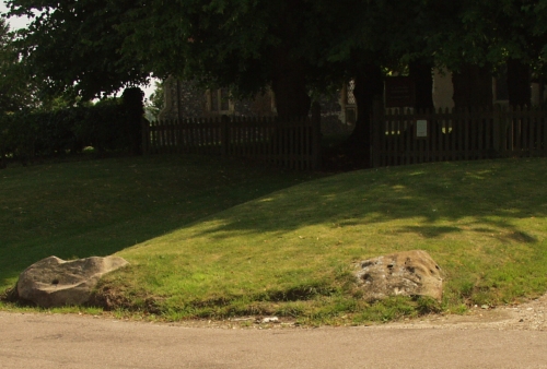
Image of Barnfield Pit, Swanscombe by ocifant

Barnfield Pit, Swanscombe

Underneath the crap, this reads:

Swanscombe Skull Site National Nature Reserve

On this spot on 29 June 1935 A T Marston discovered the oldest known human remains in Britain.
A fossilized fragment of a skull 250,000 years old. The smaller blocks mark the sites where two further pieces of the same skull were found in 1936 and 1955.
This site was declared a National Nature Reserve in 1954. Magnus Magnusson, writer and broadcaster unveiled this memorial 29 June 1985 the fiftieth anniversary of the first discovery.

Image credit: Alan S>