


These two large facing stones to the east may be related to an entranceway.
Intermittent facing stones protrude from the southern rampart of the broch.

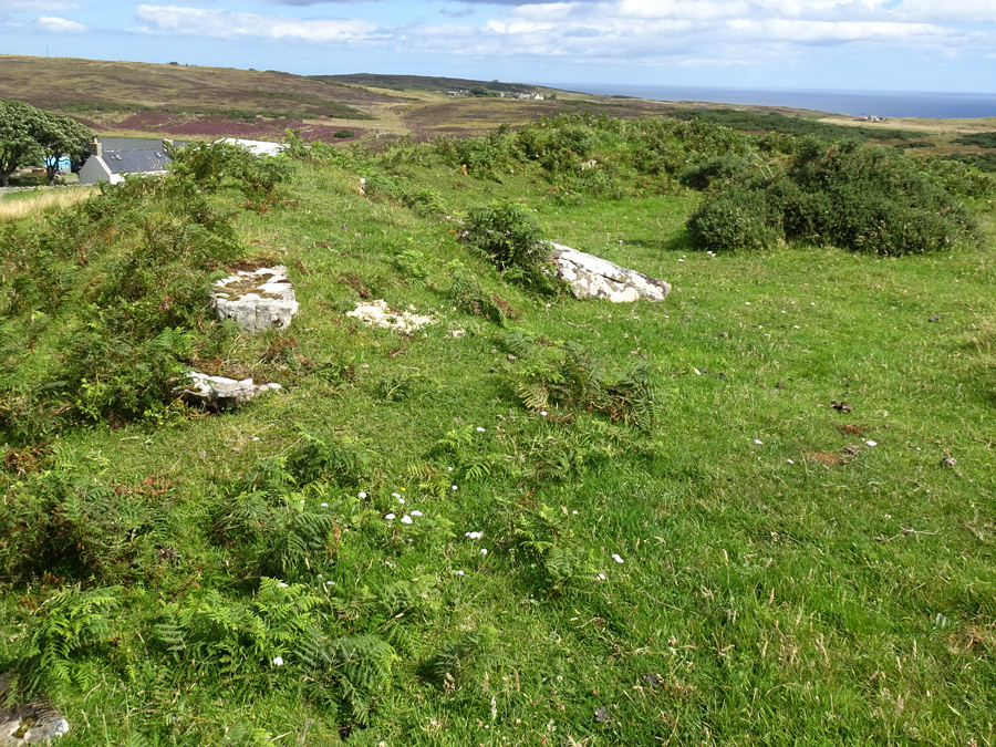
Exposed fragment of outer walling courses on the west of Watenan South.

Outlook from the broch over Loch Watenan towards the North Sea.
Visited: August 6, 2020
The ruined broch at Dunbrae stands about 500 metres north of its more famous sibling at Dunbeath, but is not accessible from the latter. Instead you must take the road signed Houstry 3 about half a kilometre past Dunbeath (when travelling north) and head fror Rhemullen.
The broch stands in the field immediately ahead after you cross the Bridge over the stream. Unfortunately, at the time of my visit this field was occupied by a huge herd of cattle, so the only sight I had of the broch was obteined from the road after circling around the field.
For definitive comment on Dunbrae Broch, see what Canmore has to say about Dunbrae broch.
Visited: August 8, 2020
The dilapidated remains of Thrumster Little Broch are located a little north of the community of Thrumster on the A9 in Caithness, just a couple of hundred metres along the track to Thrumster Little farm.
The broch is visible from the road as a grassy mound, but as you approach it is seen to possess several courses of ground level walling, comprising quite large, light coloured stones. The interior, however, is completely filled with debris, rising as a grass-covered dome perhaps three metres tall.
On the eastern flank, the exit from the entrance passage can be seen behind the tight embrace of a wire mesh fence.

The remains of Thrumster Little broch stand in a flat area in front of a farmhouse.

The foundation course at Thrumster Little is visible round most of its circumference.

Thrumster Little, showing the opening into the entrance passage.


Large white stones in Thrumster Little’s foundation courses.

Loch Rangag Broch, more commonly known as Greystell Castle, seen from close quarters.

The barest remnants of the foundation course of a double wall on the western arc of Greystell Castle.
Visited: August 6, 2020
This broch, more commonly known as Greystell Castle (sometimes as Greysteil Castle) stands on a stubby peninsula on the eastern shore of Loch Rangag. The structure is severely dilapidated with a tumble of angular blocks surrounding it. Indeed the only obvious signs of structure are a hint of double wall around the western arc and slight signs of a ruined entrance passage on the east.
It has been suggested that the peninsula might well be a man-made structure, perhaps originally a crannog, though it does seem rather too close to the shore of the loch to be the latter.
The easiest access to Greystell Castle, from the car-park, is to follow the main road south until level with the broch. Although the field below is protected by an electric fence, you will find at this point a narrow break in the fence where the electric wire is safely ensconced in a loop of insulation to allow clear passage. It’s just a matter now of descending an easy grassy slope to the stile that gives access to the broch.

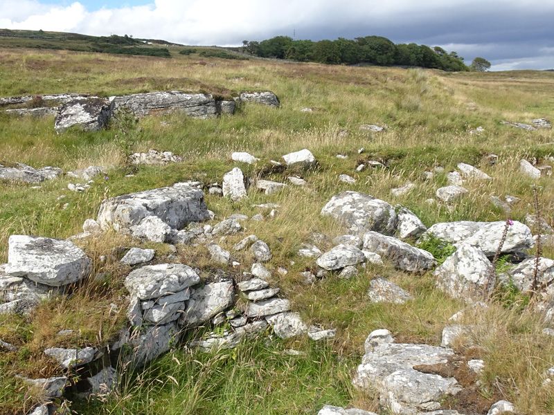
There is little sign of walling structure at Loch Rangag Broch.


The remains of the entrance passageway to Greystell Castle.

Wag of Forse can be a little difficult to locate.
It sits in a depression in undulating terrain, and this is the first sighting of it.

Approaching the dun from the north, this is the entrance portal, complete with a massive wedge-shaped lintel.

View across the interior of the dun, towards the entrance with its prominent lintel.
The wall of the dun is now reduced to a handful of walling courses.

This is a view along the dun wall from the north, overlooking the doorway lintel.

Most of this complex is a ruin of tumbled walls, but the outlines of many of the wags are still easy to make out.

A view over the best presenved of the longhouses (wags) from the bank on its east.

Ground level view into the best preserved longhouse (wag) showing wall courses and monoliths.
Visited: August 8, 2020
Wag of Forse is a dun associated with an extensive complex of stone structures, including longhouses, known locally as wags. The site is extensive and fairly ruinous. The first feature to catch the eye is the entrance into the dun with its huge wedge-shaped lintel. Rather than try to interpret the scene, I recommend reading the in-depth discussion about Wag of Forse on the Canmore website.
This is not the easiest of sites to visit: there is no path to take you there. My route started at a lay-by on the A9 about one mile north of Latheron (white marker) and followed the good track leading to Corr (yellow line) for about 600 metres to a point where the dense gorse on the right eventually gave way to grass and heather. Leaving the track I headed directly towards the prominent stone wall that surrounds the area, a distance of about 80 metres. This well constructed wall is about 1½ metres tall and is guarded by a double strand of taut barbed wire along its top, making it all but impossible to clamber over.
Fortunately, if you turn left at this point and follow the wall northwards for a short distance, a gate appears, and this allows easy access beyond. Wag of Forse now lies several hundred metres to the southeast over relatively easy grass and heather (cyan line on map), but in a dip in the undulating terrain. This means you will not see any structures until you are relatively close to the site.
Visited: August 7, 2020
Coill’ach a’ Chuil is an almost totally ruined broch that sits on the south shore of Loch Naver, some 600 metres west of the point at which the River Naver exits the eastern end of the loch.
At the time of this visit Coill’ach a’ Chuil supported a rank growth of bracken which obscured the finer details of what structure remains of the broch. I could find no trace of the stretch of outer wallface, entrance and guard cell cited by Canmore. What was clear, however, is that around and immediately above the waterline, a substantial barrier of very large boulders marks the boundary of the broch, suggesting perhaps that the enture structure had been built atop an artificial platform.
Access to the broch starts at a track leading south from the Strathnaver road at NC 669 385, and which leads to a bridge across the River Naver. Immediately across the bridge, a path heads right towards the adjacent woodland where there are two gates. Take the rightmost gate and follow a walkers’ path that roughly follows the loch shore to the broch. The walking is easy, over grass and short heather, and it takes around half an hour to gain the broch from the road.

The small headland bearing the remains of Coill’ach a’ Chuil.

These large stones are typical of this broch, though little walling structure remains.

Large boulders immediately above the waterline mark out the periphery of the broch.

Any fine structural details of the broch are concealed under rank bracken.

Yet more large boulders marking out the base of the structure.

The upper level of the broch peeks out from a mass of bracken.

An overview of the top of the broch where many large stones remain in view.
The page for Hunebed D27 in Drenthe can now be found using the above link.
In 1963, the Spanish government under Francisco Franco built the Valdecañas Reservoir, which brought water and electricity to underdeveloped parts of western Spain. However, the creation of the reservoir flooded some inhabited areas as well as large stone (megalithic) monuments. After 50 years of being submerged, one of these ancient monuments—the Dolmen of Guadalperal—has resurfaced due to dry, hot conditions in 2019.
More information at https://allthatsinteresting.com/dolmen-de-guadalperal.


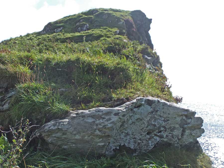
The sole remaining block of the wall that originally guarded the neck of the connecting ridge.


Visited: September 6, 2019
Rising above the cliffs, just under a kilometre southwest of Dun a’Chleirich, stand the rudimentary remains of Dun Ban, a striking promontary fort. The dun stood on the summit of a largely grass-covered rock rising steeply above the clifftops and connected to the land on its northwest by a narrow rocky ridge that has the appearance of having been artificially strengthened. From its summit, Dun Ban plunges steeply towards the sea, with just the footings of the stone wall that once surrounded it remaining.
Although only a short distance from Dun a’Chleirich, the thick bracken that plagues the clifftops here makes a direct approach towards Dun Ban well nigh impossible. The best approach is to start from the same parking spot beside the wooden shack then walk down the road for about 10 minutes to a prominent farmhouse and barn on the left.
Just a few metres down the service road here, a gate on the right leads into the field and onward towards the dun, which is now a prominent feature on the coast. Make your way to the bottom of the field where your progress is arrested by a high fence. Follow the fence to the left and you will soon encounter a metal gate. Go through the gate, follow a rough path down to the stream, step across, then follow another rough path up the grassy approach to Dun Ban.
