
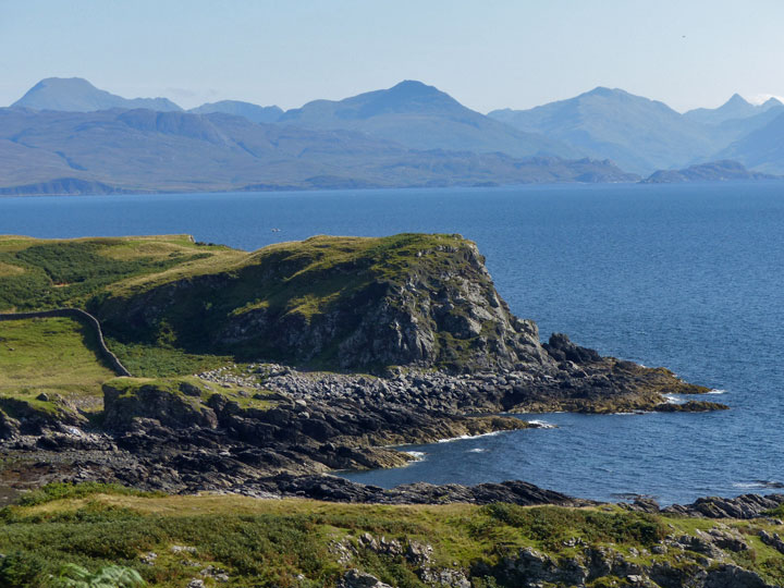
The cliffs of Dun Acardinon, seen from the south.
Image credit: Les Hamilton
The cliffs of Dun Acardinon, seen from the south.

Dun Acardinon, seen from the shore, emphasising the split through its structure.

There are some pretty large masonry blocks at Dun Acardinon, but they are hard to find under the luxuriant undergrowth. Those hiding in this photograph are on the south flank of the dun.

Dun Adhamh, sitting atop its rocky plinth beyond a high fence, viewed from the west.


Some sturdy remnants of the enclosing wall at Dun Adhamh remain.


The large southern cairn, situated in a field of sheep.


The northern cairn, viewed from the east, showing the damage to its structure.

The ruins of Dun Sleadale, viewed from above, with the splendid Preshal Mòr in the background.


External walling courses can be seen round most of the circumference of this broch. In this view, the entrance passage is prominent.


The tumble of stones from the collapsed eastern stretch of the broch’s wall.

The neatly built walls of the Dun Raisaburgh entrance passage.


Foundation courses on the exterior of Dun Raisaburgh.

There are fantastic views to be had, such as this one, looking north over Dun Raisaburgh towards Loch Mealt.


This stretch of walling on the north of Dun Raisaburgh stands six courses tall.

This is the view of the fort as you climb to the col. It hardly prepares you for the extent of the fort beyond.

This panoramic view to the north shows the expansive interior of the fort. The tumbled eastern wall is on the right.

An extensive defensive wall, now in a very tumbledown state, formerly ran the full length of the eastern boundary of the fort.

This photograph illustrates the width of the eastern wall.


This is the best view of Dun Bernisdale, taken from the lay-by on the main road.

Dun Bernisdale lies in direct line with the house in this photograph, but almost completely blends into its surrounding terrain, little more than a gentle undulation in the landscape.

Large foundation blocks at Dun Bernisdale.

Some of the few remaining walling blocks at Dun Bernisdale.
Dun Chlo promontory, viewed from the main road.


Scant residual kerbing at the southwest of Dun Chlo.

The view from across the River Ose. The red arrow above the horizon at right shows the location of Dun Arkaig.


Part of the wall at Dun Arkaig, with the modern cairn prominent.


Dun Colbost, sitting on its mound, seen from the southwest.


A panoramic photograph across Dun Colbost, towards Dunvegan.
