

This site, though grouped with Nuraghe Albucciu and Malchittu, has free access. The tombi is not particularly well conserved – the central stele, or portal stone, is missing and there’s only one capstone left, but the corridor of almost 10 metres is impressive, and probably originally an allée couverte reused and restyled as a tomba in the bronze age.
Nuraghe Albucciu is just outside Arzachena on the SS125 and well signposted in the vicinity. It has an information office/shop with parking on the opposite side of the road to the nuraghe, which is reached through an underpass. We bought tickets to visit here, and Malchittu and Coddu Vecchju, at 5½ euros per person (includes an A5 colour site guide for each of the 3); the site is open from 09:00 – 19:00; the shops sell the expected range of drinks and souvenirs, and has clean toilets round the back; there’s a café right next door.
The nuraghe was built onto the side of a granite cliff. The entrance is on the east side and above it you can see corbels which would have supported a wooden balcony; inside, there’s a tholos (false domed ceiling) room on the right with a niche in the far wall which once led to another entrance to the nuraghe cut into the cliff, and to the left is a low entrance to a possible store room. Both these rooms have no natural light, but an electric lamp is supplied for visitors. A central staircase leads up to the terrace level, where you get a good view of the rooms surrounding the tower, and to the south a few steps down take you through a doorway into the largest room, with one wall of solid granite, and two windows constructed with the narrower part to the outside.
Finds from the site are exhibited at the museum in Sassari.
As Jane has said, easily to find just off the main road to Cala en Porter, this site has ample free parking, but a small entrance fee is payable and a guide leaflet is available at the hut.
A pair of unloved and unsignposted talaiots only yards from the roundabout at the exit from the airport road. Directly under the flight path of everything, I’d guess!
The grid reference is for the better preserved of the two; its more ruinous neighbour is about 50 metres east of here.
Directions: when you come out of the airport, take a right at the roundabout onto the M12 and after about 300 metres, take the narrow left turn just past the first buildings. The road winds round and at the T head, go right. The talaiots are in the field just past the last buildings on the right.
Off the main road from Porto Christo to Porto Colom, just past a zoo, there’s a left turn to Cales de Mallorca – also with the pink sign to Hospitalet Vell. The first site that was clearly marked on our (AA) map as “ruinas prehistoricas”!
Only about 1km down the road, you can see what appears to be a huge wall to the right a way off the road, and soon after there’s another sign and a layby in front of a gate where we parked up and walked up the track to the poblat.
Before you actually get to the wall you’ve seen, a signpost directs you to the left to the foundations of 3 naviforms with a small wood still separating you from the major part of the site.
Back round the wood and the sheer scale of what appeared to be a wall reveals itself as a rectangular monument with the huge blocks of stone typical of the building style of the era. The interior of this monument had inner walls added later.
Exploring round the back, a path leads to the left to a square talaiot with a series of rooms around it and wooden steps to allow visitors to admire the central support pillar of the talaiot and the only known remaining spars which formed the ceiling and second floor – the last century hasn’t been kind to the momuments on the island and many have been left to go to ruin, if not ruined intentionally.
Beyond the talaiot and surrounding rooms, there’s a heavily overgrown area with more ruins extending into the woods.
Limited parking, open access & no entrance fee.
This site is on the road out of Porto Colom towards S’Horta – the road narrows as it leaves the urban area and the roadside stones – a naviform – are clearly visible on the right hand side.
Almost all the site is in the process of being excavated, but at a very slow rate (20 days a year apparently) and almost all was covered with black tarp and spikes, and we could only make out only one naviform in the uncovered area beyond the road and that was becoming overgrown.
Listed as naviform as this is what’s visible but thought to be a settlement of more than 10 buildings.
Signposted off the main road from Capdepera to Son Cervera, just before Canyamel Golf Club, this one is a bit of a mystery.
The pink sign says “Es Claper des Gigant” – nb the first time we tried to visit was a Sunday and the gate was padlocked with no way in – but open the 2nd time so we could park and walked round and came out on the path round a golf course.
Almost immediately, there’s a path off to the left with a wooden sign for “Es Clapers” so we followed the way through a wooded area until we came to a gate and turned right at the T head through it on the basis that my instructions said the talaiot was on high ground.
There were gardeners out on the wide sandy track cutting back the undergrowth, and a few minutes walk later we caught a glimpse of some stone ahead so took a left fork off the main path and after a short climb found ourselves here.
A beautiful talaiot with a path up its side so you can see the entrance, blocked from the outside, and a series of walls and enclosures beyond it .... only checking my notes, I realised it’s the poblat of S’Heretat we were in. But the signpost was quite clear ....
So I’ve listed it as both names and hope someone can identify the location of Es Clapers or confirm that that is the name of the talaiot in the poblat.
Two square talaiots, right next to each other; the first one you come to has a modern wall enclosing it and was very overgrown when we visited – it was all but impossible to see the zigzag entrance runner or the central column, and the second one is so ruinous it’s barely more than a pile of stones in the field boundary.
Directions: From Sencelles take the PM314 south to Cas Canar. After the houses at Cas Canar, just as the road bends sharply to the right, take the turning to the right watch for a pair of gates on the left – one low and rusty, the other over 8ft high with spikes on the top, opposite a sign saying “Sencelles 2,8”, – as you look at the gates the talaiots are in the field to the left.
Some important information about Capocorb Vell:
There’s an entrance fee of 2 euros (2006).
There’s a bar and toilets etc.
There’s ample car parking.
It’s closed on Thursdays!
What day did we visit? Yes, you’ve guessed it, a Thursday, and our last day of holiday too so no chance to try again.
The perimeter walls were sufficient enough, together with the cacti, to discourage hopping over – a huge site with 5 talaiots and numerous rooms to explore ..... next time!
From Santanyi, we took the C714 north towards Cas Concos des Cavalier, but after only about 1km took the first right turn. This narrow road bends after maybe ½km, and glancing into the field to the left, I spotted a magnificent section of wall and following the bend round, the talaiot of Ca’n Jordi set back from the road.
This talaiot has a magnificent, if precariously balanced, central pillar and an unusual zigzag entrance runner.
There appeared to be the remains of some walls or rooms adjacant to the talaiot, but an alarmed, and equally alarming when it popped out of the undergrowth, chicken with chicks was in residence, so we didn’t investigate too closely, but went into the next field where the wall continues.
Sadly, the talaiot and the sections of wall are all that remains of the poblat Ses Talaies de ca’n Jordi.
From the southern town of Felanitx we took the PM512 towards Campos del Port but after about 1km turned off to the right onto the Cami de Son Mesquida. After about 4km, and just before Son Mesquida itself, we took a left onto Cami de Pedreres and almost immediately left again following the signpost to Can Roig.
Before long, there was a right turn with a sign saying “Formatges” which we followed, past a building with huge lettering “Santa Son Mesquida” on it. There’s a house numbered 2098 to the right, and after this we kept to the left down a farm track – with a substantially sized ostrich in the field to the left – and pulled up in the farmyard.
We asked permission, and the farmer, with a beaming grin, escorted us past the cowsheds to the naviform.
The naviform is the remaining one of three; it was the middle one, and the wall to its right contains some of the stones from its neighbour. The inside is impressive, with the walls way taller than us; the interior dividing walls are thought to be later, maybe Roman, additions, and the construction of the apse has lead archaeologists to believe there was originally an attic space.

The central talaiot; overgrown but the central pillar is visible.

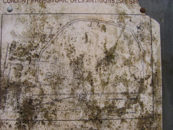
The site information board was in the usual poor state, but you can just about make out the layout of the poblat
This is a little mysterious. At the front of the relevant section of TME, there’s a picture of the talaiot of Sa Canova, in ruins.
In fact there are two talaiots in this area, one of which is a ruinous square one called Canova d’en Morell (pictured in TME) but the guide leaflet to Ses Paisses shows a magnificent talaiot of Sa Canova .... a round one.
This is actually known as Sa Clova des Xot, and is hopefully the one indicated on the map. According to the guy at Ses Paisses, it’s on private land, but is visible from the road to Sant Pere if you know where to look.
Trebalugaret is one of the oldest talaiots on the island according to its sign, and is built on the remains of a pre-talaiotic construction.
One of the easiest to climb, there are the remains of the walls and pillars of a house at the top, though these are thought to have been added at a later date. The site has been enclosed by a modern wall, and houses are creeping up along one side.
Free and open access.
Wow! And wow again!
If you visit just one site on the island, make it this one. It’s just north of Montuiri, which is quite central on the island so not far from anywhere. The site is reasonably well signposted, and it’s only 50 metres or so from the narrow gate to a parking spot under some trees. No entrance fee, and a completely blank information board.
The first area has two talaiots. Talaiot number 1, the first you reach but the one on the left in my panoramic-ish photo is magnificent – 17 metres in diameter with a huge central pillar, a side chamber big enough to climb into, and a 5 metre entrance passage to negotiate. Both talaiots have pillared rooms surrounding them, and talaiot 2 has very distinct internal steps.
In the next field SSE there’s a circular building with a series of rooms beyond it.
But, to the north, there’s a huge circular platform built up from the surrounding land, with a series of wide stone steps leading down from the north west towards the track below.
The site is being excavated periodically but was completely deserted when we were there; spend a day here, go to the museum in Montuiri too.


The south east corner of the site, looking through the trees towards Montuiri

South of, and signposted from, the village of Arta in the east of the island.
If you are visiting out of season check the opening times first. The site has a car park; the entrance fee was 1,55 euros (2006) and a guide leaflet just over 2 euros. The hut where you pay also sells postcards, ice creams etc.
This is a walled settlement – with a very impressive entrance – built around a central talaiot with a series of rooms around it, and another group of rooms to the west. It’s all neatly laid out with a suggested route and information boards for each element.
A visit to this site had been very highly recommended – and despite having the place almost to ourselves, with dappled sunlight filtering through the oak trees, it didn’t inspire me that day .... though anything would have struggled to do so after Son Fornes the previous day.
A confession – we never actually visited this one! It’s two structures, one of which is a circular talaiot.
Our instructions were courtesy of Babelfish and with “In the highway of Son Cervera to Cala Rajada, in lands of golf of It polishes, one is in a small alongside same hill of the highway, in its right side” it’s not surprising we didn’t look the right way until the last day when we didn’t have time to stop.
The joy of Google Earth has located it!
In Spanish. Great detail on everything on the island – well worth a look and a babelfish if your Spanish is like mine, fairly limited!
In Spanish but don’t let that put you off. Loads and loads of info on everything you could possibly want to visit, categorised by type .... fantastic!
Another Menorcaweb link, this time in English, Spanish or Catalan. “Interesting” navigation and page transitions but useful content!
A great site guide from Menorcaweb. Available in a variety of languages – the link is to the English version.
A good quality guide to several of the major sites of Majorca.
In Spanish, includes the opening times, details and photos and layout of the whole site.


