


This is a very substantial barrow. Sadly the interior of the copse is fenced with barbed wire (I was able to step over, however) and used to rear grouse for mighty hunters. Well, I’ve heard grouse can be pretty fearsome...

The great round barrow is heavily wooded... however, for me, that adds to the vibe.


The ‘Cup Barrow’ and the enigmatic ‘Four Barrows’ seen while hanging out for a while.

Looking approx east... with the possibility of showers. Apparently.


Into the sun upon an afternoon of crazily volatile weather.

The Giant’s Grave resides within the copse beyond.

By far the finer of the pair...

Approaching along the byway from Upham to the west. The great round barrow is concealed within the trees... and, regrettably, a barbed wire fence. Note a further substantial round barrow with – as the former – a ploughed out cohort, standing beside the track a little beforehand.

Ever wondered how a Wessex long barrow was constructed? Suffice to say the local fauna are about as meticulous excavators as the Victorians were in their day.

Liddington Hill’s copse – the hill fort is to its left – may not be as enigmatic as that at Minning Low... but it’s getting there. Note the position of the LB’s possible ‘chamber’. And the bloody fence splitting the monument in half.

There’s nothing like embedded stone upon an ancient mound to make this Gladstone glad he stopped by. Simple things..

Whereas this stonework appeared to possess proper structure, appeared integral to the monument?

Stonework upon the long barrow. I had the feeling this grouping was probably field clearance; but that’s just my hunch.

Toward Sugar Hill from the long barrow... I was debating with myself – as you do – whether the extension would be worth the effort. Suffice to say it is. Incidentally the excellent Aldbourne Four Barrows are located upon the hillside far right background.

The monument is well seen from the byway to west of The Giant’s Grave, near Upham. The wondrous ‘Aldbourne Four Barrows’ are above and to the left.
Well seen by visitors to Sugar Hill to the north-east, Pastscape has this to say:
“A Bronze Age bowl barrow is visible on aerial photographs as an earthwork. Classified by Grinsell as Aldbourne 14 the barrow has since been ploughed out and is now visible as a cropmark of mound and outer ditch with a diameter of 40m. In the centre of the barrow is the mark of a pit possibly the result of excavations. When Greenwell excavated in 1878 he discovered a primary cist with a cremation and associated scrapers. The barrow may be associated with the two possible Bronze Age round barrows to the east (SU 27 NW 101; SU 27 NW 171).”

Limited zoom from the great Sugar Hill round barrow to approx north-east.


Despite not exactly being cherished – as one would expect, to be fair – this remains a pretty substantial monument. Thankfully what might be said to be a completely OTT barbed wire fence had been brought down at one point, allowing access.


The Aldbourne Four Barrows, a fabulous quartet, lies beyond and to the right of the far trees; the ‘Aldbourne 7’ barrow stands behind a vicious barbed wire fence to the left.

Where’s the Mam C when I need her – I mean really need her – for scale duties.

Love the little tree... “I aint goin’ nowhere for no one, me”.

Looking approx south toward the wooded site of the excellent Giant’s Grave. To be fair this monument gracing Sugar Hill is arguably even more deserving of that moniker. The whimsy of local folklore can be so cruel to some Bronze Age spirits, you know?


The magnificent round barrow crowning Sugar Hill... the sheer size and preservation fair blew me away, so it did.
Two round barrows, one more or less ploughed out, the other pretty substantial stand some way to the approx west of The Giant’s Grave. According to Pastscape:
“The larger and more complete of the two barrows, at SU 2433 7642, measures 30m in diameter and displays no sign of an outer ditch. In the centre of the barrow the soilmark of a pit is visible. The smaller of the two, at SU 2431 7643, measures only 20m, but is barely visible as it has suffered damage from ploughing. [RAF 106G/UK/1415 3312 14-APR-1946]”
It would appear folks have got a little confused over time as regards what was found at which of the many barrows in the vicinity of Aldbourne. However I believe the following, taken from Pastscape (MONUMENT NO. 225145) refers to this example, well seen from the ridge west of The giant’s Grave:
“Aldbourne 6, (WG 280) 30 paces in diameter x 5 1/2ft in height, (2) no trace of ditch (3). Excavation by W Greenwell revealed a primary cremation on a plank of wood in a cairn beneath the barrow, surrounded by wood ashes. Associated
objects found include an Aldbourne cup with lid, parts of a bronze dagger, two bronze awls, beads of faience, amber, shale and encrinite, a shale ring-pendant and ring, a V-bored button, the cast of a cardium shell and a polished haematite pebble. A secondary (?) burial of scattered burnt bones was discovered to the north with a lidless Aldbourne cup, inlaid with white material, two flint arrowheads, one barbed and tanged, the other triangular. In the material of the barrow were nine sherds (1 of beaker) and many flint flakes. (2 & 3).
Wessex grave 33 (4). Finds went to the British Museum (2). (2-4)”


More of that footprint... Garreg Lwyd rises top right.

The excellent cemeteries of Tair Carn Uchaf (centre) and Tair Carn Isaf (far left) grace the ridge beyond to north-west.

Highlighting the pretty large grassy footprint...

Approx south east toward Upper Brynamman. Nice day for it.
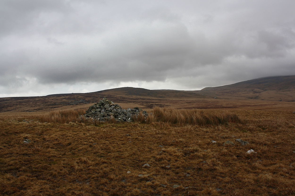
Looking approx north-east. The great stone pile of Carn Pen y Clogau visible top left skyline (the western sub-2,000ft hills of Y Mynydd Du possess some magnificent cairns)

Appalling weather... I’d have been better off in flippers... yet an intriguing place to be for 30 mins or so.


Below and to approx SE of the settlement, I initially thought this was natural outcropping due to its sheer size. However I soon made a reappraisal; there is little regularity to the fabric and, furthermore, a grassy footprint.


The cairn crowning Foel Deg ar Bedol can be seen approx centre left skyline across about a click of the worst, most incessant bog I’ve encountered this side of Pumlumon

My assumption would be these settlements may well have been rebuilt and adapted by later peoples?

Looking toward Rhiw Wen and Garreg Lwyd... well, in a manner of speaking.