


The great hill fort from the head of the Nant Buarth Glas

Could’ve hung out all day... but there are a few other sites in the vicinity.


Strangely... Coflein includes images of a cairn at these co-ordinates with cist and slipped capstone??

Not the best of conditions; but nevertheless a pretty fine, well placed cairn with heaps of vibe.
Ah, Cwmdeuddwr. So, what’s in a name? Now whilst Welsh speakers will no doubt already have a pretty good idea where I’m heading, those unfamiliar with the vernacular, but nonetheless harbouring a fascination with language, with words... may be interested to discover the prosaic epithet transposed to my mother tongue as ‘Valley of the Two Waters’. Or something like that. It would be churlish to deny that there certainly is a lot of water in these parts; however my understanding is we’re concerned with two rivers here: the Afon Ystwyth and Afon Elan. Not house hold names to the uninitiated, perhaps, particularly with that superstar of UK rivers – the mighty Wye – flowing a few miles to the east, en route from its enigmatic birth upon Pumlumon to subsequently caress the less rugged landscape of blighty. However it is fair to say both of the underlings have their moments: the nascent Ystwyth undertaking an initial alacritous, youthful cascade through Cwm Ystwyth to finally merge with the Irish Sea at Aberystwyth... clearly with nothing more to prove – an analogy for life itself maybe?; the Elan, flowing in the opposite direction, of course gives rise, in a quite literal sense, to the wondrous water world of the Elan Valley Reservoirs so beloved of travellers and tourists alike. Mind you, I’d wager even Costner couldn’t find ‘Dry Land’ here in Mid Wales.
Yeah, water. For me, one of the signature features of the Cwmdeuddwr Hills is the supporting cast of a myriad crystal clear streams feeding the ever-demanding reservoirs. Arguably, few offer a more impressive spectacle than the Nant Cletwr where discharging into the Craig Goch Reservoir, here spanned by an old stone bridge carrying tourists upon their motor itineraries looping back toward Rhayader. Now, according to a scrawled annotation upon my somewhat distressed map, I stopped here on 15/4/95 and duly observed: ‘Good valley and falls’. 23 years later... a stone track leading westward along the northern bank to the (now derelict) farmstead of Lluest Abercaethon beckons the curious traveller onward into the unknown. Should he feel so inclined. I do, as it happens. Well, as Einstein once famously said, “The most beautiful thing we can experience is the mysterious....“. Now, whether or not one believes in the faster-than-light neutrino, I reckon Al had ‘beauty’ bang to rights.
Speaking of which the track, although traversing a working landscape devoted to sheep husbandry, as you might expect in Wales, is not without aesthetic appeal, this courtesy of the aforementioned river. The farm buildings stand in stark profile at the head of the cwm, roofless, gaping door and windows in drystone walls inviting – or rather compelling – the traveller to enter and view what was once a glowing, vibrant hearth in curiously hushed reverence. Beyond the stock control paraphernalia and fence lines: the open hillside. Here, at SN87156877, my map shows.... bugger all. However owners of the latest 1:25K version will note a ‘mound’ at said spot. I prefer the much more enigmatic ‘Tumulus’, but there you are. To be honest this is but splitting hairs, not that I’ve much to spare myself, you understand, since Coflein has no doubt that this represents the remains of a round barrow. A pretty substantial, impressive one, too. Furthermore, the monument has no corresponding issue with ‘top cover’, duly sporting a mop of that ubiquitous ‘tussocky’ Mid Walian grass so luxuriant that even Boris might well consider reaching for the shears. When not spouting shite about Brexit, that is. It’s all that rain, see? Whatever, it surely doesn’t take an Einstein to deduce that the sight of early morning light illuminating the round barrow is infinitely preferable to that upon Mr Johnson’s napper? Theoretically speaking... not that I’ve experienced the latter. The barrow’s positioning is excellent: surrounded – nay, encircled – by the bleak, clean lines of the grassy ridges of Cwmdeuddwr stretching away into the hinterland, the latter strangely inviting under blue skies. A natural amphitheatre.
So, that’s the ‘easy bit’ over, then. Yeah, tell me about it. No more tracks to ease a Citizen Cairn’d’s progress across this brutally uncompromising landscape. To the (very) approx north-west one of the aforementioned ridges, Esgair Beddau, is my next objective, the site of two obscure cairns. Again, these are absent from my map but highlighted upon the new in that wondrous ‘antiquarian’ typeface. Don’t you just love it? Now this is the point where I reacquaint myself with the equally wondrous Nant Cletwr, the erosive action of the river across millennia ensuring I must descend steeply to, then step over its nascent flow prior to undertaking an equally abrupt upward scramble beyond. Suffice to say the cairns are not exactly upstanding. However, upon electing to follow the vague ghost of a sheep track to the west, I finally notice an orthostat peeping above the grass. This belongs to the western of the pair; there are more uprights, albeit of lesser size, it being – in my opinion – fair to state the sum of the whole representing a former kerb. There is also what appears to be the remains of a cist, although in no great repair. The companion cairn, a short distance to the approx east, lacks the surviving orthostats of its neighbouring monument, but compensates the traveller with a more obvious cist element... if still not conclusive. But there you are. It is the overwhelming sense of place which engulfs here, not the archaeology.
Needless to say both cairns share the same ‘other worldly’ vibe, their lack of stony profile ensuring the gaze is drawn upward to focus upon the billowing, white galleons of cloud... advancing across a disconcertingly blue canvas in stately procession. Yeah, it’s more or less impossible to think of mundane topics in such an environment. Not with the ‘big picture’ quite literally before my very eyes. Such vibrant colour can not last, of course, as Winsor apparently noted to JMWT himself. So one must enjoy the moment. Time flies, as it always seems to do ‘up here’; however, loathe not to explore further, I decide to continue my ascent to the west and, upon circling around the headwall, return to the car via Trumau across the cwm. Looks easy on the map – even an old one – and, for that matter, on the ground, too. However half way ‘round I find myself cursing the lack of any kind of path whatsoever... whilst simultaneously revelling in the fact of their very absence. Now this may seem paradoxical, absurd even? Maybe. But then perhaps having the opportunity to experience a landscape so raw, so uncompromising, yet within scope of an average punter is the prime reason, the whole point of coming to Cwmdeuddwr. Truly, it is the Green Desert. Only with water. Lots of water.
I arrive back at the car, intent upon sleeping below the source of the Ystwyth, with satiated questions duly replaced by yet more to ponder. The mystery of why I love these bleak uplands still very much undiminished. I hope Einstein would’ve approved of the harmonious equilibrium of the universe remaining intact. If not Mick Jones.
Set above and to the approx west of the now derelict farmstead of Lluest Abercaethon, this round barrow, not mentioned upon the 1:50K OS map, is depicted as a ‘Mound’ upon the latest 1:25K.
Coflein has no such reservations regarding classification. A round barrow it is... and I concur. Dimensions are:
“Average 15m in diameter x approx 2m high . Slight hollow in area of centre, in part made by OS datum post, still present (RSJ 2000).”
Note that the ‘OS datum post’ was conspicuous by its absence.
There is, I reckon it’s fair to say, a widespread view prevalent amongst the ‘hillwalking fraternity’ assuming a direct correlation between increasing height above OD and quality of ‘outdoor experience’... to resort to the annoying modern parlance. Now while I’ll happily concede there is some merit in this outlook – altitude does, after all, tend to help eliminate periphery obstructions to far reaching vistas, not to mention progressively isolate the potentially transcendental ‘up there’ from the everyday, humdrum ‘down here’ – my experience over the course of some 30 odd years inclines me to believe that it is the exceptions which, in this respect, very much disprove the rule.
Consider a visit to the great upland cairn of Cerrig Cewri (Giant’s Stones) a little to the approx north of Carn Twrch, an obscure Mid Walian summit looming above the southern, sinuous extremity of Llyn Brianne: a perfunctory, somewhat blurry perusal of the map over breakfast upon Cwmdeuddwr had suggested a relatively easy, straightforward mile and a half (or so) walk along a public bridleway to what is, after all, a hill not quite reaching 1,600ft in height. Yeah, how hard can it be? No, really? Suffice to say I reckon, with the warm glow of hindsight, that the approach from the north is quite possibly one of the most physically demanding ascents/descents of any Mid Walian summit I’ve undertaken. All things considered.
To be fair, the proverbial penny drops as soon as I park up above Bwlch-y-ffin and lament the initial height loss inherent in following – or rather attempting to follow – the aforementioned official ‘bridleway’ depicted upon the map. You see, these little details matter when the knees don’t want to keep on doing what you want them to keep on doing any more. Furthermore, I soon find myself apparently bereft of any map reading skills I may – or may not – have been born with as my chosen route is abruptly terminated by a semi-trampled barbed wire fence above a stream. Mmm, seems I’m following in the uncertain steps of other, more militant punters before me? Where’s the friendly(?) neighbourhood giant to stand upon the shoulders of when you need him. Or her?
Anyway... beyond, the terrain rears up at a seemingly prohibitive angle, the Nant y ffin cascading down the hillside within a seriously deep gulley so steep-sided I baulk at the thought of crossing. Instead, I elect to continue onwards and upwards following the natural line of ascent where, theoretically at least, Nature will provide a less overwhelming obstacle. Sure enough, a little before the forestry limit upon Cefn Ystrad-ffin, I step over the nascent stream... and ... straight into deep bog. But there you are. Serves me right for losing the ‘obvious’ track, doesn’t it? The low ridge of Cerrig Cewri is soon visible to the approx south-west, significantly further away than I had anticipated, to be truthful. The landscape is an unforgiving mix of the aforementioned bog and tussocky grass ensuring my yomp is subject to a bovine grace. Hell, this bloody cairn had better be worth it.
It is. According to RCAHMW (12/2/2009) it measures “13.20m in diameter and is up to 2.0m high”. So pretty substantial, then, despite being, assuming the ‘Inventory of the Ancient Monuments in Wales and Monmouthshire’ (HMSO 1917) is to be believed, but a surviving remnant of what once was: “The carnedd has been so much reduced within living memory as to be now no more than 4 feet high, and it is said that in the course of its disturbance traces of fire and some burnt bones were met with”. Ha! Voices from yesteryear throwing light upon our own tentative forays into that yawning void BCE, observations published at a time when the very fabric of society was being torn asunder by the clash of imperialistic titans and the birth of the fledgling, evil spectre of Lenin and his acolytes. For me it is this desire to understand the past, to view what went before as the foundations of an ongoing, hopefully improving story which defines the western democracies; a worldview which, if maintained, will ensure our way of life will always be worth fighting for. Precious detail... adding additional pixels, further definition, clarity to that image of who we were, what we are and, potentially, what we could be. So to speak.
A sun burst streams through a crack in the otherwise minacious cloud base illuminating the ancient stone pile for but a fleeting moment. All too soon it is gone, a tantalisingly brief wash of colour from the cosmic paintbrush rendering all the poetry, prose and whatever other descriptive language you may think of redundant. For a few seconds. To the south, appropriately enough, the great, mountainous escarpment demarcating South Wales rears up, darkly brooding in sombre intensity, upon the horizon. Nearer to hand and on a more intimate scale is Twm Siôn Cati Cave, set upon the sculptured crags of Dinas to the west, the legendary, infamous former owner apparently a sort of Welsh ‘Robin Hood’... only without the ‘giving to the poor’ bit. Which is kinda missing the point of being a ‘people’s hero’, one would have thought? But there you are. A case study in notoriety for a certain Jessie James, perhaps? The dubious heroic ethics of our Twm notwithstanding, Dinas is a striking landscape feature fully prototypical of the harmonious aesthetic of the area. And to think, as compelled to think the traveller most certainly is here, that this haunting, ethereal cairn is not even at 1,600ft. Surely some mistake? I fumble for my glasses and check the map again. No. It would appear not.
All is not rosy up here where giants apparently did not fear to tread, however, for forestry plantations encroach with their attendant widespread devastation, the shrill clatter of logging lorries upon forestry tracks, their whereabouts betrayed by clouds of dust, periodically echoing across the hill side. Indeed the great, summit cairn of Carn Twrch, visible to the immediate approx south(ish) sits within a landscape which may well have brought a shudder to the contemporaries of those 1917-era archaeologists. But there you are.... at least Carn Twrch survives, albeit topped by an OS trig pillar. And pretty hefty it is, too.
For me, however, the Giant’s Stones are the jewel within this Mid Walian crown and it is a bummer to have to begin the descent. If anything, this proves to be more difficult than the ascent, the terrain sending me sprawling, head first, into a murky pool at one point. In no uncertain manner. Yeah, I find no sign of the supposed ‘bridleway’... although, of course, that might well have just been me. Again. Losing patience, not to mention reserve endurance, I go for broke and fling myself down and up the other side of the mighty defile of the Nant y ffin. The final pull to the car is sheer purgatory. Whether one believes in that sort of thing, or not. But hey, it was worth every step to prove – once again – that spending a few hours or so ‘being elevated’ doesn’t necessarily mean what your average hill walking punter might think it does.


The sharp-eyed may just make out Cerrig Cedny top right. Not a stone.... but many, arranged in a great pile


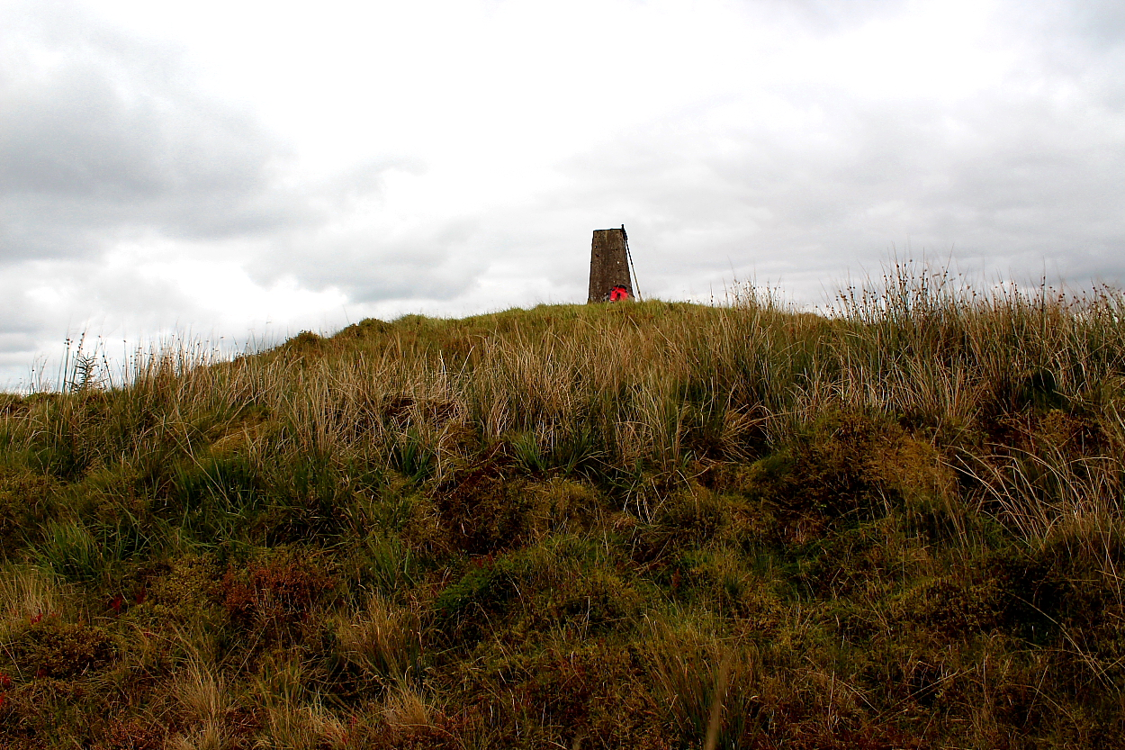
Crowned by an OS trig pillar.... set amongst forestry operations – indeed, damaged by those operations, despite obvious efforts of those in charge – this is nonetheless a large, well preserved (presumed) cairn. Presumed, since the grassy mantle is absolute.


The summit cairn of Carn Twrch can be see beyond...


Toward Y Mynydd Du and the great escarpment barring access to South Wales. Pen-y-Fan and Corn Du can just be discerned extreme top left beyond Carn Twrch.

Another excellent upland round cairn to add to the Mid Walian canon.


The other cairn.... and some sky. To be fair the sky takes precedent here.

Western cairn. Note the obvious kerb

Western cairn. Note the orthostat, foreground.

Both cairns display – to me – clear indications of former cists elements/kerb. This is the western cairn.

The cairns sit upon Esgair Beddau, approx centre of image (the middle of the three roughly parallel ridges.


Craig Goch Reservoir can be seen extreme right....


The landscape is classic Cwmdeuddwr Hills...

Looking across to Egsgair Beddau, home to a brace of cairns. The ridge continues to Clawdd Du Mawr… note that a circuit of the surrounding hills, despite the relatively modest height, is a serious undertaking owing to lack of any paths across knee high tussocky grass and bog. As you would expect from the Cwmdeuddwr.

Unless you are aware what you’re looking for.... but once located this is clearly a fine round barrow, excellently positioned within the landscape.

Approaching from Trumau to approx south.... the round barrow stands upon the near rise, lower centre of image.

The irony of places such as this – pragmatic, utilitarian structures – also being so goddam exquisitely beautiful never fails to impress upon me.


Looking back to the ‘enclosure’ upon Cefn-y-Gaer. I must say I agree with the local farmer (who came up to check me out and was an unusually well informed man) that the powerful nature of the ramparts of the latter suggest something much more significant than ‘livestock enclosure’ apparently assigned by the pros.

Western defences. Suffice to say these people weren’t messing about.


