


With Belstone Tor on the left, looking across the East Okement valley towards High Willhays and Yes Tor.

The eastern arc of the badly damaged cairn.

Dusk at Watchet Hill. The pole is used to signal when the firing range is active.

Looking south along the ridge towards Steeperton Tor. The small bump of an outcrop to the right is Oke Tor, with the higher Hangingstone Hill, almost 2000ft and crowned with cairns, directly behind.


Looking west. I think the high hill capped with cloud is Yes Tor, the second highest top on Dartmoor.

Looking north. The outcrop far left of shot is Winter Tor, with Higher Tor on the right.

Looking east across the cairn. The big whalebacked hill on the left is Cosdon Beacon, topped with a large cairn.

Higher Tor cairn, with Higher Tor rising behind.

Some landscape context from the slopes of Winter Tor above. The cairn circle is just above the valley bottom, left of centre.

Looking northwest down the East Okement valley.

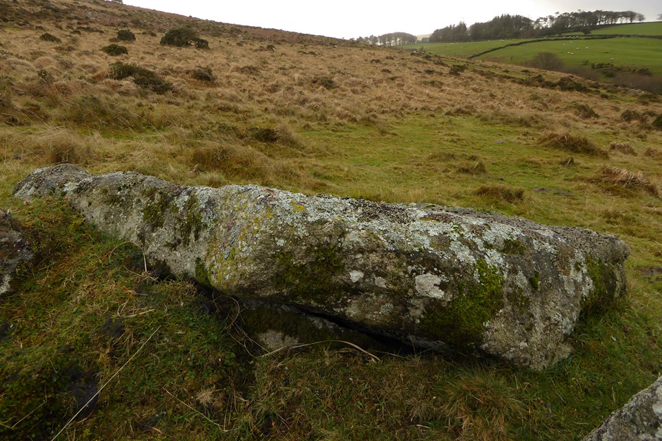

The displaced capstone leaning against the edge of the cairn circle.

Looking southeast towards Winter Tor. Fragments of cist can be seen in the centre of the cairn circle.

A brief grin-inducing sunburst on the circle.


Large recumbent slab on the edge of the cairn circle.


The prominent cairn at ST 16700 34898.

Prominent but overgrown cairn at ST 16700 34898, southeast of the summit.


Very overgrown cairn at ST 16426 35195, a little northwest of the summit cairn.

The platform cairn at ST 16416 35619, looking towards Great Hill.

Platform cairn at ST 16416 35619, next to path up Wills Neck from the Triscombe Stone.


The Triscombe Stone. It was nice to reach the shelter of the trees out of the driving wind and rain.

The encircling bank of the platform cairn at ST 1565 3625.

Looking across the platform cairn at ST 1565 3625.

Fine platform cairn (one of two on Great Hill) at ST 1565 3625.

West Hill platform cairn from the northwest.

The central mound of West Hill platform cairn.

Section of the bank around the rim of West Hill platform cairn.

The excellent West Hill platform cairn.
Two large cairns on West Hill and Fire Beacon. Pastscape descriptions:
Fire Beacon cairn (ST 1491 3697)
A Bronze Age cairn located on the summit of Fire Beacon, a south west facing hill in the western region of the Quantock Hills. The cairn is of irregular shape with a spread mound, approximately 2 metres above ground level at its highest point and 26 metres in diameter. The surface of the mound has been disturbed which may indicate that a partial excavation has been carried out, probably in antiquity. Scheduled.
West Hill cairn (ST 15433719)
A very large platform cairn lies on the summit of West Hill at ST 1542 3717. The cairn comprises a rather disturbed stony mound, 28m in diameter and 1.6m high. Stone has been taken from the mound, probably to build the nearby enclosure bank. Despite this disturbance, the vestiges of a bank around the north part of the mound, and a central mound, 10m NS x 12m EW x 1m high, may be original features, suggesting that the cairn may have been an embanked platform cairn with a central mound.


The mound of the eastern cairn, looking towards Black Hill.

The eastern platform cairn. There is little to see of the surrounding bank.

Detail of the flank of the heather-covered western barrow.


Wilmot’s Pool western barrow and eponymous pool.
There are two cairns at Wilmot’s Pool. Pastscape descriptions:
Western barrow (ST 15303813)
A large Bronze Age barrow lies on the southeast side of Wilmot’s Pool at ST 15310 38135. The barrow comprises a circular mound 21m in diameter. The top of the mound has a circular depression in it, 10m NS x 8m EW x 1.5m deep. This may be the result of antiquarian excavations or it may be the site of a beacon fire. The semi-circular bank on the south edge of the mound is formed of material from this hollow. A small satellite cairn, 5m NS x 4m EW x 0.6m high lies on the southeast side of the barrow and compares to a similar feature on the southeast side of the barrow on Beacon Hill.
Wilmot’s Pool is a pond, teardrop-shaped, 45m x 30m and some 1.5m deep. It still holds water in the winter, although the north side has been breached. The pond is of considerable antiquity: it appears on a map of 1609 (Somerset Record Office 1609 A plot of Quantock belonging to the right honourable the earle of Northumberland DD/SAS C/923). Narrow ridge and furrow ploughing has slighted its west and southwest sides. The pond was probably dug in the medieval period for watering stock on the commons.
Eastern cairn (ST 15483813)
A large embanked platform cairn lies some 200m to the east of Wilmot’s Pool at ST 1548 3813. The cairn comprises a circular mound, 17m in diameter and 1.1m high. The bank which runs around the perimeter of the mound is 0.8m wide and 0.8m high. A mound 3.4m in diameter and 0.8m high is placed to the northwest of centre on top of the mound.

Low cairn hidden by bracken – this is the easternmost of the Black Hill summit group, at ST 14742 38207. The big hill over on the right is Dowsborough hillfort.

The other side of the most prominent Black Hill cairn.

The most prominent of the cairn group to the northwest of Black Hill summit.

The southwestern cairn on the slopes of Hurley Beacon at ST 14125 37998, very overgrown with gorse and heather.