

thesweetcheat

Looking west towards Chelmorton Low, which has another round barrow on top of it.
Image credit: A. Brookes (7.9.2021)

The eastern chamber, looking towards the prominent Priestcliffe Low, which has a round barrow on top of it.
Image credit: A. Brookes (7.9.2021)

The overgrown western chamber, with the eastern behind.
Image credit: A. Brookes (7.9.2021)


Landscape context from the west. The tomb is behind the trees.
Image credit: A. Brookes (6.9.2021)


The two largest slabs, forming the southeastern end of the pit.
Image credit: A. Brookes (6.9.2021)
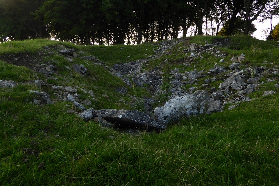

Showing the smaller slabs on edge on either side of the pit.
Image credit: A. Brookes (6.9.2021)


Looking south-ish across the pit with the slabs.
Image credit: A. Brookes (6.9.2021)
Walked up from Tideswell on a lovely late summer/early autumn evening (6.9.2021). I approach along Tideslow Rake from the east, with the extremely disturbed ground and the trees at the top of the hill obscuring the tomb. The trees are full of clearly artificial mounds, but these aren’t the mounds I’m looking for.
Coming out of the trees, the mound I am looking for is massive but very disturbed. Sadly I’ve timed my visit a bit late, so the monument is in deep shadow cast by the trees, while the surrounding countryside basks in lovely low light.
The central pit with the slabs is interesting. Stu describes the pair of slabs at the southeastern end of the pit as coming from a lime kiln. This may be so, but they’re also just the right size for the edging slabs you get in some of the chambers round here (I’m thinking of Green Low near Aldwark, for example). There are further smaller slabs lining the long sides of the pit and I wouldn’t be surprised if these were also part of the original megalithic structure.
Whatever, it’s a fine spot. The resident sheep are a bit non-plussed by my visit and I don’t stay as long as I might have done due to the deep shadow making photos rather unrewarding.
I leave the hilltop down the western slopes, the retrospective view back to the top reminiscent of Minninglow. Once you know where this is, the trees and mast make it quite an obvious landmark in this part of the Peaks.
I return to Tideswell via a nice stroll down Brook Bottom, passing a very peculiar wellhouse made of a cone of (presumably) concrete.
A good way to finish the day.

The eastern ramparts, the one part of the earthwork that survives to any height.
Image credit: A. Brookes (28.8.2021)

Looking across the site from the west. The western rampart would be in the immediate foreground, but it would take a real eye of faith to see anything of it.
Image credit: A. Brookes (28.8.2021)

Looking across the site from the southeast. The course of the rampart is just visible as a lighter green line.
Image credit: A. Brookes (28.8.2021)

The low line of the southeastern rampart runs across the picture, parallel with the fence, but is very ploughed down.
Image credit: A. Brookes (28.8.2021)


The southwestern side, where only the inner rampart remains, the outer rampart ending on the right of the shot.
Image credit: A. Brookes (20.8.2021)

The line of the destroyed southern ramparts next to the river.
Image credit: A. Brookes (20.8.2021)

Outer rampart and inner ditch towards the south of the fort, where the diversion of the River Stiffkey destroyed the earthworks.
Image credit: A. Brookes (20.8.2021)


Southeastern ramparts, looking towards Wighton church.
Image credit: A. Brookes (20.8.2021)

The eastern ramparts, looking towards the modern entrance.
Image credit: A. Brookes (20.8.2021)


Stone in the top of the barrow, liberally studded with flints.
Image credit: A. Brookes (20.8.2021)

The barrow is in a nice little (publicly accessible) enclosure, which may be a nice wildflower meadow until the man with the mower comes.
Image credit: A. Brookes (20.8.2021)

From the southeast, showing that the barrow is more oval than round.
Image credit: A. Brookes (20.8.2021)


The central barrow from the south.
Image credit: A. Brookes (14.8.2021)

The central barrow from the northwest.
Image credit: A. Brookes (14.8.2021)

Looking from the top of the central barrow to the lower southwestern barrow.
Image credit: A. Brookes (14.8.2021)

Looking from the top of the central barrow towards the northern barrow.
Image credit: A. Brookes (14.8.2021)

The central barrow.
Image credit: A. Brookes (14.8.2021)

Northern barrow.
Image credit: A. Brookes (14.8.2021)

Looking from the northern barrow to the central barrow.
Image credit: A. Brookes (14.8.2021)

The dent in the top of the northern barrow (where the quoit landed, presumably).
Image credit: A. Brookes (14.8.2021)

The northern barrow.
Image credit: A. Brookes (14.8.2021)

The excellent northern barrow.
Image credit: A. Brookes (14.8.2021)

The group from the southeast.
Image credit: A. Brookes (14.8.2021)

Centre barrow from the road to the east.
Image credit: A. Brookes (14.8.2021)

The barrow group from the northwest.
Image credit: A. Brookes (14.8.2021)

The northern barrow.
Image credit: A. Brookes (14.8.2021)

Reconstruction of the hillfort phase from the information board.
Image credit: Forestry England/Historic England (14.8.2021)

The northern outworks. Looking west along the edge of the Blackdown Hills towards Staple Hill, where I headed next.
Image credit: A. Brookes (14.8.2021)

The northern outerworks. Looking west towards three of Somerset’s highpoints: Staple Hill on the left, Exmoor centre and the Quantock Hills right.
Image credit: A. Brookes (14.8.2021)

The highest part of the fort, in the northern section. This would have been the site of the Norman motte or keep.
Image credit: A. Brookes (14.8.2021)