
Image credit: A. Brookes (25.2.2023)


Apart from the damage on the top, the stonework is well-consolidated in the mound.

Visited 25 February 2023.
The last hill and last site on a hilly walk from Port Talbot. After steep but straightforward visits to Twyn Disgwylfa round barrow and the Buarth y Gaer sites, my post-Covid stamina is starting to fail as I get back to the minor road to the west of Foel Fynyddau. The sporadic sunshine that had accompanied me so far is gone, replaced by failing light, grey skies and a chill wind.
Foel Fynyddau’s summit is open access land, with a track heading off from a bridleway to the southwest of the summit, past a farm. For whatever reason, probably fatigue-induced brain fog, I decide to avoid the farm and the easy track, instead heading directly up the rough ground to the west of the summit. Although the terrain is open and the distance not that much, I regret this decision pretty soon, as the tussocky grass, ankle-sapping heather and various small streams and valleys suddenly seem as exhausting as climbing a mountain. By the time I reach the upper slopes I’m practically falling over with tiredness, resorting to a longer but less steep zig-zag along faint sheep tracks to avoid having to tackle the slopes head on. It’s a blessed relief to make it to the masts and the cairn.
Despite the inevitable trig pillar and central hollow, the cairn is decent and stands to a good height. The views are excellent, other than the masts and sundry fenced off compounds in close proximity, which sadly detract from the monument’s atmosphere. On this grey afternoon, the whole area feels a bit forlorn and unloved.
I sit down on a handy bench a little way off the summit, eat my sandwiches and feel a little less weary. Restored, I have another mooch around the barrow and take in the sweeping views from this very prominent hill. Y Mynydd Du, Fforest Fawr and central peaks of Bannau Brycheiniog are all on display to the north, with the Hafren/Severn and far away Somerset to the south.
To the east and south the hill drops very steeply to forestry tracks which have been co-opted to form a network of suicidal cycle routes. I don’t fancy going back to the west, having decided to catch the bus back to Port Talbot from the village at the foot of the hill, so I tentatively head off to the southeast.
This turns out to be a very bad decision, as the very steep descent off the hill this way is perilously slippery, with me clinging to the vegetation to avoid a swift fall. Once past the steepest section, I’m into the cycle tracks, which have been made smooth and slippery by use. Before long I’m on my arse in the mud. Eventually I emerge onto a broad, stony track, but unfortunately it only seems to go back up the hill and so I have to resort to a much smaller track, shown on the OS map but quite badly overgrown. The further I go, the more overgrown the narrowing passage between gorse and brambles gets, and eventually I have to climb underneath a gorse bush to get any further, as there’s no way I can face going back now. I emerge with lots of bits of twigs and branches down the back of my neck and under my clothes. Yuck. I slip over again on the muddy tracks before I finally reach a road, battered and exhausted. It’s rather taken the shine off what had been a really nice walk! I strongly recommend just following the damn track from the west and returning the same way if you come here.

Central enclosure earthworks.

Looking across the multiple banks of the central enclosure.

Southwestern arc of the central enclosure, looking towards Mwmbwls.

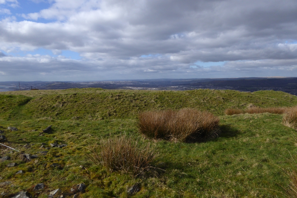
Concentric earthworks of the central enclosure.

Looking down on the central enclosure from the outer banks. The prominent hill to the right of centre is Mynydd Marchywel, with Y Mynydd Du distant far right skyline.

The inner/lower of the two outer ramparts. The uppermost/outermost rampart is to the left, parallel with the fence.

Uppermost/outermost rampart, southern side of site.

The uppermost/outermost rampart along the southern side of the site. Looking down towards Castell Nedd/Neath.
Visited 25 February 2023.
Like Carl I come down here after visiting Buarth y Gaer hillfort and cairn. The fences on the current OS 1:250000 are out of date; the fence to the south now encloses the whole site rather than separating the outer earthworks from the central site.
It’s a big site overall, there are two low banks uphill and to the south of the central site, which if continuous would enclose a very large area. Although the OS map describes it as a “fort”, the size suggests a big settlement site, with Buarth y Gaer being a more likely position for a properly defensible spot, with extensive views in all directions.
The inner enclosure is however surrounded by at least three lines of banks and ditches, so there is a sense of something more than the mere domestic here as well. There are great views to the north across the Vale of Neath, stretching as far as Y Mynydd Du’s distant summits, with the prominent ridges of Mynydd Marchywel and Hirfynydd dominating the middle distance (there are plentiful Bronze Age remains on those ridges).
Interestingly neither the Buarth y Gaer cairn or hillfort are visible from the central enclosure, although they can be seen from the uppermost/outermost rampart.
The sun comes out briefly and casts some welcome light on the scene. Not exactly a first rate site, but there’s certainly enough here to warrant a visit coupled with the Buarth y Gaer sites. I head back up to the cairn and then regain the forestry track to the east, which provides an easy and fence-free route up to these sites. I have one more hill to climb, the biggest of the day.

The footprint below the turf. The rampart of Buarth y Gaer hillfort can be seen on the skyline above.

Looking down on the Vale of Neath. I suspect some of the larger stones may be field clearance.

From the west. The field gate over on the right gives easy access to the cairn and hillforts up a forestry track from the east.

Looking north towards the distant mountains of Y Mynydd Du.

Looking WSW towards Swansea and Mwmbwls. The cairn has been very robbed out, but an arc of its original footprint remains.


The northwestern rampart. Y Mynydd Du mountains on the right skyline.

The southwestern part of the rampart has been rather damaged over the centuries. Looking towards Mwmbwls and Gwyr across Bae Abertawe.

Looking over the southern rampart towards Twyn Disgwylfa, with the Hafren/Severn beyond.

The badly damaged round cairn inside the fort.



Twyn Disgwylfa from the nearby hillfort Buarth y Gaer. Looking across the Hafren/Severn to Somerset and Exmoor.
Visited 25 February 2023, after Twyn Disgwylfa round barrow. Carl came at this site the hard way; a much easier approach involving no fences is to take the forestry track from the minor road to the east, which leads to a gate into the field to the north of the hillfort, just above the cairn. From here it’s a gentle ascent over the grassy slopes to the fort. A rudimentary (i.e there’s no foot boards) stile then gives access to the earthwork.
It’s a pretty decent univallate ring, well preserved but not particularly big ramparts. The views are excellent, taking in Twyn Disgwylfa, Bae Abertawe across to Mwmbwls and the Gower, then northwards as far as the southern flanks of Y Mynydd Du.
There’s a small, dug out round barrow on the high point of the fort’s interior, which makes a good place to sit for a bit to get out of the fresh February breeze as the sun goes behind cloud.
From here it’s an even easier stroll back down the hill to the north, to visit the cairn and the neighbouring complex enclosure.

Although it’s an extremely prominent summit, the forestry surrounding the summit clearing cuts off any views. Without the trees there are extensive views of Bae Abertawe across to Mwmbwls, as well as north to Y Mynydd Du’s gentler southern flanks, taking in the Buarth-y-Gaer hillfort and the barrow on Foel Fynyddau nearer at hand.


It’s quite a decent sized mound.

There are some stones protruding through the turf, indicating a stone cairn.


The solitary Ashton Court stone.

I came across this stone alone while crossing Ashton Court on the Community Forest Path. It stands on the slopes of a dry valley, just below the “probably prehistoric terraces”. It’s quite likely natural, and the area has been heavily landscaped, but there are no other similar stones or outcrops around so it makes for a striking feature.

There are various earthworks in the eastern part of Ashton Court, including a field system and terraces which the North Somerset HER describes as “probably prehistoric”. Looking towards Dundry Hill.


Looking across the Avon Gorge to Clifton Down Camp from the eastern tip of the fort.


The stony construction of the inner rampart shows through the thin turf.

The top of the inner rampart, western side of the fort.

Looking down on the inner ditch and outer rampart.

Looking towards the inner rampart from the outer, west side of the fort.

Inner and outer ramparts on the west side.
