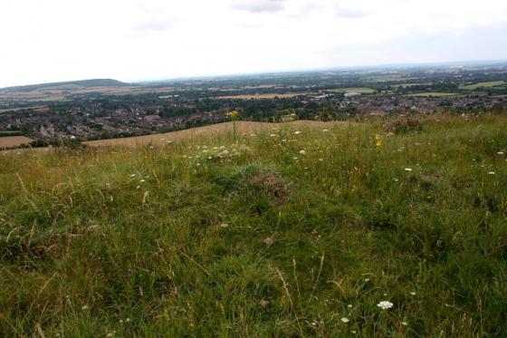
The Modern Antiquarian
Log in
|
Register
Home
Latest Posts
Forums
Maps
Help
Browse Sites
News
Blog
Contributors
The Books
Select
-
Belgium
Denmark
Eire
France
Germany
Greece
Italy
The Netherlands
Norway
Portugal
Republic of Malta
Spain
Sweden
Switzerland
United Kingdom
England
Southern England
Buckinghamshire
Whelpley Hill Camp
Ancient Village / Settlement / Misc. Earthwork
Whelpley Hill Camp (Ancient Village / Settlement / Misc. Earthwork) on The Modern Antiquarian, the UK & Ireland's most popular megalithic community website. 3 images, plus information on many more ancient sites nearby and across the UK & Ireland.
Image © RiotGibbon
Nearest Town:
Berkhamsted (4km NNW)
OS Ref (GB):
SP996040 /
Sheet: 165
Latitude:
51° 43' 31.26" N
Longitude:
0° 33' 28.11" W
Added by
RiotGibbon
Images (3)
0 discussions
Start a topic
Show |
Hide
Web searches for Whelpley Hill Camp
Flickr
Google
Google Images
MAGIC
The Megalithic Portal
Bing
Stone Pages
Streetmap.co.uk
Wikipedia
Show map
(inline Google Map)
- Sites within 20 km -
-
Ashley Green (0.1km E) (1 post)
Chipperfield Common (5.8km E) (1 post)
Cholesbury Camp (7.31km W) (15 posts)
Bridgewater Monument Barrows (9.36km NW) (3 posts)
Moneybury Hill Barrows (9.81km NNW) (2 posts)
Boddington Hill Camp (12.04km W) (19 posts)
The Aubreys (12.21km NE) (6 posts)
Bowl Barrows (South of Beacon) (12.93km NW) (8 posts)
Prae Wood (12.96km ENE) (0 posts)
Bowl Barrow (East of Beacon) (13.26km NNW) (2 posts)
Round Barrow (within Beacon Hill Hillfort) (13.28km NW) (4 posts)
Gallows Hill (13.36km NNW) (4 posts)
Devil's Ditch (13.52km ENE) (1 post)
Oaken Grove (14.09km WSW) (2 posts)
Southend Hill (14.66km NW) (1 post)
Bulstrode Camp (15.99km S) (19 posts)
Beacon Hill (16.09km W) (8 posts)
Grim's Ditch (16.13km WSW) (2 posts)
Pulpit Hill Camp (16.37km W) (12 posts)
Beech Bottom Dyke (16.39km ENE) (3 posts)
Keep Hill, High Wycombe (17km SW) (0 posts)
The Five Knolls (17.02km N) (33 posts)
Whiteleaf (17.33km W) (13 posts)
Whiteleaf Cross (17.44km W) (22 posts)
Whiteleaf Cross Barrows (17.44km W) (4 posts)
Blows Down (17.99km N) (1 post)
Maiden Bower (18.38km N) (22 posts)
Pudding Stone (18.55km WSW) (3 posts)
Hare Stone (18.89km ESE) (4 posts)
Church Hill Camp (19km WSW) (13 posts)
The Mount, Princes Risborough (19.04km WSW) (0 posts)
Slough Glebe Farm Barrow (19.56km WSW) (3 posts)
Seven Ways Plain (19.93km SSW) (8 posts)
- Facilities within 20 km -
-
The Greyhound (Pub: 9 km NNW)
Verulamium Museum (Museum: 14.4 km ENE)
- Add -
-
Add news
Add an image
Add fieldnotes
Add folklore
Add miscellaneous
Add a link
-
Add a site
Add a nearby facility
Add an alternative name/spelling
Images
(click to view fullsize)
Add an image