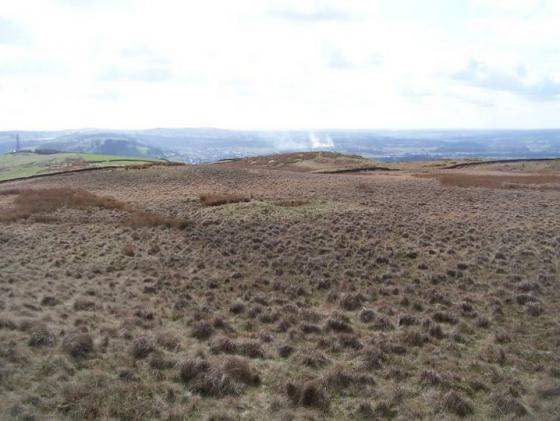
I arrived at the Ringstones just a short walk from Worsthorne Stone Circle with its clearly discernable banks, ditches and avenues, im not quite sure what this was but am told its an old farmstead possibly late Bronze Age, early Iron Age which has more than likely been raided to make the stone walls round here it has two enclosures with avenues connecting both one leads away from the larger enclosure a good 40/50 metres into the field leading to hameldon pasture the other avenue leading into the next field to a smaller enclosure. Ive sketched a rough map to give some perspective. A nice little place to sit and gather your thoughts. I'm sat here looking towards twist hill knowing there's another similliar farmstead up there and a bronze age barrow curiosity gets the better of me and I head off to Twist castle
First visited this site in summer 2003. I wasn't quite sure what it was; A few curved banks and ditches with seemingly erraticly placed stones on top at irregular intervals.
Coming back here in winter though does make a difference because the banks and ditches are much more prominent. We have some unusual sites here in Lancashire. I'm not quite sure what this is but it seems to have carried on into the next field (but has all been ploughed away on that side). I've also posted an old aerial photo of this site, which makes the site look rectangular. This is the same shape for the structure marked on the old O.S. maps as the Ringstones, subheaded as supposedly Roman. Then again the map marks Hambledon pasture barrows as supposed Roman beacons, when they're clearly not. Confused? So am I.
A roughly circular area of stoney embankments, with a curved "avenue" heading up the hill, probably well trashed by wall builders but it is very recognisable.
Walk north 500yds from Worsthorne Hill Stone Circle over stile and it is on the right.