
Image credit: A. Brookes (26.6.2013)

F3, looking out to sea.

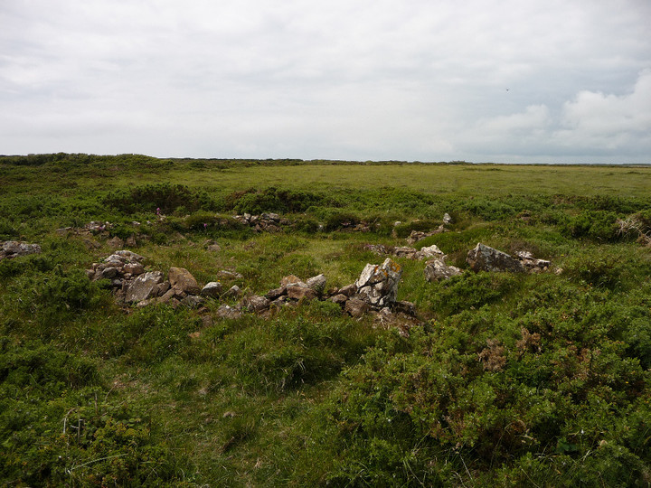
F4, one of the less well-preserved houses in the southern group.
F3, the largest of the round house structures in the group.

The southern part of the settlement is built around this prominent rock outcrop.


The best preserved of the round houses in the southern settlement (I think it’s F1 on the plan).

Hut A1 (see plan).

Ivor Thomas’ 1960 plan of the southern (enclosed) part of the settlement, from the info board on site.
Mentioned by Craig Weatherhill, in “Cornovia: Ancient Sites of Cornwall & Scilly” (Cornwall Books – 1985, revised 1997 & 2000) – “The settlement is divided into two main groups of dwellings. The northern group has five detached round houses averaging 9m in diameter and standing on artificial terraces. Other huts may lie beneath the dense scrub. The southern group, 60m away, is clustered around a natural rock outcrop and consists of eight huts connected by an irregular ring wall. Bronze Age hearths and pottery – over 2,000 sherds – were found here, indicating that the Early Iron Age settlement is on a Middle Bronze Age site which seems to have been abandoned c.1000bc (1250 BC), then resettled in the Iron Age. Hut walls exist to a height of 0.5m.”


