
Caer y Twr on Holyhead Mountain (centre), seen from Traeth y Gribin on the west coast of Ynys Mon’s mainland.
Image credit: A. Brookes (25.4.2017)
Caer y Twr on Holyhead Mountain (centre), seen from Traeth y Gribin on the west coast of Ynys Mon’s mainland.

Sunny landscape perspective from The Range to the south. The fort occupies the highest point, right. Garn cairn is on top of the rocky promontory to the left of that.

Caer y Twr crowning the summit of Holyhead Mountain is the dominant landscape feature when looking westwards across most of Ynys Mon. Seen here at dusk from Rhosneigr.

Looking east to Caer y Twr upon Holyhead mountain from Gogarth Bay round cairn.

As seen from Gorsedd Gwlwm

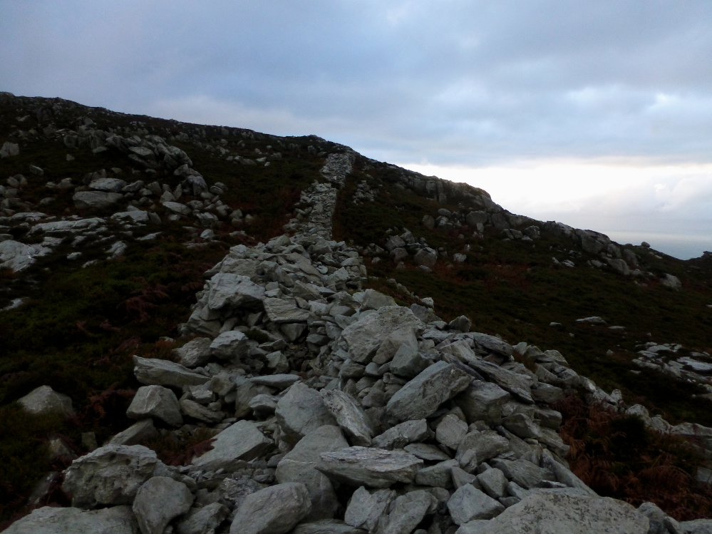


Impressive ramparts.

G/F gives some scale to the main entrance through the stone-built ramparts.

Looking down on the eastern ramparts, snaking across the shot as lighter lines against the dark vegetation. Holyhead/Caergybi lies below.

Looking south across the rocky interior of the fort. The tip of the Lleyn would be visible on a clear day, the Penrhosfeilw stones are in the farmland below.

The foundations of the Roman signal tower on the highest point of the hill, in the centre of the hillfort. A simple re-use of a good strategic position, or making a point to the locals about their former stronghold?

The top of the mountain, with roman watch tower.

The craggy summit can be seen through the Hillforts entrance.Beautiful rock here riddled with quartz seams


Eric defines the Eastern entrance


No need for fortifications on this side .looking from the South-west
Visited 10.9.12
Of all the CADW sites I have visited, this is without doubt the hardest to get to.
Don’t expect any sign posts or information boards here!
Looking at the O/S map there was nowhere obvious to start from and in the end I decided to approach from the eastern side of Holyhead Mountain.
We drove up a very steep and very narrow road past some houses and parked next to a post box. There is room to park a couple of cars here.
Directions:
To the left of the post box is a footpath. Take this path and head straight up the mountain until you come to a ‘crossroads’ of paths.
Turn left and keep on this path until you come to another path which does a ‘dog leg’ to the right, heading up hill – take this narrow, rough ‘path’.
Stay on this ‘path’ until you near the summit of the mountain.
Look up to your left and you will see the remains of drystone walls – this is it!
The walk from the post box to the Hillfort takes about 30 minutes but it is only suitable for those who are reasonably fit and mobile.
I have been to a few ‘stone wall’ type Hillforts and this is as good as I have seen.
The walls at this point are still approximately 2 metres high x 2 metres wide.
As is usually the case the builders have made use of the naturally occurring boulders to form part of the defences.
The views from the top are fab – you can see for miles all over Anglesey.
At least you would if the weather hadn’t been closing in!)
I did however have great views over Holyhead and along the coast.
It was blowing a gale and starting to rain so my visit was a lot shorted than I would have liked – to be fair Karen and Sophie were waiting for me back in the car.
You could easily spend hours up here on a nice day.
As I said; not easy to get to but well worth the effort for those able to do so.
More than ample parking at the Country park which is more like a built up crossroads of footpaths,take any path they all go up.
The fortifications are on the east,and south mainly, at times nearly 5ft tall with a well defined entrance at the east .
The last time I came up here it was ultra clear and we could see all the way to The Isle of Man and across to the Wicklow mountains


