Panorama of the interior ramparts near the entrance to the fort.
Image credit: A R Cane
Panorama of the interior ramparts near the entrance to the fort.

The view to the South is just stunning. It was so clear on this particular morning that you could make out the clump of beeches on Chantonbury Ring some 30 miles away.

Just the one rampart to south east... but a pretty powerful one.

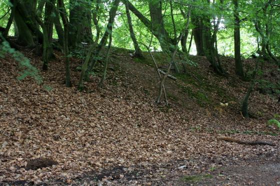
At approx east, looking south. Note the double bank defending the more easilly approached flank.

To the approx south-east

North-western flank, inner rampart viewed from the outer.

The inner rampart of bi-vallate defences to north-east.

The powerful, single rampart to approx south-east.

The defences are not obvious to the south...... but then the hillside is precipitous here.

The (approx) north-western front.
This much overgrown, yet nonetheless impressive hillfort, is sited upon Greensand Ridge within The Hurtwood, an area of private woodland above Holmbury St Mary which was dedicated for public “air and exercise” in 1926, apparently thanks to the efforts of Reginald and Jocelyn Bray.... which by coincidence also happens to be my mother’s maiden name. Right on, lads!
The easiest way to access the site would appear to be – appropriately enough – via Holmbury Hill Road, which leaves the B2126 a little way past the prominent hillside church, heading south. This leads to a large off road car park, the hillfort a short walk away to the approx south-east. Obscure site this is not, although, to be fair, a bright Bank Holiday Weekend Sunday was probably never going to be the quietest. But hey, take what you can get is my motto. And I guess the somewhat comically attired ‘mountain bikers’ have just as much right to be here as I. Yeah, unfortunately an ‘official’ bike trail actually cuts through the site.
The defences are damaged, overgrown (as mentioned), yet still substantially bi-vallate to north, west and parts of the east, with a powerful single rampart to approx south-east. It would appear that only to the south, where the hillside falls away very steeply, were minor earthworks deemed necessary. Certainly not a route for a man to take if wearing any form of body protection, hands clutching weapons. Not if he wanted to live, that is.
In my opinion Spring is without doubt the best time to visit a hillfort, and Holmbury is no exception. Wild flowers colonise the ramparts, carpets of blue bells arguably forming one of these Isles’ most beguiling natural sights (there are others, but certainly not suitable for a family web-site!). It is possible to just about walk the entire enceinte of the hillfort – probably easier in winter – so such things must be done. Then there is little finer an occupation than to lie amongst the bluebells, drink some coffee and watch the ‘cycling muppets engaged in their wacky races.
A cairn (very much modern, unfortunately), ‘toposcope’ (highlighting Chanctonbury Ring, amongst other locations) and an information board occupy the very busy 857ft summit of the hill.
Yeah, I’m glad I came.
“...a more or less square Iron Age Hill Fort overlooking the Weald. It measures 8 acres and has a double bank and ditch on the N and W sides. To the S and E, where the defences are no longer clear, the slope of the hill would have acted as a natural defence. Excavations in 1930 were limited to the defences. Pottery recovered suggests but does not confirm a connexion with the SE Wealden Culture, and a date just prior to the Roman conquest.” “The Buildings of England” Surrey, Nairn Pevsner Cherry ISBN 1407110213.