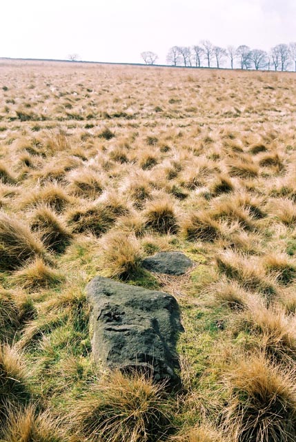
Baildon Moor CR?
8-6-2008

Baildon Moor CR?
8-6-2008

Baildon Moor CR?
8-6-2008

Baildon Moor CR?
8-6-2008

Cup marked rock, Baildon Moor.

Single cup marked rock showing recent signs of damage.

Cup mark with a wide ring and possible cup mark on top of stone.

Cup and ring marked rock, Baildon Moor.

Cup and groove marked rock, Baildon Moor.

Cup marked rock, Baildon Moor.

Cup, ring and groove marked rock, Baildon Moor.

Three cups with single ring on the path leading west from the campsite, Baildon Moor.

Single cup marked rock, looking towards Baildon Hill, Baildon Moor.

An apparent low circular enclosure – possible remains of a ring cairn or hut circle, Baildon Moor.

Double cup and ring, near the well known stone set into Dobrudden Campsite wall, Baildon Moor.

Cup and groove rock, Baildon Moor.

SE 13771 40235

The small stone next to Stone 1 Dobrudden.

Stone at SE13645,39803. It has a cup with a possible wide ring, although the left hand side looks natural.

Stone at SE13845,40356
N AMATEUR archaeologist believes he has stumbled across Yorkshire’s first selfie, carved into a 4,000-year-old stone on Baildon Moor.
Gordon Holmes, from Shipley, first became interested in carved cup and ring stones on the district’s moors when his father pointed one out to him when he was about 12.
Now aged 64, retired design engineer and IT technician Mr Holmes has dedicated his life to studying the weathered ancient carvings which he believes could date to the late Stone Age.
But he says it had dawned on him recently that one carving he had been studying was of the artist himself.
“I realised that I was looking at a Stone Age selfie,” he said.
“There are many cup and ring stones around the moors, carved into millstone grit, but there are at least five such rocks with carvings representing aspects of the night sky which are on Baildon Moor.
“It seems that only Baildon Moor carvings correlated to patterns of star constellations. The other moors of Ilkley, Rivock Edge, Harden and Bingley only have the odd example of astronomical significance.
“What’s more, these five appear to have a particular style, a bit like handwriting, and I am convinced they are by the same artist.
“My father said to me all those years ago that no-one knew what the markings were, so I made it a mission to find out. I discovered the carvings showed the Pole Star, Cassiopeia, Hyades and Pleiades.
“One particular stone shows Cassiopeia, distinctive in the night sky because it forms a clear ‘W’ shape.
“It also shows a stick figure, which I presume is the artist, sitting or standing in the local landscape or round a fire with almost like a speech bubble above their head showing Cassiopeia above him. It is as if he has carved a selfie of himself,” said Mr Holmes.
“I know there could be earlier interpretations of selfies, such as those drawn in hieroglyphics by the Ancient Egyptians, but this stone carving selfie on Baildon Moor may well be the earliest example in Yorkshire.”
Mr Holmes is also interested in astronomy and has taught the subject at Bradford College.
He is also known for his search for the Loch Ness monster. In 2007 he filmed a large moving object in the loch. Almost a decade later, US-based software firm DreamFactory was able to analyse the footage and confirmed Mr Holmes’s suspicions that he had filmed a giant eel swimming in the loch.
Camping at Dobrudden was a great experience. Within half an hour of rolling out of bed each morning, I was out walking the dogs and searching for rock art. Most of the photos I’ve uploaded are from the ridge on which the campsite/caravan park sits, but from what I see here, I’ve missed quite a few. More carved rocks and a possible stone circle are on the next ridge down near the curve in the Brackenhall Road.
I also found a faint, vaguely circular enclosure to the east of the caravan park.
Also worth noting is the livestock on the campsite. Turkeys, geese, chickens and peacocks! Watch out when you’re reversing!
Baildon Moor is Ilkley Moor’s little sister, a few miles to the south it is both smaller and flatter which certainly makes it easier on the legs. For some reason it seems particularly popular with weekenders out for a stroll and folk walking dogs, but there are around 40 or so marked rocks here, with two third of them north/north-east of Dobrudden Farm caravan park although two of the best examples are to the east and the south of the park.
There are also said to be the remains at least 2 stone circles – one at Windy Hill and one north of the road at Pennythorne Hill but don’t expect to see much, if anything. There are also several badly damaged cairns, a destroyed Bronze Age field system, and quite a few recent bell pits.
Parking is easy at a free carpark north of Bingley Road where there are the remains of ‘Coll’s Burial Mound’ ring cairn, from here walk a short distance west to a track that leads uphill and south to Dobrudden Farm. Many of the stones lie close to this track. In Dyers ‘Discovering Prehistoric England’ he mentions 4 prominent stones and I’ve added these as separate sites and used his numbering system as an aid for those who have the book.
Baal in Baildon – an article from a book called
“Through Airedale From Goole To Malham” written in 1891