The Modern Antiquarian. Stone Circles, Ancient Sites, Neolithic Monuments, Ancient Monuments, Prehistoric Sites, Megalithic MysteriesThe Modern Antiquarian


Munkwolstrup

Megalithic Cemetery

<b>Munkwolstrup</b>Posted by NucleusImage © Uwe Häberle 11/2019
Also known as:
  • Arnkiel-Park

Latitude:54° 43' 8.72" N
Longitude:   9° 26' 45.35" E

Added by Nucleus


Discussion Topics0 discussions
Start a topic


Show  |  Hide
Web searches for Munkwolstrup
Show map   (inline Google Map)

Sites/Regions:

12 posts
Munkwolstrup 1 Long Barrow
4 posts
Munkwolstrup 2 Long Barrow
3 posts
Munkwolstrup 3 Long Barrow
4 posts
Munkwolstrup 4 Round Barrow(s)
4 posts
Munkwolstrup 5 Long Barrow
7 posts
Munkwolstrup 6 Long Barrow
6 posts
Munkwolstrup 7 Long Barrow

Images (click to view fullsize)

Add an image Add an image
<b>Munkwolstrup</b>Posted by Nucleus

Fieldnotes

Add fieldnotes Add fieldnotes
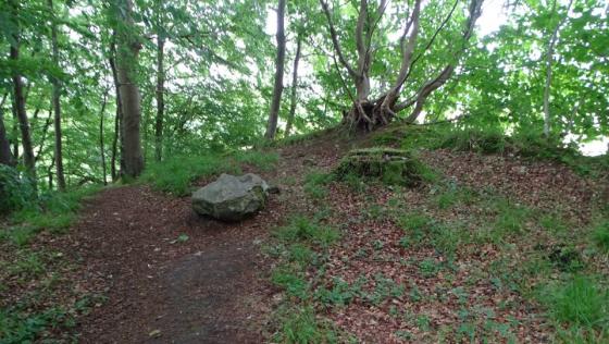
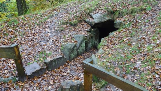
At Munkwolstrup lies a group of seven megalithic tombs. From the B76, which leads from Flensburg to the south, turn off into the Munkwolstruper Weg. The graves are signposted from here. After about 150 meters you reach the parking lot of Arnkiel Park. It is an archaeological park with an information pavilion to the tombs. North of the Munkwolstruper Weg are three sites, south four. Sprockhoff's numbering does not follow the series from north to south, but begins with the southern group. Here lies also the reconstructed, largest tomb of the group Munkwolstrup 1.

On the grounds are in total 6 long barrows and a burial mound. They all originate from the Funnel Beaker Culture. For a long time, there were only grassy hills covered with grass and bushes, with some curbs at the edges. In the 18th and 19th century almost all the stones of these monuments were removed to be used for road construction, as well as the reconstruction of the village Munkwolstrup, which was almost destroyed by fires around 1788.

The name Arnkiel Park refers to the Danish Probst Magister Trogillo (Troels) Arnkiel, who provided a first description of the graves. So these tombs are the only ones in northern Europe that have credible descriptions from the time before their destruction.

Visited November 2019
Nucleus Posted by Nucleus
24th November 2019ce
Edited 24th November 2019ce

Links

Add a link Add a link

Arnkiel-Park - Official Website


Magister Troels Arnkiel-Park archäologisch-landeskundlicher Park (only in German)
Nucleus Posted by Nucleus
8th November 2019ce
Edited 24th November 2019ce

Latest posts for Munkwolstrup

Showing 1-10 of 40 posts. Most recent first | Next 10

Munkwolstrup 1 (Long Barrow) — Fieldnotes

Munkwolstrup 1 lies south of the Munkwolstruper Weg. It is the largest site of the complex. The enclosure is oriented in northwest-southeast direction and has a length of 70 meters. During Sprockhoff's recording in 1934 there were still 6 stones on the northeastern long side, and on the southwestern still 8 stones and one stone of a chamber.

Archaeological research began in 2000, and Arnkiel's excavation results and records showed the original location of the missing stones. Thus, the site could be reconstructed again with boulders from surrounding gravel pits. At the southern end, in contrast to the original state, a passageway was built into the interior of the hunebed and equipped with several information boards. Quite a strange reconstruction! In the hunebed there are two extended dolmens, one on each long side. Below the tomb hook plow traces could be detected, which prove with the help of charcoal found in it, that in this region already 3600 BC agriculture was practiced.

The long barrow is today the largest reconstructed megalithic tomb in Northern Europe and after the long barrow of Karlsminde the second reconstructed monument of this type in Schleswig-Holstein.

Visited November 2019
Nucleus Posted by Nucleus
1st December 2019ce

Munkwolstrup 7 (Long Barrow) — Fieldnotes

Munkwolstrup 7 lies north of the Munkwolstruper Weg, it is the southernmost of the three tombs lying here.

The enclosure is northwest-southeast oriented and about 46 meters in length and 15.5-17 meters wide. The site is thus considerably wider than the surrounding tombs. The embankement is still relatively well preserved. On the long sides there are still some stones of the enclosure. An excavation in the northern half probably marks the location of a chamber. Another, smaller burial can be found in the southern area.

Visited November 2019
Nucleus Posted by Nucleus
28th November 2019ce

Munkwolstrup 6 (Long Barrow) — Fieldnotes

Munkwolstrup 6 lies north of the Munkwolstruper Weg, it is the middle of the three tombs lying here.

The enclosure is northwest-southeast oriented and is about 63 meters long and 7 meters wide. The embankment is still relatively well preserved. On the long sides there are still some stones of the enclosure. A deep depression marks the location of the chamber.

Visited November 2019
Nucleus Posted by Nucleus
28th November 2019ce

Munkwolstrup 5 (Long Barrow) — Fieldnotes

Munkwolstrup 5 is located north of the Munkwolstruper Weg, it is the northernmost of the three tombs lying here.

The enclosure is north-west southeast-oriented and about 31 meters long and 6 meters wide. The embankment is still relatively well preserved. On the long sides and at the northern end there are still some stones of the enclosure. Just south of the center, an hollow marks the location of the chamber.

Visited November 2019
Nucleus Posted by Nucleus
28th November 2019ce

Munkwolstrup 4 (Round Barrow(s)) — Fieldnotes

Munkwolstrup 4 is located south of the Munkwolstruper Weg, just a few meters east of Munkwolstrup 1.

It is a burial mound of 14-16 meters in diameter. In the middle of the mound there is a depression, probably the location of the now destroyed chamber. Only one stone is still preserved here. All the stones have disappeared from the enclosure. During his recording Sprockhoff found two stones of the enclosure in 1934.

Visited November 2019
Nucleus Posted by Nucleus
28th November 2019ce

Munkwolstrup 2 (Long Barrow) — Fieldnotes

Munkwolstrup 2 is located south of the Munkwolstruper Weg, east of the south end of Munkwolstrup 1.

The enclosure is oriented in a north-east west-southwest direction. The site is quite heavily destroyed, there are only a few stones left at the western end. The original size of the enclosure has been about 30 x 6-7 meters. During Sprockhoff's recording in 1934, more stones of the enclosure were preserved. The chamber, of which there are no more stones left, was in the western half of the hunebed.

Visited November 2019
Nucleus Posted by Nucleus
28th November 2019ce

Munkwolstrup 3 (Long Barrow) — Fieldnotes

Munkwolstrup 3 is the most southern tomb within the group, about 150 meters south of the southern end of Munkwolstrup 1.

The hunebed is oriented in northeast-southwest direction. The site is quite heavily destroyed, there are only a few stones of the enclosure preserved. The original size of the hunebed has been about 30 x 6 - 7 meters. A burial chamber is no longer recognizable.

Visited November 2019
Nucleus Posted by Nucleus
24th November 2019ce
Edited 28th November 2019ce

Munkwolstrup 2 (Long Barrow) — Images (click to view fullsize)

<b>Munkwolstrup 2</b>Posted by Nucleus<b>Munkwolstrup 2</b>Posted by Nucleus<b>Munkwolstrup 2</b>Posted by Nucleus Nucleus Posted by Nucleus
24th November 2019ce
Showing 1-10 of 40 posts. Most recent first | Next 10