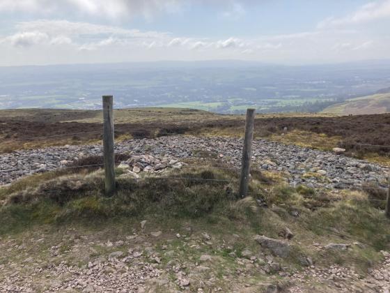
The Modern Antiquarian
Log in
|
Register
Home
Latest Posts
Forums
Maps
Help
Browse Sites
News
Blog
Contributors
The Books
Select
-
Belgium
Denmark
Eire
France
Germany
Greece
Italy
The Netherlands
Norway
Portugal
Republic of Malta
Spain
Sweden
Switzerland
United Kingdom
Scotland
Central Scotland
City of Edinburgh
Wester Craiglockhart Hill
Hillfort
Wester Craiglockhart Hill (Hillfort) on The Modern Antiquarian, the UK & Ireland's most popular megalithic community website. 2 images, plus information on many more ancient sites nearby and across the UK & Ireland.
Image © thelonious
Nearest Town:
Edinburgh (5km NNE)
OS Ref (GB):
NT22827006 /
Sheet: 66
Latitude:
55° 55' 2.66" N
Longitude:
3° 14' 6.07" W
Added by
thelonious
Images (2)
0 discussions
Start a topic
Show |
Hide
Web searches for Wester Craiglockhart Hill
Flickr
Google
Google Images
MAGIC
The Megalithic Portal
Bing
Stone Pages
Streetmap.co.uk
Wikipedia
Show map
(inline Google Map)
- Sites within 20 km -
-
The Buck Stane (1.71km E) (10 posts)
The Bore Stane (2.21km NE) (10 posts)
The Caiy Stane (2.3km ESE) (16 posts)
Braid Hills (site of) (2.32km E) (2 posts)
Blackford Hill (2.53km ENE) (25 posts)
Blackford Hill fort (2.68km ENE) (2 posts)
Galachlaw Cairn (3.04km E) (11 posts)
Penny Well (3.83km ENE) (4 posts)
Caerketton Hill (3.95km SE) (12 posts)
Edinburgh Castle (4.11km NE) (8 posts)
Hillend (4.21km SE) (19 posts)
The Cat Stane, Inch (4.59km ENE) (6 posts)
Corstorphine Hill (4.64km WNW) (21 posts)
St. Catherine's Well (4.71km E) (6 posts)
St. Vining's Well (5.09km NE) (1 post)
Wells O' Wearie (5.12km ENE) (5 posts)
Samson's Ribs (5.21km ENE) (8 posts)
Ravenswood Avenue Standing Stone (5.37km ENE) (6 posts)
Arthur's Seat and Crow Hill fort (5.45km ENE) (13 posts)
St. Margaret's Well (5.6km NE) (12 posts)
St. David's Well (5.6km NE) (2 posts)
The Dasses (5.62km ENE) (4 posts)
Cultivation Terraces (5.8km ENE) (3 posts)
St. Anthony's Well (5.85km NE) (4 posts)
Delf Well (5.97km ENE) (6 posts)
Duddingston Loch (5.98km ENE) (8 posts)
Castlelaw Fort (6.06km SSE) (24 posts)
Dunsapie (6.16km ENE) (14 posts)
Castlelaw Souterrain (6.26km SSE) (21 posts)
St. Triduana's Wellhouse (6.97km NE) (8 posts)
Cammo Stone (7.04km WNW) (11 posts)
Niddrie Standing Stone (7.14km ENE) (6 posts)
Parkburn Cist Cemetery (7.54km E) (7 posts)
Gogar Stone (7.54km W) (15 posts)
Turnhouse Hill Cairn (7.56km S) (4 posts)
Glencorse (7.69km SE) (9 posts)
Newhouse Standing Stone (7.79km WSW) (4 posts)
Turnhouse Hill (7.96km S) (1 post)
St. Matthew's Well (8.43km ESE) (3 posts)
Carnethy Hill (8.5km SSW) (27 posts)
Gorton House (8.56km ESE) (16 posts)
Roslin Glen (8.57km ESE) (6 posts)
Ravelrig (9km WSW) (1 post)
The Cat Stane (Edinburgh) (9.04km W) (2 posts)
Platt Hill (9.64km W) (2 posts)
Dalmahoy Hill (9.81km WSW) (6 posts)
Tormain Hill (9.89km WSW) (33 posts)
Kaimes Hill (10.32km WSW) (5 posts)
Hully Hill Monument (10.78km W) (59 posts)
Camp Hill (11km SSW) (5 posts)
Earl Cairnie (11.43km WNW) (4 posts)
Westfield Cursus (12.17km ENE) (0 posts)
The Gowk Stane (12.7km S) (13 posts)
East Cairn Hill (14.94km SW) (7 posts)
Pinnelhill (15.97km NW) (6 posts)
Harlaw Muir (16.2km SSW) (4 posts)
Wright's Houses Standing Stone (16.51km E) (8 posts)
West Cairn Hill (16.77km SW) (6 posts)
Binn (16.81km NNW) (17 posts)
Old Deepsykehead Enclosed Cremation Cemeteries (17.28km SSW) (6 posts)
Lamancha (18.06km S) (5 posts)
Glassmount (18.26km N) (6 posts)
Sowburn Rig Small Cairn Cemetery (18.6km ESE) (5 posts)
Crichton Souterrain (18.96km E) (24 posts)
North Wood (19km WNW) (0 posts)
Ormiston Hall (19.11km E) (8 posts)
St Margarets Stone (19.25km WNW) (8 posts)
Dechmont Law (19.37km WSW) (1 post)
Pitcorthie (19.86km WNW) (9 posts)
- Facilities within 20 km -
-
The Last Drop (Pub: 4.3 km NNE)
- Add -
-
Add news
Add an image
Add fieldnotes
Add folklore
Add miscellaneous
Add a link
-
Add a site
Add a nearby facility
Add an alternative name/spelling
Images
(click to view fullsize)
Add an image