
Visited April 2019
Image credit: Uwe Häberle 04/2019
Visited April 2019

Visited April 2019

Visited April 2019

Visited April 2019
Visited April 2019

Visited April 2019

Panorama shot
Visited April 2019

Panorama shot
Visited April 2019

Visited April 2019
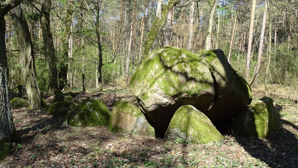
Hohenwulsch-Friedrichsfleiß is a grand dolmen consisting of seven pairs of supporting stones and probably an oval enclosure. The current state of preservation is moderate, the enclosure is missing for the most part, the largest capstone has burst and fallen into the chamber. The location of the six remaining enclosure stones suggests that the enclosure was once round or oval. Outside diameter: 13.3 m in east-west direction. The chamber (7.4 m long, 1.8 – 2 m wide) is also east-west orientated and lies in the middle of the enclosure. Fourteen of formerly sixteen wall stones and four of formerly five capstones are preserved. The biggest, broken capstones measures 2.6 m x 2 m x 1.2 m.
Drive on the K1069 from Friedrichsfleiß towards Schorstedt. Immediately before Freidrichshof turn right towards Grassau. After about 1 km you will reach a larger forest road (N52 ° 40 ‘34.1 “E11 ° 39’ 30.9”) coming from the south. Park the car here and follow the forest path in a southerly direction for about 550 m, here crosses the way from Friedrichsfleiß to Grassau. At the intersection, turn right towards Friedrichsfleiß and follow it for about 80 m. The tomb lies here left of the way.
taken from the information board:
Megalithic tomb G R A S S A U
Megalithic tombs are silent witnesses of the past.
More than 4500 years ago, the inhabitants built these places of worship. Only rolls (logs) and piled-up inclined planes were used to transport the tons of boulders. What a performance. It could only have been Titans or Giants.
The term megalithic tombs dates back to the Middle Ages. The stones for the graves were brought or pushed from northern Europe, central and southern Sweden in the ice age in our area by glaciers (debris).
In 1843 there were 34 tombs in the district of Stendal, today there are only 4 in the area of Kläden. The remaining tombs were used as building material.
About 100 m west of the crossing Grassau – Friedrichsfleiß and Bülitz – Schorstedt are the remains of this megalithic tomb. The cracked capstone rests on four wall stones. Another 10 stones of the burial chamber and enclosure are still present.
Besides this tomb are still preserved:
Graves on the Trappenberg near Bülitz, west of the road towards Grünenwulsch, north of Steinfeld.
Further, but no longer existing megalithic tombs lay between Schmoor (Friedrichshof) and Grassau near the deserted medieval town Finschow. Two more in the district Grassau, between the Schartauer and the Schorstedter road. There was a grave in Kläden. It formed with some stones the basis for the built in the 30s war memorial on the church hill.


