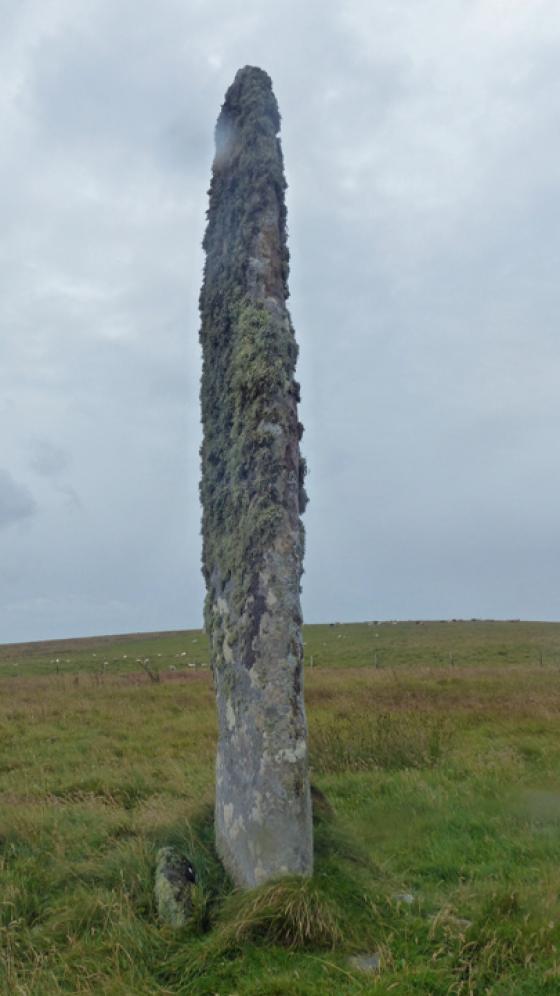
Photo taken 9th June. The stone on a perfect Westray day.

Photo taken 9th June. The stone on a perfect Westray day.

Photo taken 9th June. Looking west at the stone from just inside the field. The cairns atop the flanking hills are just visible to either side of the stone.

Photo taken 9th June 2016. Looking south the stone has a bit of a phallic aspect!

Photo taken 9th June 2016. Stone of Quoybirse, with the village of Pierowall in the background.
Visited 9th June 2016
A glorious sunny day on our trip to Westray with barely a cloud in the sky, and in my continuing quest to track down all of Orkney’s standing stones I notice one marked on the O.S. map enticingly close to the road. I try to spot it in the fields at the side of the road whilst simultaneously trying not to fall off my bike or veer into oncoming traffic (fortunately not much of a problem on Westray) but the stone proves elusive, and I figure it’s probably one of those small stones not easy to spot unless you’re right on top of it, how wrong I would turn out to be!
The rest of the day is pleasant though, visiting some of Westray’s other archaeological treasures and on our way back down the island I cast a final longing glance towards the spot where the map indicates the standing stone and just spot a tantalising glimpse of what could be the tip of a menhir peeking above a rise in the field. We are next to a farmhouse called Braehead Manse & Reid Hall, and propping the bike at the side of the road I follow a rough track up the side of the farm buildings which seems to lead toward another derelict house. Soon though I encounter a barbed wire fence across the track, placed to corral a herd of somewhat truculent looking cows who now seem to be the derelict building’s inhabitants. Although there is no way through I get a better view of the stone, and it looks a whopper!
Not to be defeated in the hunt for a site I head back to the road, where Ellen points out a gate into the field to the south side of the farmhouse, a field thankfully free of bovine interlopers, and just visible ahead the top of the stone. And what a stone it is, a slate-like finger, squared off and rising around 11 feet from its base of packing stones. The top is covered with a bristly growth of lichens, whilst the lower corners are rubbed to a polished smoothness due to its use as a cattle rubbing post. The menhir stands atop a small rise close to a stone fieldwall, looking down to Pierowall to the north.
The ‘front’ of the stone, or at least its widest face, draws the eye toward the western hills of Westray, hills that are topped with a line of cairns. I wonder if this stone sentinel in some way was meant to delineate this area, signifying a boundary with the sacred high grounds beyond. In this way it reminded me of the Stone of Setter on nearby Eday, which also seemed to signify the start of an area rich in ritual sites. Standing here I can see the cairns atop the hills to either side framing the stone.
There’s nothing better than finding a site for the first time, particularly when it exceeds your expectations, like this stone has. The calls of Curlews and Oystercatchers, for me the soundtrack of Orkney, ring out around us, the sun warmed stone on my back providing a sense of snugness, and I think how perfect it is to be here. It’s more than just having ‘bagged’ this stone, but instead having found somewhere I’m captivated. One day I’ll return and walk to the cairns in the hills, to look down on the stone from above, but until then we’ll have to leave, with just enough time to spot some Puffins on the rock stack of the Castle O’ Burrian nearby.


