The Modern Antiquarian
Log in
|
Register
Home
Latest Posts
Forums
Maps
Help
Browse Sites
News
Blog
Contributors
The Books
Select
-
Belgium
Denmark
Eire
France
Germany
Greece
Italy
The Netherlands
Norway
Portugal
Republic of Malta
Spain
Sweden
Switzerland
United Kingdom
Scotland
Dumfries and Galloway
Dunrod
Cup and Ring Marks / Rock Art
Dunrod (Cup and Ring Marks / Rock Art) on The Modern Antiquarian, the UK & Ireland's most popular megalithic community website. 1 image, 1 weblink, plus information on many more ancient sites nearby and across the UK & Ireland.
Image © Rhiannon
Nearest Town:
Kirkcudbright (5km NNW)
OS Ref (GB):
NX697459 /
Sheets: 83, 84
Latitude:
54° 47' 26.99" N
Longitude:
4° 1' 36.3" W
Added by
Rhiannon
Images (1)
Links (1)
0 discussions
Start a topic
Show |
Hide
Web searches for Dunrod
Flickr
Google
Google Images
MAGIC
The Megalithic Portal
Bing
Stone Pages
Streetmap.co.uk
Wikipedia
Show map
(inline Google Map)
- Sites within 20 km -
-
Blackhill Cottage (0.8km WNW) (5 posts)
Drummore (0.9km WSW) (12 posts)
Drummore Castle (0.93km WSW) (5 posts)
Townhead (1.2km NNW) (49 posts)
Milton (1.3km NE) (89 posts)
Knockshinnie (1.36km WSW) (11 posts)
Grange 1 (1.5km WNW) (4 posts)
High Grange 2 (1.51km N) (0 posts)
Knockshinnie 2 (1.56km WSW) (8 posts)
Torrs 1 & 2 (1.59km WSW) (12 posts)
High Grange 1 (1.63km N) (13 posts)
Torrs 7 (1.7km WSW) (2 posts)
Torrs 4 (1.74km WSW) (8 posts)
Torrs (1.83km WSW) (8 posts)
Grange 3 (1.83km WNW) (11 posts)
Torrs 3b (1.83km WSW) (1 post)
Balmae 35 (1.84km SW) (3 posts)
Torrs 3 (1.92km WSW) (12 posts)
Grange 2 (2km WNW) (3 posts)
Torrs 10 (2.19km WSW) (2 posts)
Galtway 18 (2.6km NNE) (6 posts)
Galtway (2.97km NNE) (5 posts)
Galtway 7 (2.99km NNE) (2 posts)
High Banks (3.23km NNE) (46 posts)
Galtway 5 (3.26km NNE) (6 posts)
Castlecreavie Dun (4.23km NE) (5 posts)
Castlecreavie (4.23km NE) (15 posts)
Castlecreavie (4.25km NE) (9 posts)
Newlaw Hill 1 (4.67km NE) (17 posts)
Newlaw Hill 2 (4.67km NE) (3 posts)
Bombie 5 (4.68km NE) (0 posts)
Bombie (4.71km NE) (3 posts)
Newlaw Hill 3 (4.75km NE) (19 posts)
Bombie 1 (4.76km NE) (5 posts)
Bombie 4 (4.77km NE) (3 posts)
Bombie 3 (4.79km NE) (9 posts)
Bombie 2 (4.84km NE) (18 posts)
Senwick 1 (5.04km W) (5 posts)
Clash (5.19km W) (11 posts)
Senwick 4 (5.38km WSW) (8 posts)
High Nunton (5.51km W) (5 posts)
Clauchendolly (5.53km W) (54 posts)
Brighouse Standing Stone (5.69km WSW) (6 posts)
Borgue (6.53km W) (6 posts)
Culdoach (6.68km N) (22 posts)
Auchenhay (8.2km WNW) (2 posts)
Ingle Stone (8.29km NW) (4 posts)
Arden Fort (8.9km NW) (7 posts)
The Doon (Twynholm) (9.23km NW) (7 posts)
Tongue Croft (9.69km W) (18 posts)
Park of Tongland (10.09km NNW) (9 posts)
Nether Linkens (10.22km NE) (9 posts)
Castle Haven (10.59km W) (6 posts)
Park of Tongland (10.91km N) (1 post)
Big Airds Hill (12.04km ENE) (0 posts)
Little Airds Hill (12.64km ENE) (0 posts)
Slagnaw (13.75km NNE) (3 posts)
White Cairn, Gelston (13.87km NNE) (4 posts)
Glengap House (14.02km NW) (1 post)
Trusty's Hill (14.76km WNW) (13 posts)
Giant's Dike (14.77km NNW) (7 posts)
Harper's Hill (15.13km WNW) (10 posts)
Rutherford's Well (15.28km WNW) (7 posts)
Mossyard 6 (15.75km W) (7 posts)
Rutherford's Witnesses (15.77km WNW) (6 posts)
Lodge Of Kelton Farm (15.79km NNE) (9 posts)
Newton Farm (15.89km W) (3 posts)
Newton Farm (15.91km W) (1 post)
Newton Farm Burial Chamber (15.97km W) (12 posts)
Lagganmullan 8 (15.98km W) (11 posts)
Lagganmullan 9 (15.98km W) (6 posts)
Lagganmullan 10 (15.98km W) (3 posts)
Mossyard 1 (16.09km W) (9 posts)
Lagganmullan 1 (16.1km W) (0 posts)
Mossyard (16.11km W) (21 posts)
Lagganmullan House (16.15km W) (3 posts)
Lagganmullan 2 (16.26km W) (6 posts)
Lagganmullan 6 (16.4km W) (0 posts)
Lagganmullan 7d (16.4km W) (5 posts)
Lagganmullan 7a (16.4km W) (5 posts)
Lagganmullan 7 (16.4km W) (2 posts)
Lagganmullan 7c (16.4km W) (2 posts)
Lagganmullan 7b (16.4km W) (3 posts)
Lagganmullan 4 (16.42km W) (13 posts)
Lagganmullan 3 (16.48km W) (4 posts)
Lagganmullan 5 (16.53km W) (2 posts)
Laggan Farm (16.63km W) (3 posts)
Upper Newton 3 (16.95km W) (4 posts)
Upper Newton 2 (17km W) (5 posts)
Kirkclaugh (17.21km W) (2 posts)
Carlingwark Loch (17.26km NNE) (7 posts)
High Auchenlarie (17.39km W) (20 posts)
Upper Newton 1 (17.42km W) (4 posts)
High Auchenlarie (17.43km W) (8 posts)
Court Hill (17.45km NE) (0 posts)
Upper Newton 4 (17.5km W) (0 posts)
Torrs Hill (17.51km NNE) (1 post)
Whiteside (17.53km W) (3 posts)
Kirkclaugh (17.76km W) (1 post)
Bardristane 3 (18.28km W) (3 posts)
Bardristane 4 (18.38km W) (6 posts)
Bardristane 1 (18.52km W) (5 posts)
Barholm 3 (18.9km W) (2 posts)
Barholm 2 (18.91km W) (1 post)
Ernespie Standing Stones (18.94km NNE) (10 posts)
Cairnharrow (19.05km W) (18 posts)
Cairnharrow (19.25km W) (11 posts)
Cairnholy Cairn (19.47km W) (5 posts)
Cairnholy 03 (19.53km W) (0 posts)
Cairnholy (19.54km W) (138 posts)
Cairnholy 01 & 02 (19.54km W) (8 posts)
Kirkdale House (19.58km W) (2 posts)
Barholm 1 (19.58km W) (1 post)
Cairnholy 10 (19.88km W) (0 posts)
Cairnholy 06 (19.92km W) (1 post)
Kirkmuir 2 (19.94km W) (1 post)
Kirkmuir 1a & 1b (19.94km W) (1 post)
Cairnholy 09 (19.97km W) (5 posts)
Kirkmuir 3 (19.98km W) (1 post)
- Facilities within 20 km -
-
Newton Farm (Camping Site: 16 km WNW)
Cairnholy Old Farmhouse (Bed & Breakfast: 19.8 km WNW)
- Add -
-
Add news
Add an image
Add fieldnotes
Add folklore
Add miscellaneous
Add a link
-
Add a site
Add a nearby facility
Add an alternative name/spelling
Images
(click to view fullsize)
Add an image
Links
Add a link
Canmore
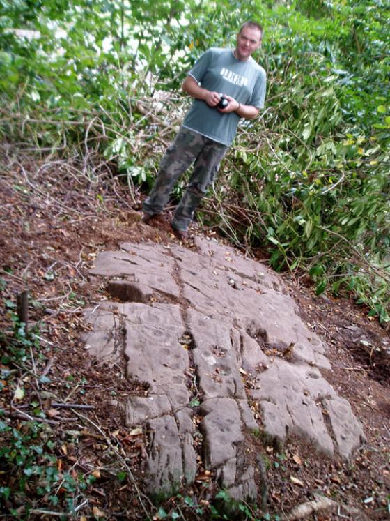
I felt suspicious of adding these because mysteriously they're not already on TMA. But I think the probable reason is that they're within a firing range. Maybe they're accessible occasionally...
Comments (1)
|
Add a comment
|
Permalink
Posted by
Rhiannon
6th May 2011ce
Edited 6th May 2011ce