Tappoch from the north.
Image credit: drew/amj
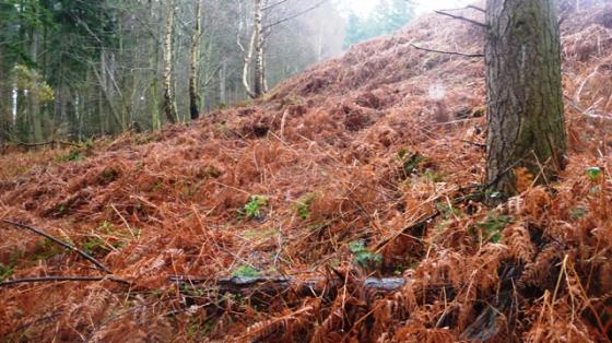
Tappoch from the north.

Note the flies, almost as bad as the Monk’s Cairn.


The Black Isle is in the distance.

As is usual there is a hard way to climb up to a site and a much easier way back down. This site was to prove to be no exception. Follow the B9013, west of Elgin, north towards Burghead and turn north east at the small village, College Of Roseisle. Take the next minor road direct east. I parked between the farms of West Bank and Mid Bank.
Over the gate, up the side of a field, climb another fence, follow the gap the in the trees to the top of the hill. If you survive the insects the cairn is situated at the top of the hill. But it is worth the trek as the views are fantastic. To north the Moray Firth and the Black Isle, which today was shrouded except for the distant thunder and lightning show. The views south over the Moray plains to the Highlands are equally breathtaking. The cairn itself must have been massive. Even today it is some 36 meters wide and 3 meters tall. On it’s summit is a trig point and a much welcome trunk bench. Two cists were discovered in 1859 during an excavation by the well liked and respected Lady Dunbar of Duffus.
As for the way down follow the track south east. This leads to Mid Bank farm. No fences, no jabby things just the hungry flies. I felt sorry for the horses in the fields, they seemed to having a hard time today. At least I could escape.
Visited 19/07/2010.
The Hill of Roseisle bounds the plain or “laigh” of Moray to the north. Its top is crowned with a little wart, apparently a gathered cairn, known as the “Tappock” of Roseisle. The plough is encroaching upon it from all sides, and last summer the farmer of Hill of Roseisle came upon a grave with a cist of rough stones about twelve yards north of the Tappock. The soil is very light there, adn the deposit was near the surface.
James Jeans, the very intelligent young man who made the discovery, gave me the dimensions of the cist. It was 2 feet 10 inches in length, 18 inches in depth, and 18 or 20 inches broad. It contained bones and a skull tolerably entire, – the latter carried to the Museum at Elgin; and it contained also the beads, sixty-four in number, and the larger ornaments of jet, which James Jeans still keeps.
I do not know that I should have been so successful in my own person, but Jeans did not hesitate to lend these to Lady Dunbar of Duffus; and that lady has been good enough to make the careful and accurate drawing of these jet ornaments, which I now exhibit, and which she allows me to present to the Society. (The drawing referred to exhibited two triangularly-shaped portions, each ornamented with a double row of punctured lines; and a series of rounded beads of an oblong shape.)
From v3 (1867) of the Proceedings of the Society of Antiquaries of Scotland, an article by Cosmo Innes.