19/04/2023 – The cairn with trig plonked on top of it in the fading light. Nearly an hour past sunset now. Nearly time to head home.
19/04/2023 – The cairn with trig plonked on top of it in the fading light. Nearly an hour past sunset now. Nearly time to head home.

19/04/2023 – Cairn-Mon-Earn. Nice colours on the stones as the sun set.

19/04/2023 – Cairn-Mon-Earn

19/04/2023 – Watching the setting sun from the cairn

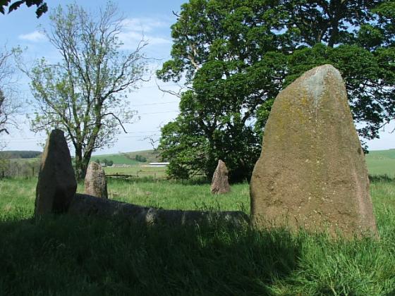
Looking north from Raedykes.

Darkness begins to fall, the fog gets thicker and I get more drenched.

No ghostly masts.

The top of the cairn.

Yet another ghostly mast.

Another ghostly mast.

In a lonely prison camp.

Trees and masts hiding in the fog.

Taken from near one of masts.

On a day of mist and drenchings.


Trig point on top of the cairn
19/04/2023 – Evening walk to Cairn-mon-earn. It’s been 12 years since our last visit here. This was our first time up after sunset, just for something different really. Started from the small parking area just off the Slug Road. It’s an easy 45min walk up a curving track to the top. Quiet this evening. We sat, had a brew and watched the sky slowly turn dark. Really good stars tonight. The Bronze Age cairn at the top is big, 17m in diameter by 3m in height. A nice midweek walk.
Taras’s fieldnotes are spot on and it looks like they had a beautiful day. I headed south on the A957, much more widely known as The Slug Road in these parts, and I had a very rainy day. Undeterred I followed the track as it wound its way up the hill. Now this track is in very good condition until the final climb when it veers west. Severe floods in the NE, including here, have washed away much of the top section until just before the masts. So if walking up in the near future take care as this is an ankle breaker.
The cairn is lovely except for the obvious minus points i,e. the trig, the concrete slab. It still stands at 17 meters wide and is 3 meters tall. Now I like the heavy mist and the masts loomed like huge giants. Being quite tall I felt at home. It also makes the site feel timeless. Even the little buildings nearby don’t detract from this special place.
After quite a long time looking around it was time to go back down the hill in near zero visibility amongst the swirling clouds.
Visited 26/5/2016.
Limited parking spaces at the foot of the hill, just off the A957; coming from Stonehaven, the entrance is on the right, immediately after a very straight bit of road, and marked as a mountain biking trail.
A fairly easy, spiralling walk of about 45 minutes takes you to the summit, where the cairn shares its home with several imposing communications masts. Good views as far as Aberdeen on a clear day.
The cairn itself is topped with a trig point and is partly capped with a piece of concrete – presumably machinery or cabling relating to the masts is deep underneath.