Skip to content
Julian Cope
presents
The Modern
Antiquarian
Latest
Posts
Sites
Map
Blog
Forum
search
Search
⚠️
Sign in
more_horiz
United Kingdom
Northern Ireland
County Antrim
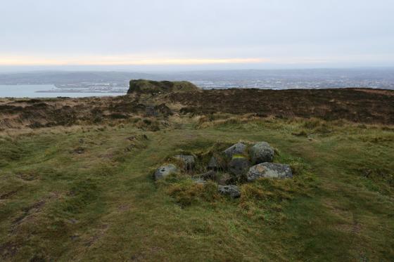
Craigarogan
Passage Grave
J270842
expand_more
Nearest town:
Stranraer (68km ENE)
OS reference:
J270842
OS sheet:
15
Latitude:
54° 41' 23.11 N
Longitude:
6° 1' 49.04 W
Added to TMA by
FourWinds
Images (1)
Add
content
Images
Image credit: david
david
Oct 11, 2024
Sites within 20km of
Craigarogan
Kilmakee
Cairn(s)
•
5.27km W
Ballyaghagan
6.39km ESE
description
1
Cave Hill
Cairn(s)
•
6.89km ESE
photo
2
description
2
McArt’s Fort
Promontory Fort
•
7.13km ESE
photo
4
description
1
The Three Brothers
Stone Row / Alignment
•
8.18km ENE
Ballygomartin
Standing Stone / Menhir
•
8.22km SSE
photo
4
description
1
Tobergill
Stone Circle
•
8.81km WNW
The Witches’ Stone
Bullaun Stone
•
12.15km W
photo
1
description
1
Ballin Tagart (Reconstruction)
Court Tomb
•
13.35km SE
photo
3
description
1
link
1
Carncome
Standing Stone / Menhir
•
15.64km WNW
photo
1
forum
1
Ballynahatty
Standing Stone / Menhir
•
17.23km SE
photo
2
Ballynahatty Stone
Standing Stone / Menhir
•
17.39km SE
photo
1
The Giant’s Ring
Passage Grave
•
17.42km SE
photo
26
forum
1
description
5
link
2
Like all websites everywhere,
we use
cookies
.
OK
search
I’m looking for…
location_on
photo
ondemand_video
forum
description
link