Image credit: Sals

From the southern town of Felanitx we took the PM512 towards Campos del Port but after about 1km turned off to the right onto the Cami de Son Mesquida. After about 4km, and just before Son Mesquida itself, we took a left onto Cami de Pedreres and almost immediately left again following the signpost to Can Roig.
Before long, there was a right turn with a sign saying “Formatges” which we followed, past a building with huge lettering “Santa Son Mesquida” on it. There’s a house numbered 2098 to the right, and after this we kept to the left down a farm track – with a substantially sized ostrich in the field to the left – and pulled up in the farmyard.
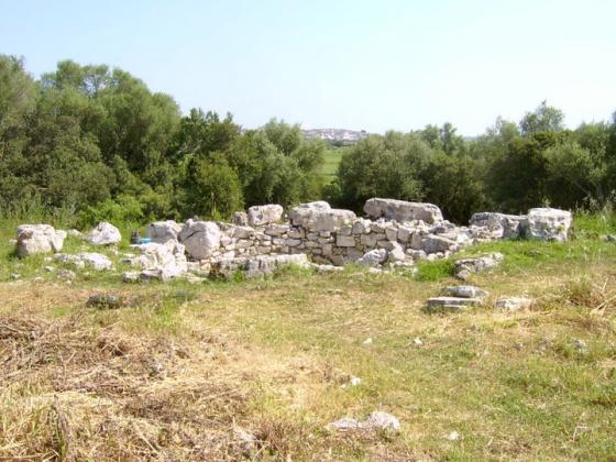
We asked permission, and the farmer, with a beaming grin, escorted us past the cowsheds to the naviform.
The naviform is the remaining one of three; it was the middle one, and the wall to its right contains some of the stones from its neighbour. The inside is impressive, with the walls way taller than us; the interior dividing walls are thought to be later, maybe Roman, additions, and the construction of the apse has lead archaeologists to believe there was originally an attic space.