Skip to content
Julian Cope
presents
The Modern
Antiquarian
Latest
Posts
Sites
Map
Blog
Forum
search
Search
⚠️
Sign in
more_horiz
Eire
County Cork
Glantane East
Glantane South
Stone Row / Alignment
W278830
expand_more
Nearest town:
Boherboy (18km NNW)
OS reference:
W278830
OS sheet:
79
Latitude:
51° 59' 40.22 N
Longitude:
9° 3' 4.57 W
Added to TMA by
bawn79
Images (8)
Add
content
Images
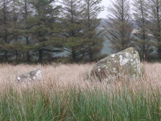
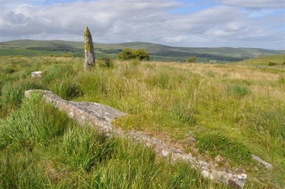
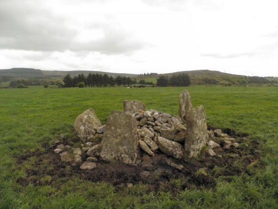
Visited October 2008
Image credit: Uwe Häberle 10/2008
Nucleus
Oct 30, 2017
Visited October 2008
Image credit: Uwe Häberle 10/2008
Nucleus
Oct 30, 2017
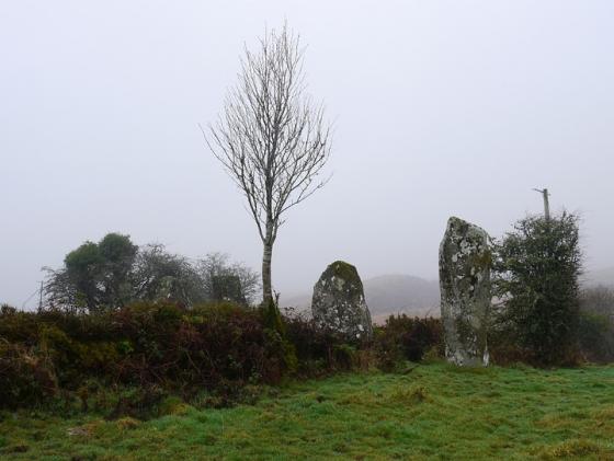
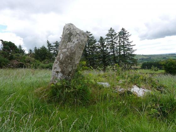
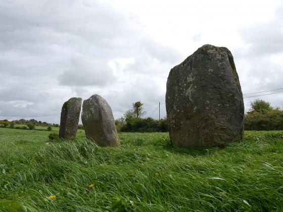
July 2014
Image credit: Michael Mitchell
Meic
Jul 30, 2014
July 2014
Image credit: Michael Mitchell
Meic
Jul 30, 2014
July 2014
Image credit: Michael Mitchell
Meic
Jul 30, 2014
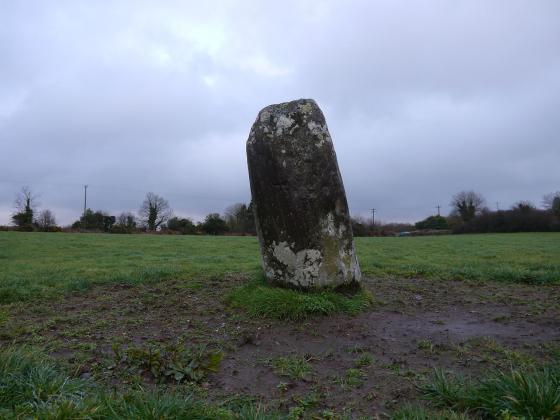
July 2014
Image credit: Michael Mitchell
Meic
Jul 30, 2014
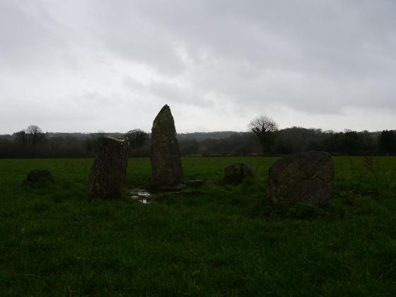
July 2014
Image credit: Michael Mitchell
Meic
Jul 30, 2014
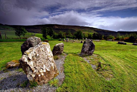
Image credit: Bawn79 © 2008
bawn79
Feb 22, 2008
Sites within 20km of
Glantane South
Glantane East S
Stone Circle
•
0.5km NE
photo
15
description
1
Glantane East N
Wedge Tomb
•
1.12km NNE
photo
5
Glantane East N
Stone Circle
•
1.12km NNE
photo
13
description
1
Glantane East
Stone Row / Alignment
•
1.43km NNE
photo
5
description
2
Carriganimmy
Stone Circle
•
1.52km E
photo
14
description
1
Knocknakilla
Stone Circle
•
2.3km NE
photo
23
description
1
Carrigonirtane
Stone Circle
•
2.5km SE
photo
6
Knocknakilla
Standing Stone / Menhir
•
2.93km ESE
Cabragh N
Stone Row / Alignment
•
3.2km SSE
photo
6
Cabragh
Stone Circle
•
3.2km SSE
photo
4
Carrigonirtane
Stone Row / Alignment
•
3.31km S
photo
4
Cloghboola Beg
Stone Circle
•
3.47km NE
photo
8
description
3
link
1
Cabragh
Stone Row / Alignment
•
3.7km SSE
photo
4
Knockraheen
Stone Circle
•
3.74km ESE
photo
17
description
2
Cloghboola More
Stone Circle
•
3.9km NNW
Cloghboola Beg
Stone Circle
•
3.9km NNW
Clashmaguire
Stone Row / Alignment
•
4.5km SSE
photo
2
Lackaduv
Wedge Tomb
•
5.38km ESE
photo
5
Knocknagappul
Cairn(s)
•
5.46km ENE
photo
2
Clashmaguire
Standing Stone / Menhir
•
5.51km SSE
photo
1
Scrahanard
Wedge Tomb
•
5.51km ESE
photo
13
description
2
Gortnalicky
Standing Stone / Menhir
•
6.02km SSE
photo
1
Claragh E
Stone Circle
•
6.34km WNW
photo
1
description
1
Kilmeedy E
Stone Circle
•
6.34km WNW
Knockagappul 2
Wedge Tomb
•
6.4km E
photo
6
Kilmeedy W
Stone Circle
•
6.55km WNW
Knocknagappul
Stone Row / Alignment
•
6.67km ENE
photo
5
Stone Row, partially ruined
Stone Row / Alignment
•
6.72km ENE
photo
4
description
1
Claragh W
Stone Circle
•
6.94km WNW
photo
1
description
1
Knockagappul 1
Wedge Tomb
•
7.36km E
photo
4
description
1
Lissacresig
Stone Circle
•
7.74km S
photo
2
description
1
Knocknagappul
Standing Stones
•
7.84km E
photo
3
Lissacresig 1
Standing Stone / Menhir
•
7.99km SSE
photo
4
Lissacresig 3
Standing Stone / Menhir
•
7.99km S
photo
4
Lissacresig 2
Standing Stone / Menhir
•
7.99km S
photo
5
Knocknagappul
Standing Stone / Menhir
•
8.01km E
photo
3
Glenleigh
Stone Circle
•
8.4km NNE
photo
2
description
1
Kilboultragh
Stone Circle
•
8.46km SE
description
1
Carrigagulla
Stone Circle
•
9.17km ENE
photo
16
description
5
Ballymakeery
Standing Stones
•
9.24km SW
photo
5
Carrigagulla NE
Stone Row / Alignment
•
9.26km ENE
photo
7
description
3
Carrigagulla
Standing Stones
•
9.36km ENE
photo
6
description
1
Carrigagulla NE
Stone Circle
•
9.4km ENE
photo
14
description
3
Inchinlinane
Standing Stone / Menhir
•
9.49km SSE
photo
6
Carrigaphooca
Stone Circle
•
9.62km SSE
photo
6
description
1
St Abban’s Grave
Bullaun Stone
•
9.67km SW
photo
1
Shanacloon
Sacred Well
•
9.67km SW
photo
4
description
1
St Abban’s Grave
Standing Stones
•
9.67km SW
photo
4
Caherbaroul
Stone Row / Alignment
•
9.68km E
photo
7
Cools
Standing Stones
•
10.36km SSW
photo
3
Kilberrihert large wedge tomb damaged
Wedge Tomb
•
10.86km E
photo
2
Gortnatubbrid
Stone Row / Alignment
•
11.04km SW
photo
4
Gortnatubbrid
Stone Circle
•
11.04km SW
photo
12
description
1
Ballyvoge 1
Standing Stone / Menhir
•
11.13km S
photo
6
Kylefinchin
Standing Stone / Menhir
•
11.23km S
photo
1
Oughtihery W
Stone Circle
•
11.29km E
photo
8
description
1
Kylefinchin 2
Standing Stone / Menhir
•
11.3km S
photo
5
Gortanimill
Stone Circle
•
11.3km SW
photo
14
description
2
Maulmore
Standing Stones
•
11.48km E
photo
6
description
2
Gortyleahy
Stone Row / Alignment
•
11.88km SE
photo
3
description
1
Bealick
Wedge Tomb
•
12.29km ESE
Bealick
Stone Row / Alignment
•
12.46km ESE
photo
3
Shanralagh
Standing Stones
•
12.46km NNW
photo
3
Reananerree
Stone Circle
•
12.55km SW
photo
10
description
1
Reananarree
Stone Row / Alignment
•
12.57km SW
photo
3
Laharankeal
Stone Circle
•
13.01km E
description
1
Deelish
Standing Stone / Menhir
•
13.08km E
photo
4
Laharankeal
Standing Stone / Menhir
•
13.25km E
photo
4
Teergay
Stone Circle
•
13.64km SSE
photo
7
description
1
Derryfineen
Standing Stone / Menhir
•
13.84km SW
photo
6
Derryfineen
Standing Stone / Menhir
•
13.91km SW
photo
5
Oughtihery E
Stone Circle
•
13.93km E
photo
9
forum
1
Lack More
Standing Stone / Menhir
•
14.21km SW
photo
9
Eastern Pap
Passage Grave
•
14.58km W
photo
5
description
1
Knocknashannagh
Cup and Ring Marks / Rock Art
•
14.82km NW
description
1
City of Shrone
Sacred Well
•
14.92km W
photo
2
City of Shrone
Christianised Site
•
14.92km W
photo
13
description
2
The Paps of Anu
Sacred Hill
•
15.15km W
photo
4
description
2
link
1
Lumnagh More
Stone Circle
•
15.53km WSW
Rosnascalp
Stone Circle
•
15.99km ESE
photo
3
description
1
Rylane
Stone Circle
•
16.03km E
photo
4
description
1
Rylane
Standing Stone / Menhir
•
16.32km E
photo
2
description
1
Kilmartin Lower
Stone Circle
•
17.22km E
description
1
Rossnakilla
Stone Row / Alignment
•
17.87km SE
photo
9
Rossnakilla
Standing Stone / Menhir
•
17.87km SE
Farrankeal
Cup and Ring Marks / Rock Art
•
18.08km WNW
photo
1
description
1
Farrankeal
Standing Stone / Menhir
•
18.08km WNW
photo
1
Turnaspidogy
Stone Row / Alignment
•
18.62km SSW
photo
6
description
2
Coolaclevane
Stone Circle
•
19.1km SSE
photo
2
description
1
Knockane
Wedge Tomb
•
19.16km SE
photo
7
description
1
Gorteennakilla
Standing Stone / Menhir
•
19.19km SW
photo
5
description
1
Knockaunnagorp
Standing Stone / Menhir
•
19.3km SSE
Coolaclevane
Standing Stone / Menhir
•
19.3km SSE
photo
2
description
1
Knockavullig NE
Stone Circle
•
19.58km ESE
photo
1
description
1
Barnadivane
Standing Stones
•
19.61km SE
Knockavullig SW
Stone Circle
•
19.65km ESE
photo
3
description
1
Clearagh
Cup and Ring Marks / Rock Art
•
19.69km SE
photo
2
search
I’m looking for…
location_on
photo
ondemand_video
forum
description
link