


Photo taken from the North end looking towards the road from Adderbury to Bloxham (L to R).


Taken from a pile of logs next to the track on the south west. The walls of Castle Dounie in the middle.

Visited early April on a windy, overcast morning . Easy to find as signposted from Ashbourne to Buxton Road and parking up a farm track. Honesty box or pay the man a pound for adults, children free. A nice stroll up a stony track to the henge. A wonderful place that holds its magic. There are two entrances through the bank in roughly SE and NW alignment, ditch crossings and a ring of fallen stones with some larger ones in the middle, one of which attracts offering which it was nice to see were largely biodegradable.
It is interpreted as a stone circle surrounding a central arrangement but I’m going to suggest, based on seeing many ruins similar, that it was a dolem surrounded by kerbstones and covered by a mound inside the henge. The site is close to several barrows, mostly removed and rifled by “The Barrow Knight” a local Victorian amateur who dug a lot of barrows. While digging the one in the next field (see separate entry) he discovered a Neolithic burial and when his tunnel collapsed a Bronze Age cist with grave goods including a Jet necklace was revealed. This is interesting because the early burial mound predates the henge and a long time later it was reused and a new barrow constructed on top, similar to Waylands Smithy for example, so these monuments evolved over time as each wave of settlers stamped their presence on this obviously important place. A beautiful, peaceful place where I had only buzzards for company. I recommend a visit and will be back on a future, better planned tour of this area.
Visited early April on a windy, overcast morning . Easy to find as signposted from Ashbourne to Buxton Road and parking up a farm track. Honesty box or pay the man a pound for adults, children free. A nice stroll up a stony track to the henge. A wonderful place that holds its magic. There are two entrances through the bank in roughly SE and NW alignment, ditch crossings and a ring of fallen stones with some larger ones in the middle, one of which attracts offering which it was nice to see were largely biodegradable.
It is interpreted as a stone circle surrounding a central arrangement but I’m going to suggest, based on seeing many ruins similar, that it was a dolem surrounded by kerbstones and covered by a mound inside the henge. The site is close to several barrows, mostly removed and rifled by “The Barrow Knight” a local Victorian amateur who dug a lot of barrows. While digging the one in the next field (see separate entry) he discovered a Neolithic burial and when his tunnel collapsed a Bronze Age cist with grave goods including a Jet necklace was revealed. This is interesting because the early burial mound predates the henge and a long time later it was reused and a new barrow constructed on top, similar to Waylands Smithy for example, so these monuments evolved over time as each wave of settlers stamped their presence on this obviously important place. A beautiful, peaceful place where I had only buzzards for company. I recommend a visit and will be back on a future, better planned tour of this area.

Saxons’ Lowe from the South West


Taking the long way round I approached from the north.


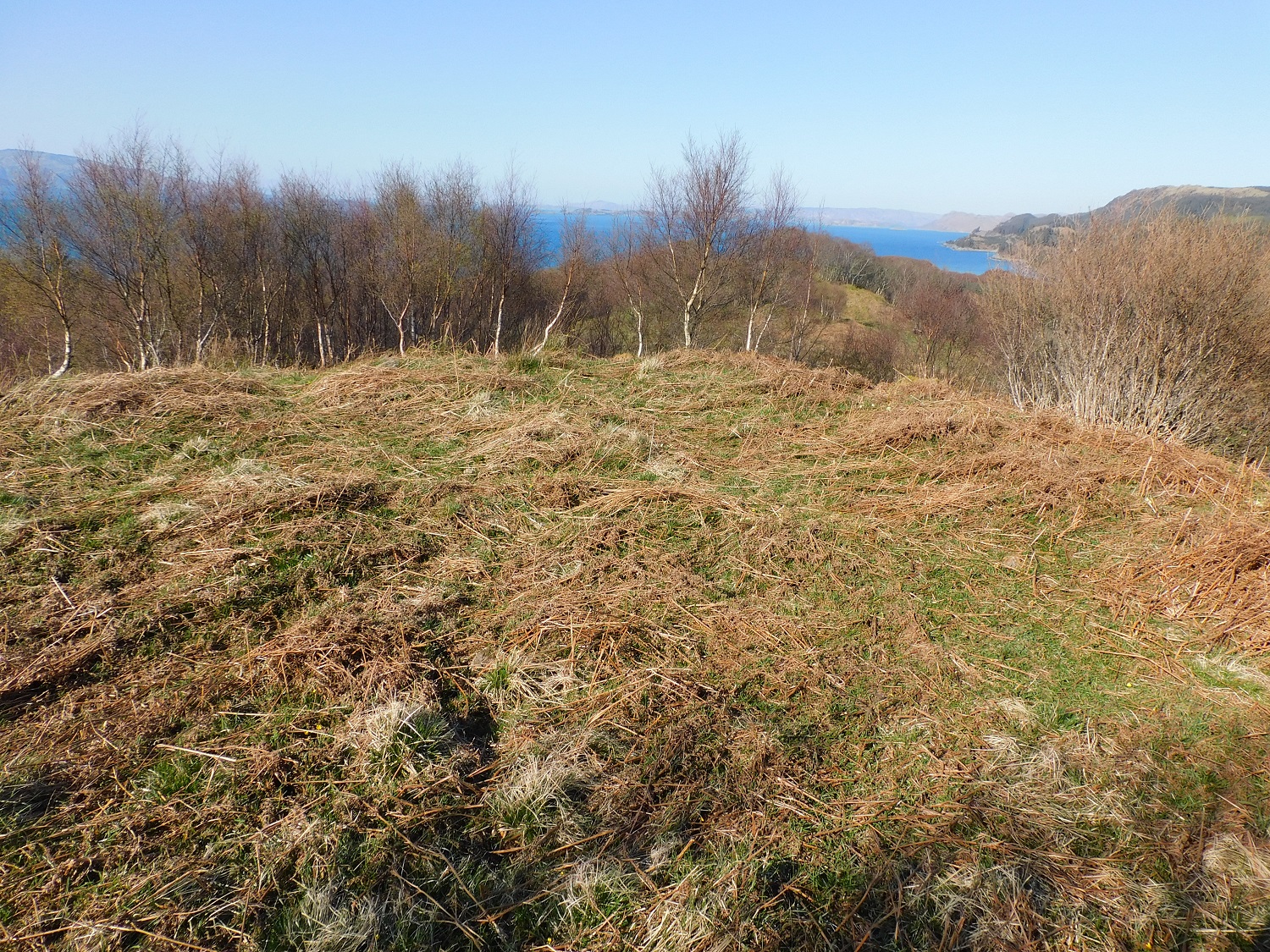
The dun, in the clearing, taken from Cnoc-an-t-Samhlaidh (Summer Hill)

The slight depression in the middle is the front door on the east side of the dun.


The north wall, the island of Eilean Traighe almost immediately below, Eilean Dubh slightly further out.
Directions to Cairnholy 06
Take the signed Cairn Holy Chambered Cairn turn off the A75 at NX 51646 53037 (///bound.hotel.scrubbing) between Creetown and Gatehouse. Go past the first left turn, instead take the 2nd left for Cairn Holy Chambered Cairn then bear left at the Y junction after c. 100 yards. Continue up the lane to the carpark at Cairnholy. Walk W along the farm track for c. 150 yards to reach a gateway on the right. There is an interesting recumbent stone c. 20 feet W of the gate. Head to a gate in a stone wall c. 80 yards NNE. Follow the path NNE from the gateway for c. 130 yards then walk W for c. 50 yards to a grassy mound in the field. This is listed as Cairnholy Cairn on TMA. Walk NNW for c. 50 yards to a gate in a stone wall. Head NNE for a pair of small clearance cairns c. 100 yards from the gateway. Cairnholy 03 is a large stone on the W edge of a clearance cairn at NX 52000 54282 (///larger.fairway.subplot) c. 35 yards N of here.
It is possible to extend your walk to visit Cairnholy 6 & 7. Cairnholy 6 is located c. 140 yards ENE of Cairnholy Sheepfold in a drainage ditch running parallel to a stone wall. Cairnholy Sheepfold is located at NX 51721 54902 (///critic.jetted.nutty) in the NW corner of a grass field containing a large clearance cairn. Cairnholy 6 is located at NX 51871 54968 (///maker.blunt.downfield).
Cairnholy 7 is located in a grass field containing a large clearance cairn and Cairnholy Sheepfold in the NW corner. Cairnholy 7 is carved on a narrow rock ridge aligned ENE-SSW, c. 75 yards SSE of the sheepfold and c. 30 feet ENE of the stone wall. Cairnholy 7 is located at NX 51758 54840 (///gossiped.cook.valued). My route is viewable as Cairnholy 3,6 & 7.
Directions to Cairnholy 07
Take the signed Cairn Holy Chambered Cairn turn off the A75 at NX 51646 53037 (///bound.hotel.scrubbing) between Creetown and Gatehouse. Go past the first left turn, instead take the 2nd left for Cairn Holy Chambered Cairn then bear left at the Y junction after c. 100 yards. Continue up the lane to the carpark at Cairnholy. Walk W along the farm track for c. 150 yards to reach a gateway on the right. There is an interesting recumbent stone c. 20 feet W of the gate. Head to a gate in a stone wall c. 80 yards NNE. Follow the path NNE from the gateway for c. 130 yards then walk W for c. 50 yards to a grassy mound in the field. This is listed as Cairnholy Cairn on TMA. Walk NNW for c. 50 yards to a gate in a stone wall. Head NNE for a pair of small clearance cairns c. 100 yards from the gateway. Cairnholy 03 is a large stone on the W edge of a clearance cairn at NX 52000 54282 (///larger.fairway.subplot) c. 35 yards N of here.
It is possible to extend your walk to visit Cairnholy 6 & 7. Cairnholy 6 is located c. 140 yards ENE of Cairnholy Sheepfold in a drainage ditch running parallel to a stone wall. Cairnholy Sheepfold is located at NX 51721 54902 (///critic.jetted.nutty) in the NW corner of a grass field containing a large clearance cairn. Cairnholy 6 is located at NX 51871 54968 (///maker.blunt.downfield).
Cairnholy 7 is located in a grass field containing a large clearance cairn and Cairnholy Sheepfold in the NW corner. Cairnholy 7 is carved on a narrow rock ridge aligned ENE-SSW, c. 75 yards SSE of the sheepfold and c. 30 feet ENE of the stone wall. Cairnholy 7 is located at NX 51758 54840 (///gossiped.cook.valued). My route is viewable as Cairnholy 3,6 & 7.


