
William Borlase’s plan of the speculative stone circle on Salakee Down, from Observations on the Ancient and Present State of the Isles of Scilly.
Image credit: William Borlase (1756)
William Borlase’s plan of the speculative stone circle on Salakee Down, from Observations on the Ancient and Present State of the Isles of Scilly.

William Borlase’s drawing of The High Stone from Observations on The Ancient and Present State of The Isles of Scilly (1756).
Jeremy Butler notes that the arc and spread of stone around the trig point on the summit of Gutter Tor is probably the remains of a very damaged cairn (Dartmoor Atlas of Antiquities: Volume Three (1994)).


One of two lanulae found in a barrow at Harlyn Bay in 1864. In the Royal Cornwall Museum, Truro.

Electrotype copy of the Rillaton Cup, Royal Cornwall Museum, Truro. The original is in the British Museum.

Beautifully decorated beaker, from a cist within a barrow at Trevedra Common, excavated 1954. Now in Royal Cornwall Museum, Truro.

Small Early Bronze Age decorated urn with chevrons from Harlyn Bay (second from left) with other cinerary urns found at Carnkief (left) and Treworrick Farm, St Ewe (second from right) and a copper cup from Colliford Barrow, Bodmin Moor.

The two urns found near the foot of the stone, mentioned in Mark’s Miscellaneous post. Now in Royal Cornwall Museum, Truro.

A very small perforated pottery vessel, possibly for incense. Found at Harlyn Bay in 1940 along with an urn, spindle whorl and whetstone. Now in Royal Cornwall Museum, Truro.

The wooded site, seen from the southwest.


Visited by accident 20 June 2024. I haven’t been able to find out anything about this stone, which is in the walled garden at National Trust Trengwainton, next to a pond. It’s a ringer for the Tregeseal holed stones near St Just, but I have no idea if it’s the real thing or a copy.


Seen across Porthbeer Cove from Chynhalls Cliff to the SSW.


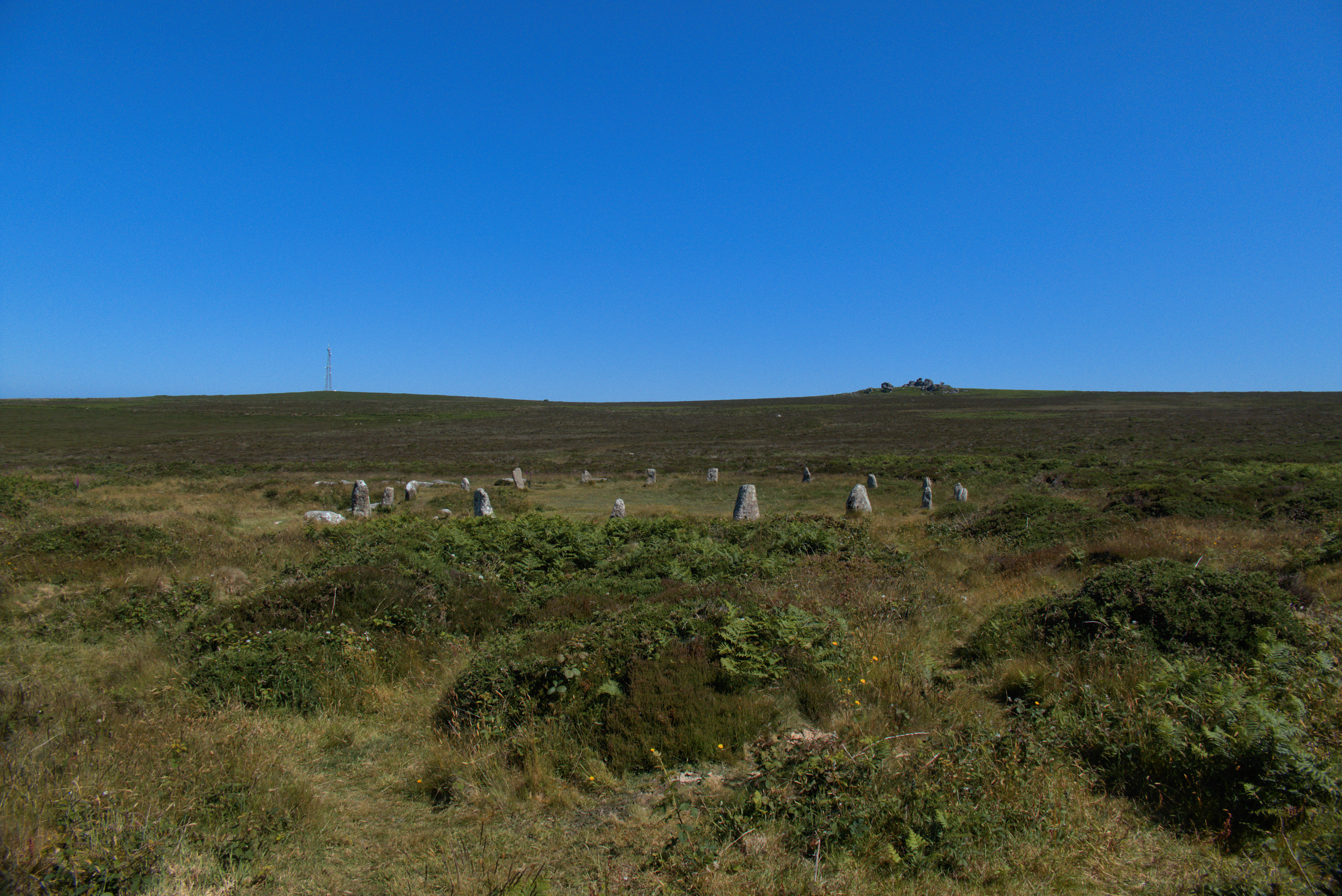
Circle stones. Looking towards Nine Maidens Downs.

Inner rampart with its cleared ditch on the right.

Section of cleared outer rampart on the south side of the fort.

Really impressive stone walls have been revealed in the outer rampart by the clearance of vegetation.

Cleared outer rampart on the western side of the fort.

Clearance work has revealed more of the outer rampart around the north-western arc from the gate.


Looking south. Botrea barrow cemetery is on the skyline, left of centre,


The flanks of the SW barrow are gradually being reclaimed by the gorse.


Early summer on top of Cotley Hill.

‘Tenshun! No digging, no tanks, no lorries. That means YOU, you ‘orrible little man.

The summit round barrow has a modern marker cairn of chalky flint. There are fine views towards Scratchbury and out across the Imber Range (right).

The summit round barrow. The OS map shows a further barrow midway between the NW pair and this one, but there’s nothing to see on the ground.

The pair of barrows to the NW of the summit. Looking towards distant Cley Hill and Cop Heap.

On top of the SE of the pair, with the NW barrow to the right of centre. Cop Heap (far left) and Scratchbury (left of centre) on the skyline.

The SE of the pair of barrows to the northwest of the summit.

The NW of the pair of round barrows to the northwest of the summit. The OS shows a third barrow here, but there’s nothing particularly obvious on site. This is a fine barrow though.

Two fine round barrows to the NW of the summit, on the route from Scratchbury.

Zoom on the long barrow from Scratchbury.