23/09/2017 – Curious hole in Louven Howe.
23/09/2017 – Curious hole in Louven Howe.

Looking southeast

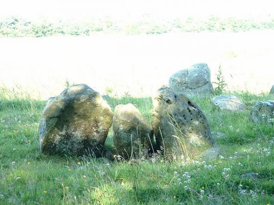
Looking roughly north. Boundary stone on the barrow, Trig point to the right.

23/09/2017 – X93 bus out from Scarborough to the Falcon Inn on the A171 to start a nice loop of three hills – Brow Moor, Stony Leas & Barns Cliff End. Long day and it was dark by the time we caught the bus back.
Good track to start through the trees and then out to the moor to make the small climb to the trig on Brow Moor. Even though it was still early in the day I knew already we just didn’t have the time to look round this area for cup marked rocks which was a bit sad. We pushed on and headed west.
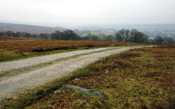
The walk between Brow Moor trigpoint and Louven Howe on the top of Stony Leas was easy going but felt long. The crossing of Jugger Howe Beck was nice and Burn Howe was worth a look. It did feel good to finally make it to Louven Howe for a sit and a brew.
There’s plenty of round barrows around here and from the ones we saw, they all looked pretty much of a muchness. If you want to visit one or two, this and Lilla Howe make for a nice walk from a few directions. I don’t think this would be the best place to visit in rubbish weather though.
Louven Howe has a large hole in it, I couldn’t make my mind up about it. Bit odd.
After a stop to rest and take in the views, which are good, we headed south to enter the trees and make the long walk back to the A171 via Barns Cliff End.
Nice day out but couldn’t quite fit in everything we wanted to see.
Louven Howe represents the highest point in this chain of barrows and stands just by the junction of several tracks. One leads north into Sneaton High Moor Woods, one south into Langdale Forest, one southeast towards Scarborough and one northwest along the same ridge as Ann Cross and Foster Howes.
This barrow (now marking a boundary) is said to contain a pot of gold. But don’t be getting any ideas. It is guarded by a ‘big hag-worm or adder’, and if that isn’t enough to see you off, then the inevitable thunderstorm that will roll up when you start meddling will soon scare you away.
(recorded by Grinsell in ‘Folklore of Prehistoric Sites in Britain’ 1976 – will have original source noted but I forgot).
Origin of name and cross on top :
In 1121, King Henry 1 married Adeliza, daughter of Godfrey de Louvain, Duke of Lower Lorraine. As part of her entourage, came her half-brother, Josceline de Louvain. Shortly afterwards, Josceline married Agnes de Percy, whose family owned this moorland. (Her brother was Alain de Percy, whose name is preserved in Allen Tofts). It is thought that this cross was raised on top of the howe to commemorate the wedding. It couldn’t have been much later because, when Alain died without legitimate heir in his father’s lifetime, Josceline de Louvain changed his surname to Percy in order to preserve his wife’s illustrious dynasty
The cross was broken – along with about thirty others on these moors – by Puritan ‘iconoclasts’ who regarded them as idolatrous. This would be during the Commonwealth period (1649 – 1660).
Louvain Howe marks the junction of roads from Whitby and Robin Hood’s Bay on the way south to Thornton-le-Dale. There is a well here, served only by surface water, and, consequently, often dry. It’s roughly eight feet deep and three feet square – I once sheltered in it during a storm!
Photo of the howe by Paul Allison.