|
|

|
Latest Posts — Weblog |
Showing 1-25 of 781 posts. Most recent first | Next 25 
Pleasant Valleys Sunday - Between Sirhwyi and Rhymni 30 January 2022 |
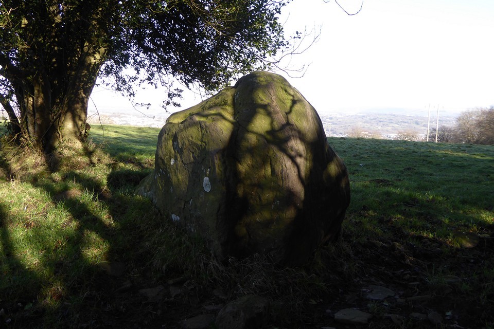
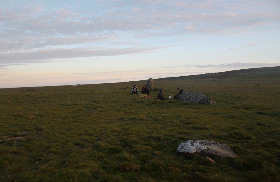
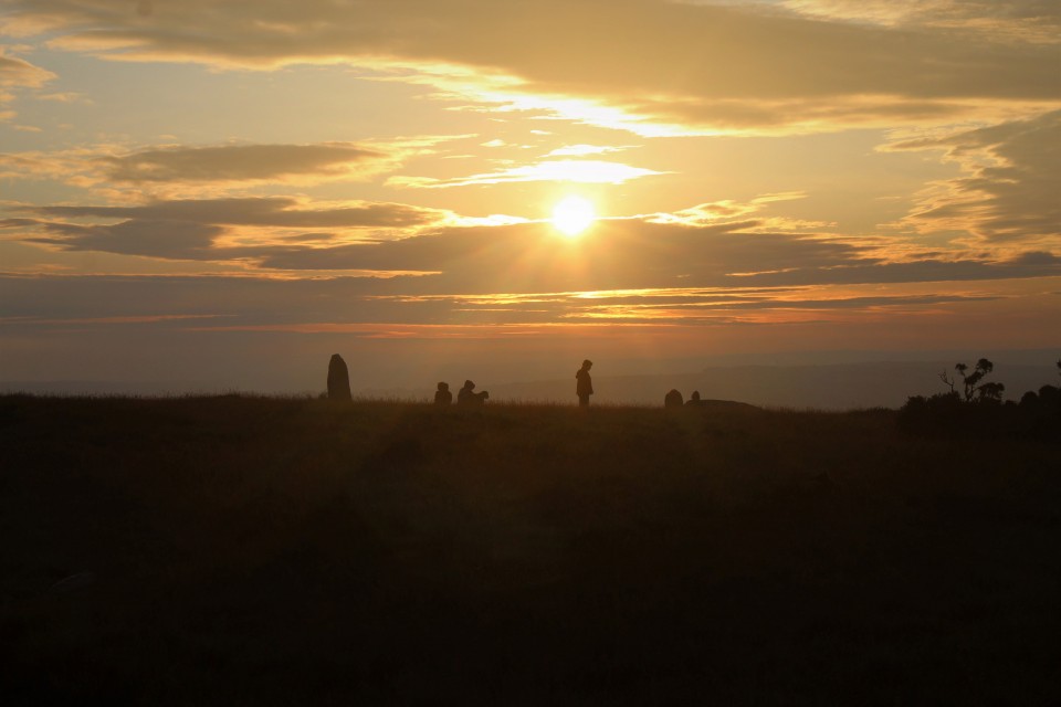
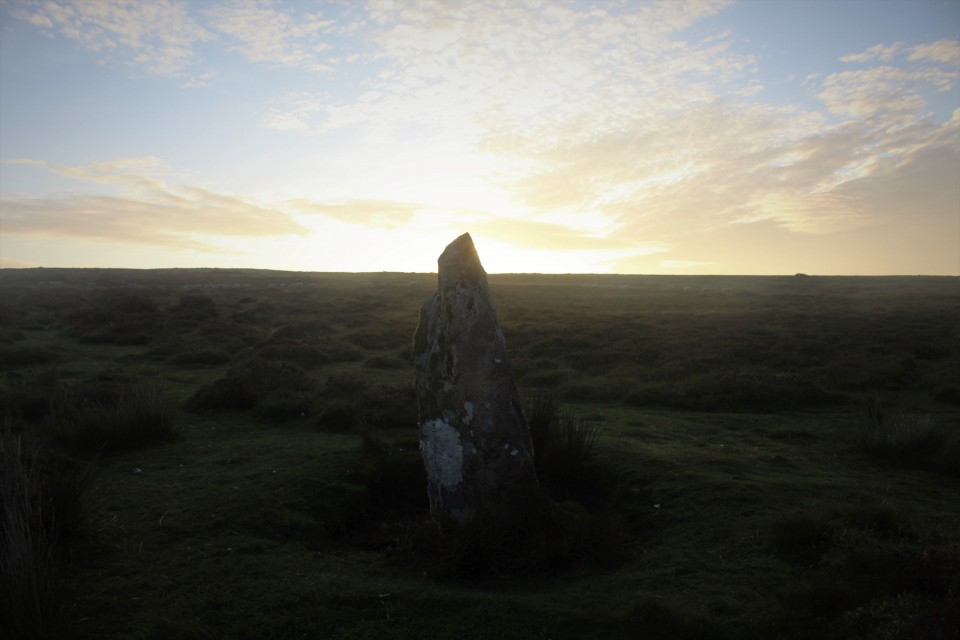
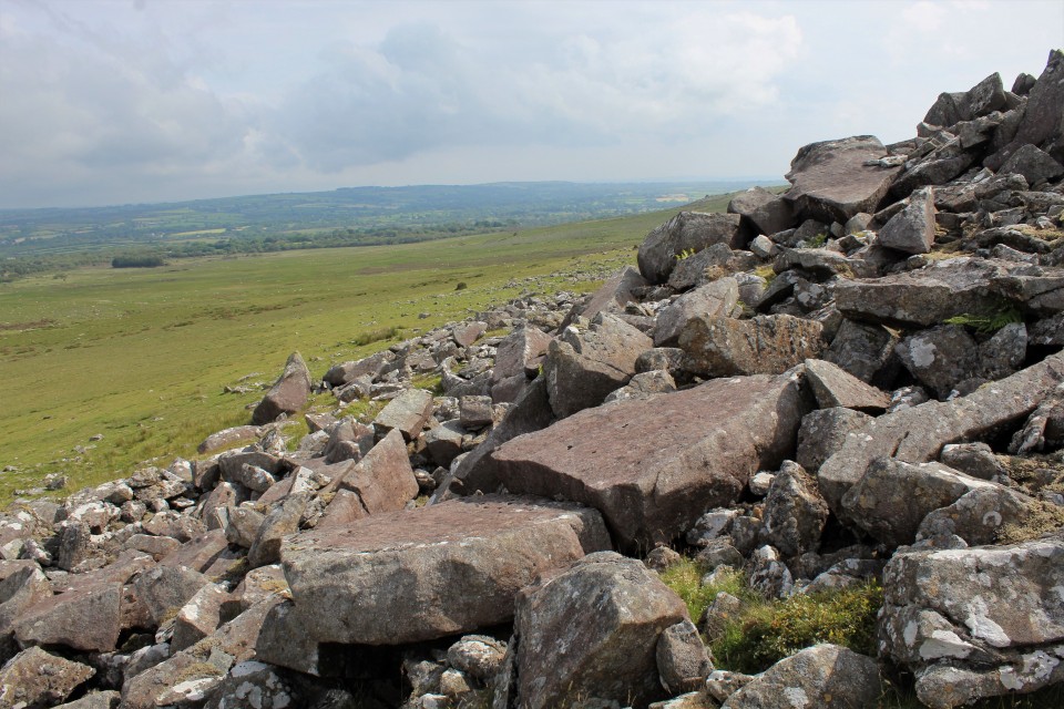
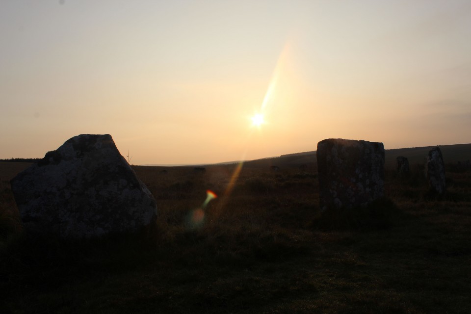
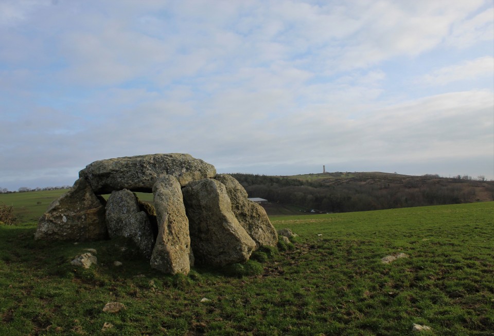
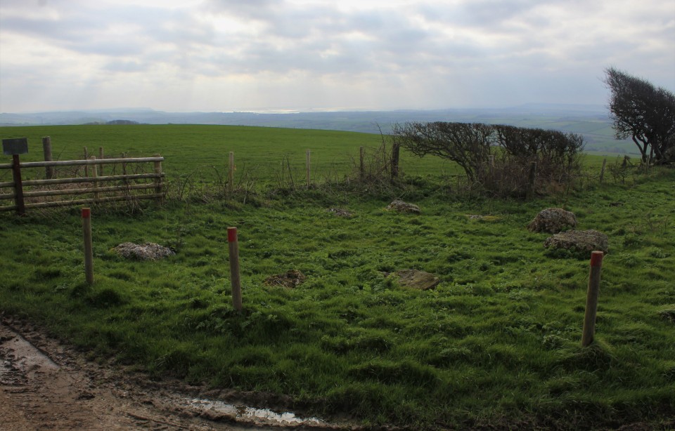
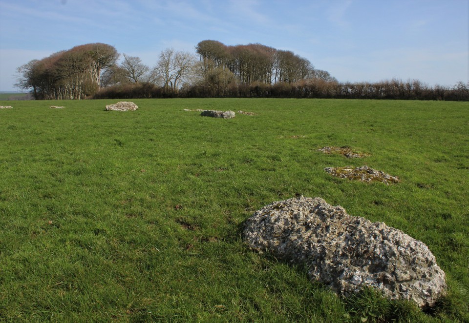
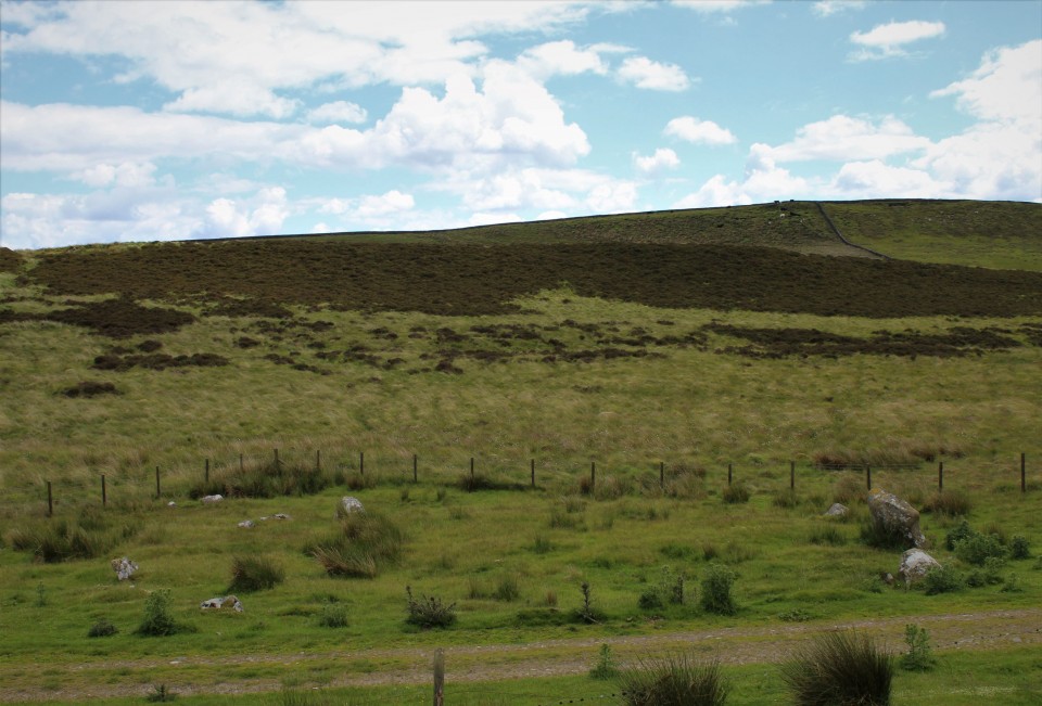
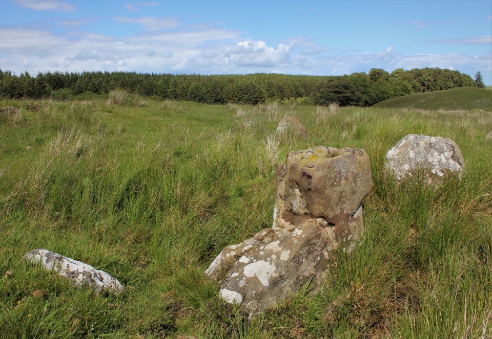
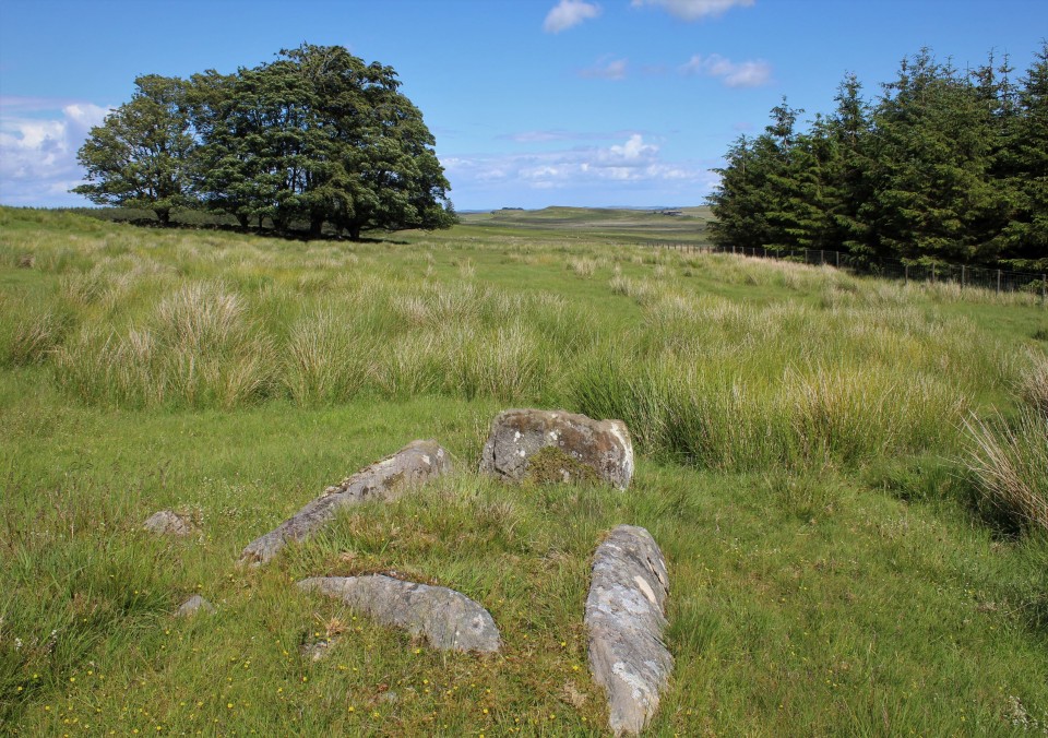
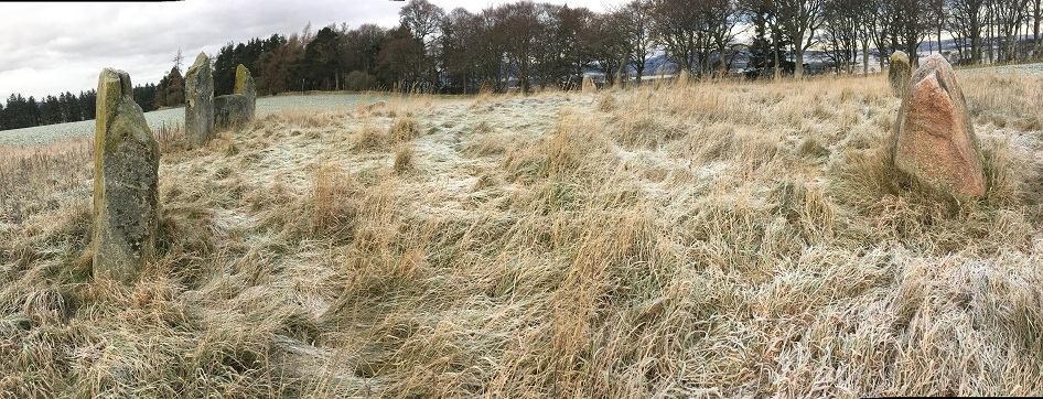
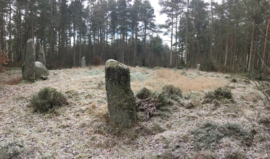
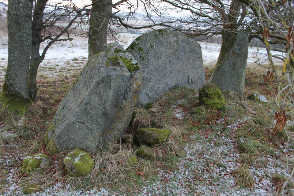
Pleasant Valleys Sunday - Between Sirhwyi and Rhymni 30 January 2022Back in the 2010s I was slowly exploring the prehistoric archaeology of the steep-sided ridges above the towns and villages that make up the South Wales Valleys. After visiting most of the cairns and occasional standing stones above the Rhondda and Cynon rivers, I got distracted and my trips out to these largely ignored sites dwindled. 2020 marked a year of stagnation, with Wales mostly unreachable, but a beautiful hot day in spring 2021 found me hanging out above Blaenavon, at the easternmost end of the Valleys. It was enough to rekindle a feeling that there was a lot still to visit here. Last weekend finally saw me properly re-engage, in a strenuous but very rewarding horseshoe walk above Ebbw Vale, taking in solitary cairns on two of the high ridges that mark the northern frontier of the Valleys. Today I’m going for something shorter, lower, and with more archaeology, on a ridge that Carl trailblazed for TMA a decade earlier. A quick glance at the map reveals a potential embarrassment of riches in a relatively small stretch of ridge between the lower Rhymni and Sirhwyi valleys, ending with the prominent summit of Mynydd Machen, an obvious landmark from both the Gwent Levels to the south and from the magnificent Twmbarlwm hillfort across the valley northeast. So it’s an early start for a Sunday; a saunter through a bitterly cold and largely deserted Newport city centre, then a bus towards Blackwood has dropped me below the small hamlet of Wyllie, nestled on the side of the ridge above Cwm Sirhywi and a good place to start the walk from the northwest. Despite the low temperature and the open windows that kept the bus ride cold, it’s a steepish climb up to Wyllie and I’m soon feeling warmer than I might have liked. The winter sky is clear blue, with the low sun raking through the trees framing the slightly sunken lane leading me onto the ridge. I’d done my homework for once, and Historic Wales has turned up a possible standing stone right next to my route. Tyle-gwyn — Fieldnotes15.01.23ceTyle Gwyn (“White Bank”) stone turns out to be a big upright lump of sandstone. It’s one of those stones that looks too improbably erect to be natural, but too bouldery to be an obvious choice for a menhir. The stone is close to the lane, with a barbed wire fence between it and me. The field has cattle and some farm workers are repairing fences across the way, so I decide not to make the effort of trying to get any closer. The contrast between the sharp shadows of the lane and the brightness of the field and hills beyond makes getting any decent photos difficult, but it’s a worthwhile stone to come and see. Given the prevalence of South Wales’ standing stones marking apparent routes to upland stone circles and cairns, I can’t help but feel nudged towards accepting this as the real thing and not merely a natural erratic. It certainly sets me on my way with hope for the monuments to come. Tyle-gwyn — Images08.01.23ce
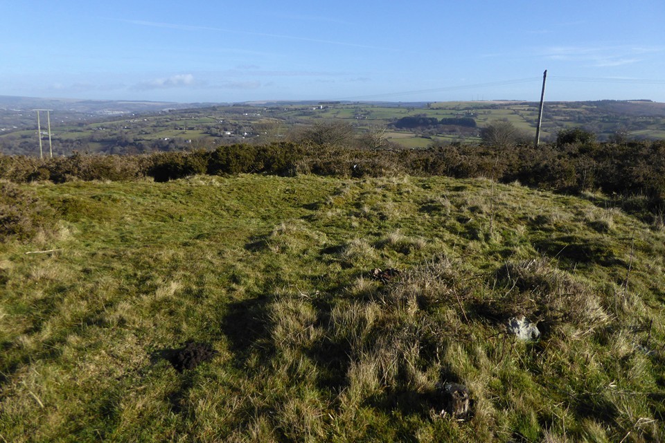
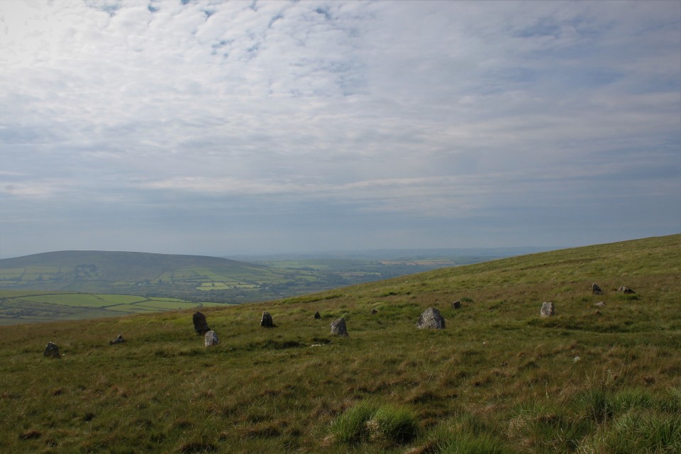
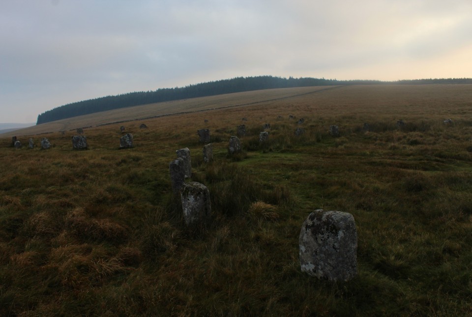
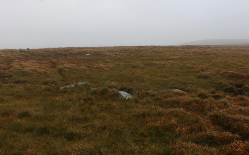
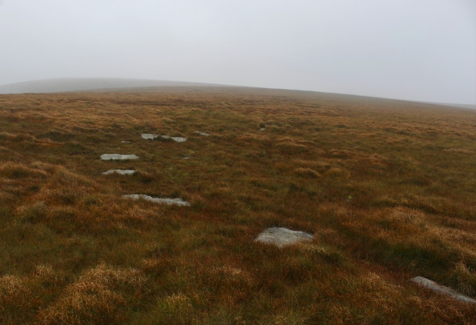
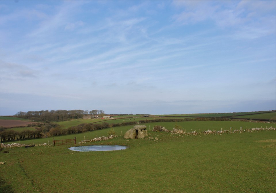
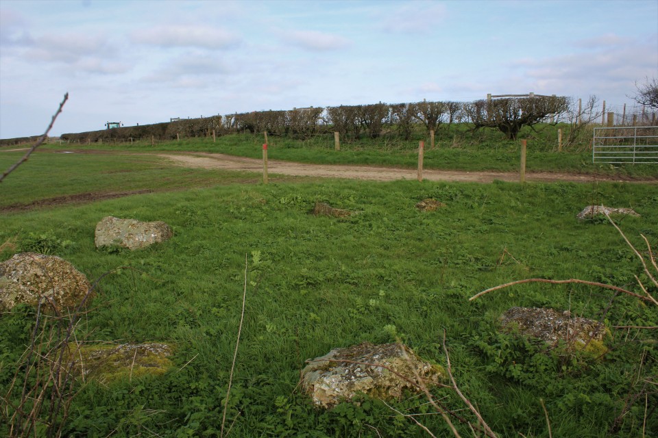
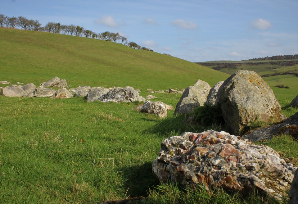
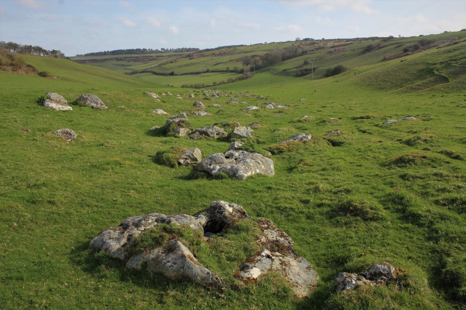
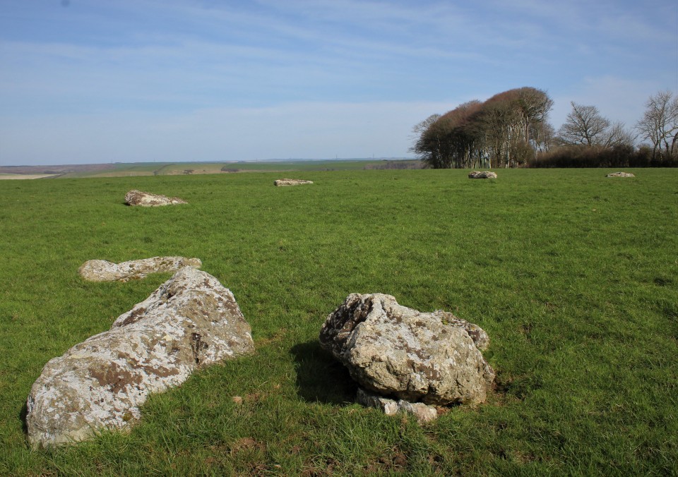
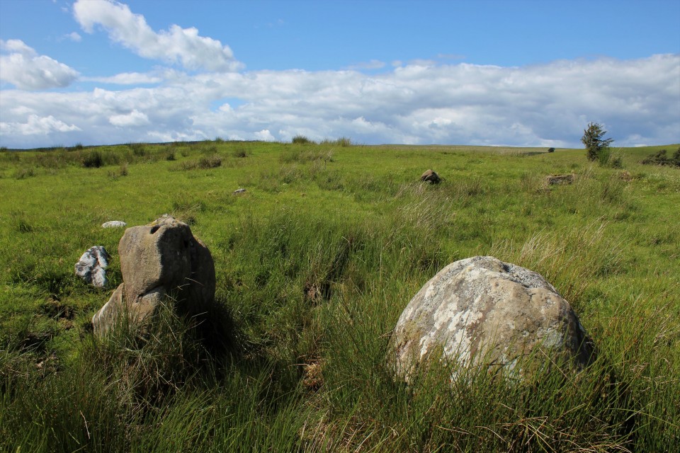
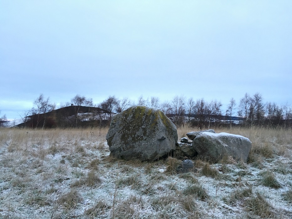
Not much further on, the end of the lane brings me out onto the ridge proper, and I head south on the minor road that will take me to the access land. The views eastwards have now opened up, particularly of Mynydd y Lan across Cwm Sirhwyi, which has its own unmarked cairn (one for a future trip). There is vehicular access along the ridge, the main restriction being whether a car’s suspension will handle the deep ruts and watery potholes. It also makes for a lot of motorbikes, some of which are being ridden responsibly, others less so. As I saw above Ebbw Vale last week, there is an ongoing threat of damage here from people who don’t know or don’t care about the ancient heritage on these ridges. Mynydd Bach (Maesycymmer) — Fieldnotes15.01.23ceThe first cairn of the day is Mynydd Bach 2, a low monument marked on the Ordnance Survey map. It sits in an area of gorse and scrub, criss-crossed by various tracks and I’m not particularly optimistic that it’s going to be easy to find. I follow one of the broad tracks running west from the main ridgeway, then another heading south. And amazingly, clear of the thick gorse smothering much of the area, here is the cairn. As described in the HER, it’s a low, circular monument. It rises highest above the surrounding ground surface on its eastern arc. I wouldn’t be surprised if it has always been a low monument, rather than the remains of a bigger robbed-out mound, as there are other ring cairns close by. From here I can see the obvious profile of Mynydd Machen, which is on the agenda for later. Apart from a couple of stones protruding where gorse bushes have been cut back, the monument is covered in turf. Close by are signs of rubbish or motor debris having been burned, but at least it’s not happened on the monument itself. Although it’s not the most exciting cairn, I’m delighted to have found it so easily and drink in the extensive views. Next I head into the scrubbier ground to the west, where there is supposed to be another ring cairn, unmarked on the OS map. After wandering for a bit and poking around in the gorse and tussocks I declare this one a failure. There’s plenty more to come, so I’m not too disheartened by this setback. Returning to the main ridge path, the next cairn south (Mynydd Bach 1) is much more obvious. It lies in a grassy field to the west of the access land, and can be seen prominently from the path. The unexpected obstacle to this one turns out to be resident sheep, who take curiosity to heights bordering on belligerent, crowding around right behind me as I cross their field. To be fair I’m intruding on them, but it’s like something between panto season and Life of Brian; my attempts to convince them that I am not the messiah are unsuccessful. They follow me all the way onto the cairn itself, which makes taking photos somewhat difficult as I’m constantly on the brink of being pushed over from behind by whichever sheep is the bravest of the flock. Nevertheless, this invasion of my personal space doesn’t detract from what is a fine monument, with a cist exposed in its centre. Two side slabs remain, one still in place, the other lying out of position. There’s a bit of rubbish too, unfortunately, although by local standards it’s quite minor. A further small slab lies on the northern edge of the mound, but I’m not convinced it would have been large enough to be the capstone. There are fine views to the northwest, looking towards the higher ridges. To the west Cwm Rhymni drops away. If you can shake off the sheep, this is a very decent monument to visit. With my retinue following me to the fence, I head south. Leaving them behind, the ground drops quite steeply and according to Coflein (but not GGAT) there is supposedly another very irregular cairn here. Apart from an area of stone exposed from quarrying, I can’t find anything at all in 10 minutes or so of walking backwards and forwards across the sloping field, so I give up and head back to the ridge path. The next monument, Pont Bren Gwyn ring cairn, sounds like it will be elusive. However, the OS map is helpful in showing an obvious kink in the wall right where it’s supposed to be, and so it proves. Beneath a lone tree, with a broken wall on its west side, the arcing bank around the east side of the monument is quite easy to make out in the low sunlight and low vegetation of this time of year. Definitely one for the enthusiast, but like Mynydd Bach 2 it’s the sort of monument that gives a sense of satisfaction just from finding it at all. The name defies my attempts at translation; although it sounds like it may be related to “Brenin”, it seems that “Bren” may be a proper noun, which would make it “White Bren’s Bridge” I think. Like Mynydd Bach 2, the views are all eastwards, towards Mynydd y Lan. All in all this little group of sites has been a great start to the walk. There are plenty of other people out enjoying the winter Sunday sunshine, but no-one seems overly interested in these obscure lumps and bumps. No change there! Mynydd Bach (Maesycymmer) — Images12.01.23ce
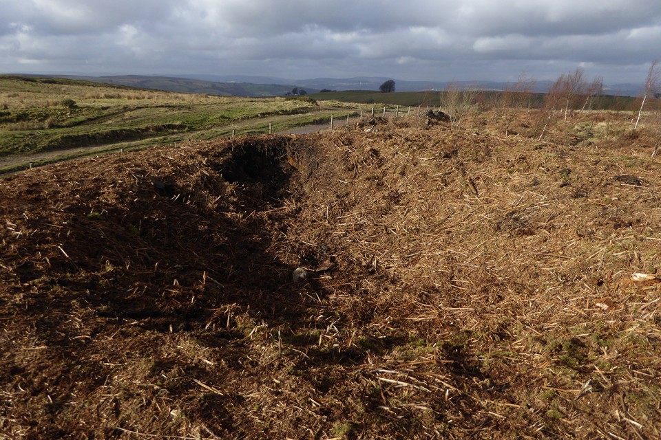
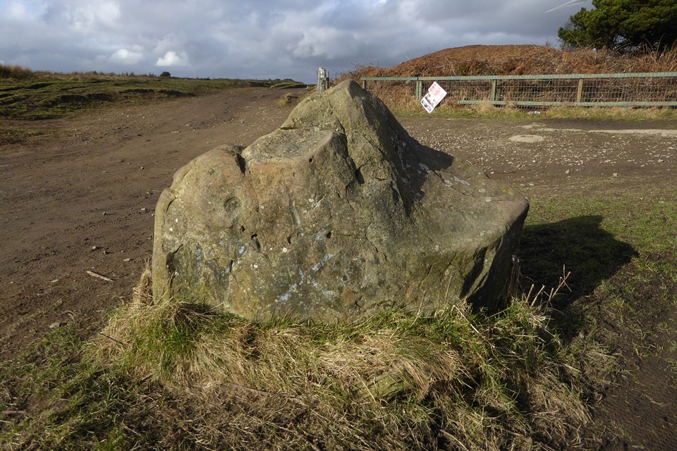
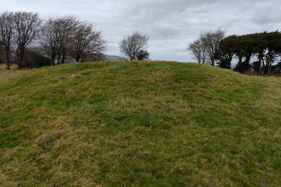
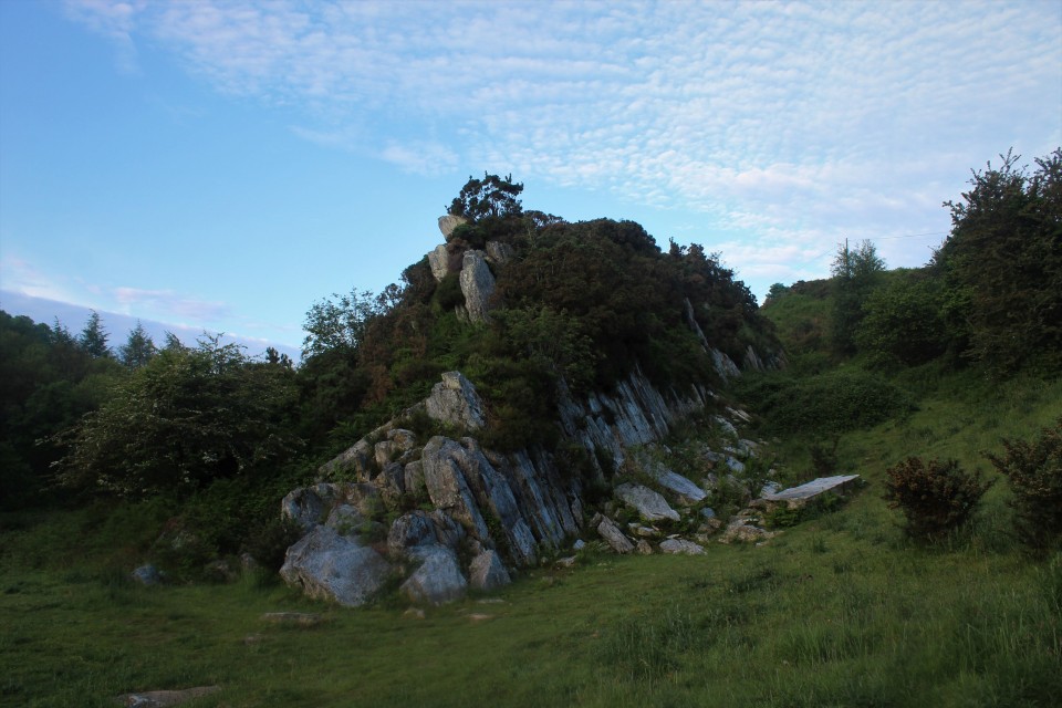
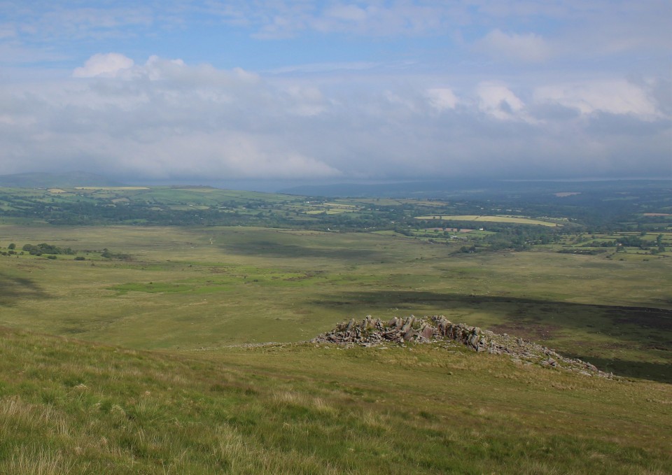
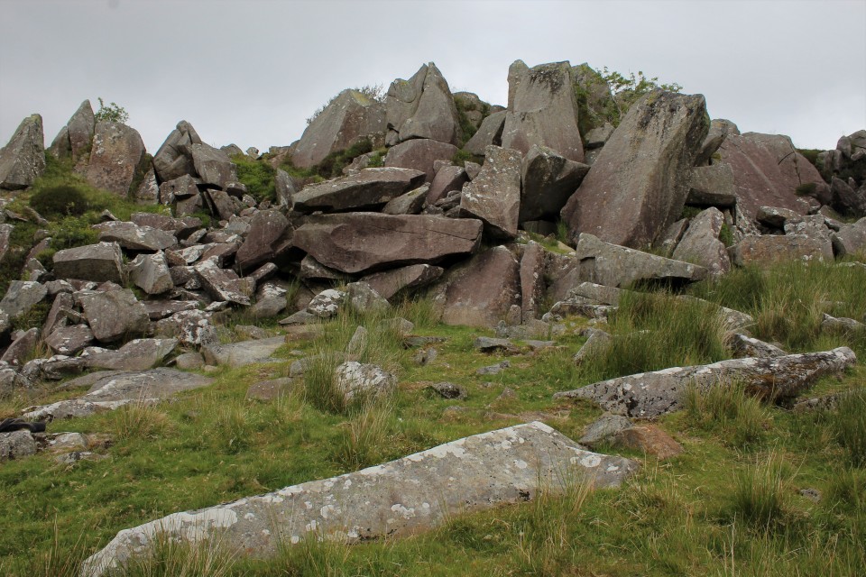
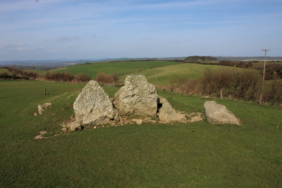
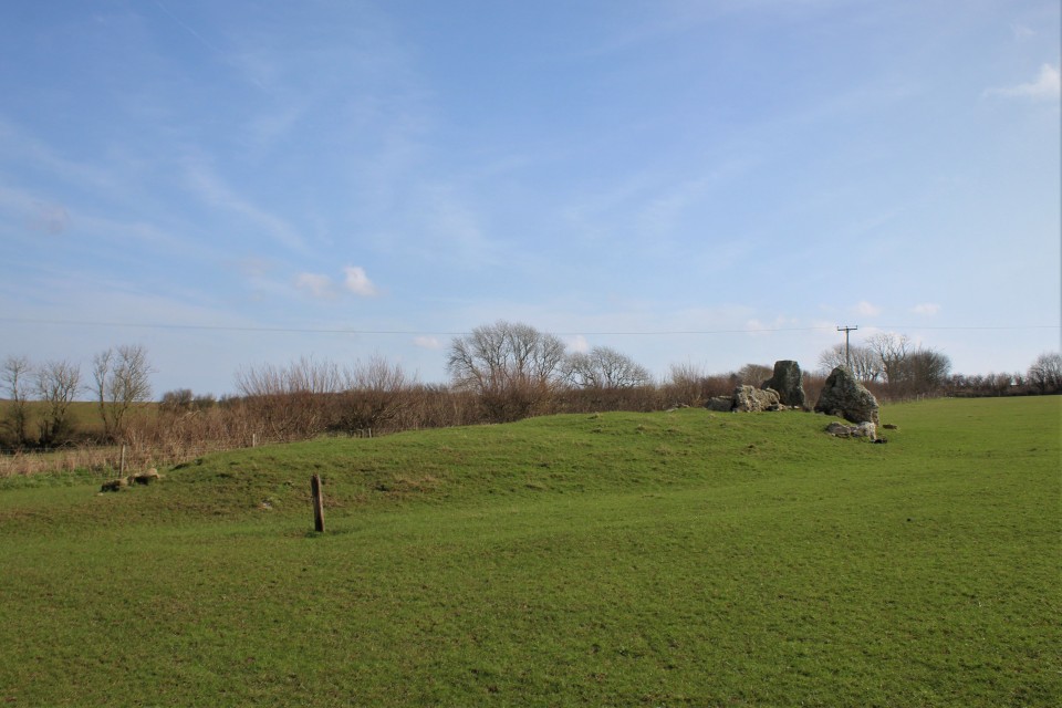
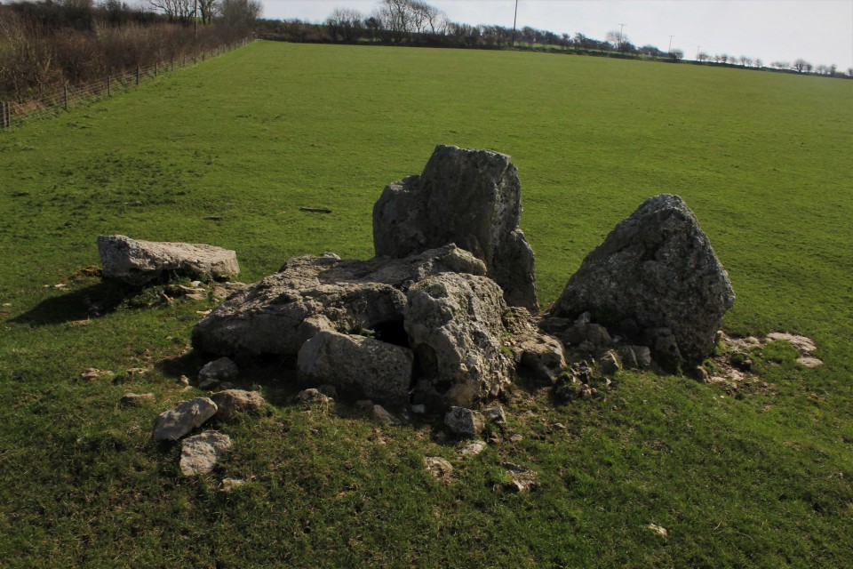
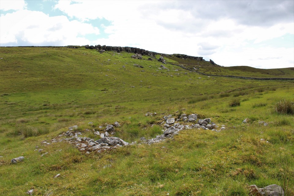
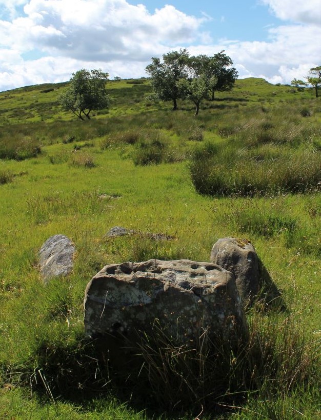
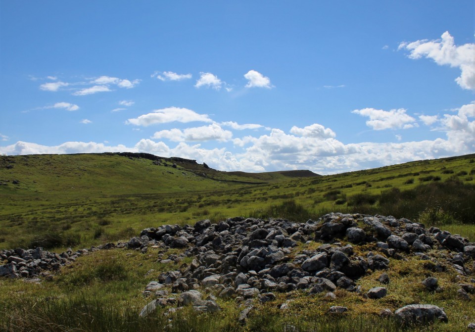
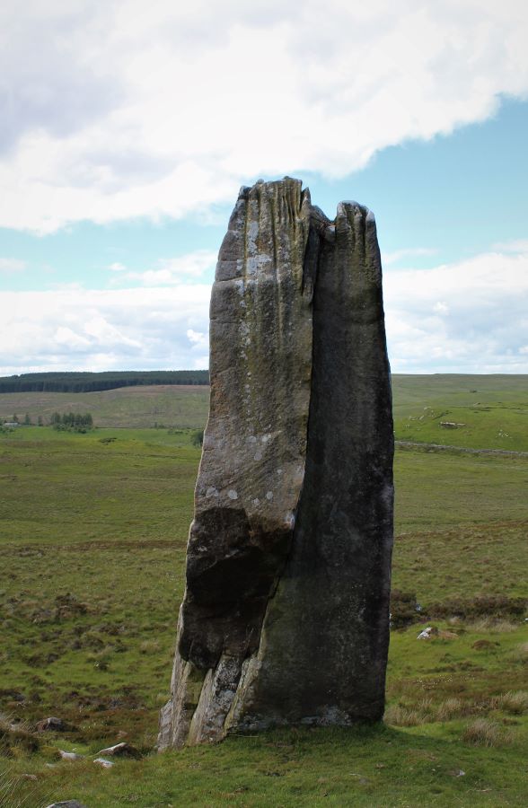
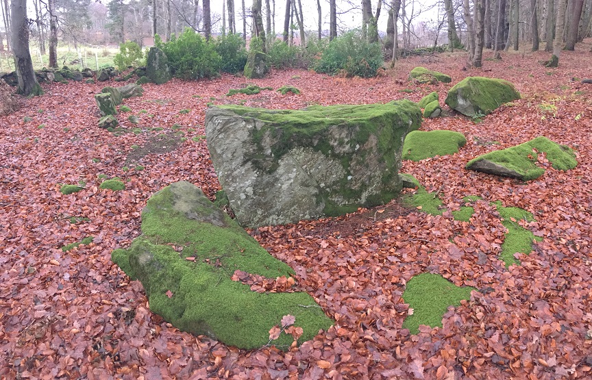
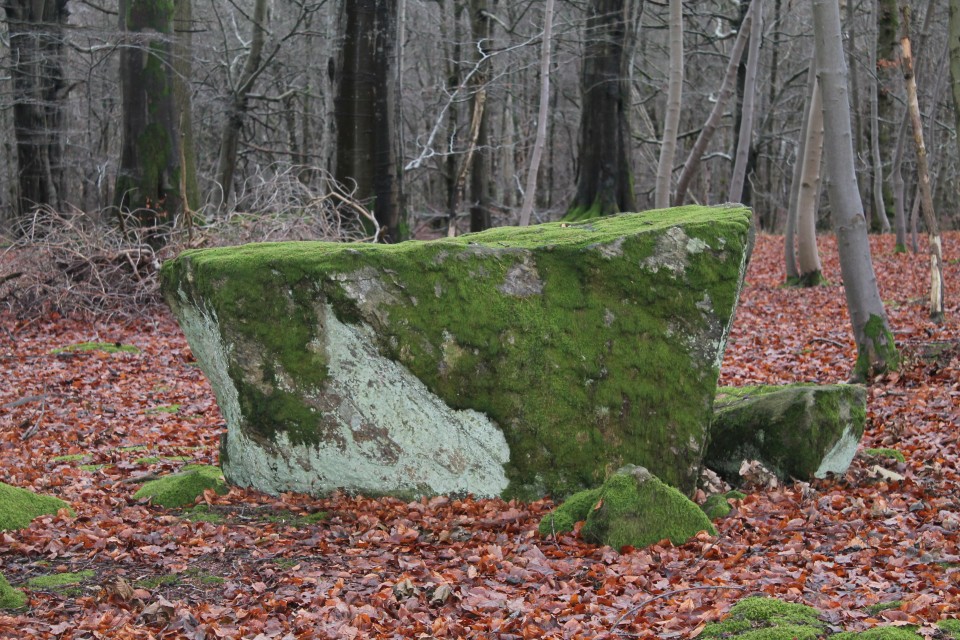
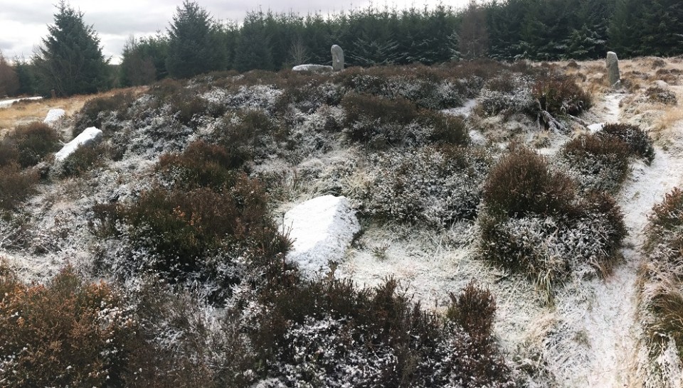
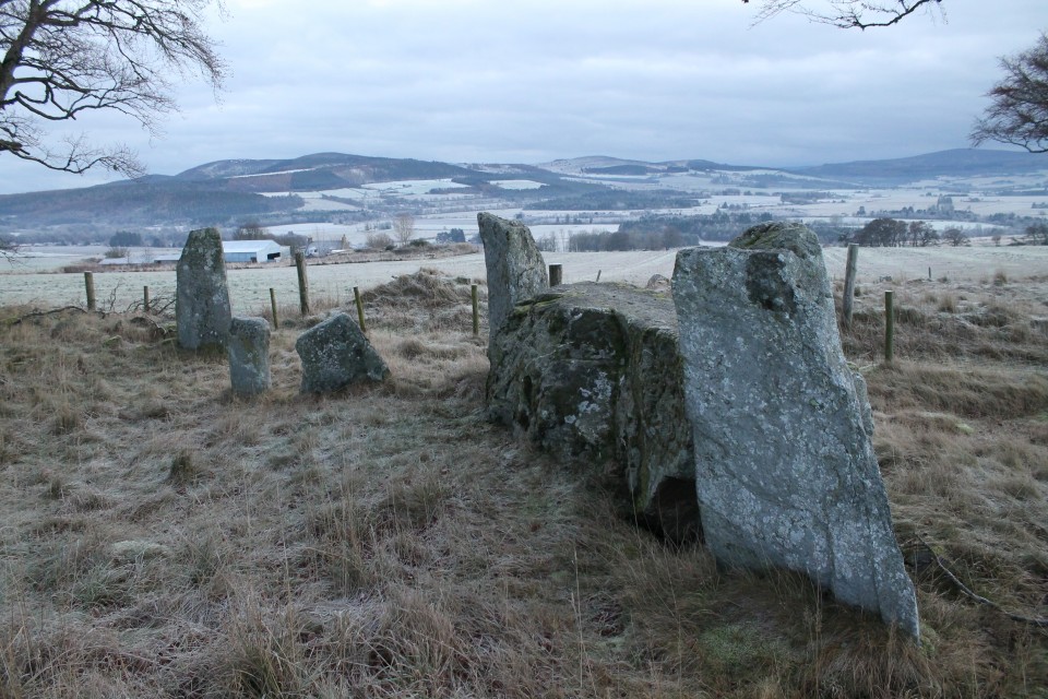
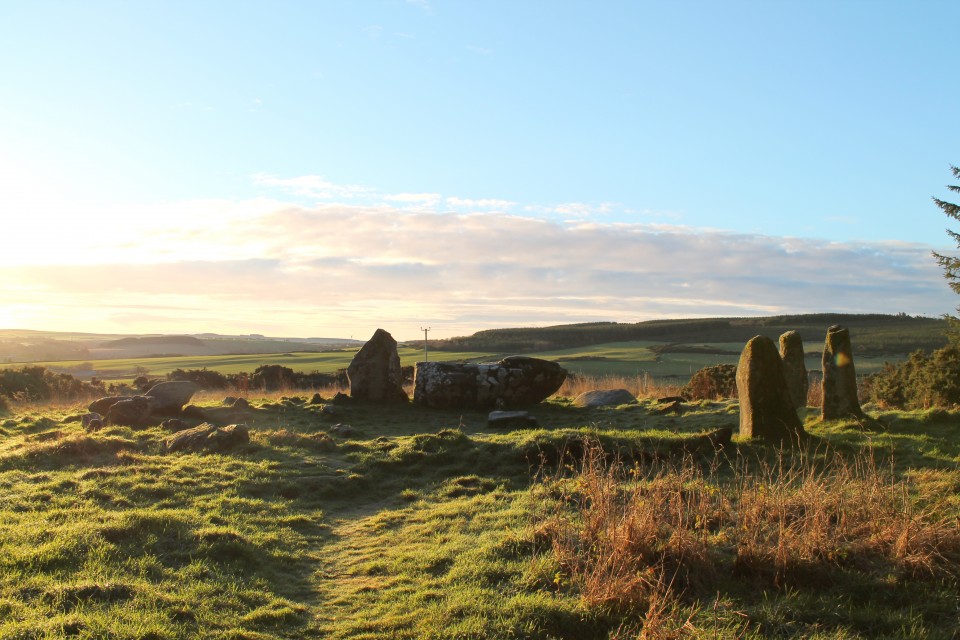
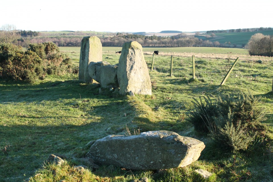
Twyn Cae-Hugh — Fieldnotes15.01.23ceHeading southeast, the main ridge path starts to climb gently up towards an area of forestry on my left. And rising rather majestically from the forest’s margins is the biggest barrow so far by some distance, Twyn Hugh-Cae (“Hillock of Hugh’s Enclosure/Close”). When Carl visited it was covered in summer vegetation, but today it has been close-cropped, probably by someone with a strimmer. The fence at its foot has been broken and there are worrying signs of bikes tracks cutting into its edges. Nevertheless, this is a big, impressive monument, regular sides sloping up to a flat top. On further investigation, the summit of the mound has been dug deeply into, a wide crater exposing earth and roots but no sign of any central chamber or cist this high up in the barrow. The construction appears to be more earth than stone. Views to the south are truncated, but the barrow has decent views north across Mynydd Bach (Maesycymmer) and beyond. Across the main track to the west is an area of open ground, which hides the low banks of a square-cornered earthwork. The shape suggests it’s medieval or later, but it’s curious how close it is to the massive barrow and I wonder if it’s related to the site’s name. Immediately south of the barrow is a pointed standing stone. None of the HER records mention it, and it’s far too obvious to have been overlooked so I assume it has been taken to be modern. However, it’s a nice slab of sandstone and all its sharp edges have been worn smooth in a way that suggests it has been exposed for a long time. Hmm. Twyn Cae-Hugh — Images15.01.23ce
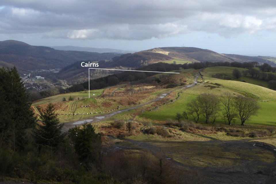
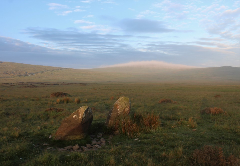
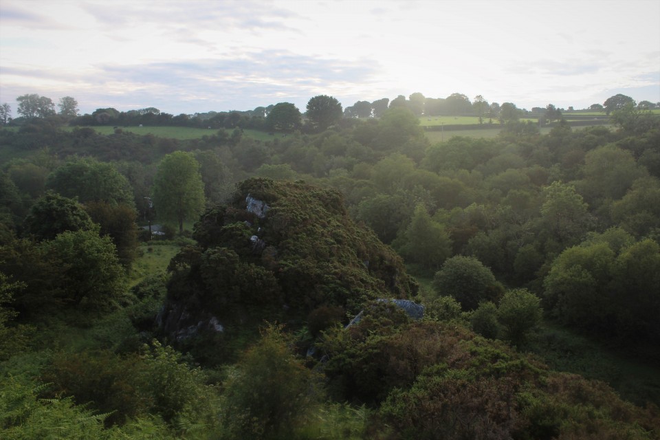
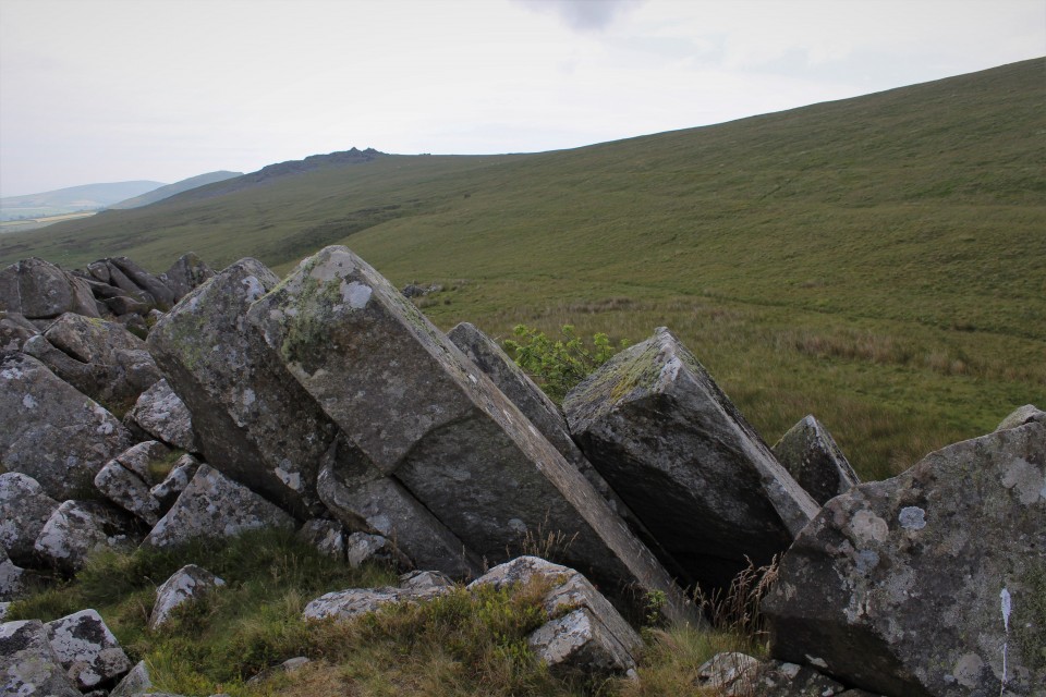
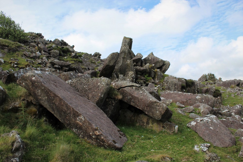
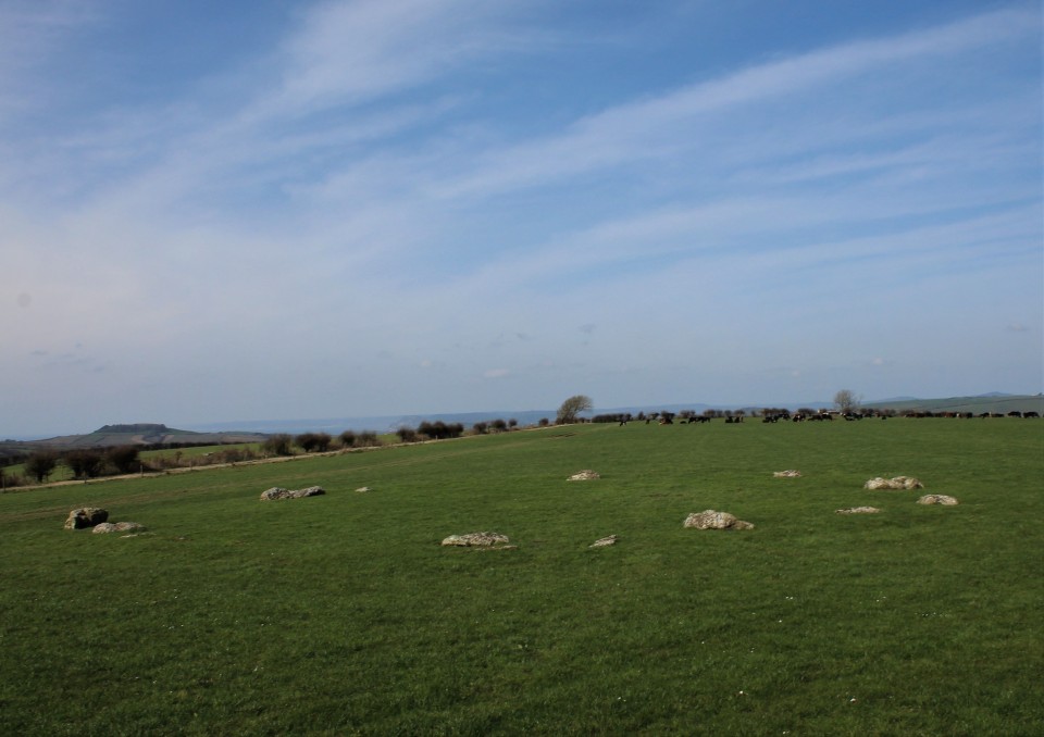
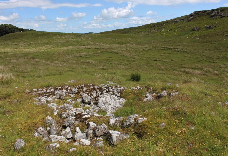
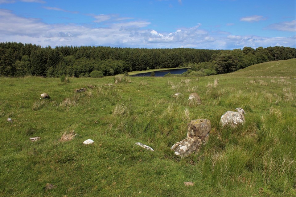
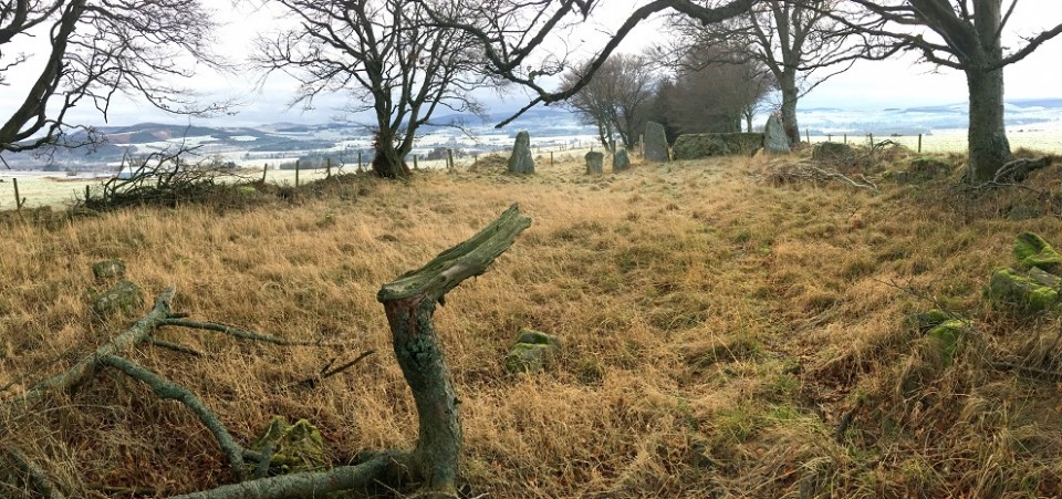
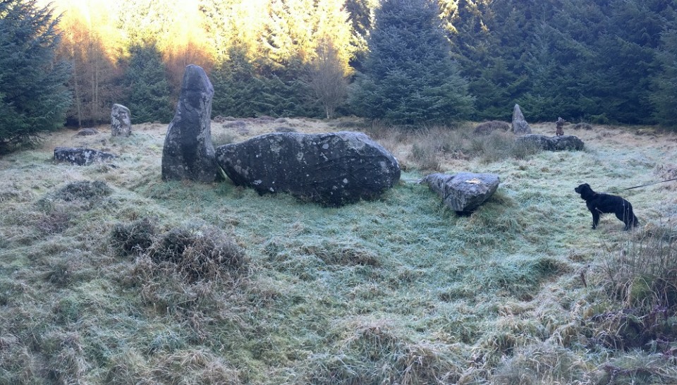
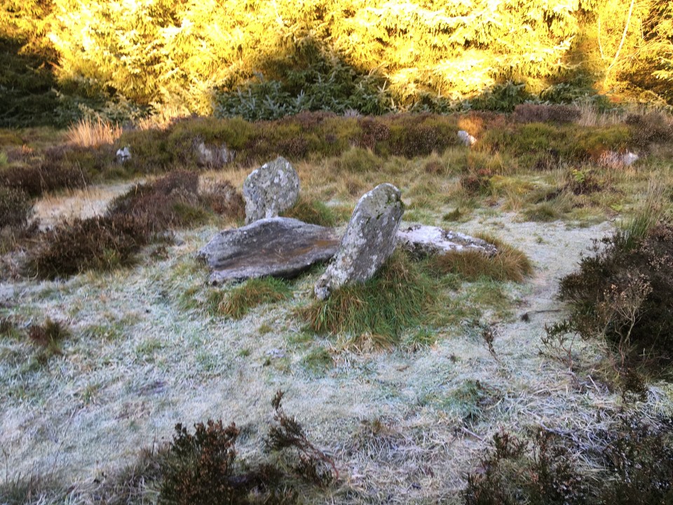
The main ridge path continues to head southeast, the ground rising ahead of me. The surface is becoming increasingly rutted and muddy, and the rising ground to my right has turned into a blighted landscape of churned, black earth. This is Mynydd y Grug, where the natural surface has been raised to a much greater height by the addition of mining or quarrying spoil. I slog my way up to the top to get a sense of the views. The top is gradually becoming vegetated, and I guess that in a few years this dark mass will blend more naturally into the wider landscape. It is worth coming up to the top for the elevated views the artificial height provides of my next objective, the pair of cairns or barrows at Twyn yr Oerfel and onwards to Mynydd Machen. Above the Sirhywi valley I can also see the round prominence of Twmbarlwm rising forbiddingly. Twyn Yr Oerfel — Fieldnotes15.01.23ceWhen Carl visited Twyn yr Oerfel (which appears to translate as “Hillock of Chill” or “Cold Hillock”) he expressed concerns about the barrows being damaged by motorbikes. From my elevated vantage on Mynydd y Grug I can see that the nearer western monument has now been encircled by a double ring of stone blocks, presumably to discourage vehicles from encroaching. After making my somewhat slip-sliding descent from the spoil, reaching the western cairn reveals an excellent monument. Although there are ruts from wheels cutting its side, they appear to be mostly old and are being slowly grassed over. The mound stands to a good height and doesn’t have the usual signs of antiquarian digging in its top. Best of all though is the view. Perched right on the edge of steep slopes of Cwm Sirhwyi, the cairn enjoys a brilliant vista to the north and east. It’s a shame it’s been badly treated, but don’t let that put you off, it’s a cracking site. The eastern cairn is similarly poised above the drop. As I approach a number of motorbikes zip along the ridge path towards me, thankfully ignoring the mound which stands next to the track. Like the cairn I visited on Y Domen Fawr last weekend, this one has had the ignominy of a wooden bench being inserted into its top. Fair enough, the view is superb, but surely the Powers That Be didn’t need to actually stick the bench right on top of the cairn? The feeling persists that there is a lack of care or concern about the preservation of the heritage these monuments represent. Whatever, this is a great pair of monuments; in terms of placement these are the best-situated cairns on this ridge. I stop here for a while and have a late lunch (yes, I am sitting on the bench). Twyn Yr Oerfel — Images15.01.23ce
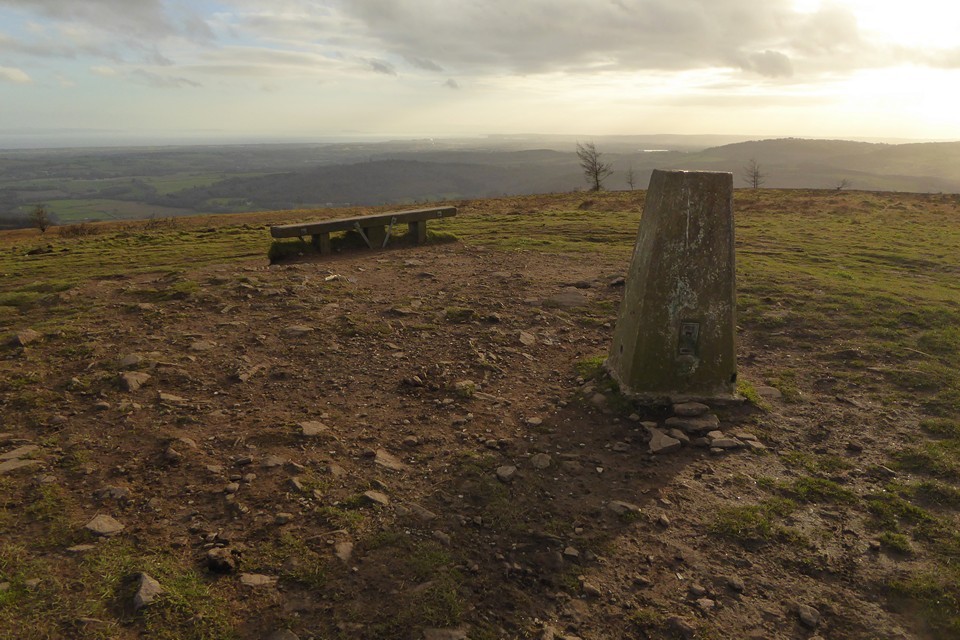
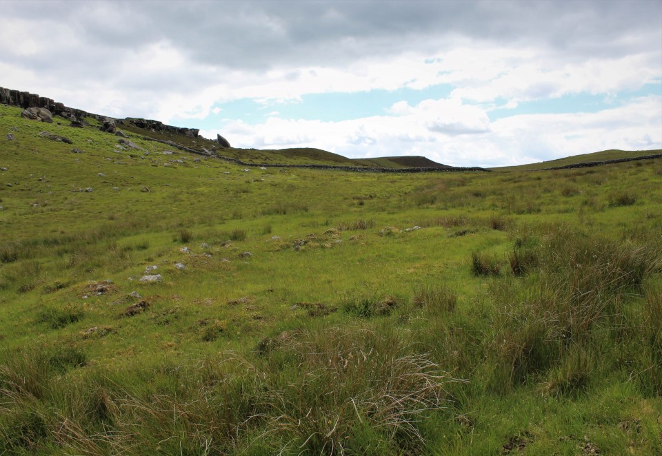
At length the need to get going again kicks in, I still have one biggish hill to climb before I’m done. I leave the main ridgeway before it turns back into a road and instead head northeast along a pleasant tree-lined track north of Penllan Farm. Eventually I reach a road and forestry parking area, busy with Sunday walkers. Eastwards the ground now rises steeply, and I’m huffing and puffing a bit as I reach the open land next to the extraordinary man-made ridge of Pen-Rhiw Tip. Although it’s a blighted landscape, it is slowly reverting to nature and the tip itself is worth a walk along for the excellent views it provides across the valley towards Mynydd y Lan and Twmbarlwm. The eastern end of the ridge is rather steep and loose, as I discover when I try to get back down from it! Mynydd Machen — Fieldnotes15.01.23ceThe final hill of the day is now directly ahead of me. It’s not that steep a climb from this direction though, and the going is easy. I reach the summit area next to the masts to find a few other people up here, enjoying the last of the sunshine, which is rapidly giving way to an overcast evening as the sun sinks behind low cloud. There’s also a 4x4 parked up, overlooking the much steeper drop eastwards. The cairn is another fine one, but judging by ruts and loose stone on its top and sides it’s being actively damaged by vehicles. It’s a real shame, as the placement here is terrific. Although visibility has lessened with the cloud, there’s still an amazing panorama looking south and east across the Gwent Levels to the mighty Afon Hafren (Severn), with the instantly recognisable Flat Holm and Steep Holm islands. While I’m taking photos, the 4x4 pulls away from the edge of the drop and comes and parks up right on top of the mound next to me. The driver and passenger grin idiot grins through the window at me, I’m sure they think they’re very clever. I carry on taking photos, now with the 4x4 as an additional feature. Belatedly realising that number plates can be traced, the driver decides he’s had his fun and drives away off the hill. It’s left a sour taste at the end of what has otherwise been a fine ridge walk. It’s so frustrating that people like this are wrecking the excellent archaeology around here. With them gone, I enjoy the last sun rays on the barrow before making my way down the steep slopes to the east. Mynydd Machen — Images15.01.23ce
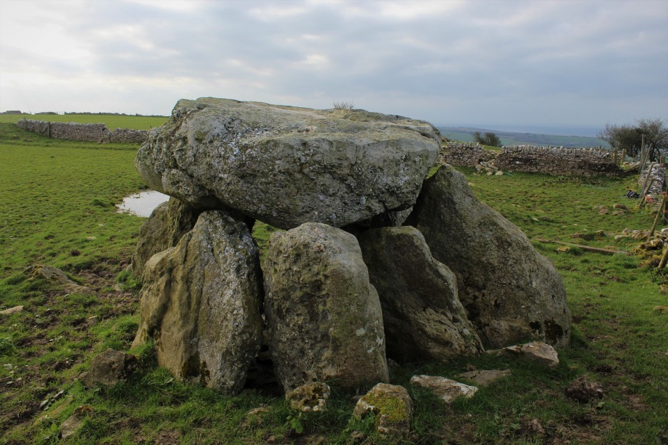
Off the hill, my route carries on southeast, and there’s one further site to fit in as the sky darkens and evening approaches. Twyn Pant-Teg — Fieldnotes15.01.23ceI wasn’t necessarily expecting much from this, a barrow in a field with all the attendant risk of being ploughed down to nothing. It comes as a very pleasant surprise to find this is a very decent monument, a good upstanding mound with a few stones embedded in its top and sides. As Carl notes, there are good views down to the valley below; the Rhymni valley in this instance, as this barrow is at the top of a southwest-facing slope, unlike the other monuments I’ve visited today. The name (“Hillock of the Fair Hollow”) seems very apt. It’s a great site to finish the day despite the failing light, and lifts me after the irritation of my experience on Mynydd Machen. Twyn Pant-Teg — Images15.01.23ce
The last part of the walk is down very steep roads into Risca. The rain, which has held off all day, arrives as I cross the Afon Ebbw and head for the bus shelter. It’s been a very pleasant Sunday in the Valleys. The walks around here are often superb despite the human damage inflicted on the landscape. It’s just a shame that these visits often include brushes with an idiot mentality that can’t or won’t see that there is fine heritage worth preserving here. Never mind, there is beauty here for those that have eyes to see it, and that will be enough to bring me back to these ridges, time and again. |
 Posted by thesweetcheat
15th January 2023ce |


Cerrig Duon and the Tawe valley Triangle |
Cerrig Duon and the Tawe valley TriangleThis may interest some on here. https://www.megalithic.co.uk/modules.php?op=modload&name=Forum&file=viewtopic&topic=8735&forum=4&start=0 |
Posted by cerrig 24th October 2021ce |
Television made me do it. |
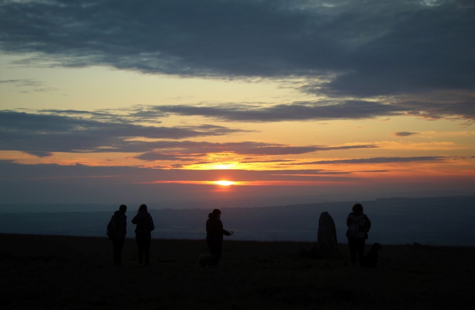
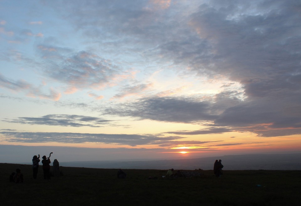
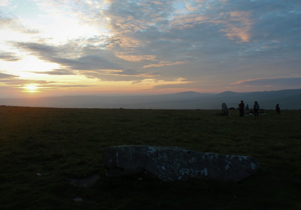
Television made me do it.One day earlier this year I was at work and my buddy asked me if I was aware of a new programme on tele tomorrow, he said it was about Stonehenge, I'm sad to say I wasn't aware. But keen to watch I turned on, tuned in, and then absolutely dropped out. I'm sure anyone interested also saw it, and talked about it at length, I know not everyone was but I've got to say, I was pretty convinced. I continued thinking about it for days, and a plan arose in my mind, Craig Rhosyfelin had long been known as a match for certain Stonehenge bluestones, and was on my now dwindling list of places still to see in Wales, but Alice on the tele had shown me a couple of new places to be interested in, Carn Goedog another bluestone source, and Waun Mawn once thought to be a stone row or perhaps even a remnant stone circle though with few champions, til now. The plan was a simple one, get in car, drive to south wales, and see these sites for myself. The Preseli hills are about a four hour drive from my house and quite an expensive road trip so to sweeten the deal as it were I decided to get there early and attempt a solstice sunrise at Waun Mawn. I did indeed get there early for a change, too early in fact, time for a much needed nap before standing on a hill top at 5am. Napped and ready I drive from the car park back down the road to the cattle grid and park my car by another one. A gate leads one on to the open moor then a path turns off to the right, it is taken and and as I walk on I can hear voices, I'm now reminded of a question my buddy asked a couple of days ago, "will anyone else be there"? infernal people, I responded in the time worn manner of "I hope not". Getting to the site I counted fifteen others, two of which said woof and eyed me up. Waun Mawn Row / Circle — Images22.06.21ce
So this is definitely the site of a once amazing stone circle, rivaling in excellence such sites as Castlerigg and the Rollrights, but is it the original home of the Stonehenge blue stones? I need more convincing, why didn't they take all the stones? are the stones that remain the same as the Stonehenge blue stones, too many questions arise, so, for now I couldn't possibly say. What I can say is, it was a very good sunrise, I was comfortably in time, I had a stone to sit on while the sun rose and the naked ladies danced their mesmerising twirl of wonder, only one of those things happened, what two ladies did do though was blow on their big horns, (one of them told interested onlookers it once belonged to someone who used to go to the Isle of White festival, I reckon it came out the arch druids a**e) this was done to signify the moment of sunrise I presume, which was good because I was thinking about something else at the time and didn't notice the super giant ball of flaming gas entering our view. As a site to visit it doesn't have much to recommend it, only one stone still stands, two have fallen and there's a possible stump of a stone, they are all in an arc of a circle so I cant really see why a stone row appellation got applied. It seemed very clear to me to be the site of a large stone circle, it's got outliers, and with good views to both ends of the solstices, like that other place. So where did all the stones go? It's beyond me. So I go for a look at where they might have come from, as if that might furnish me with answers. On the way back to the car I have a look at some outliers? a single standing stone and a pair of single standing stones, the pair are close together. Waun Mawn Stone — Images22.06.21ce
Tafarn y Bwlch — Images22.06.21ce
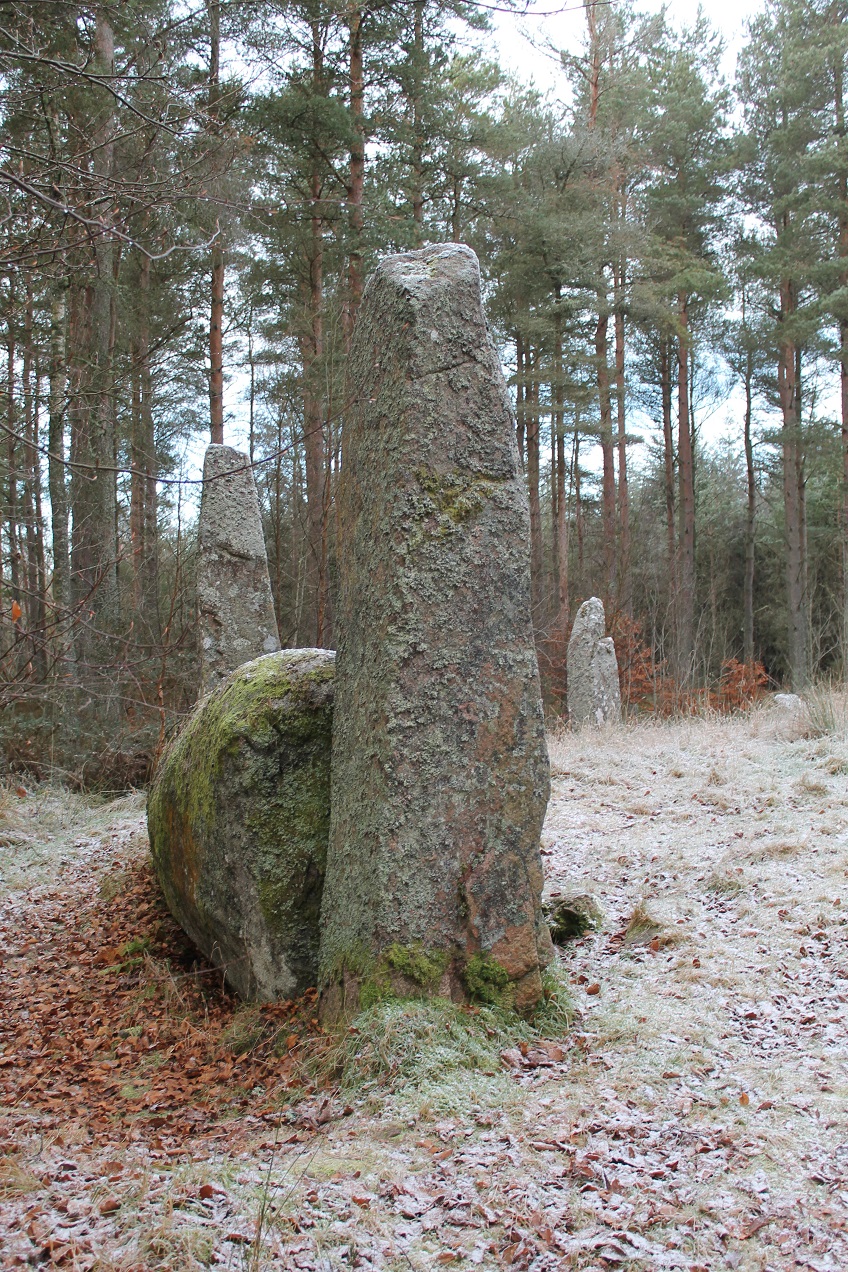
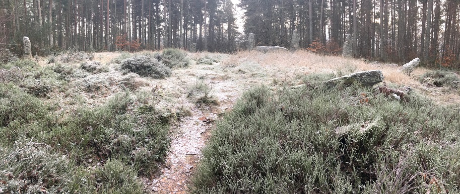
Back in the car I return to Brynberian and keep going out the other side but just before Crosswell turn sharply left, just after going through a ford park the car and a footpath across the road leads to Craig Rhosyfelin. Entering the field it is not visible until you round a corner and my first thought was ooh its quite big isn't it? Viewed from the north east it looks pyramidal almost, then as you move round it extends it's back until it fits into the surrounding hill side. There are a few menhir like blocks of stone at the foot of the outcrop, whether they are what they look like I don't know. I go for a walk up its right hand side, if you come at it my way you'll know which is the right side, the small path takes you up the hill and gives you a spellbinding view of the big outcrop and its little valley. Craig Rhosyfelin — Images22.06.21ce
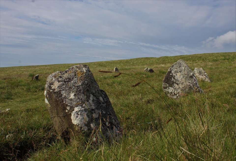
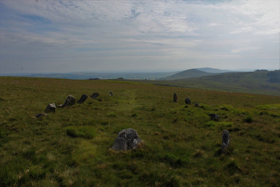
I sat here for a while, it was nearly half six in the morning, only nature, farmers and me were moving about, the little stream babbled, the birds sang, the sun warmed and the land rovers struggled to haul livestock up the hill road next to us, you cant have everything, right? In my effort to have everything it was now time to go have a look at that other possible/probable blue stone source Carn Goedog. It is unfortunately for me not as easily accessed as Craig Rhosybobin, it is a long walk up and over the Mynydd, but by happy chance maybe, I would get to have another look at Bedd Arthur. The walk was long, it took about an hour, last time I was here 12 years ago I had my then 10 year old daughter with me so at least had someone to talk to, she never complained once about the long walk, unlike me, wheres my damn electric mountain bike, oh yeah they're dead expensive. Passing through the clutter of Carn Bica the half pint stones of Bedd Arthur come into view I scurry down to them cast off my fleece and camera bag and lay down in the Bedd, it was comfy, not too soft or too hard just right for staring sideways at the base of a stone, green on the right blueish to the left, I'll stand back up. Bedd Arthur — Images22.06.21ce
I'm now not convinced it's a horse shoe shape at all, the open end does have a stone in it, all be it very low, but that seems to confuse even further, is it a horse shoe, a big U, or Britain's most elliptical stone circle. Pffffft, I'm getting used to the answer to such questions being I guess we'll never know, not if we don't excavate we wont. Directly north from Bedd Arthur and Carn Bica over the side of the hill is the massive outcrop known as Carn Goedog, The wooded Cairn ? Carn Goedog — Images22.06.21ce
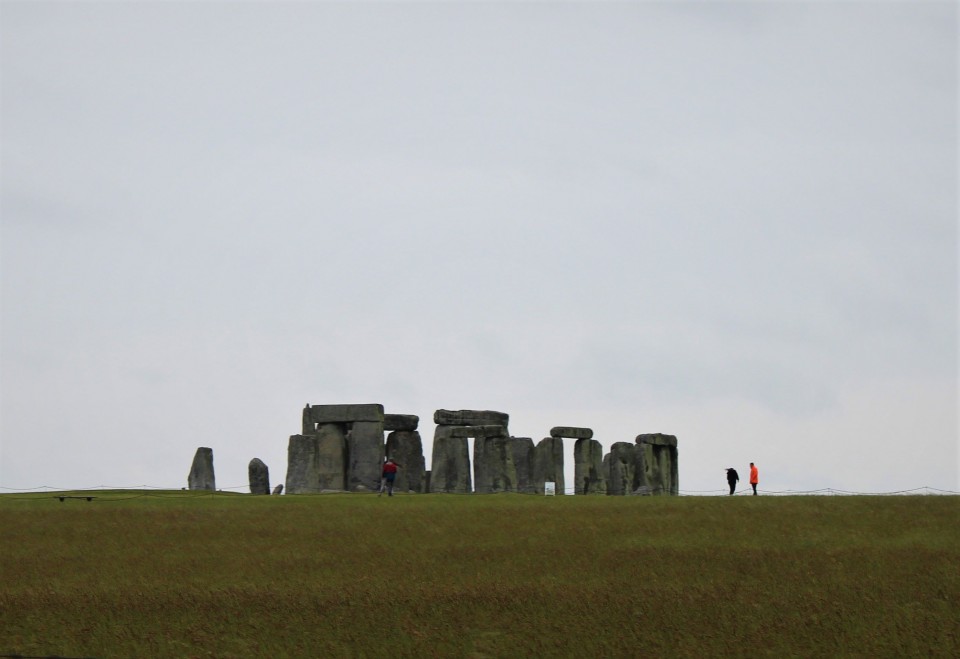
I'm remembering a specific part of the TV programme where Mike the beard is standing among the rocks pointing out likely menhirs in waiting, it's that that I want to find and won't consider the site seen until then. So I give it a really good scrambling over, so good that I almost don't have time to see the last place on my list. The place is beautiful and exhilarating, from up here I can see where Bedd Yr Afanc is and Moel Drygarn with it's trio of cairns and a hill fort, and of course I can see the hill that started this mornings odyssey, from up here I can see maybe why they used more stone from here than they did at Bob Rhosyfelin it's all up hill from Craig and almost no uphill at all if they follow the contours of the hill from here. Not conclusive is it? If they did take stones from here were they dressed at all, I've heard one commentator say no stones were quarried from here because there's no detritus from the dressing of the stones, most stones I've seen don't look dressed at all, rather, as they came. But I'm still not an expert despite 25 years of stone hugging, some say I'm not even an expert mail carrier. I'm not sure my memory of the programme will allow me to pinpoint the place where Mike said his piece to camera about menhirs in waiting so I make do with photographing the whole place, which was at times dangerous and at all times brilliant, if they didn't take stones from here to stand up they were as stupid as us modern day guzzle monsters. Modern day guzzle monster that I am I must consume more of the planets resources and get the yuk out of here, one more place on my days list is still outstanding but I wont know if I've got the time or if my eyes will stay open long enough for me to get there, so I drive. Passing through Carmarthen I get on the M4 and head east, over the Prince of Wales bridge and I'm faced with a dilemma left for the M5 north or right staying on the M4 to Stonehenge, I couldn't resist, it just felt right, I wouldn't be able to live with myself if I didn't. But it's that day, that one day a year where a field in Wiltshire goes absolutely mental. How would I fare, I knew that it would now be closed to touching, I wasn't even going to stop and pay for a longing so near but so far look, but I would settle for a seat upon one of the Kings barrows. Alas it was all still blocked off to traffic and it was all taking too long, traffic was insane so I settled for the very least I could do and went for a very slow drive by along the A303. Stonehenge — Images22.06.21ce
See that blue stone there? quick! yes the smaller ones, I went where that standing stone was born this morning, stood in the field where it spent it's youth, saw the summer solstice sunrise, then followed it halfway across the nation. Probably. It's a small thing, perhaps a crazy thing, but I did a thing, I could have stayed in bed, I really like my bed, but this was better. |
 Posted by postman
22nd June 2021ce |

Dude wheres my car? |
Dude wheres my car?So it's an equinox sunrise your after is it? Have I learned anything about being somewhere far away at sunrise? Yes I have, if you can't be very close to your intended destination the night before then youd best get up early enough to get there in time. So I did, by three am I was passing keele services going south, at six thirty I was on Dartmoor, minutes later I was putting on walking boots in the half dark and thinking I 'd cracked it. With nothing more than a "hm they've changed the parking place a bit" I opened the gate and headed off towards Fernworthy stone circle, but with the intention to ignore it for my intended destination is the pair of circles that is the Greywethers. I did a spring equinox here fourteen years ago and it turned out really well, so I'm at it again though walking this time not mountain biking. So, I'm innocently walking up the track when it starts to do unexpected things, then when Fernworthy doesn't appear on my right I know something has gone wrong, then I remember the strangeness of the new parking place and begin to suspect that I didn't park where I thought I did But what to do? I decide to wing it, immediately take a dead end track, backtrack, wing it some more. See two big deer with big antlers, then get me compass out, clever boy. I am at least heading north, "right" I say to the departed deer "first left turn, I'm taking it". About now the sun makes its appearance, half a big orange ball makes it's way out of distant smog, damn and blast it, in a clearing I at least get a few good pictures of the sunrise, even not at my destination its always good to see the moment of rising, and not any old sunrise an equinox sunrise, they're better, they just are. So after the left turn came and was taken the track got close to the edge of the forest, which is where I wanted to go, but doesn't go all the way so I have to carefully pick my way through the thick forest , open moor beckons I can see it just ahead, am I too far south? North? Dare I hope to be just right, just then the developing sunrise kicks me in the back, I am too far north, but not much I can see the circles but they're far off. Tut and sigh, another failed attempt to catch the golden moment in the act. I make do with the situation, suck it up and strike out across the severely uneven moor towards the stones. After what seemed like an age I eventually arrived at my destination, that made me happy, the circles were as perfect as ever and I was only twenty minutes late for the rising, its still got some legs in it so I inexpertly set about trying to capture the beauty of being out about early. But in the back of my mind was, where the hell did I leave my car? The Greywethers — Images23.09.20ce
After more self berating (sounds fun, but isnt) cloud quickly comes out of the south and the sun disappears, almost for good. I begin to console myself with the fact that there is a new stone circle west over the hill, the recently rediscovered Sittaford stone circle. I go west, up and over the tor, following the lowest of three walls. Following the lowest of three walls brings me almost magnet like to a slightly leaning standing stone in a gap in the wall, the stones are just twenty yards from the leaning stone. Sittaford stone circle is caught halfway between being brilliant and being unvisitable, all the stones are lying down, some lie proud of the grass, some are below ground level but cleared in their entirety, four stone shaped water filled muck holes may yet contain stones, if so then I counted twenty seven potential circle stones. That's brilliant! One assumes the stones once did stand, excavation only found two stone holes, what does that mean, they never finished it? Or what? Sittaford — Images23.09.20ce
It's now time to retrace my steps, as far as the forest anyway, I don't think I could all the way even if I wanted to. On the way back I showed the Greywethers a little fondness and moved towards the dark forest, ready to do battle with the malevolent spirits that make you lose your car. Dude wheres my car? The walk back goes by uneventfully, after a right turn at the crosstracks Fernworthy the welcome appears on my left. Familiar ground, always welcoming. The grass has been mowed very short, and some trees have been felled since my last visit, making the whole clearing a lot bigger, I decided to have as good a look round as possible. First off the track is a short stone row, pointing directly at the stone circle, but perhaps more involved with a vague but recognisable cairn just before the stone circle. Fernworthy Stone Row (South) — Images24.09.20ce
Fernworthy stone row (North) — Images24.09.20ce
Then it's back up the double stone row for a good ole sit down on a nice flat topped stone, of the Fernworthy variety. Fernworthy — Images24.09.20ce
Leaving Fernworthy with a sense of unease I make my way down hill towards where I thought I'd parked, where I'd parked all the previous times. It wasn't there, I knew it wouldn't be, it still made me cross though. There were a few no parking signs so I was hopeful that all I had to do was follow the road back and I would come across it at the next parking place. So I walked and so it turned out to be, dude theres my car! I breath a sigh of relief and swear at the new car park, if it wasn't for those meddling do gooders I'd have gotten there in time. "Oh well" I jump in and go to see some more stones. |
Posted by postman 28th September 2020ce |
Days without end. |
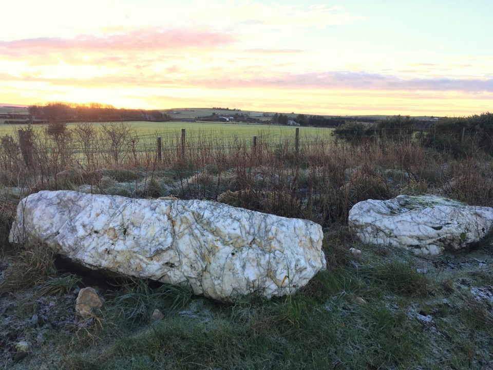
Days without end.The 19th of June started much the same as any other day off work, get up late, walk dogs, watch tele, research stones for next trip out, make tea for kids and me, and then at the end of the day, instead of going back to bed we all jumped in the car and drove off to Scotland. Scotland?! Tomorrow being the 20th of June is of course the summer solstice, and the one place i'd like to be on such an auspicious day as this is the Brainport alignment near Inverary. It's a five and a half hour trip, I've driven further for a sunrise, but I've never had to sneak into another country. Because of the stupid virus Scotland is still apparently in lock down, I've no idea what to expect at the border, will there be road blocks? will there be random car stopping? Luckily none of the above, we drove on through without incident, with hardly any other cars on the road we were making good time. Passing a sign for Crarae gardens I know we're nearly there, then we pass through the loch side village of Minard. Immediately on leaving Minard there is a field on the left, when you go by the gate into the field there is a parking space on the right, stop here. It is now about 4.30 am, needless to say the kids are fast asleep, or pretending to be, either way I get my boots and waterproof trousers on grab my camera and enter the field making for the shore line of Loch Fyne. It's not a bad morning, as far as early mornings in Scotland go, but I don't think there's much chance of seeing the sun rise today, there's too much cloud, in Scotland? I know. After getting to the lochs shore I turn right and follow a well trod path through the trees, shortly we exit the woods and onto Brainport bay, the alignment is on the far side of the bay. At first I couldn't find it, I know the stones are small but I hoped they'd be easier to find, I traipse through sodden undergrowth, without luck. Back at the bay again I start again, there is a white park bench next to a white box, next to a slight rise in the ground I investigate and whoohoo and tralaa, here be stones. I'm at long last at the Brainport alignment, on the morn of the summer solstice no less, but without the sun. But is it really necessary to have the sun show up? it is there, the stones are there, and so am I, it suffices. I start to have a look round, one thing that is instantly obvious is the flora has distinctly grown somewhat since the last TMAer was here, and there are information boards, two to be exact, wasn't expecting them. One of the information boards tells me the two stones are not the only parts of the alignment, it has six parts. The Pointer stone and the outcrop it stands on, the rear stone, the lower platform, the boulder setting and at the back the rear platform for standing on and appreciating the magic you have wrought. I would add a seventh part, the gap in the rock by the rear stone. One might even add two more, the viewer themselves and of course the sun, but probably not. Brainport Bay Solar Alignment — Images21.06.20ce
The rear platform is about forty yards from the rest of the alignments elements, it is built of small to medium sized boulders and set into the slight hill for a more elevated view of the, erm view. Next is the boulder setting, two boulders, set side on to the alignment, one much larger than the other, the smaller one on the side of the rear platform. The boulders have small white pebbles on it left there by stony lovers like me. The lower platfrom is a low cairn like structure, that seems to serve no purpose at all really, unless the rear stone is set into it. The rear stone, no more than knee high, is right next to the gap in the rock. On the other side of the rock gap is the outcrop with the pointer stone set into it. And that is the Brainport alignment. One of the information boards tells us that there are other alignments involved, mid winter and equinoctial sunsets, but I find these hard to wrap my mind around. I haven't been here long before the midges make themselves known, one of them there flamethrowers wouldn't go amiss right now. With the alignment fully investigated and fully appreciated I decide it's probably time to go, so I start to head back, no sooner have I left the sun comes out, is it taking the piss or what. Back at the car, the kids are still asleep. I start the car and start the long drive back home, but I decide that this is too long a drive to just see only one site, so at Lockerbie I leave the M74 and head off to Eskdalemuir and a pair of stone circles, the Girdle Stanes and the Loupin Stanes. I havent been here for quite a while, this time I find the proper parking place, just across the road from the Loupin stanes. Eric and me walk down to the stones, what a lovely little circle this is, ten or so smaller stones and two large portal stones, looks a lot like The Nine Stones of Winterbourne Abbas in Dorset. Girdle Stanes & Loupin Stanes — Images21.06.20ce
Across the field but out of view is the Girdle stanes, the ground is covered in what look like buttercups, millions of them. Cows are inhabiting the circle, but move out of the way when we arrive. The river Esk has apparently destroyed half the circle. But what is left is a bit of a treat, and well worth the detour on the way home. But time has caught us up and we really should be on our way. Driving home was tough, tired just doesn't cut it. Upon reaching my humble abode it took about five minutes before I was dozing on the sofa. The day without end had merged into a 48 hour day, I'm glad summer solstices come round but once a year. |
Posted by postman 5th July 2020ce |

Maen Llia |
Maen LliaI am presently posting my findings from 20 years of visiting Maen Llia and its surroundings on the Megalithic Portal website. This is the link for anyone who may be interested. https://www.megalithic.co.uk/modules.php?op=modload&name=Forum&file=viewtopic&topic=8258&forum=4&start=20 Maen Llia — Images21.06.20ce
|
Posted by cerrig 14th April 2020ce |
TMA Google File |
TMA Google FileHello All I am trying to download KML file for sites on TMA. From home page I go to maps then click Google icon. Google Earth then loads but I cannot see or find where to download KML file. Pretty sure there is no problem with link and its probably me thats at fault. Any suggestions please much appreciated. Thanks Rough Tor |
Posted by Rough Tor 29th March 2020ce |
Mobile Isolation Unit and the dogs blanket. |
Mobile Isolation Unit and the dogs blanket.It's surprising how quickly three months can pass, it's already equinox time again and I thought I'd make a proper long old day of it. Twelve sites in twelve hours, a touch ambitious possibly, but I've neglected to bring either of the kids, which will help, and the car though small and slow has been faithful so far. The plan, such as it was, was to witness an equinox sunrise from Kingston Russell stone circle. There's just two small problems with that, the actual equinox was yesterday, and I'm apparently a slow driver, because i'm not going to get there in time, I blame the poor state of British motorways, roadworks for mile after mile. Poop! So I pull over early at the Nine stones, I haven't been here since before the big tree came down, it is not the only difference. I parked at the farm building fifty yards down the road, walked back to the stones down the not dangerous at all road, and found no way to get to the stones. The stream was too wide to jump easily, the bridge is gone and the gate, there's no way in this way. Back to the car and I drive a bit further down the road away from the stones, there is some new work going on, a housing estate possibly, I parked by the road. Passed through the fence with the red sign that says something like footpath closed and made my merry way off through the field. It's about now I should make note that I have once again forgotten my coat, it is windy and cold, I really don't like being cold. Having crossed the two fields, I arrive at the stones, here among the trees it is at least less windy. The circle is as lovely as I remembered it, with not much deviation from the original I reckon. The two big stones, being entrance stones perhaps, meaning the stone between them is not in it's proper place, are two simply stunning stones, with huge amounts of chocolate rose flint showing, and a small colony of Harlequin ladybirds. Nice. It's not easy to get the moment of sunrise and all the stones into the picture, first of all you have to be on the other side of the enclosing fence and there is a hill side in the way as well. So, not good for equinox sunrises, or winter ones, the hill would be even more in the way, but summer solstice would be fine, if you can cut down a few trees. I did say I was going somewhere else for the sunrise. The Nine Stones of Winterbourne Abbas — Images25.03.20ce
After failing to see a sunrise, staring closely and intently at the tall flinty stones, and walking round in at least a dozen circles, and this and that, it was time to go get my next stoney fix. Six sites in six hours, they are all close together never too far away from the road, so off I go to Hell, there is a stone there. The path to the Hellstone has indeed changed, I parked in the aforementioned layby, left the road opposite the farm going through a gate, there were cows in the field so I kept to the left side of the field. This leads to a stile, which in turn leads to a path between two fields, when one whole field has passed on your right, turn right, over the fence at a makeshift sort of stile. then it's up the gentle hill to the stones. Even though it looks like it's been restored by someone who clearly didn't have a clue what it was supposed to look like, the Hellstone is still a pretty awesome thing to see. From on the mound by the stones you can see Chesil beach, Chesil means shingle, pebbles, it is the longest shingle beach in Britain. In the other direction a heath covered hill has a tower on it, Hardy's monument, Nelson's mate, not the poet, the monument is a handy orienteering wotsit, you can see it from almost all the sites i'm getting to this morning. The Hellstone — Images25.03.20ce
My coat hasn't magically appeared before me and it is terribly exposed on these hillsides so I have wrapped the dogs blanket off the back seat round me in an effort to fend off the icy winds. But it really is too much so I retreat into the dolmen and take a seat huddling for warmth. Boy do I not like the cold. After having a long look round the tombs interior, there is nothing else for it but to brave the weather outside, I didn't spend more than ten to fifteen minutes here, I really am a plonker. The wind is making a mockery of my improvised cloak, whipping it up and over my head, rediculous. But the Hellstone is awesome. After having retraced my steps from the Hellstone back to the car, it is straight across the road following the footpath sign saying Abbotsbury hill fort. Unfortunately the fort isn't on my itinerary but this is also the way to Hampton Down stone circle. Improvised cloak wrapped fully round me and with the hedge to my right acting as wind break this is as pleasant as walking has been this morning. Following the hedge on my right, leads to a gate with a sign on it, the sign is for the stones which are now at my feet. That was easier than I anticipated. Hampton Down — Images25.03.20ce
Most of the stones are pretty low but hefty boulders, made of the same flinty stone as places I've yet to see, the two at the south are largest. In past years summer growth drowns the site completely, so I'm pretty lucky to see it in such good apparel. The view south reveals Chesil beach again, and north once more to Hardy's monument. With less wind because of the close by hedges, I remove my cloak and get the tripod out. I've not yet been to a stone circle that didn't benefit from an elevated photo of the site, so I hoick it up and try to keep it still in the wind, not easy, but always yields good results. This was site three out of the hoped for twelve, and my first site of the day that I haven't been to yet. I liked it. After having been to the Hellstone and Hampton down stone circle I drove north and parked at the space by the junction of Bishop's Road and National cycle route 2 Road. Not as eloquently named that one. Passing through the gate, or was it a stile? I can't remember, just get into the field with an information board then head down hill following the most worn path you can find. The Valley of stones is on your left just another stile and your there, you are entering the valley from it's north east. I mostly pass by the drift of stones passing the curious circular structure higher up the east slope until I cant take it anymore and dive straight down into them, Among the most notable stones in the meander are large flat boulders with cup like erosions on the surface, boulders with coffee or rose coloured flint extrusions, a stone with a hole in it, and a stone circle, of sorts. The Valley of Stones — Images25.03.20ce
I've not been here before, clearly my one and only trip to Dorset twenty years ago was a bit of a rush job, a cursory glance at best. I passed the Valley of stones by in favour of the Grey Mare and her colts. This time is much better, time to wander and time to ponder, and the wind can't get me down here, but the dog blanket is still being my cloak 'cause it's still cold. After having sat and stared at the "stone circle" I get up and walk the stone arc back and forth, in the end all's I can say is one stone in the circle is a boulder practically bristling with rosy caramel flint, it's just about the prettiest stone I've ever seen, and I didn't get the stone circle feel from it, more of an enclosure of some sort, it has an entrance, and no where for the western arc of stones to go. I guess it could be Iron age. Also, this is the place people came to to take stones away to build stone circles, it would be like going to B&Q and building your patio right there in the shop. Or perhaps not. From the Valley of stones, a very aptly named place, I head south west on Bishop's Road until the road forks and I go right, and park at the gate with cattle grid. Take the right hand path to the Grey Mare and her Colts, a very inaptly named place. Follow the path with the hedge to your left, in the corner of the field go through the gate for another twenty yards then left over a stile follow the hedge that's right in front of you until you get to a gate, go through it and there she is, looks nothing like a horse. The Grey Mare & Her Colts — Images25.03.20ce
I immediately take shelter behind the stones away from the biting cold, I am no longer using the dog blanket as a cloak but instead have wrapped it round me then put my hoodie over that, it's more practical and less stupid looking, still cold though, wish I'd brought my coat. Sat behind the tallest stone i'm right next to what is left of the chamber, one stone is still in situ as it were, the rest is a bit of a jumble, I was unable to tell if the larger stones were chamber side stones or capstones or a dollop of both. Also right next to me in my hunched up position is a low stone with a hole in it, the significance of which utterly evades me. Out of the cold I extend my tripod to its fullest, then emerge from the comfort of the nook I'd found and circle the tomb a couple of times taking photos from 11 to 12 feet in the air, it's not easy and may take a few tries and if anyone sees you you might look a berk, but it is I think worth it. The pursuit of a new angle and all that, speaking of new there's a stone circle a little over half a mile from here that I've never been to, Kingston Russell, lets go. From the Grey Mare and her colts go back to the bridleway over the stile then turn left and keep going on a north westerly heading, when the track takes you to two hedges either side of the track and there is two gates on your right look for the Kingston Russell information board. The stone circle is through the gate away from the information board. Pretty easy, what went wrong Carl? Hopping over the gate I stroll as nonchalantly as I possibly can, i'm even typing this carefully because that is one big herd of cows over there, and I'd appreciate it if they stayed there. During my nonchalance I extended the tripod for another bout of hoicking. So a hoicking I go, walking round the outside of the circle clockwise, noticing as I go, my only companion, Hardy's monument. Kingston Russell — Images25.03.20ce
It looks like none of the stones are still standing, the largest stone has erosion marks on it like none of the others, like it was pulled out of a river. The immediate area is very flat, which is why I'd chosen this site as an equinox sunrise for this morning, but I'd have gotten here too late. Which is a maddening shame because it is a perfect site for a sunrise, or sunset, someone closer should get onto that. It's not a great stone circle, but it is a good one and having been there gives me a warm feeling inside. It's now half past midday and I'm behind schedule, that's the first six done, the first half of the day done, i'm very hungry and it's time to seek out another sort of warm feeling inside, en route to site number seven, strangely in the middle of the town of Dorchester. |
Posted by postman 26th March 2020ce |

North of the Wall. But only just. |
North of the Wall. But only just.After a mostly successful summer solstice sunrise at Fontburn Dod, and after a much overdue return visit to Blawearie cairn, and after a good look round Old Bewick hill fort with it's fancy rock art, and after I've squeezed in a standing stone, for measure, it's time for the big one. Any of the places we've seen this morning could be construed as the big one, but this particular grande finale is a seven mile walk, maybe more, seven sites to be seen, and twenty pounds in cold hard cash. Ridley and Haughton common's stone circles are my quest, never heard of them? I'm not surprised, they are pretty obscure, in the middle of no where and on the very edge of the map. Parking is non existent, these sites can not be seen from the road, perhaps Hob could get his car closer than I could, but the best I could come up with is Housesteads Roman fort, because the eponymous Wall is that of the old mucker himself Emperor Hadrian. The car park for Housesteads Roman fort is on the B6318, I cant remember the exact tariff but in the end it cost me £7. Of course then you'll want to walk up the path, ignore the fort entirely and break through the wall and out of the empire. But that will cost you money again, they think people are going to be interested in Roman stuff, but for us it's just in the way. £13 for me and Eric, barring perhaps Stonehenge or Newgrange the most expensive entrance to any old stony place, but then you do get Hadrian's wall and a fort thrown in, and if your really lucky you might even catch a glimpse of a time team expert taking a guided walk. As soon as Eric saw how far up the hill the fort and wall were he asked me how far we were going to have to walk to find these stone circles, I didn't have the heart to tell him the truth so early on in the hike, it wasn't a walk, you might walk to the shop or the bus stop, this was further than a hike really too, almost an expedition, in the end I lied bare faced and said two or three miles. Miles? he bewailed. So, up the well walked path to the fort, ignore it, go to "the wall" and follow it west to where the Pennine way crosses it. Break through the wall putting on your wildest Scottish accent and laughing wildly, if you have a Claymore I suggest you wave it now. Follow the Pennine way north, away from the wall, making towards the east end of Greenlee Lough. When you can see the dark waters of Greenlee Lough below and to the left, do not descend the hill your now on the edge of, instead walk west along the farm track until a stone circle appears on your left hand side. You have arrived at Ridley Common stone circle. Ridley Common — Images25.06.19ce
It's not a big circle, all but one stone is very definitely on the low side, but it is a nice place, and a good stone circle and one more with a big tick by it's name, only 387 to go. This is a bit of an odd place for a stone circle, the hills north and south are nearby and cut off any views or feelings of openness, the view west is better, but to the east is perhaps the reason these stone circles and cairns are here, the local rock god, now called Gwenhyfar's chair, but in times gone by, probably by many names. Done with this circle I jolly Eric along and we walk along the track east towards a gap in a wall (not thee wall, a wall) and that chair rock thingy. The rock, long ago had broken off from Queens crags and landed in an unlikely place, perfectly upright, from one aspect it looks just like a Devil's Arrow. But for now we pass it by a few hundred feet distant, making instead for a trio of cairns, two round cairns one with an exposed cist capstone inside it, and one cairn that looks more like a ring cairn, but perhaps is still just a round cairn too. Kingscrag Gate — Images25.06.19ce
Haughton Common — Images25.06.19ce
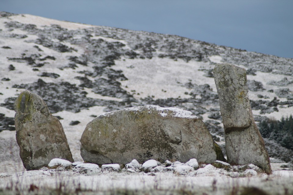
Haughton stone circle is another small ring. The northern half of the circle has quite big stones some oddly shaped, the other half of the circle barely makes it above the grass. There are two small odd little cairns either side of the circle. If it were not for the trees we'd be able to see the Rock god Gwenhyfar's chair, but we cant. I do the hoiking up of the tripod for an elavated view, it works well, the camera must be twelve feet up. Back at the ruin I pick up the tired little boy and carry him a bit further west to the big cist known as King Wanless green. Quite a big cist this one, worthy of a position on Dartmoor, cist central of England. There is no capstone, just the four side stones, one stone, lets call it the headstone, has two cup marks on it's upper surface. There is another lesser cist hiding in the grass, I forgot to look for it, so i'll leave that one for the TMAers of the future. King Wanless Green — Images25.06.19ce
Going almost straight to Gwenhyfar's chair we stop off for one more cairn, a big cairn, it's lower courses are grass covered, there's no sign of a cist. Kings Crag Cairn — Images25.06.19ce
Eric picks himself up, girds his loins and prepares for the last walk, the long walk, the sneaking back into the Empire. But first, that rock god. Gwenhyfar/Gwenhwyfar or Guinevere, so the story goes had the rock thrown at her by King Arthur for annoying him with an expression whilst doing her hair, one can only imagine what he did when he found out about Lancelot. From all directions the big rock looks like that, a big rock, one flat edge and a curved edge on the other side, but up close, by it's side, it looks just like a big standing stone, perhaps a twin for Yorkshire's Devils Arrows. Kingscrag Gate — Images25.06.19ce
Almost right below it are the three cairns we saw earlier, and the cist and circles can all see it too. Bonkers. And that is all, we struggle back towards the wall, it's about now that I remind Eric I said the walk was about two or three miles, and then admit that I gave it a bit of a measure on Google earth and it 's about 6.8 miles, give or take a half mile. he uncharacteristically thought this was funny and stepped into a tiny stream and fell over, unable to get up from laughing, I joined him on the grass. Until in the end we practically crawled back to the wall climbed over it, waved the Claymore and walked along the wall back to the fort. I would have liked a look around the Roman bits but really after trekking about this way and that for over four hours we were both pretty close to collapse, so we ignore them again and walk the walk back to the car park. Passing on the way a guided tour, the chap doing the guiding had a voice, I know that voice, getting closer I knew his face too, that odd shaped beard, I dont know his name but Ive seen him on Time team a few times, as I held the gate open for him I looked at him and he looked at me, I'm sure he knew I recognised him. Then the moment was over, and we left. A quick stop off at the Mare and Foal standing stones and it's run for home, Run for home, run as fast as I can, Oh, running man, running for home. Via Burger King. |
Posted by postman 10th July 2019ce |

Return to the Land of the RSC - Day Four (& Five). |
Return to the Land of the RSC - Day Four (& Five).Day Four. Due to other commitments, day four of my trip would be a shorter one – more like half a day. So I returned to where I left off yesterday – around about Dunnideer, and of course the all-encompassing Bennachie. Old Rayne — Images23.12.18ce
I headed off early, so much so that by the time I got to OLD RAYNE it was really still too dark to get a good view of anything. The light today wouldn’t get that much better as the day went on. After sitting there for a while, looking at my map(s) by the light inside the car, managing to block up a passing place, I finally left the warmth of the car and took the short stroll over the muddy field to the circle. One upright left, and a collection of big stones making up the recumbent and flankers, which sadly lay about. Finally this week, the weather turned wet and gloomy, not allowing any views over to those surrounding great hills, and I felt no urge to stay here much longer today. New Craig — Images23.12.18ce
My inadequate little hire car dived through an increasing amount of puddles, as I sped over towards Daviot, first stopping off at NEW CRAIG, and a short hop over the gate and up to the impressive stones stuck in the wall. The recumbent and flankers look as imposing close up as they did from driving along the road towards them. I really like the remains of this RSC, and I’m really glad I saw New Craig this time. I had forgotten them (how?!), on a visit to Loanhead of Daviot years before. Loanhead of Daviot — Images23.12.18ce
For some reason I remembered the walk through the wood up to LOANHEAD OF DAVIOT, as being a bit of a trek – it’s literally only about 30 seconds! Anyway, I headed off to the circle, as another visitor followed a little way behind. An elderly cyclist appeared just behind me at the circle –he said he lived quite nearby and had never visited the circle until today. Whether I scared him off, or he was just fed up by the weather or underwhelmed I don’t know, but (luckily) he left almost immediately. I feel horribly selfish when I arrive at any site, but really I just vant(sic) to be alone. Loanhead is a good as I remember it to be. It’s easy to be dismissive of this show site, and take it for granted just because it is so easy to get to. Hillhead Of Barra — Images23.12.18ce
Thought I’d go a bit more north, aiming for Kirkton of Bourtie, and ended up spotting HILLHEAD OF BARRA. I pulled in next to HAWK LAW, seeing various stones scattered about amongst the trees (though stupidly took no photos?). Kirkton of Bourtie — Images23.12.18ce
Shortly afterwards I came upon KIRKTON OF BOURTIE. Again the low cloud and rain offered no views, but the circle glistened nicely in the wet, and had my full attention. It was a slightly more together version of Old Rayne, which I had left a few hours ago. Again, these are big stones, set a bit higher up than the field on a rise. Spent as long here as I could – partly as the weather was starting to clear a bit – but then drove on. South Ythsie — Images23.12.18ce
I was unable to gain access to SHEILDON, sitting up on its hill, and so carried on further to SOUTH YTHSIE. A nice easy site to reach (signposted all the way), and a neat little circle of six even and equal stones, raised up on a small mound. It has got a four-poster vibe about it. Balquhain — Images23.12.18ce
Time was running out on me now, as I headed back through Inverurie. I had one last site to visit – Easter Aquhorthies. Well, actually I skipped past BALQUHAIN, and stopped for a picture or two. I regret not wandering down the hill to it, as it looked like it was quite easily accessible today. But as I say, time pressed on. Easter Aquhorthies — Images23.12.18ce
EASTER AQUHORTHIES was the first stone circle I ever visited over 20 years ago. Where it ‘all’ started. I thought I’d round off this wonderful trip to Aberdeenshire with a visit here. By now the clouds had passed, and the sun was coming out. Perfect omen. This circle felt like ‘coming home’ in a weird way. When I got into the circle I was suddenly only then aware of a banging/ringing noise seemingly coming from somewhere in the valley – one of the nearby farms? I sounded exactly like a heartbeat. It wasn’t easily placed as to what it was, and as I became totally distracted by this, something in me imagined that the noise was magical; that it was coming from the earth. It felt so right. Last time I was here the weather was appalling and visibility was zilch, so it was a bit of a shock for me to see that Mither Tap looked so close, peering over the hill. A beautiful way to finish. Day Five. ..Ah, yes….. Binghill — Images23.12.18ce
I had a few hours before I had to pick my wife up and we were to head to the airport, and then home. I had considered a quick trip to Tyrebagger on the way to Dyce, but instead I found myself in the vicinity of BINGHILL, which had caught my curiosity for some reason. Like others, I parked at the start of the row of houses back on the street, and walked back up to the corner, where the track headed off in the woods. By the first few properties there were lots of people around, and one homeowner awkwardly asked me what I was doing. Looking for the stone circle I replied casually – “oh” (no real opinion expressed). Anyway, the circle was surprisingly not as far in as I thought, and easily spotted. I really enjoyed this one – the stones glowing green/grey against the brown floor. Also it was more complete than I’d expected. The recumbent is a great little quadrilateral, reminding me of a block of charcoal, with its side ridges. Very different from other RSCs I’d seen, and a nice one to end on (Tyrebagger would have to wait until next time). |
Posted by ruskus 23rd December 2018ce |


Return to the Land of the RSC - Day Three. |
Return to the Land of the RSC - Day Three.My third day in Aberdeenshire began with its coldest morning so far. -5 still didn’t feel so bad though, as the wind was kind, and the landscape just had a glorious monochromatic vibe. Springhill — Images19.12.18ce
Nether Corskie — Images19.12.18ce
Today’s target area was the A944 corridor running up from Dunecht to Alford, taking in the Dunnideer area of sites. More than enough to keep me busy! I aimed for Balgorkar being first on my list, and as I travelled out that way I passed by the standing stones of SPRINGHILL, and had actually forgotten all about NETHER CORSKIE. I didn’t head down from the road, over the field to the remaining recumbent and flankers, instead I was satisfied with just a longview via the camera. Balgorkar — Images19.12.18ce
BALGORKAR itself is one I’ve wanted to see for a long while, since having visited Castle Fraser many years ago (pre-megalithic obsession years). At this halfway point in my week, I was aware of how lucky I was to have this chance to explore so many sites in one go, but also about wanting to actually take in each moment properly. It is not about ‘collecting’ numbers of sites, but more about having a number of experiences, and I reminded myself to soak up my time among these stones. In another life (my job), I get to teach mindfulness, and I was aware that this approach is something that easily marries up with each visit. Enjoy it, don’t rush it. At this point, a call from my daughter at University, made me spend a longer time here, and although equally focussing on her, I also had time to study the circle more. The mist hung low over the field with the two outliers nearby, and apart from some horses nearby nothing stirred in this frozen valley this morning. Balgorkar felt stark and ancient, and commanded my attention. Deer Park — Images20.12.18ce
By the time I got to DEER PARK the sun was coming out, and this collection of three stones felt somehow warmer in every way, compared with Balgorkar. I parked in the cul-de-sac, just down from the big red gate on the corner. I walked down to the corner of the astro-turfed pitch, where a big chunk of fencing is lifted, leading onto a path down to the stream, which in turn leads down to the river. From here, you turn left along the bank, until in a few seconds you are about to leave the cover of trees, and then must turn left and head back up the hill towards the road. A pretty little spot. Whitehills — Images20.12.18ce
Next up was a bit of a trek (20 mins each way) up the lightly snow-dusted forestry track that led to TILLYFOURIE. ‘Whitehills’ indeed. The snow covering the fallen stones really helped define the circle amongst the grass and heather. Although I felt away from everything, there were lots of footprints in the snow around and through the circle already this morning. Easy to find, and easy on the eye. Cothiemuir Wood — Images20.12.18ce
After leaving here, I managed to completely miss the road up to North Strone RSC, and after a long time spent at Tillyfourie, I decided that trying to get back on track (and a long-ish trek up to North Strone) would take too much time. So I pushed on, stupidly missing Druidsfield & Druidstones, and ended up in Keig. First I went east to COTHIEMUIR WOOD, following signs to the empty car park for the burial ground there. After a short walk into the trees, a path snakes off to the left, and you are soon into a clearing. Well…I suspected this one would be good, but Cothiemuir Wood RSC is just stunning. With just the clearing being frozen – the trees beyond sheltering the orange/green floor beneath – the site appeared like some holy relic. Like a cathedral of the forest. Beautifully graceful uprights, with sharp, balanced flankers gripping a massive slab of a recumbent. Winter suits this grey circle. Probably the high point of my week, and shooting up my list of favourites. I really wanted to stay there for as long as possible, and found it hard to leave. Old Keig — Images20.12.18ce
Still on a bit of a high, I made the short drive up to OLD KEIG, which provided a bit of a double whammy after Cothiemuir. Another fantastic RSC, albeit more trashed in part. The walk through the line of trees is all about the drama of expectation; leading you down the hill until big Old Keig greets you, like an old king in his branch-strewn throneroom. Although kept in its pen, and protected by trees, Old Keig sort of expands out into the landscape, down the valley and up to the distant rolling hills. This huge recumbent and accompanying stones have a truly timeless quality. Again, I could have stayed happily transfixed by here and nearby Cothiemuir Wood for as long as necessary. But, the afternoon was moving on… Ardlair — Images20.12.18ce
On reaching ARDLAIR I had a change of heart – possibly feeling not encouraged by the lack of any “to stone circle” sign, which I expected to find. Stonehead — Images20.12.18ce
I pressed on, wanting to get closer to Dunnideer. Took a quick stop at STONEHEAD, which is a beautifully placed monster. Feels an iconic RSC kinda feel here, looking perfect in the snow. Dunnydeer Farm — Images20.12.18ce
Wish I would’ve stayed longer here, but moved along to DUNNYDEER FARM, where I barely had space to park up, before following the many dog walkers up the hill, through the trees (bit like the reverse of Old Keig). As the path swept ‘round I first saw the top of Dunnideer, with its ruined arch, before reaching the small group of trees which hang messily about the last remaining stones. It’s a great spot, though not the greatest looking recumbent and flankers. Probably looks stunning in the summer, but feels wrecked in December. Wantonwells — Images20.12.18ce
Time to go home, as the light was disappearing quickly, I thought. However, I realised I was coming down right near WANTONWELLS, so made a quick detour up the road to the deserted little field, with its snowy bundle of rocks. Great view back across to Dunnideer once more. Now the light really was gone. |
Posted by ruskus 19th December 2018ce |


Return to the Land of the RSC - Day Two. |
Return to the Land of the RSC - Day Two.Today’s targeted area was the north east of Aberdeenshire; my guide – drewbhoy. We made sure we got an early start, and along with Bess the dog for a companion, we headed out eastwards. Although it was an icy morning, there was no bitter northerly wind to chill the bones, and a nice dry, sunny day of looking at stones awaited. Auchmaliddie — Images14.12.18ce
First stop was the remains of AUCHMALIDDIE – just a quick walk up the field-side track from the road. These two remaining stones glow so bright in the frosty morning sunrise. With the surrounding white ground, they resembled two melting snowmen, pushed over and at that stage when the snow looks dirty as it shrinks. The white quartz seems so different from anything else in the area, and reminded me of the circle way down in Duloe. Aikey Brae — Images14.12.18ce
AIKEY BRAE is one of those big, ‘famous’ circles which I had been desperate to include in this trip, and visiting it confirmed why. As others have mentioned, the walk through the trees to the circle, following the pebble-edged path, adds much to the moment. The great reveal reminding me also of my visit to Clune Wood 24 hrs ago. Another big recumbent, vaguely resembling a boat (or something altogether more phallic), laying between two relatively small-looking flankers (one fallen). The evenly-spaced west side uprights remain, unlike the east side casualties. Loudon Wood — Images14.12.18ce
For the next site I thanked the Lord that I had Drew to shed some light on the mystery of LOUDON WOOD. Whilst preparing for this trip, I had been dreading the search for the circle, and had another plan for getting quite close to the wood, which thankfully I didn’t have to put into action. Drew’s invaluable knowledge led us right up to the near vicinity of the path through the wood to the circle. Initially we slightly skewed off to the side, and went into the trees too far, backtracking a couple of times before taking a direct route off the path in a presumed general direction. This led us out into a frost-white clearing, where the circle sat, looking forgotten by the world. It was difficult underfoot to notice any bank or wall-ring typical of the Buchan rings, but honestly I was just glad to finally be here. It is a magical spot. Netherton — Images14.12.18ce
NETHERTON was very different from Loudon Wood; access was quicker(!), being easily reached at the back of the farm. As Drew asked permission, we crunched through the cracking mud puddles up the track to find the complete (?) RSC that is Netherton. I really liked this one. The trees within the circle block any decent camera view, but within the messy ‘forest’ the circle is clearer than initially thought. The recumbent and flanker stones are quite undramatic, being fairly shapeless boulders, with an abundance of other stones shoved up next to them, but it feels a sturdy little group which isn’t going anywhere. Berrybrae — Images14.12.18ce
BERRYBRAE, also has a recumbent/flanker set up similar in look and feel to Netherton, and being away from any farm buildings/machinery should appeal more than the previous site we had been to, but somehow Berrybrae underwhelmed me a little in comparison. Its setting is a little scrappy and overgrown, but its ring-bank is clearer. Still, it’s easy to get to, and let’s face it – it is still pretty wonderful to be here and appreciate what is here. Drew tells me enough horror stories, during our travels, of cairn and circles destroyed nearby. Memsie Burial Cairn — Images14.12.18ce
Strichen — Images14.12.18ce
After a short detour to the astounding MEMSIE, we get lunch sorted, and talk music, politics and of course, all things megalithic, sitting at the parking spot near Strichen. Refreshed, we let Bess lead the way up to STRICHEN. By now the sky is bright, and shows this reconstruction off to its best. Although one orthostat lays flattened (by cattle apparently), this ring stands proud, looking uniformed and balanced on the hillside. Great views all around also help to make this a must visit site. White Cow Wood — Images14.12.18ce
And finally, Drew took us back to WHITE COW WOOD, for more walking along empty forestry tracks. Bess was loving it, and my weak, old legs were pretending to as well. I hadn’t necessarily planned to visit here before linking up with Drew, but glad I did, as it’s a decent cairn. With its fallen mini-dolmen-like cist in the centre, it is a fair sized ring. With the light fading, we left this corner of Aberdeenshire, and as I thanked Drew for his amazing help today and said my goodbyes to Bess the dog, I drove back to the City, already starting to work through tomorrow’s itinerary, but still trying to process all of today’s marvels. Superb. |
Posted by ruskus 14th December 2018ce Edited 21st December 2018ce |


Return to the Land of the RSC - Day One. |
Return to the Land of the RSC - Day One.I had not been to Aberdeenshire for many years now, having been twice in the distant past. Those trips had been whistlestop visits, where I had perhaps only had a chance to see a few of the obvious sites around the outskirts of Aberdeen. A few months ago my wife said that she had an opportunity for a 5 day work trip to Aberdeen in December, and we agreed I would tag along. 5 days!….That’s a lot of potential for hunting down sites right there. So I have been planning this trip for a while now; trying to work out how I could possible do justice to so many Recumbent Stone Circles, which over the years had become a bit of an obsession from afar. I don’t know why I have this strong attachment to the region – I live in Suffolk! Other than my best friend from childhood living in Aberdeen, and my wife’s irregular work jaunts there, I do have a link also in that my maternal grandfather’s family were from Peterhead. But it feels something beyond that; like I have been here before somehow. Anyway; that’s the background, let’s get going with these stones… Day One: I had roughly sectioned off Aberdeenshire into 5 areas for the 5 days ahead; SouthWest Aberdeen (inc. Aboyne area), South of Dunnideer, North of Dunnideer, between Huntly and Turriff, & the north east (Fraserborough/Peterhead way). I had a target to cover as many RSCs as possible – maybe around the 50+ mark even! I realise now that was pretty ambitious. Clune Hill — Images12.12.18ce
I thought I would start close to Aberdeen, with a few huddled together sites, to quickly get some successes under my belt. So I headed off in my hire car with the dry, frosty weather on my side, looking for CLUNE HILL (Clune Wood). After a few wrong turns around Durris forest. I found the car park and headed off up the path, remembering just how unfit I really am these days. After a short 15 walk uphill, I veered off left through the trees, before coming out into the circle’s peaceful clearing overlooking the valley. The rust-coloured bracken attempted to hide the fallen stones of the circle, but with enough still standing, the rough circle can be easily seen. The warm glow from the low early morning sun really made the colours come alive here, and indeed at one point the glare played tricks as I turned to look back at the circle believing a figure was standing there, quickly to my relief realising it was one of the lifeless orthostats. But it would be wrong to call this RSC lifeless, it is full of character and feeling, and a perfect benchmark was set for the rest of the day. Nine Stanes — Images12.12.18ce
Onwards to the NINE STANES, which are reached within seconds from the road. Quite a low, similar-sized set of stones, including a big boulder of a recumbent and its flankers (one fallen). Orange/brown pine needles covered any flat surface of stone, noticeably giving the recumbent and fallen flanker an eye-catching look. An open aspect, and vista looking across the circle to the south gives this wooded glade a wide, spacious, relaxed feel. Esslie the Greater — Images12.12.18ce
Just around the corner from the Nine Stanes, are the Eslies. First up is ESSLIE THE GREATER. Sitting there, exposed to the elements, in the middle of its field, it looks a big ‘ol jumble of rubbly rocks and tufts of grass, raised on a platform. Approaching from the road, passing through the busted gate, over to the rough trapezoid-shaped platform, and up into the low-stoned circle. Esslie the Lesser — Images12.12.18ce
ESSLIE THE LESSER had to make due with just a flying visit, as I headed off to Glassel next. En route I was called by Drewbhoy. We had made contact just before my trip to Aberdeen, and Drew had kindly offered to be my guide on one of my days here, so we finalised plans for tomorrow, and I parked up near Glassel house, and headed into the woods. GLASSEL always looked as if it was going to be difficult, and it delivered on that front. The ‘track’ soon faded, but I reached a wall, which I knew would act as a guide onwards. Without any GPS,etc I was never likely to find it though. I reached the brook, and headed left and right, but could not find any clues (even without a print out of advice from the TMA’s previous entries). Everywhere I just saw tree stumps or the dark stone-like silhouettes of up-ended root balls of fallen trees, leading me further into nowhere. I even texted Drew in my frustration for any hints, but I made the decision to leave my search as I had wasted too much time. Of course, I’m sure I was yards from it at one point. Image Wood — Images12.12.18ce
Next to Aboyne, and the easier woodland wander to reach IMAGE WOOD. Possibly Image Wood would make more of an impact on a different day, in a different season, but it left me a little underwhelmed. 5 little stumps huddling together in their cold, winter woodland setting, as the numerous dog walkers passed by. Tomnaverie — Images13.12.18ce
Leaving Aboyne, I headed out towards Tarland and TOMNAVERIE. Whilst driving up from Coull towards Tarland, I was suddenly taken aback by the sight of Tomnaverie perched high on a hilltop, looking like a golden crown in the sunlight. I hadn’t expected that to be my first view, and regret now that I didn’t stop for a picture from there. There’s ample parking up the short track from the road, and only a few minutes’ walk up the hill to the stones. What an incredible site this is – lovely views of course, but just a delightful circle to keep the attention back onto itself. I was reminded of the far away Torhouskie for some reason. The restoration here feels just right, and definitely must have changed quite a bit from the previously almost wrecked location next to the quarry (what quarry?!). Whilst looking across the recumbent I was amazed to find the line of hills matched the surface of the stone facing both ways! Soon after this my phone died whilst standing centre circle taking pictures (but on return to the car, it displayed as having plenty of power). Midmar Kirk — Images13.12.18ce
As the light began to go, and the chill factor set in, I decided to return towards Aberdeen, taking in the double whammy of Midmar Kirk and Sunhoney. I had visited both of these over a decade ago, but felt is silly to ignore such beauties, by taking them for granted. MIDMAR KIRK always seems a cold, but quiet and obviously respectful place. I feel the ancient stones seem quite ‘natural’ being here in a way. They feel protected, and bring an even more peaceful stillness to the graveyard. They seem to renew the links from the past ancestors, to our more recent ones. Sunhoney — Images13.12.18ce
The walk up to Sunhoney was very muddy (Mudhoney?), but I soon reached the well-kept pathway that leads up to the grove of trees and stones. SUNHONEY always feels such a special, contained space; shut off from our world. Despite the cold, it gave me a warmer feeling than on a previous long ago visit. The grass was lower this time, and the large circle was more visible. I’d forgotten just how long that recumbent is. From standing outside the circle, looking back across the recumbent and flankers, the nearby hill (Barmekin?) was glowing bright orange in the last of the afternoon sun, whilst everywhere else was shade. Sun honey indeed. Cullerie — Images13.12.18ce
On the return journey back to Aberdeen, I passed so close to CULLERIE that I thought I’d just nip there, expecting that I would confirm my feelings about it relating to a previous visit here. But, I have to say that it wasn’t nearly as bad as I’d thought. The gorgeously clear afternoon gave the avenue of trees a grand feel, as if they were rich stage curtains pulled back to reveal the encore act for my day of stone hunting. The framing effect built as I walked towards this pretty little circle, which didn’t give me the artificial, centre-of-a-roundabout vibes I had expected. If it had a recumbent it wouldn’t seem all that different from Loanhead of Daviot really, in terms of reconstructed presentation. Bit of an undervalued site methinks. |
Posted by ruskus 13th December 2018ce |


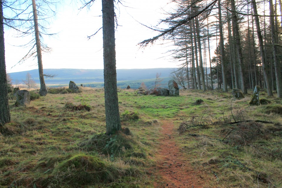
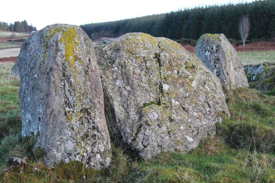


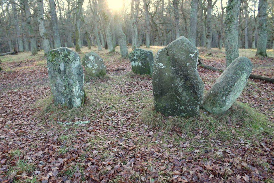
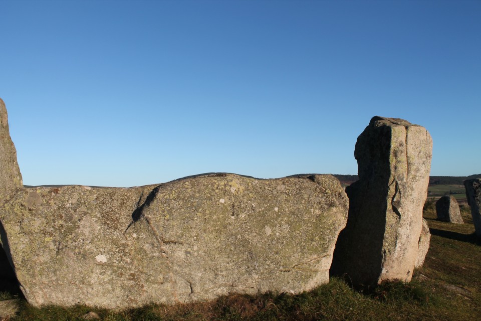
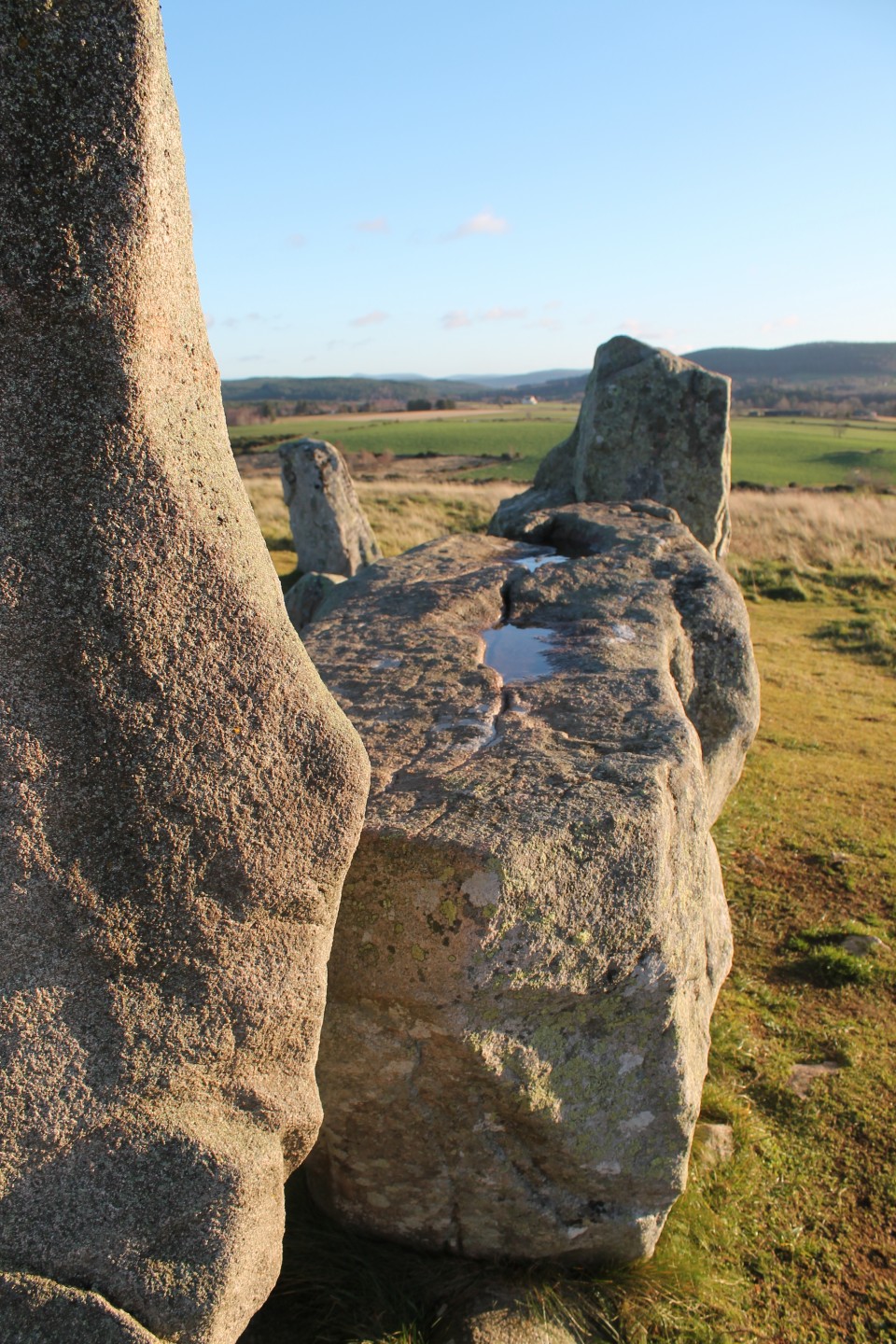
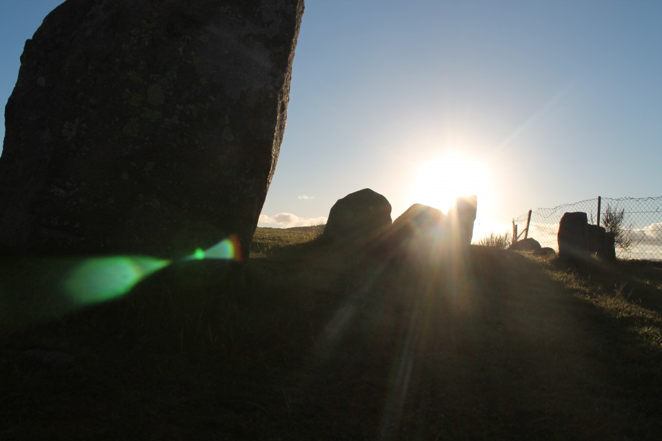
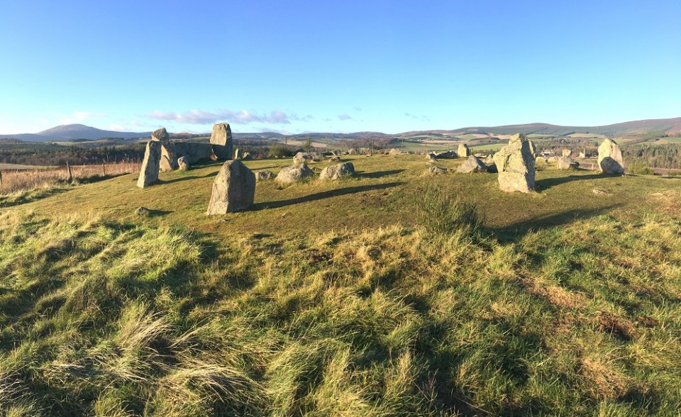


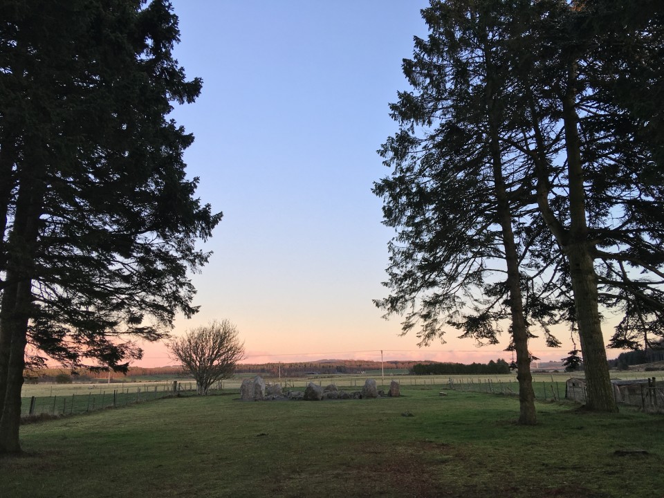
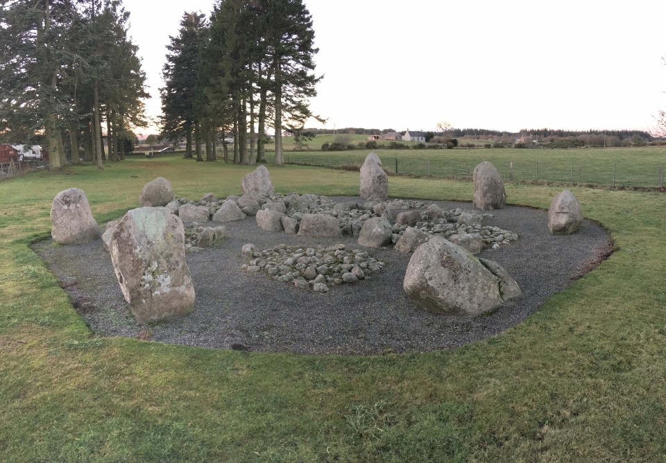
Thornborough.......A henge for everyone. |
Thornborough.......A henge for everyone.After a lovely time at the Druid's Altar four poster stone circle near Grassington we got stuck, not in mud or anything like that but in a bicycle race, the pestilence, the niche absurdity that is the Tour De Yorkshire. Druid's Altar — Images07.05.18ce
The Arrows, are always very entertaining, tall and perfect, and very brilliant. The Devil's Arrows — Images07.05.18ce
I thought what I'd do was start at the north then go middle and then of course south. A good idea, I thought. There was already two cars parked by the woods, but experience tells me that just because there's a car by an ancient site doesn't always mean that's where they'll be, apparently some people walk for fun, don't laugh, it's true, I promise Thornborough Henge North — Images07.05.18ce
I left daughter in the car and entered the woods, immediately transporting me to another world, a world where the dominant life form on the planet is Bluebells. There were roughly 9.4 people dotted about the henge, bluebells outnumbered us like a million to one, because of the trees, banks and ditches, even if there are other people here, you can still get a very personal visit with this henge. It's all very much intact as well, some of the banks are higher than in other places, but very well preserved, a sleeping giant beneath the trees. But a shadow loomed, even here, in this quaint and quiet part of the Shire, whilst looking through the southern entrance I saw a worrying thing, a thing that does not go well with ancient sites, it wasn't a bicycle race, but it was lots of people. Back in the car we go round the block looking all the time towards where were going and inwardly groaning, there appeared to be something going on at the central henge. I parked on the roadside and gingerly approached the henge. This wasn't good at all, there's hundreds of people here, camping around almost the entire perimeter of the henge, stalls selling crap and trash, portaloos, burger vans, and dread locked wastrels eyeing up young girls, not good at all. Thornborough Henge Central — Images07.05.18ce
Immediately I climbed the bank west of the entrance, to photograph the disturbing scene, and was shouted at by greasy fat lady with her husband Krustie "get off the henge" they shouted, I looked around, "good lord, they mean me" they shouted again, "get off the henge" . Natural curiosity got the better of me so I asked "why?" "Because I said so" was the reply, who was I to argue with such clarity of thought, a well planned out argument. I demurred to there outlandish ways and descended the bank, stopped when out of view of most of the hoard, sat down and skinned up. I've never been, but this is what I imagine a summer solstice at Stonehenge would be like, unbearable. I strolled across the interior of the henge to where it is at it's lowest, and crossed over into the refugee camp cum Beltane celebration. A nearby oaf sitting in his plastic chair noticed me and burbled something at me in some southern drawl, "what?". He said again, "good job no one saw you do that, they don't like it at all". I went over. "Whats going on here,? I've never been to a henge and not walked all the way round." " Celtic festival of Beltane innit mate, my misses makes us come every year, I've been here since Friday." He gave me quite a sad look. I inquired further "There's hundreds of henges all over the country, why have you all come to this one?" He shrugged. Long drawn out sigh. I decided it was time for a different henge, leaving, I photographed the ugly monster that is a Beltane celebration. Honestly, I like marking the solstices and equinoxes as much as the next guy, maybe more, but it's a bit much to do the half way points between them too, unless of course all's your after is beer, burgers, bangles and under dressed teenage girls. Returning to the car, I relayed my misadventure to my under dressed teenage daughter. Then told her I'm going to the other henge in that field right there, pointing, Ok she said. She's a good girl. Now, having a look at these henges on here the day before, I noted Carl couldn't find this henge, I couldn't remember it much either, only that its the most worn out of the three henges, so I picked the bridleway pointing in the direction of where the last henge should be, and entered the field, almost immediately I could see a rise in the land that must surely be it, I got closer, it was, it was the last henge. Thornborough Henge South — Images07.05.18ce
I sat for a while, I found a quiet henge at last, one all to myself, listening to the fine lovely birdsong and the audio equivalent of poo or torturing. It's been a mixed kind of day. Then it was time to go home, so we went home. |
Posted by postman 7th May 2018ce Edited 8th May 2018ce |
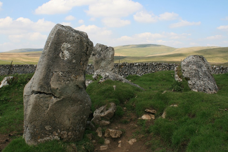
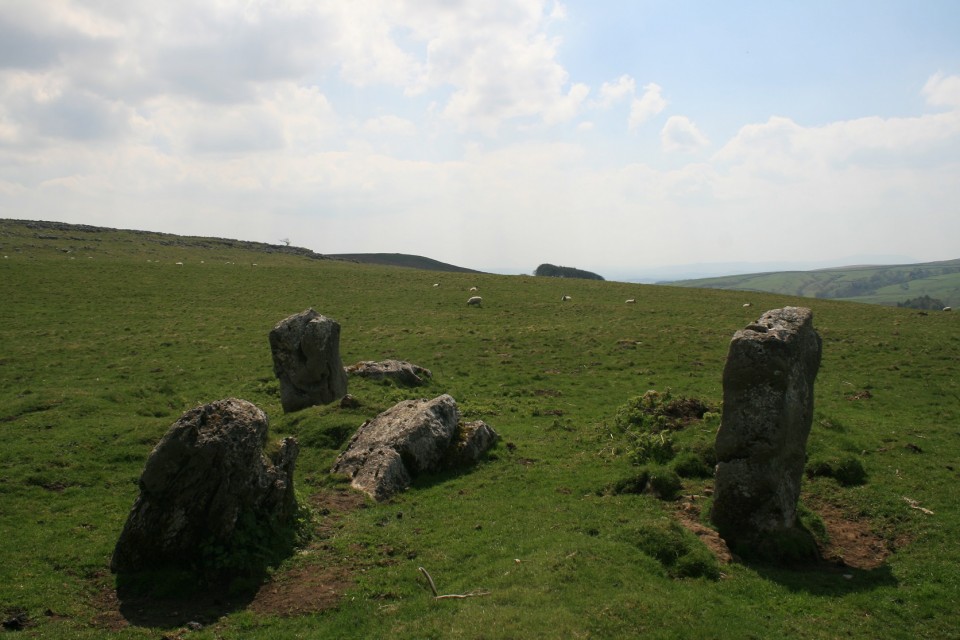
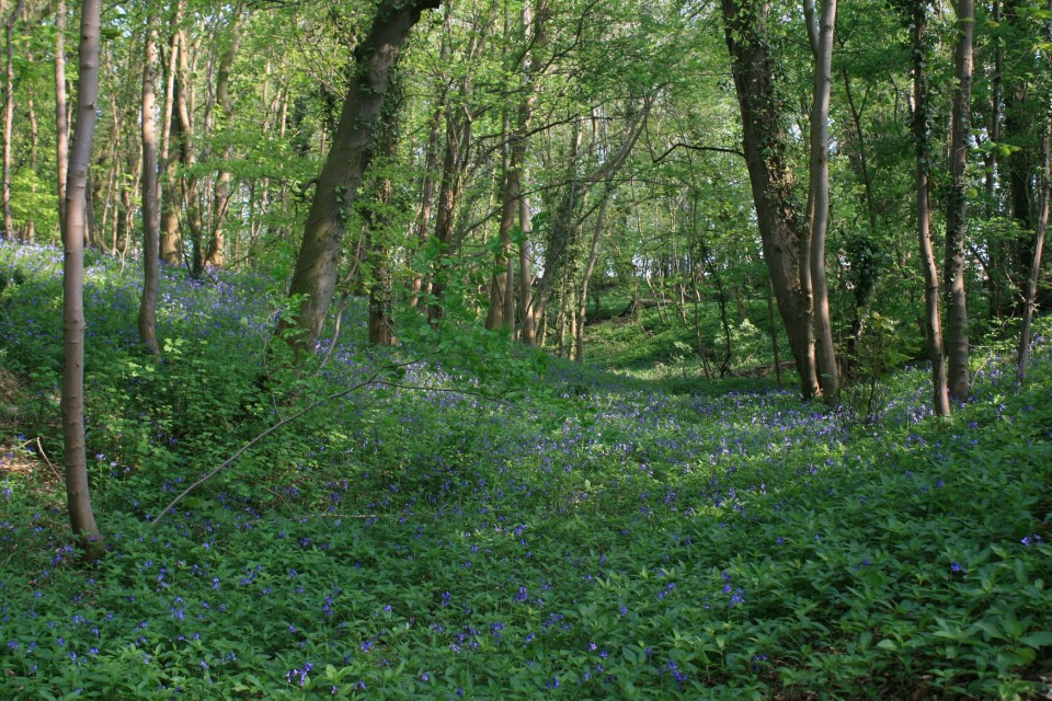
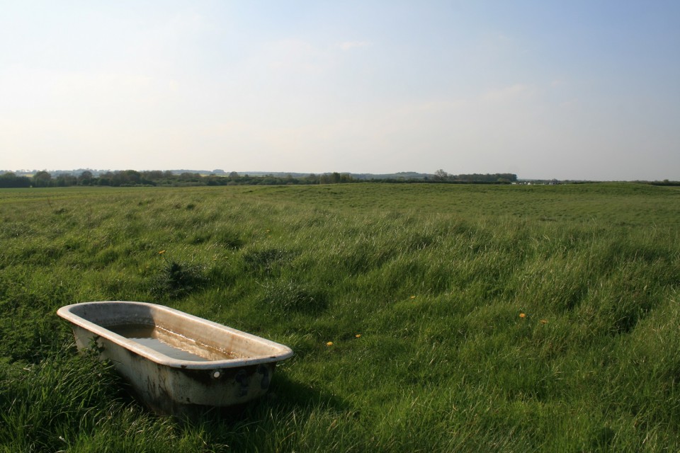
Signs. Spring Equinox at Mitchell's Fold. |
Signs. Spring Equinox at Mitchell's Fold.I don't like winter, that's not strictly true, what I really don't like is being cold, it hurts. So I am pretty eager for signs that we're moving back to the good times of warmth and light, signs like snowdrops and crocuses, the day being light when i'm going work, signs like the spring equinox. Which is today, so i'm going out to see some stones and take a look at what the sky is up to. Though I can probably guess. So, where to go, it needs to be quite close, so Callanish is out, i'm old and knackered so it shouldn't be hard to get to, so Bryn Cader Faner is out. How about the Bull stones on the edge of the Peak district, too small. Mitchell's Fold? It's been eleven years since last time. Done. It's closer than you think, to my house, I got there with time to spare, which is quite unusual. But I was going to need that extra time, because it had been snowing a day or two ago, heavily, in places I had to wade through two foot deep snow drifts. Seeing other places in winter makes me see just how strangely weather free home is, it snows, for sure, but it's only just a mild inconvenience, it doesn't close roads. After much heaving and sighing I arrive at the circle, first thing to do is remove the wads of snow from inside my not good new boots, second, breath heavily on my stinging cold fingers til there warm enough to handle the camera. Third, do photography. The equinox sun looked to be rising from behind the Stiperstones, a rocky cairn topped ridge of ankle breaking renown, about six kilometers distant. Mitchell's Fold — Images21.03.18ce
I say looked to be, cloud, which had been absent my whole drive here had come out of no where to obscure the magic moment of sun rise. There was just a thin sliver of sky protruding through the grime close to the ground, enough to see where the sun would be if all was perfect. It's not even close. If it's been eleven years since I've been here, the same must be true of the Hoarstones stone circle as well. So I march off in the direction of Stapeley hill, it was easier last time as I had a mountain bike, this was likely to take longer. I passed the Dead cow stone not seeing it, as I was talking to the sheep, they chose to ignore me. Reaching the top of Stapeley hill wasn't easy, long deep snow drifts had to be navigated like some cruel Labyrinth, or waded through, flipping snow, is it really necessary ? Stapeley hill has two rocky peaks, with superior views, hanging between the two on a shallow ridge was something I wasn't expecting, kind of. I'd seen pictures of it, but hadn't appreciated where it was, a nice little ring cairn, it was here ! cooooool, if this ring cairn was on twitter, I'd have like it. What ever that means. Stapeley Hill — Images21.03.18ce
New boots are beginning to hurt, just above the ankle, it must be time to walk further away from the car, course it is. Like I said, it's been a while since I was last here, so I decide to come down off the hill too early and start searching for a stone circle that isn't there, deep snow, hidden holes, hidden streams, all impeded progress, I was just about to give up when a van came close by, I went over, he stopped, we talked. It's not here, it's on the other side of the forest commission bit, over there, he pointed, up and over. He gave me directions, but my man mind can only hold half of all directions, I set off again. Somewhere in the forest I got distracted following animal footprints in the snow, and went wrong. Nothing was making sense, I stupidly left the map in the car, but am fairly sure I've just gone off the top of it, so it's useless anyway. I'm now poking about around a house called Hillcrest near castle ring hill fort, another man helps with directions, it's over there, holds out both arms and indicates it's between them, over there somewhere. It's looking a bit grim now, I've warmed up, but lost a stone circle, it was much easier last time. Next is a long walk along the road rounding the Hemford corner and heading back to the A 488. I have by now given up, even the sight of four Roe deer doe's doesn't fill me with positivity, I do photography and walk on, painfully, some walking boots aren't really made for walking. Back on the main road I spot a footpath that goes in the direction of back up Stapeley hill, I take it. Immediately I recognise this place, I believe I am now close to the circle, at one point I peer across the snowy moor, but see nothing and give up once more, I shouldn't have, it was there, I looked right at it but didn't see it. Grumped out, I stomp back up and around Stapeley hill, blundering haplessly upon the Dead Cow stone, at least I managed to find that, by accident. The Cow Stone — Images21.03.18ce
But I couldn't let it go for long, after wading back through the snow I get in the car and look at the map, oh, there it is, kind of exactly where both my local helpers said it was, I drive back to that same footpath off the A488, ditch the car angrily by the side of the road, don my wellies and wade through ankle deep freezing mud and shite across two fields and there it is. Then I went snow blind. The sun had decided to show itself, the snow seemed to glow thumpingly, hitting my eyes with some considerable vigour. The Hoarstones — Images21.03.18ce
I had to shield my eyes from the worst of the glare whilst I took some photos, then I sat on the edge of the circle upon a flat topped stone and closed my eyes, with some relief. After the sun had gone back in I inspected the stones more closely, well, I say closely, I mean I didn't fall over them. Two holes have been drilled into one of the remaining stones, some say they could be ancient but the loss of over half the ring suggests a more explosive reason. A central stone, there's one of them at the Bull stones on the edge of the Peak district, I wonder if the sun put in an appearance there, I imagine it would have been life changing. Time to go, I agree with the devil on my shoulder and trespass wildly in order to take a more direct mud and shite free route back to the car. Done. |
Posted by postman 21st March 2018ce |
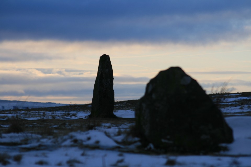
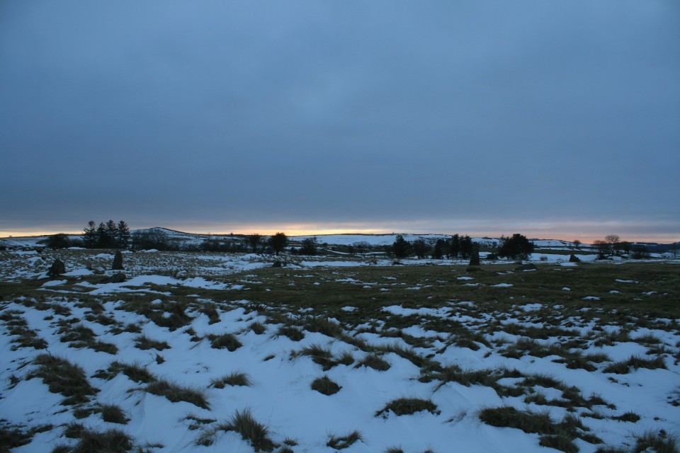
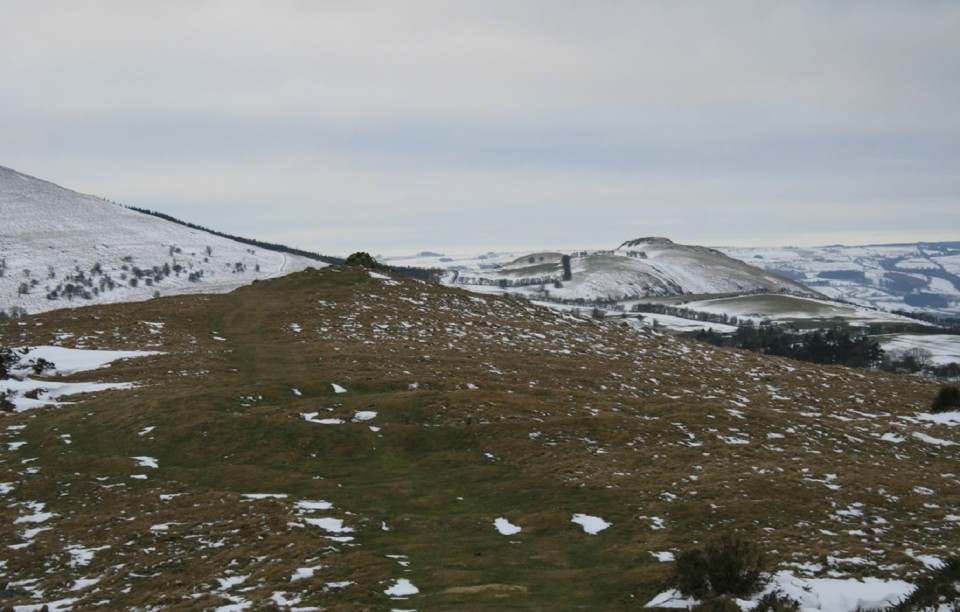
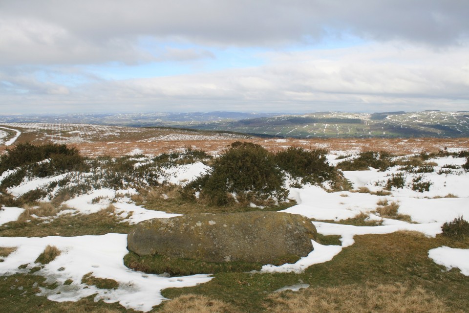
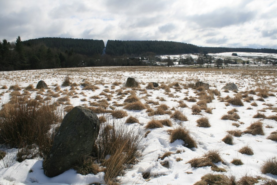
A Sutherland Cycle Tour and the £380 Stone Circle |
A Sutherland Cycle Tour and the £380 Stone CircleFor the last fifteen months my friend Jeremy and I have been out cycling in the evening once a week. It sort of combines our mutual obsessions; his cycling long distances and breathing in the natural world around him and mine visiting local prehistoric sites. Of course it doesn’t work so well in the Winter as all the cycling is done in the dark and, needless to say, freezing conditions. However, the long term aim was to go on a cycle tour for a week to somewhere wild and rugged, where we could express ourselves. Along with another old friend of Jeremy’s, Martin, we’d settled on travelling to Cape Wrath in the extreme North West of Scotland, cycling around 150 miles, wild camping or staying in bothies and living on nuts and berries. Real boys own adventure stuff! About a month before we were due to set off we discovered that the military ranges there were to be used for a major NATO exercise. Apparently they would be using live ammunition so despite our ‘devil may care’ attitude we sensibly switched our attention to an AirB&B caravan just outside Lairg overlooking Loch Shin (almost). The weather forecast for our weeks adventure had started off quite favourably, but as we got nearer time-wise and geographically, it had begun to deteriorate with the tail end of an Atlantic hurricane sweeping across the Highlands and we soon realised how sensible we’d been to put our trust in AirB&B. On the Monday morning we bravely got into the most waterproof clothing we had and pedalled off into 40mph winds gusting to 60mph with stinging horizontal rain. After a couple of hours of this I was soaked to the skin and not a happy bunny. With all the strenuous effort it took just to stay upright and keeping my head down, the thought of spying out ancient sites just went completely out the window. It just became a fight for survival as far as I was concerned although the others didn’t seem too put out about it. After four hours we’d almost reached the top of Loch Shin and stopped off to look at a small dam and hydro-electric power station, one of several in the Lairg district, before beginning our descent to the loch itself. Even this proved cumbersome as I couldn’t remember many occasions when I’d had to pedal downhill as the wind was so fierce! Rounding the top of the loch suddenly everything seemed so different. The wind that had been our enemy was now our friend, not a ‘best’ friend obviously, more like a charming acquaintance and we hardly had to put any effort into heading home down the North Eastern side of the loch. Bliss. Having arrived back at the caravan physically and mentally fatigued I began to wonder if I’d even be brave enough to get back on my bike tomorrow, and the weather forecast was still bloody awful. I also wondered how practical it would be trying to photograph any sites we came across. I had one big heavy, but weatherproof camera and another smaller, lighter, but non-weatherproof camera. Decisions, decisions. The next day the conditions were no better, but the proposed route towards Altnaharra and then some off-roading over a mountain track weighed in at a whopping 50+ miles compared with the previous days 40 miles. Again we set off into the biting wind and rain and by the time we’d gone 11 miles to the Crask Inn I’d decided that for me the war was over. After a warming coffee around a log burning stove we separated and I was blown all the way back to the caravan. After lunch I made a plan to seek out the more interesting sites nearby and started with a ruined broch no more than 200m from the caravan. I’d spotted it earlier that morning but realised that it was impossible to actually get to it without climbing a high wire fence so I had to be satisfied with a view across the Strath Tirry which was perhaps better as it gave it some context. A sizeable mound still stands but any traces of the stonework on top are barely visible now, most of it having been either carried off for local houses or maybe collapsed into the river. Getting back on my bike I cycled the 4 miles into Lairg and made my way to The Ord, easy to find as there’s a telecoms mast on top of it (unfortunately). It’s quite exciting to visit large cairns as it’s something I don’t do very often, as there just aren’t any in my neck of the woods. Plenty of grassy barrows, but no cairns. As you approach the top there are small information boards handily scattered about telling you what the various lumps or bumps are and the first one pointed out a ‘burnt mound’, a pile of burnt stones which may, or may not, have been associated with a prehistoric sauna. I have no problem with this but why keep using new stones to heat up each time, unless they always fractured when they were flung in the water, and so gradually became unusable? Next up were some small cairns on the way up to the big one, Ord South, a grass covered monster with five small standing stones at it’s summit. Momentarily the sun was shining and the view back up Loch Shin would have been fantastic if it hadn’t been marred by some aesthetically challenged numpty from a telecoms company! Westwards you also get a great view down on Ord North, not quite as old as Ord South and much less grassy in appearance. You could also see two very large stones which are part of the entrance to the tomb, but climbing down and getting a closer look, it was obvious that the interior of the cairn must have collapsed a long time ago and the entrance blocked by debris. It’s still a handsome pile though. After my second perambulation around the cairn I noticed that the threatening rain clouds were doing their thing and it was probably wise to get off the hill or face a second soaking of the day. Jeremy and Martin got back about an hour after I did and were pretty tired and told me that the ‘mountain track’ was mostly unridable even for the fattest of tyres and I felt vindicated in my decision to cut the journey short earlier. Wednesday offered a slight respite from the ongoing rainfall and the wind had dropped slightly as well. We decided that we’d have a non-cycling day today (possibly we were all slightly relieved though being English couldn’t easily admit it). We set off to find Achinduich stone circle which according to the OS map was just off the A836 south of Lairg. Parking in a handy lay-by we walked up the hill scanning the horizon for stones eventually found a slightly disappointing arc of five reasonable sized stones and three smaller inner-arc stones. It looked to me like it must once have been a quite a sweet diminutive concentric circle with a possible out-lier a little way back down the hill. As with The Ord, the view across the Strath Shin valley would have been splendid if a huge pylon hadn’t been placed behind it. Do they do this sort of thing on purpose? Was there some disgruntled Scottish Power person who really hated the countryside and had been thwarted in their efforts to study archaeology earlier in life who deliberately placed unbecoming masts and pylons next to ancient monuments in beautiful environments? Well at least there was more than one viewpoint. Stumbling back down to the car we decided to make a visit to Cnoc An Liath-Bhaid stone circle further North East, stopping off at Achnagarron standing stones on the way. Achnagarron turned out to be a shambolic farm, though we couldn’t blame the disgruntled Scottish Power employee for that, with a couple of nice standing stones nearby (maybe that’s what achnagarron means, ‘delightful standing stones and crappy farm’). Their placement on a slight, flat-topped knoll, along with a lot of recumbent stones, suggested that it may have been a ruined circle. A few minutes later we were slowly making our way down a steep, highly cambered track about a mile and a half from Cnoc An Liath-Bhaid when we heard a slight scraping noise beneath the car. We got out to check that everything was alright beneath only to find oil leaking from the sump. Bad news. In trying to turn the car around on the narrow track Jeremy then knocked off a sizeable piece of the bumper, but he succeeded in getting the car to roll almost five miles back to Rogart where luckily there was a garage. A quick inspection at the garage revealed that there was no further damage and that the sump part would have to be ordered from Inverness, 50 miles South from there and would be about £120, hopefully ready by Friday. A young lad from the garage kindly drove us back to our caravan in Lairg where the atmosphere was a little dampened by the days events, and to think we’d been so close. Thursday bought a change in the weather and the wind and rain had abated with just a slight chance of showers later. Things were looking up! It would be a day of further stoney exploration around the Southern bank of Loch Naver some 20 miles North of Lairg. We set off into a light wind with occasional bursts of sunshine which brought forth multitudes of Scots revelling in the unexpectedness of very bright light and after a couple of hours arrived in Altnaharra. According to the map there were numerous hut circles just a bit further East along the edge of the loch with standing stones and cup-marked stones. We got as close as possible on our cycles and then I pushed mine through squelching bogs for 20 minutes as I was the only one wearing waterproof boots and the others wanted to eat their sandwiches. I found the hut circles which turned out to be rectangular, so possibly they weren’t quite as old as I’d led myself to believe, maybe just the remains of crofts after the Highland Clearances from 250 years ago or less. Certainly a nice aspect though with the loch below and the formidable Ben Klibreck behind. Arriving at a river the map indicated that the standing stones were just the other side and that there was a ford. Unfortunately the rains had swollen the river and had made the ford unfordable, besides which the stones couldn’t have been very large as I could see nothing across the way. It was at that moment I noticed, almost literally beneath my feet, what might be cup marks in the large rock I was using as a vantage point. Well I’ll be. Of course this is unsubstantiated and in the wrong place, but who knows, maybe I’m the first person to notice them in thousands of years. After basking in my personal reverie of glory for a few minutes I remember that Jeremy and Martin are probably wondering where I’d got to, or were bemoaning the insubstantial supply of sandwiches, so I began to make my way back. Rejoining them we decided to start our journey back to Lairg as the threat of rain was with us again and the sunshine that had been raking the hillsides had decided to go off and rake elsewhere. On the pleasant wind-driven journey South we stopped off once more at the Crask Inn, this time for our first and only drop of whiskey and had a very nice chat with the lady who, with her husband, used to run the Inn, but now lived across the road and was just looking after it while the new owners were away on holiday. Friday was going to have to be a shortish cycle as we were expecting a call from the garage to say when the car would be ready to pick up. Around lunchtime the call came through only to say that the wrong part had been delivered and that the garage owner would personally drive down to Inverness on Saturday morning, exchange the part, drive back, fit it and have the car ready around 2.00ish. Oh dear. That changed everything. We were originally going to start home at 6.00am on the Saturday, dropping Martin off in Warwick. Martin, in a slight panic, decided that he needed to leave straight away and would take his chances by taking any form of transport from Inverness as he had to return to Vietnam early next week. We waved goodbye as he disappeared up the Shin Valley back to Lairg to gather his possessions while we contemplated marrying into the local community and growing old in the Highlands. We were never going to leave. We arrived at the Falls of Shin Visitor Centre, a swanky bit of modern architecture with a waterfall attached and consoled ourselves with coffee and cake. We decided that we’d just have to hope the car was ready Saturday afternoon, drive like maniacs and get back down to the South Coast in the early hours of Sunday morning. In the meantime we could call in at the Achany chambered cairn a few miles further up Strath Shin on the way to Lairg. This turned out to be the most accessible monument hereabouts as it stands right next to the road. It’s quite a substantial thing with a sort of facade of large stones about halfway along and a cist set into the top. At the other end is a smaller sub-cairn (I think) possibly for their dog or some slightly less prominent relative. We set off again and decided to investigate the Ferry Wood Broch which is located at the foot of Loch Shin and just below The Ord. This however proves to be disappointing as, like the Tirryside Broch near the caravan, there was just a mound, a few lumps of stone and a slew of freshly slaughtered pine trees providing a slightly Somme-like appearance. Again we consulted the map and worked out that Sallachy Broch was about ten minutes away around Loch Shin as the crow flies and about an hour away as the cycle pedals. Surely there had to be one broch worth visiting in the area and an hour later we weren’t disappointed as we slipped and slided down the hill of the South West loch side. There’s a lot to see here with a good sized mound overlooking the water, stonework in excess of two metres in places and that old double skin thing quite evident still. A reasonably well defined entrance was still there with a Westward view over the loch, but no lintel and most of the interior choked with fallen stones from the walls and a couple of small trees growing in their midst. Peaceful, quietly forgotten, faded majesty with a slight melancholy air and overtones of moss and lichen. A good rounding off to our weeks stay. Saturday lunchtime brings a helpful call from the garage to say the car was now ready and the young lad came to pick us up about two o’clock. The bill for the repairs came in at just under £380 as you always forget that it’s about £60/hour labour charges, a full oil change and the iniquitous VAT on top of all that. Cnoc An Liath-Bhaid had proved to be a very expensive stone circle and, worse still, we hadn’t even got to see it in the end, though I’d still like to. Tirryside Broch — Images15.11.17ce
Ord South — Images15.11.17ce
Ord North — Images15.11.17ce
Achinduich — Images15.11.17ce
Achnagarron — Images16.11.17ce
Klibreck — Images17.11.17ce
Achany — Images20.11.17ce
Ferry Wood — Images23.11.17ce
Sallachy Broch — Images23.11.17ce
|
 Posted by A R Cane
15th November 2017ce |
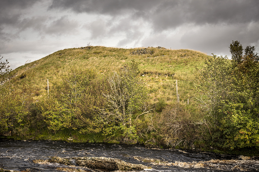
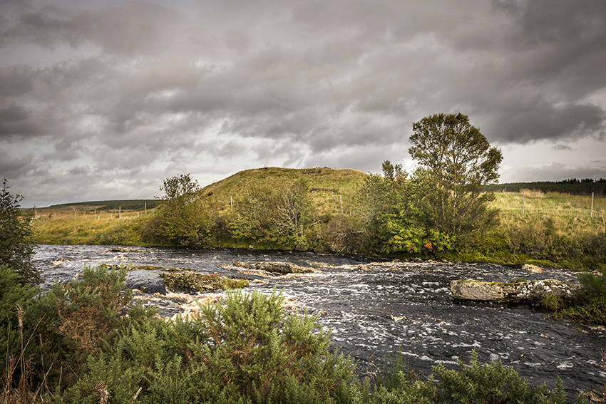
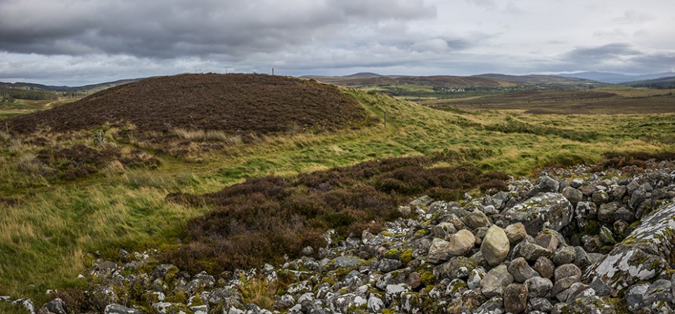
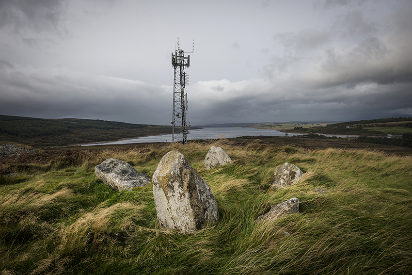

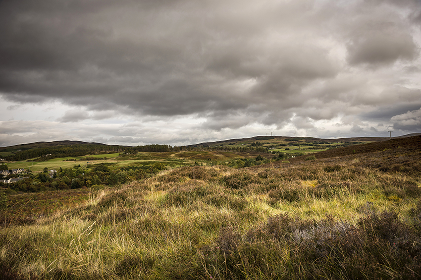
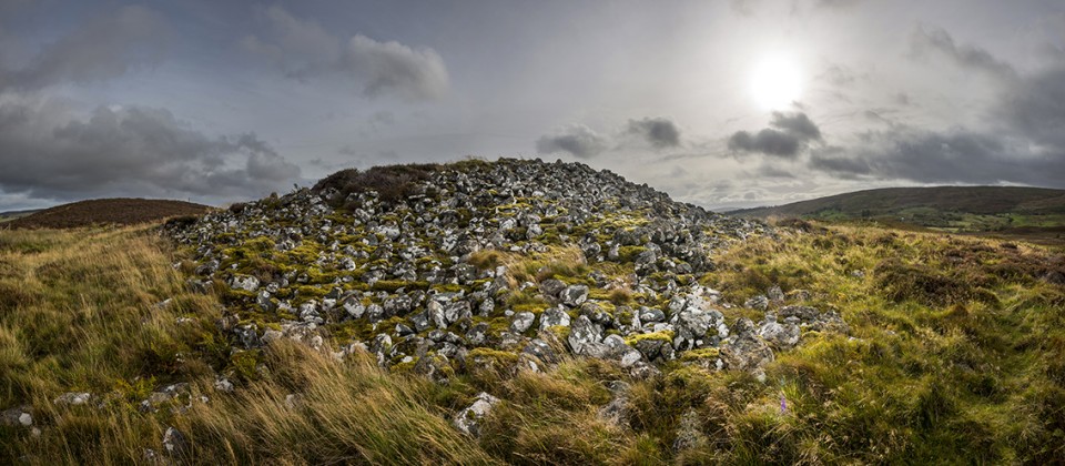
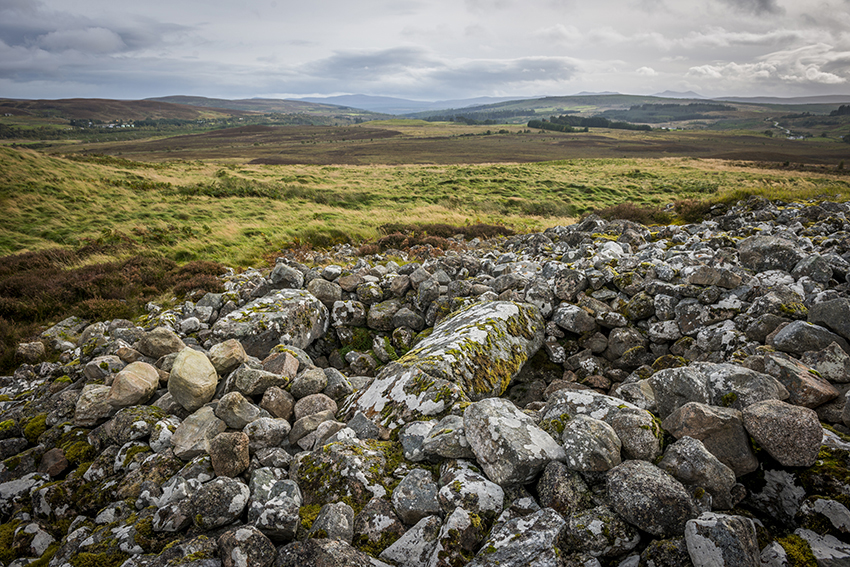
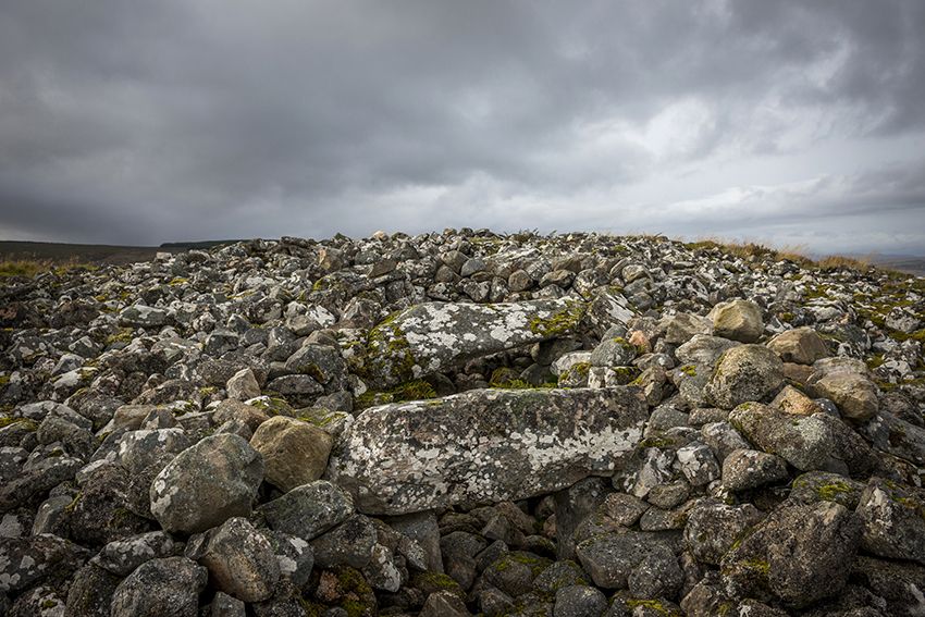
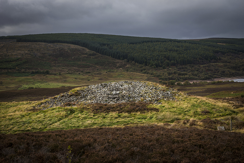
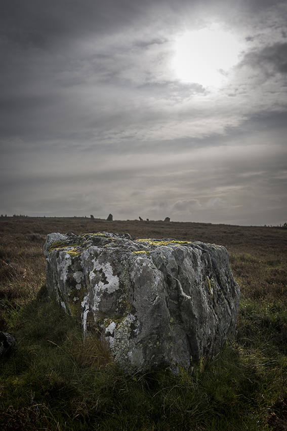
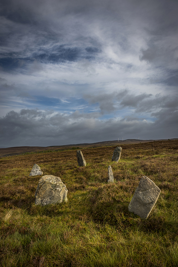
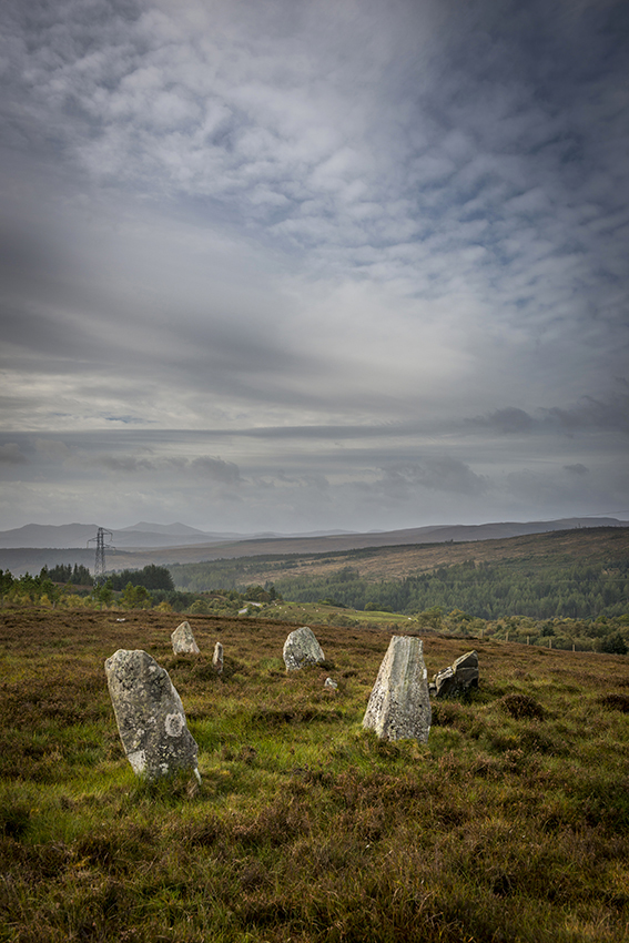
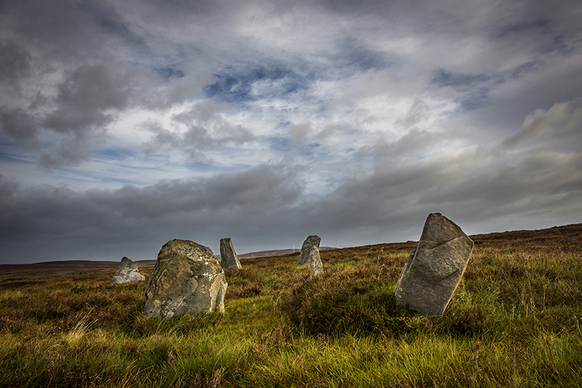
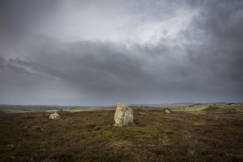
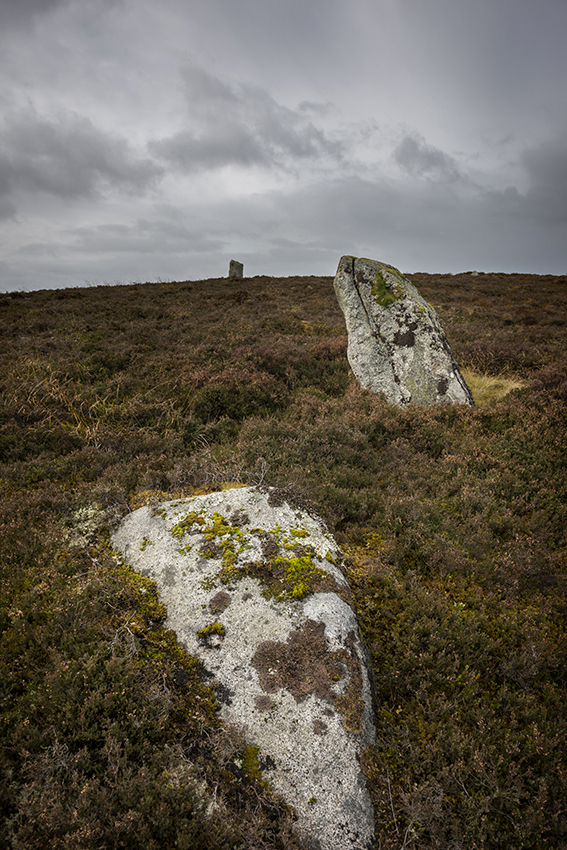
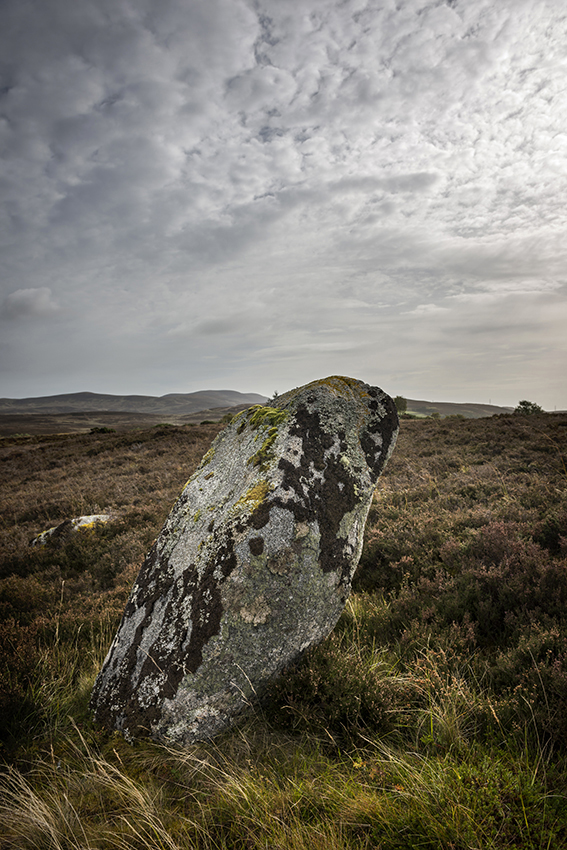
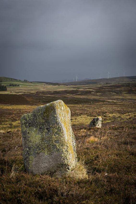
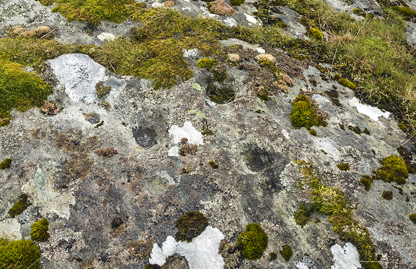
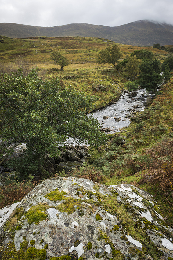
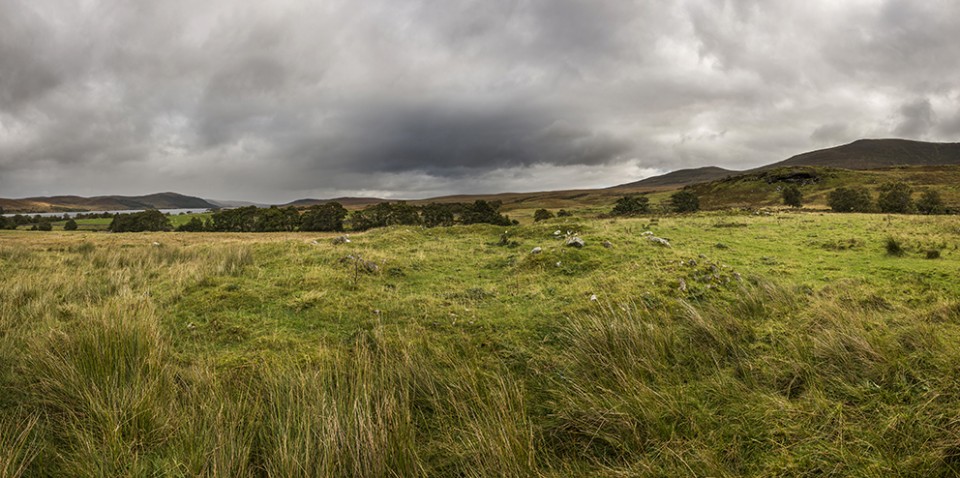
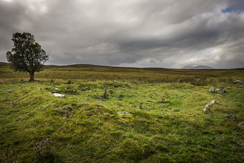
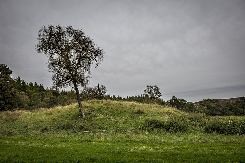
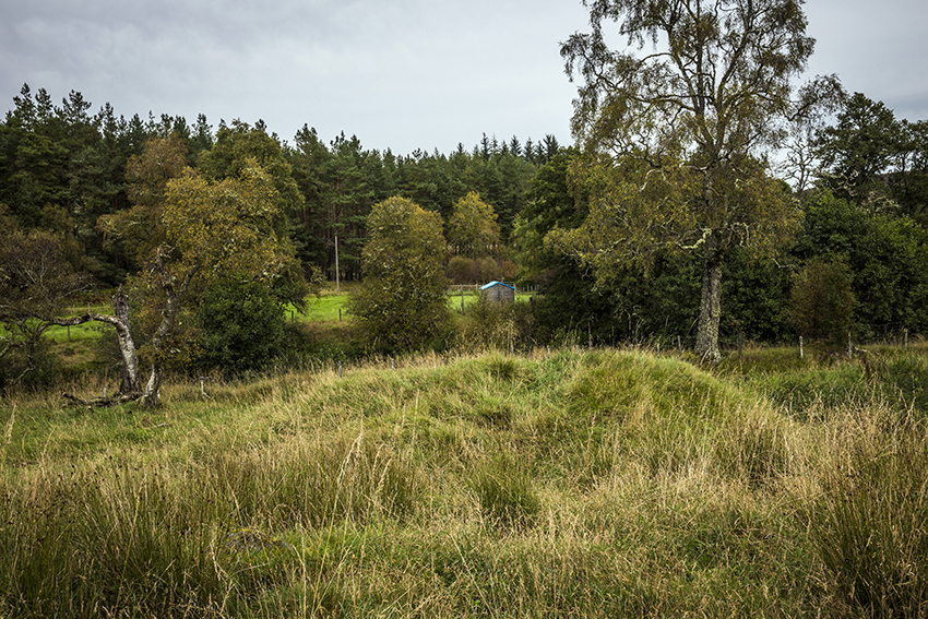
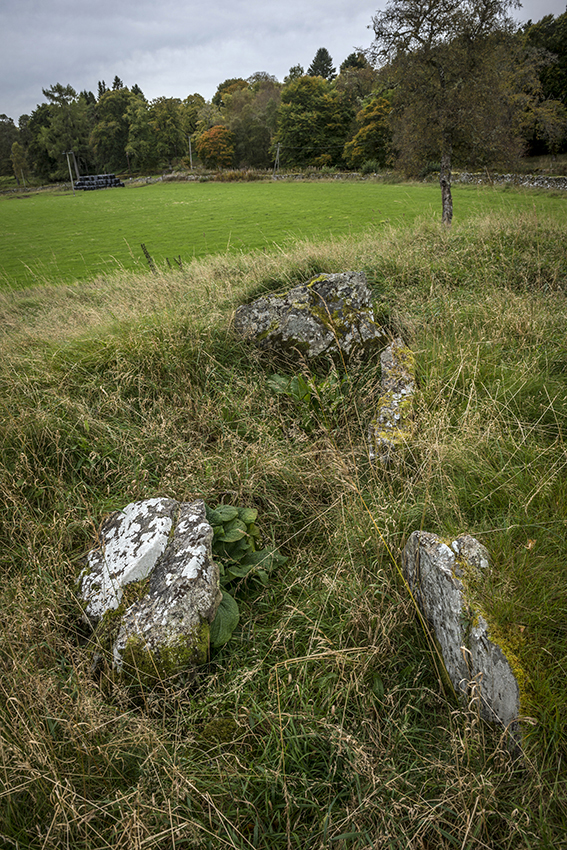
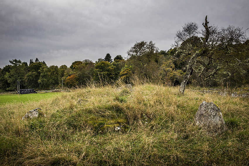

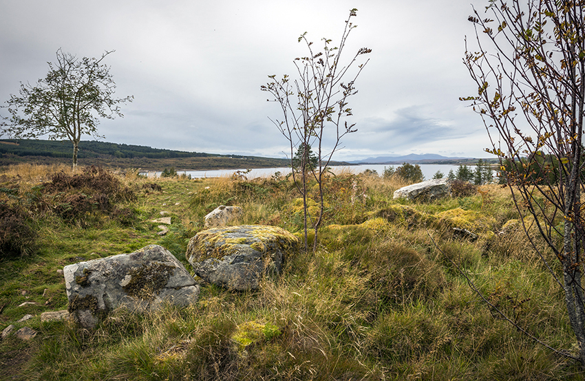
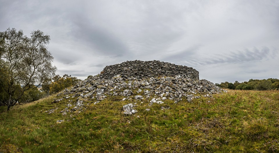
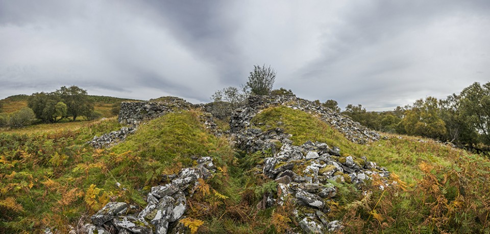
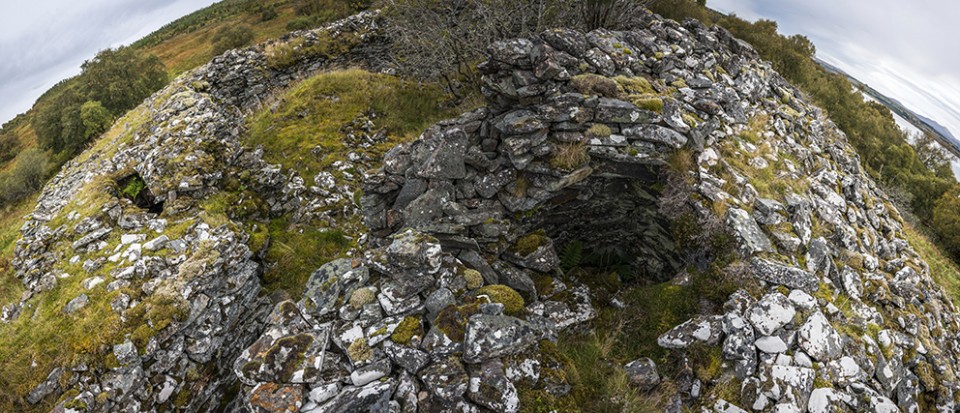
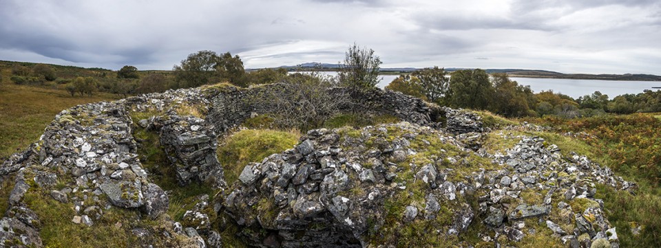
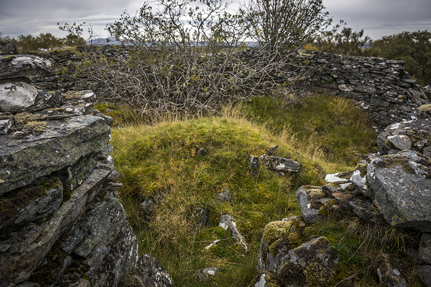
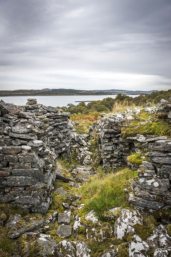
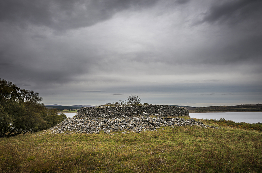
Round and round in circles. |
Round and round in circles.It's that time of year again, the most over-rated season of all, Autumn. The last vestiges of my stone hugging obsession still demand that I be at some stones on the solstices and equinox's, though in recent years it has become less important to be there on the exact day, a couple of days out is now acceptable when before it wasn't. I decide upon a Cumbrian excursion, the plan such as it was, was to be at Brat's Hill stone circle and neighbours for sunrise, then go to Sampson's Bratfull cairn but I overslept and got up fifty minutes late, given how much sleep I usually get, an easy thing to do when trying to get up at 3am. Swearing at the world in general I make my way up the M6 motorway, realising that I have no chance of getting to Boot in time I tweak the plan slightly and head instead for Castlerigg, then onto Boot. But the second disappointment of the day was about rear it's ugly and unwelcome head, just getting over the Thelwall viaduct when my car started to heavily overheat. I had to now dissuade myself from throwing in the towel, turning round and going home. Instead I stopped at Charnock Richard services filled up with water, bought a bottle of the stuff and carried on calmly up the M6. All was well, I made it to the big Cumbrian ring with time to spare and without the red dashboard light coming back on. Many years ago when I decided that solsticing and equinoxing should be something that I should be doing (What do we call someone who goes out to stones on these quarterly points of the year) the first place I went to was Castlerigg, I was all alone at the stones, but it was pretty foggy and wet. So being back here for another equinox, on my own, just as my obsession wains, seems to be very fitting, a full circle kind of thing. But, for now, everything is as it always has been. Castlerigg — Images26.09.17ce
There are three other people here, a couple with a camera on a tripod, and a single chap similarly tripoding, they've secured their seats for the sunrise and I slot myself in between the two, further back, lest anyone try to speak to me. The sky is behaving itself for a change, there are clouds but they're shapely, impressive, enhancing clouds. After three equinox's here I have determined that you may never be able to see the moment of sunrise from Castlerigg, because it is blocked by the north end of Low Rigg, but then there has always been horizon hugging cloud obscuring the rising, it could be that the sun rises out of the joining point of ground and hill, I doubt the skies will ever be perfect enough to determine such an assertion. I wonder if the sun does a similar thing at the solstice with Blencathra, there's only one way to tell, look at Fitzcoraldo's picture of the solstice sunrise, it seems to bare me out. The sun has risen, and I have said good day to it, taken 150 photos, and i'm ready to try and nurse my car through the mountains, the couple that was here have gone and a late comer is now talking to the other chap and looking at me, will he try and talk to me too? No, cause i'm going, now. Bye stones. As a postman, I've been delivering to Thirlmere Rd for nearly nineteen years, so it was with some satisfaction that I drove down the A591 alongside that very Mere, then I realised I was thinking about work whilst out stoning, punishable by death in some places, I put my foot down and leave Thirlmere behind. Reaching Ambleside (we've got one of them too) I think refilling the radiator before trying to nurse my car over Wrynose and Hardknot pass would be a good idea, it would have been to if the thing hadn't erupted boiling water straight into my face, propelling the water cap fifteeen yards away, the woman refueling her car asked If I was OK, I nodded, so, with still bubbling flesh hanging off me, I refill the radiator, buy another bottle, so I don't get caught short in Eskdale, wipe myself down, I thought boiling water was supposed to be, well, boiling, or at least quite hot, not at all, shrugged it off and kept going. Have you ever heard of the Death road in Bolivia, where someone dies every week, sometimes by the bus load, well that's what Hardknot pass is like, not really, but it's as close as England gets. Reaching Eskdale and the village of Boot, I see there's no where else but the railway carpark at Dalegarth to park, £3.50 for the day was I thought quite reasonable. The walk begins. Boot is a nice little place, with, I think, three pubs, that's a lot of alcohol for such a little place. Crossing the river and passing the 16th century mill the walk goes seriously up hill, it is steep, wet and very uneven, I remember my ex wife came up here with me last time, pre digital camera, pre children, looking at it now I must congratulate her for getting as far as she did, which was the group of mining homes that cluster near another cairn like structure that I forgot to photograph on the way back down. That time, I was left to go on alone see the stones and then come back for her, but because of the waiting woman I didn't have enough time to find the Low Longrigg stone circles. No such restrictions this time, just me, the mountains, the weather and some stones. The ground has levelled out and I'm heading for a slight mound, from on top of which I hope to be able to see the stones, brilliantly the circle is just the other side of the mound, and just a bit further on I can see the stones of White Moss, no sign of Low Longrigg though. Brat's Hill — Images28.09.17ce
Brats Hill stone circle is the largest of the five circles up here, some stones are large and prominent, whilst others are lying down and barely seen over the grass. There is what seems to be a central standing stone, well, its definitely a stone and it's around the central area, but there are also five cairns within the circle, the stone is on the circumference of one of the round cairns, so perhaps its to do with that. The cairns are a nice addition too, perfect little round mounds with occasional kerbing visible. I stroll over to the alter, a rock outcrop that is thee place to look down upon the circle and get a good view of the area. There is one big dark mountain away to the back, a quick look at my map magically informs me that it is Scafell, our biggest mountain, been up there twice, been in whiteout twice, a most uncooperative mountain. A pair of walkers have encroached upon my musings so I push on to the White Moss stone circles. They are about 30 yards from one and other, the south west circle occupies one end of a very low ridge the stones being about the sizes of a toaster to a large microwave, one for the kitcheny types there. There's two cairns here, one is just outside the circle and the other is well inside it and may even have a cist lid still in situ. The north east circle, for me the best one up here, if it were alone it would still draw me in. All the stones are stood nice and up straight in a restored kind of way, a cairn inhabits the inside of the circle. Together with a view of Scafell this is one of the best stone circles I've ever been to, if it's not on your list of places to visit, you should stop visiting places. White Moss — Images28.09.17ce
More people are coming, taking the obligatory photo, look I'm in a stone circle and my arms are out wide, click, move on. I get out of their way by marching off in what I hope is the direction of Low Longrigg, I have a map and a compass, but in the end, walking round and round in circles getting ever higher is what found me the stones. Something I've become accustomed to. Nobodies going to be coming over here in a hurry, map only says there's cairns here, they're really off the path, hiding in long grass, I have the place to myself. Low Longrigg — Images28.09.17ce
If anything the view from Low Longrigg is even better that that seen from White Moss, solely because Great Gable has now come into the picture, perhaps my favourite Cumbrian mountain. Both of these stone circles are ruinous, the stones low, the south west circle has a central cairn in it, the north east circle has two. I stay here at these two circle the longest, the view is spectacular, the way Great Gable forms a valley with Kirk Fell, is possibly reflected in one of the stones in the north east circle, if memory serves it is the closest stone to Great Gable. I don't like walking, a walk has to have a destination, anything will do really, but five stone circles is a pretty good destination, and if the long walk keeps the people away then so much the better In the end I'd been up there for four hours, and in the very end I managed to get the car back home without much palava. |
Posted by postman 1st October 2017ce |
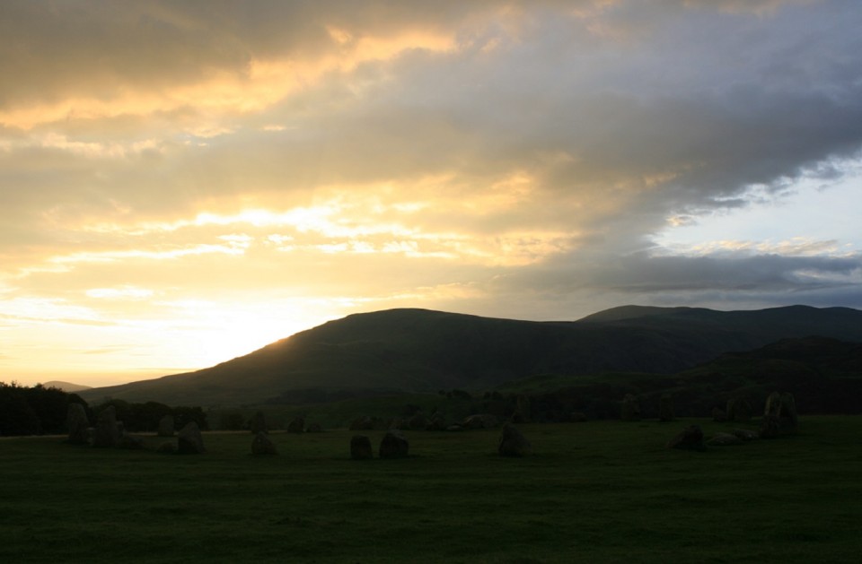
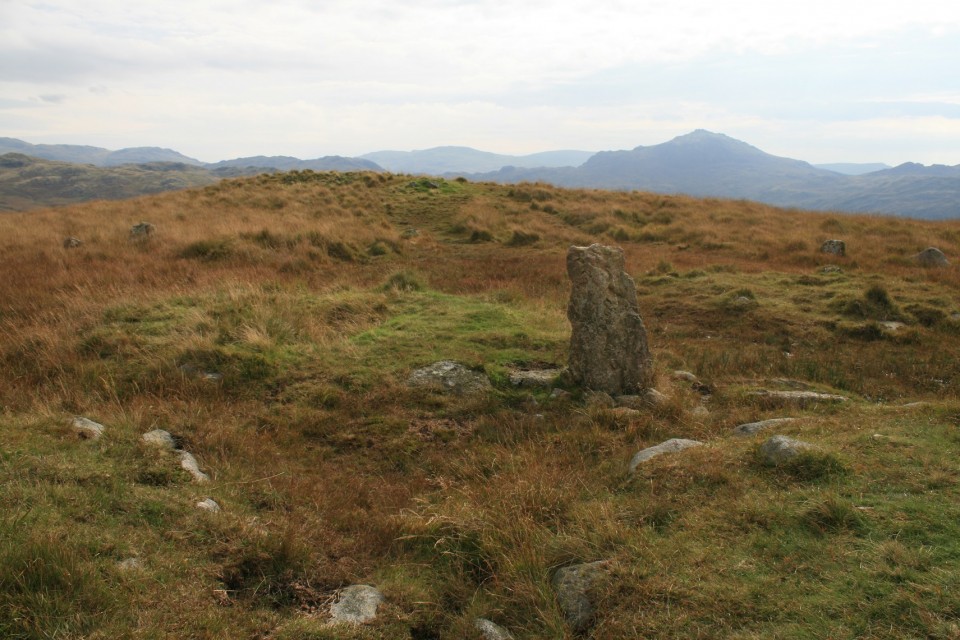
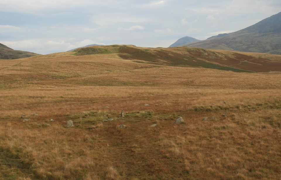
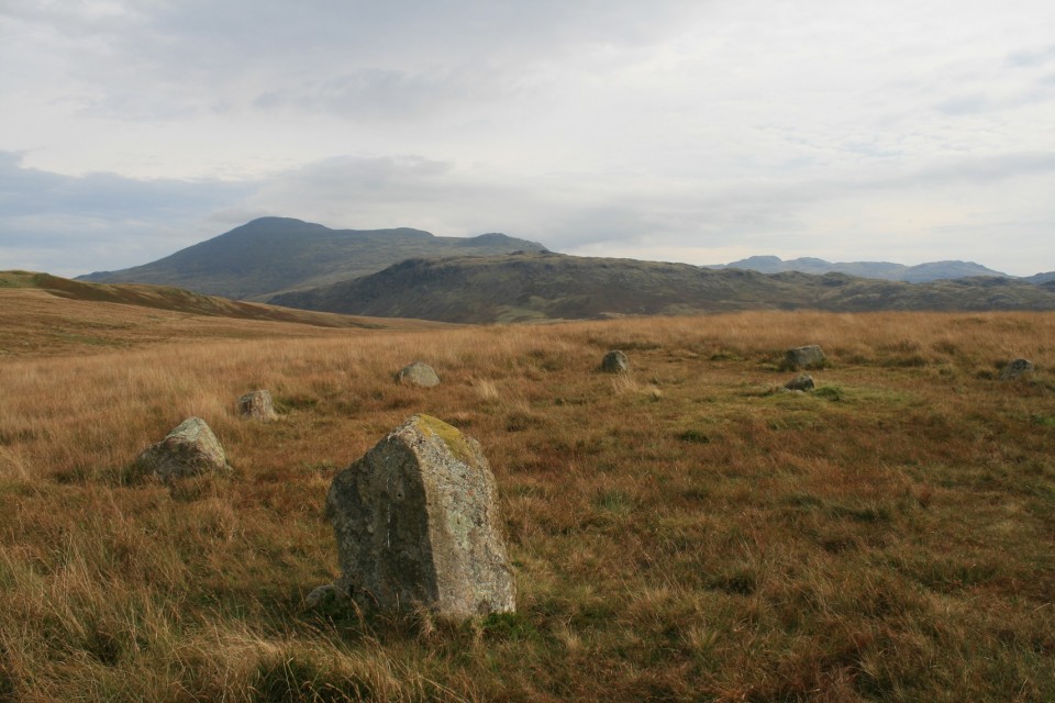
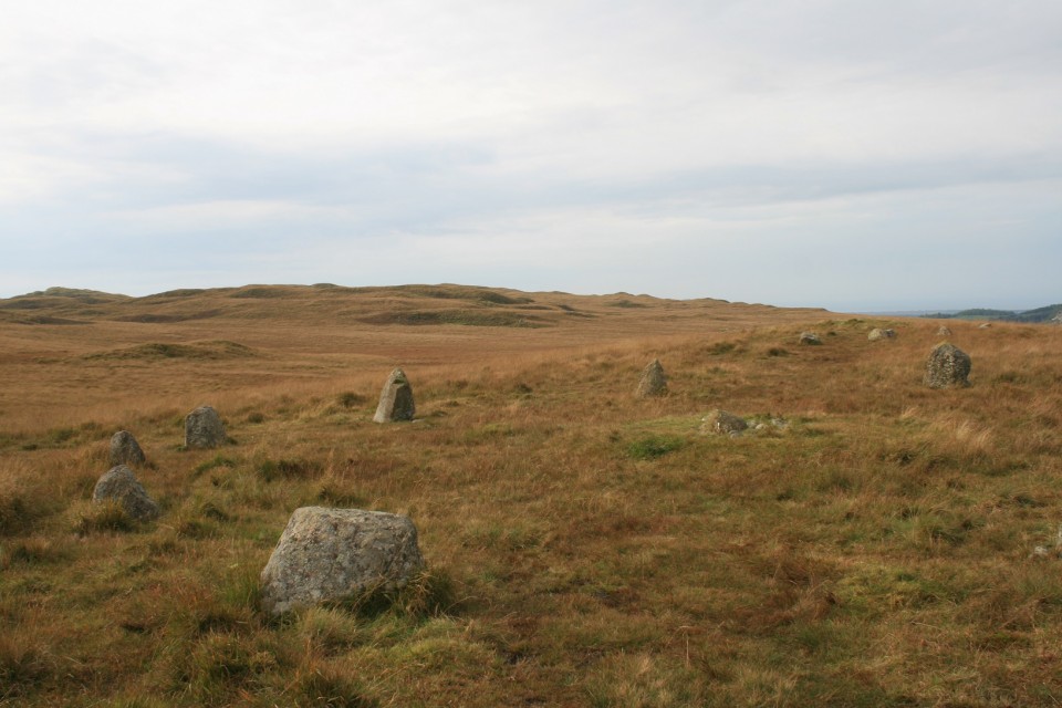

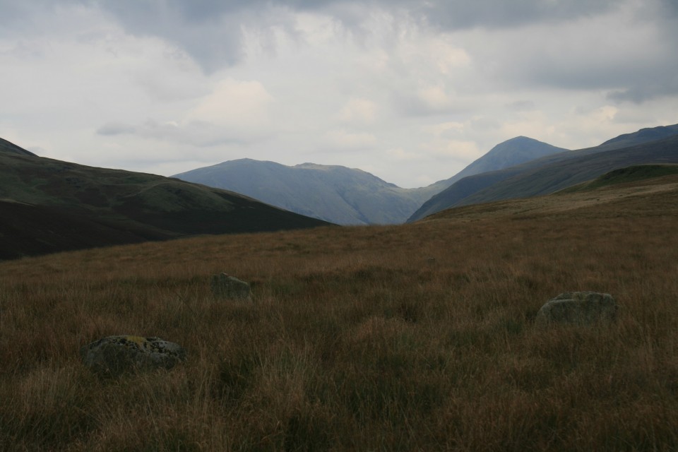
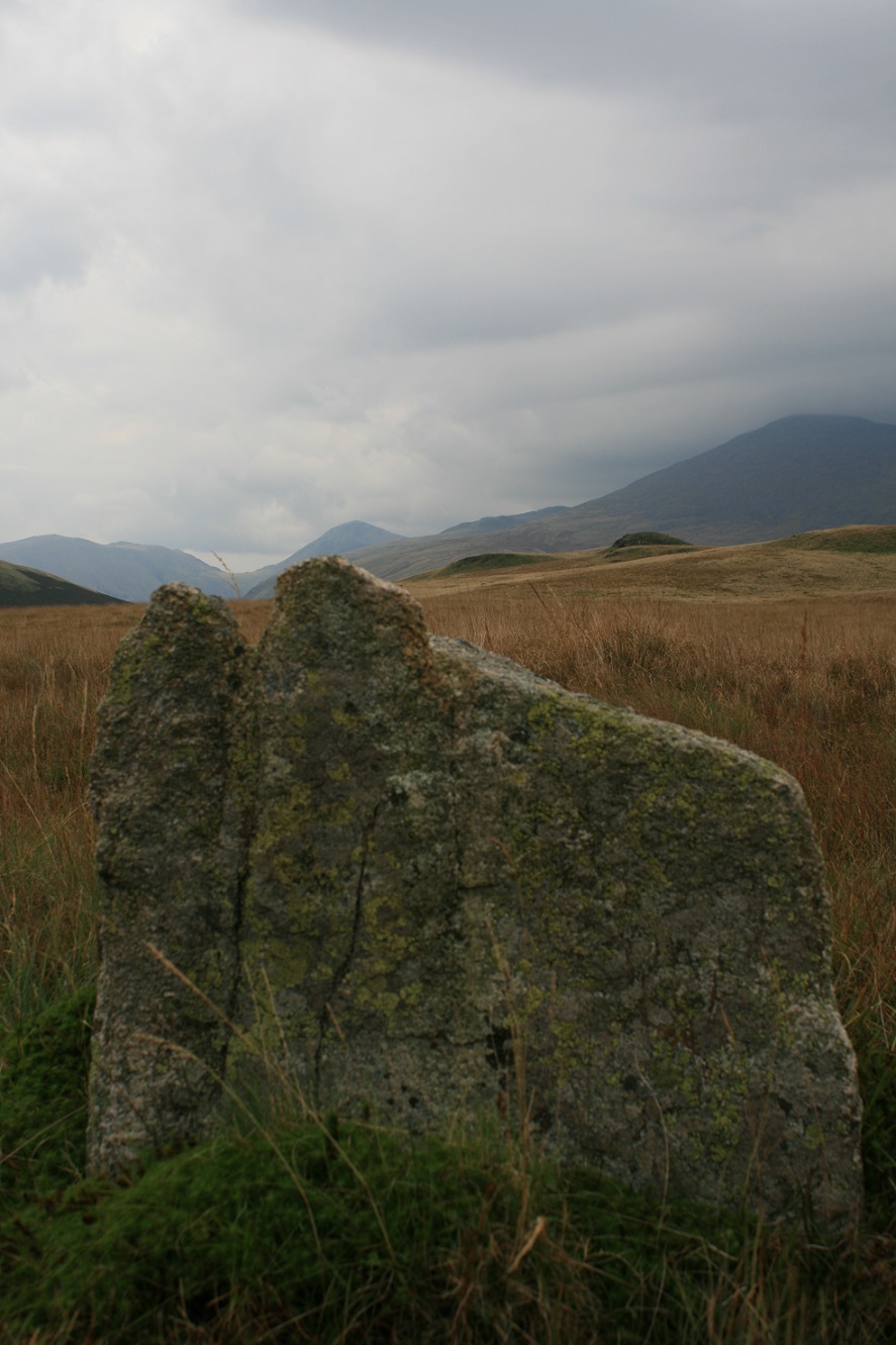
A circular tour of Denmark |
A circular tour of Denmark'I'm thinking of going to Denmark on Friday, 'Stones'? 'Yeah', 'You've only just come back from Ireland' 'I knows, its the weather see, its settled all week' 'Driving'?, 'Yeah' 'I'll get the shopping in while you get your van ready', 'OK that's kind' and that was it, permission slip in back pocket and off to Puttgarden to catch the ferry across to Lolland. Despite a lot of earlier preparation I decided to follow the route Julian took in his book and trust in his research. The first problem I encountered was that a lot of the places have different names to the ones Julian uses which doesn't help and secondly Denmark is a big country and the sites are many miles apart, all made up for by his choices, particularly the passage graves, twin entrance passage graves, passage graves you have to climb steps to get to the entrance, twin passage graves with entrances at 90 degrees to each other and all open for exploration. I'll post pictures rather than going into a lot of detail, however, in summary, I started on Lolland at the might Kong Svends Hoj the first of the many passage graves and then down into the Frejlev forest which hosts numerous sites including Siddenious Jaettestue and Kong Grons Hoj. This is a magical forest with upteen monuments scattered throughout, ra ta ta tat, ra ta ta tat, unfortunately the biting insects were out in force and coming at me in waves, eventually I had no choice other than to beat a retreat leaving many more places left undiscovered. On to Mons in particular to see the twin entrance Klekkende Hoj and the close by Kong Asgers Hoj. Next up into Zealand to explore, of particular mention is the Jaettestue at Lumas. A unimpressive looking mound at the side of the road in the middle of nowhere, however, as I crawled through the passage I must of triggered a photo switch as the inner chamber suddenly burst into light, the shock made me raise my head and BANG!, crashed onto my stomach stars everywhere, head swimming and within minutes a lump the size of an egg protruding from the top of my head. For the next five days everyone stared but no one commented, aren't people polite. A quick visit to the Viking stronghold of Trelleborg and across the Storebaelt bridge to Fyn, more passage graves at Marhoj and the triple dolmens of Lindeskov. Finding my way back onto the mainland of Jutland it was North to visit the Viking graveyard of Lindholm Hoje, nothing can prepare you for the sight as you look down the hill, stone ships, circles, individual stones spread right across the hillside, not our era I know, still very impressive. The Troldkirkevej is close by and worth the walk up to it. Many sites on Jutland, however, the complex of sites at Trustup is particularly impressive, set deep in the forest, a circular walk takes you past the many monuments and the natural habitat of the area. Finally I dropped down into Jelling to see the Stones and now understand the Bluetooth symbol on my phone, a quick flick of the sat nav and I was heading for Germany and the road home. 'You know we are busy for the next three months don't you'? 'Yeah' 'OK then' |
Posted by costaexpress 4th June 2017ce |
White Light |
White LightWe travelled to St Margarets Hope spending the hour or so on deck. I was very moved by the abandoned houses on Stroma, the island looked so strange. A fellow passenger was also strangely moved after sliding across deck cos the idiot Paddy ( our friend) was hollering about spotting a whale..needless to say no such creature was visible. We saw plenty of puffins though. We were lodged at Birsay with good views of the Brough. I thought I'd miss the trees but I didn't; I missed their shelter though. We were blessed with bright days on the whole & the wind cut through like knives; the old woman whose cottage we stayed in said she didn't notice it anymore. Straight out to Stenness, Barnhouse, the Ring of Brodgar & Scara Brae. I've seen these places so often on the telly & in photos but what can't be properly captured is the wild, wild surroundings. The water everywhere is wonderful. The big big sky. I cried at Stenness cos it didn't feel real; they're like a modern sculpture reaching for the heavens. The settlements ground me with their beds, hearths, alcoves & cupboards..layouts that feel so familiar. (What's with the trapezoid like stones? There's one at Stenness, one at Brodgar & one at the Clava Cairns.) The Ring of Brodgar has some preservation work going on so we couldn't full circle. It's surrounded by mounds; one of which is overrun with rabbits. There's really well chiselled graffiti on some of the stones; also at Stenness & Unstan burial chamber. There were lots of folk about; coachloads of Americans.. I do admire their enthusiasm, but boy can they yatter, mind you Paddy saw a few of em off spouting his usual half baked bollocks. I loved the lonely Comet stone & the huge witchy stone as I saw it; I couldn't get near to kiss it though cos of aforementioned works. We walked round & round, sheltering behind the mounds. We gazed at Maes Howe across the landscape. It was glorious. At Scara Brae the guide/ guard showed us the drains..drains! He explained that the rectangular boxes were watertight; that the beach had been a fresh water loch untill the sea encroached. He was a good lad but looked slightly blue; it was freezing in that wind. The Maes Howe tour was ok. A lovely guide called Sharon. The carved out platforms are larger than I'd realised & so exact. The chamber itself is smaller than I'd thought. I impressed the Yanks by declaring that the Vikings came through the roof. Paddy waffled on about about blocking stones shielding us from the underworld much to their bemusement; our embarrassment & Sharon's irritation. Next we visited Unstan; these chambers are set out like stalls in a stable, with little hidey holes. Paddy sought to frighten me by crawling in first but I could see his feet sticking out; still he was quiet for a bit as he waited to strike out. Small mercies. The situation of Cuween is spectacular; the views from here & Wideford Hill are spectacular. We only drove to the top of Wideford Hill; not visiting the chamber. When we stepped out to explore I was literally blown sideways & some driving rain set in. There was a chap arriving back to his car from the direction of said chamber with various digging implements who looked like he'd been to hell & back. I didn't ask him what he was up to cos I couldn't move my lips. We resloved to go back but didn't. A regret. Off topic but I found a sea glass beach at Stromness & spent a happy couple of hours adding to my collection. Sea glass to me is precious. Next to the Broch of Gurness where the fog set in & swirled about. We spent a happy hour discussing all things past with the brilliant guardian here. The enthusiasm of most officials encountered on Orkney is great. The brochs are marvellous, they shout out solidity, safety & status to me. We saw two seals here out to sea, their heads bobbing up & down. Next to South Ronaldsey of course; the Tomb of the Eagles.I have some splendid photos of Nick & Paddys arses as they crawled in & out. I chose to slide in on the trolley lying on my back. Much hilarity on my part ensued as Paddy "assisted" Nick out of the tomb. What a pathetic display. Anyway the tomb itself is grand, with the "stalls" & it's situation. The talks prior to the actual visit were informative but perhaps a little overdone? I don't know, I just got a bit impatient. Two young girls who spoke to us were very impressive though. There was a chap who kept asking questions about craniotomy & tethering poles who grated somewhat. His wife was allergic to milk & various other foodstuffs we discovered later when they plonked themselves at the table behind us at Skerries Bistro. What a waitress! The grub was scrummy. Here we met Hamish who told us the full saga 're the Tomb of the Otters. He's awaiting DNA results from the bones of the inhabitants. He said we would be able to boast about having visited the tomb on the verge of game changing discoveries. This is a dark wet place but amazing inside. It was stated that Ronnie ( the finder of tomb of the eagles) wasn't called Fox for nothing! Hmm! So, Orkney my lasting impression, wild, bright, beautiful & haunting. Stopping briefly at Inverness we got to see the Clava Cairns which are magical. Lots of cupmarks. The lovely little round cairn with its pink quartz. The stone pathways to the middle cairn. A trapezoid stone again. Some trees..yeah. Up the road another standing stone & cairn. Some suspicious stone jumbles in surrounding gardens & the ubiquitous Paddy informing some Outlander trail Americans that our ancestors on Orkney lived with & amidst sea otters in blissful harmony. |
Posted by carol27 17th May 2017ce |
The Cunning of a Fox, the Smell of the Wind & the Lips of a Fish.... |
The Cunning of a Fox, the Smell of the Wind & the Lips of a Fish....I might also add, the Light. The light on Orkney is white light, apart from when the fog, sea frets are blowing through. The wind makes sure I'm awake at all times. I've never known wind like it; not even on top of the White Horse. My senses have been battered. It's absolutely beautiful. The landscapes of Scotland are stunning. Driving to Ullapool ..Well I'm used to Yorkshire moors, but the mountains, the water ..Glencoe. I struggled to comprehend the majesty. The absolute majesty. The water is the deepest blue, like a sapphire. Water everywhere. The trip over to Lewis was good; laughing like schoolkids as we rolled with the boat. Callanish in the sunlight, white light, wild wind. What do I think? Beautiful glittering stone.; a cist so precise it could come from Ikea; bewilderment (I like bewilderment), & more water. I started to see the hill woman; when we got to Achmore I saw her get pregnant. Callinish two & three, four or whatever.. great traipses across the land; major Callinish always in view. I don't have sufficient enough language skills to describe this place. My first broch..I mean, come on. Dun Carloway. Seriously one of the most beautiful, awe inspiring situations & buildings I've ever seen. It stands so proud. The staircases , the thickness of the walls, the spiralling of construction, it's outlook. Next, going back, the Hill of many Stanes. I loved this place..like a beautiful garden with stones instead of flowers;The Grey Cairns of Camster ..whoa, monster stuff. I loved the boardwalk; crawling/ crouching through narrowing passages made me feel a bit anxious & I wasn't sure about the juju. Idiot. Anyway.. Orkney. I'll attempt that tomorrow. Still here, still being battered:) |
Posted by carol27 14th May 2017ce |
Ireland - At last! |
Ireland - At last!I am sat here writing this feeling very, very lucky, I have been fortunate enough to visit Carrowkeel, a totally magical, unforgettable location equalling anything in Europe; anyway, more of that later. I had postponed visiting Ireland on more than one occasion due to bad weather, however, this time there was no turning back, the van was packed and the ferry tickets were in my hand. It was a quilt free trip as we had recently had 2 weeks in the sun and a short break to Cornwall and so a quick dash from Lincolnshire to Holyhead and I was soon heading for the Hill of Tara. I arrived to an empty car park just before 7.00am on a very blustery day, the rooks were screeching, diving into the wind only to be swept back to the trees surrounding the church and graveyard, all very eerie. Even as a total non believer I could feel the power and the energy radiating from this site as I walked up the ceremonial route to the mound of hostages and the stone of destiny, ancient voices carried on the wind, only they were speaking English, more people had arrived and I realised I was standing on a grassy mound in Ireland, nothing more, nothing less, time to move on. A short trip to the Boyne valley were I was going to visit Newgrange and Knowth. I had read that the only way to enjoy these sites is to accept that they belong to the day tripper and that you are their visitor not the other way around and to just relax and become a tourist yourself, and I have to say I had a thoroughly good day out. A very pleasant visitor centre a nice run around the countryside in the transit bus and perfectly manicured site and pathways to walk on. I didn't even get upset by the controversial quartz wall at the front of Newgrange, its there now, no one is going to knock it down or change it we have to live with it and just hope they do not employ the same team to give Stonehenge a makeover after it sinks into the tunnel beneath. Back in the van and off to Loughcrew where I spent the night before exploring the following day. It was Bank Holiday Monday and I guessed it might attract a few people so I organised with the local guide Fechin to go up Carnbane in the morning before it got too busy. Armed with the key to Cairn T we enjoyed a beautiful sunny day, the views were spectacular and the artwork inside the cairn stunning. I could see across the valley to Carnbane West where Cairn L is located, I had also read that public access has been denied for a number of years following the last outbreak of foot and mouth. Given that it was starting to get busy I decided to head off in that direction. A quick hop over a locked field gate and a surprisingly tough little hill and I was looking into Cairn L an immaculately preserved cairn, possibly better than T, however, the real shock was to discover that there are 6 or 7 Cairns in various states of preservation up there and I had the whole place to myself, not a single fellow trespasser nor angry farmer. I ended up staying there for the afternoon soaking up the warm sunshine. Next day it was off to Carrowkeel. I had read that approaching Carrowkeel is like entering a lost valley and that is exactly how it felt, cliffs to either side, road just wide enough for the van and no one else in sight. The walk up to the most visited cairns G, H, K, L is nothing short of stunning and the cairns fabulous with no barrier to entry, you can crawl through the passage and play around inside to your hearts content, further on there is a large sinkhole and on again standing stones. On the way back down detours to the seldom visited Cairns C and D and then a scramble up to E and F provided even more stunning views. A word of caution if visiting these last 4, the paths are ill defined due to lack of visitors and its easy to miss them coming back, there a cliff hedges and sink holes around so please take care. I really did not want to leave this beautiful valley nor the mountains, I loved every moment there and every part of it and will definitely go back to explore the cairns I could see on neighbouring mountain tops. With a heavy heart I headed for Carrowmore which I didn't really enjoy after Carrowkeel, it was far too manicured and sterile, however, redeemed to some extent by the way it sat in the shadow of Knocknarea as indeed did everything. Overnight in Strandhill and ready to tackle the hill in the morning in order to visit Queen Maeve's grave. A walk from the beach at Standhill to Sligo rugby club and then up what is called the 'New Walk' up Knocknarea, actually very exciting as it gains height quickly and then follows a 300m board walk up through the trees before gaining open mountain. I didn't stay too long as no one seemed to understand the 'Do not climb' signs and for some reason I found it upsetting. Back down to the beach and a quick visit up the road to the famous court tomb of Creevykeel. Next day a longish drive down to the Burren to see the famous Poulnabrone dolmen, why this should be the most photographed dolmen in Ireland escaped me, however, the barren lunar like landscape was a most enjoyable drive. Next day was a tour through Carlow (nostalgic as I used to visit with work) and stops at the incredibly impressive Brownes Hill dolmen with its huge capstone and Haroldstown dolmen situated on a nasty bit of road. Finally I headed back towards Dublin viviting the 3 stone circles of Castleruddery, Athgreany and less visited Broadlees on the way. Castleruddery was particularly fascinating being a henge as well as a circle. Anyway it was all over bar the shouting, ferry back to Holyhead and dash home. Cannot wait to go South to Cork on my next visit just need to keep the home points building up |
Posted by costaexpress 8th May 2017ce |
Winter sun gods |
Winter sun godsIt was mid January, Christmas and New Year were well and truly over, my curfew was lifted and wife said I could go out to play again. My New Years resolution is to visit Ireland and I was keen to get on with it, however, the weather was atrocious. A quick look at the weather map indicated Portugal was the only place basking in sunshine, fearlessly, after tea, 'I softly mumbled, I'm going to Portugal on Sunday', 'Thought you were going to Ireland?' 'It's the weather', 'For Gods sake do what you want just don't involve me in it' With that ringing endorsement I threw some warm bedding in the van, food in the fridge and set off for the euro tunnel on a cold Sunday afternoon. Non stop driving through the night and following day found me nicely tucked up in bed just outside the Orca complex ready for an early start on the Tuesday morning. The jewel is the Orca dolmen itself, however, there are around 10 other sites scattered across the hillside between the villages of Fiais and Azenha. The sky was a cloudless blue and the sun bright and warm despite the low temperatures and I decided to walk. The hillside is covered with ancient trees and natural rock outcrops some with early Neolithic artwork etched into them, all in all one of the most pleasant 4 hours I have spent anywhere. Next day down to the Alpalhao region of Portugal to visit a grouping known simply as Alta 1 to 4. An unfortunate encounter with a farmer and I was off to visit more friendly sites. It was soon time for another trip further south first to the Pavia district and then on to Evora itself. In my humble opinion this area rivals Brittany, Wiltshire and Orkney for the range and close proximity of the megaliths among them the better know 'Anta Grande do Zambujeiro' and 'Almendres stone circle' although by no means the jewels in the crown, these belonged to the amazing stones at Cromeleque da Portela de Modos and Cromeleque de Vale Maria do Meio. A few wonderful sunny days in Evora and I was beginning to understand why our ancestors would want to worship the sun. All to soon it was time to point the van North. There had been some disappointment, some sites I could simply find no way through the fences and one site the long horned inquisitive cattle destroyed any bravado I had left, other than that I would gladly do it all over again, however, not sure how I am going to swing that particular trip at the moment |
Posted by costaexpress 4th February 2017ce |
Raving on the Moors Part III – Big Moor 11 November 2016 |
Raving on the Moors Part III – Big Moor 11 November 2016The third and final day of our Peak District trip is the Big One, the day out we were going to fit in no matter how bad the weather turned out to be. And in the end it’s a beautiful day, blue skies and barely a nip of autumn wind. After a revisit to Bakewell church to see the green men and huge collection of early medieval stones, we’re heading off to Owler Bar, little more than a pub and bus stop at the northeastern corner of Big Moor. Big Moor is a sea of umber and orange at this time of year, and despite the busy A road running along its edge, it manages to feel like a remote place. Features are limited, just a gentle rise to the high points, the curve and dip of the course of Bar Brook, occasional lone trees, and the glint of sun on the half-empty Barbrook reservoir. It’s towards this last feature that we head first, following a wet and muddy track running alongside Bar Brook itself. There are a few other walkers about, but they remain distant and unintrusive, leaving us to contemplate the gentle expanse of emptiness on either side as we head south. Barbrook III — Fieldnotes01.12.16ceThe first site of the day, Barbrook III will be the most difficult to find, rendered so by small stones and tall grasses. Leaving the embanked edge of the reservoir behind, we follow a faint path NNE, hoping that the stones will show themselves. Arriving at a darker ring of bracken, obvious amongst the pale oranges of reedy grass, I concede that we’ve gone too far this time, so we head slightly downhill and back on ourselves. Soon after the first stone appears, barely peaking its head above the vegetation. Then another, and another, and another. This is a laugh out loud circle, so easy to miss yet huge in size, if not stones, once discovered. It’s a bit squelchy, the stones are half-hidden, their spacing makes it hard to photograph more than a couple at a time, but it’s truly wonderful. The relative flatness of the moor makes the surroundings somewhat undramatic, but instead there is a sense of secrecy that has a charm all of its own. The play of light on the rising ground to the west, the gnarly lichen on one of the stones, the patterns of erosion and wear on the upper surfaces of others, all combine into a near perfect experience. We can see cars on the road, walkers in the distance, but it seems almost unthinkable that any of them might ever come here. Hidden in plain sight, a gem all the more precious for its coyness. Barbrook III — Images16.11.16ce
We retrace our steps towards the reservoir, then rejoin the course of Bar Brook heading south once more. The valley deepens slightly, the sides blocking the views and channelling us into a place of even greater quiet and solitude. We see no-one now, except a single doe silhouetted on the skyline to the southwest, watching our strolling progress. Closer inspection reveals the antlered head of a stag, keeping below the crest, and soon we pick out many more of the herd, blending into the browns of the hillside across the valley. As the path curves southeast, we leave it and cross onto the open moor. The sites here are concealed from the level of the track, but a substantial round cairn, covered only in a thin layer of turf, is the first obvious sign that we’re in the right area. We’ll have a look at the cairn group a bit later, but the next objective is something a bit more unusual. Barbrook II — Fieldnotes01.12.16ceBarbrook II is a bit of an enigma. A circle of free-standing stones, enclosed within a thick drystone wall that stands only slightly lower than the tops of the stones. I’m instantly in love with this place. We’ve never been before, another omission long awaiting correction. The circle feels utterly secluded, the wall and stones are low enough to escape attention from anyone but a deliberate visitor, especially as the Ordnance Survey map perplexingly shows no sign of the circle or nearby cairns at all, other than a misleading “field system” label. This is somewhere to spend time, to watch the clouds and the changing light over the moor. We sit here for a while, no-one comes, nothing intrudes. There are lots of details, the burial cairn inside the circle, the large stone propped against the outside of the drystone wall, there’s also a cupmarked stone in the central cist but I don’t even notice it. The next time I come – and I really hope that isn’t too long away – I’ll pay more attention to these little elements, but today I’m so overwhelmed by the whole that I couldn’t really care less. Perfect. Barbrook II — Images20.11.16ce
Barbrook cairns — Fieldnotes01.12.16ceThe cairn cemetery lying between Barbrook II and Barbrook I proves well worth a stop off. A widely varied group, mostly dug into in the mid-19th century, many have excellent kerbs. The star of the show is the rebuilt cairn closest to Barbrook I, a bit of a classic of drystone edging about four courses high. One of the stones in the surround shows an interesting weathered pattern that is probably natural, but just possibly could be the very eroded trace of cupmarks. From here we drop slightly to Barbrook I. Barbrook cairns — Images20.11.16ce
Barbrook I — Fieldnotes01.12.16ceThe third of today’s stone circles, and very different again from the other two. This is yer classic Peaks embanked circle, compact and neat. Unlike, say, Nine Ladies, the stones are quite varied in size, although with no particularly obvious grading towards a compass point. The top of one of the stones has cupmarks, something I was completely unaware of, but which recalls the stone at Stanage we visited yesterday. When we first got into stone circles, I read that the Barbrook sites and Big Moor were closed for environmental reasons – this was in the days before the Countryside and Rights of Way Act opened up swathes of access land, and before the internet might have told me different – so we never came here on our earlier Peaks holidays. As I’ve felt throughout these last three days, the long wait has both sharpened and sweetened the experience of finally coming to these sites. They compare with the best. The proximity of the track perhaps keeps this from quite reaching the heights of Barbrook II as a place to find solitude, but in truth no one passes our way in the time we’re here. We will definitely be back here. Barbrook I — Images20.11.16ce
So we bid goodbye to Big Moor, a brilliant introduction to some of the best sites I’ve been to. We head across the A road and skirt the edge of Ramsley Moor, our progress temporarily halted by a herd of cows that really would prefer not to get out of the way. Once these are safely persuaded to give us passage, Gardom’s Edge lies ahead of us. The sun is sinking low now, our eyes dazzle. After crossing a slightly boggy patch of open moor, we head into the long shadows of a birch wood, stark black and white trunks surrounded by the darkening reds of dying bracken. There are a few people about, children’s voices carrying through the trees from somewhere ahead, unseen. Gardoms Standing Stone — Fieldnotes01.12.16ceThe main reason for coming here is the rock art panel, so memorably filled with pink flowers by Postman a few years ago. But first, I’m hoping to find the standing stone, something of a rarity in this area. We walk through the woods, trying to stay away from the treeless edge, as I know the stone won’t be found there. It turns out to be further south than I’d realised, another site that the Ordnance Survey map doesn’t show. Eventually it makes itself known, as we get towards the higher part of the wood. The light has gone strange now, the low sun filtered around the edges of a bank of cloud giving an ethereal glow to the woods and the stone. The stone is a good one, a little taller than I imagined and different from each angle and direction. Like many of the best standing stones, it gives off a feeling of sentience. Even though I know this is just projection on my part, it’s hard to shake once felt. There’s no malignance, or beneficence, just a presence. I often find woodland sites hard to leave, and the stone definitely exerts a pull. As we leave I’m compelled to look back, Orpheus to Eurydice. Gardoms Standing Stone — Images20.11.16ce
Gardom's Edge — Fieldnotes01.12.16ceNext up, we encounter the stonework of Meg’s Walls. Half-buried in the undergrowth, too large to take in easily, this is a fascinating survivor enhanced by a lovely woodland setting. But we’re really here for rock art. After a bit of rooting about in the undergrowth, we find it on the edge of the woods, looking towards the steep western face of Birchen Edge. The light is now too low to illuminate the panel, but casts a soft orange glow across the moor ahead of us. Despite knowing that it’s a replica, the panel itself is still very impressive. I love the variety of patterns, whatever it represents – or doesn’t. Water has collected in the deepest cup, reflecting the slender trees and blue sky above, an ever open, all-seeing eye on the world. Gardom's Edge — Images20.11.16ce
The Three Men of Gardoms — Fieldnotes01.12.16ceWe follow the arc of Meg’s Walls south, before leaving the wood to emerge at the Three Men cairn. The three stone piles are clearly modern, but they sit on a much larger footprint. The views from here are great, looking down on Baslow as the sun sinks further. It’s starting to get colder and it won’t be long now until dark, so we press on without lingering. The Three Men of Gardoms — Images20.11.16ce
Gardom's Ring Cairn — Fieldnotes01.12.16ceThe path makes its descent, cutting through a cairnfield of pretty large, irregularly shaped cairns. The Gardom’s Edge ring cairn is completely hidden by bracken, but can be spotted by the forked silver birch that grows from its embanked edge. Once found, the course can be followed round easily enough, but really this is a place for a winter visit if you want to see it properly. Gardom's Ring Cairn — Images20.11.16ce
We drop down to Robin Hood, for the final bus journey back, near where we started the first walk of this break under snowy skies. I’ve been re-energised by these last three days, a shot in the arm of prehistory. Revisiting the area where it all started, finding so much still to see for the first time, a reminder why these wonderful, enigmatic sites captured my heart in the first place. |
Posted by thesweetcheat 1st December 2016ce Edited 4th October 2023ce |
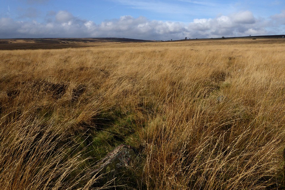
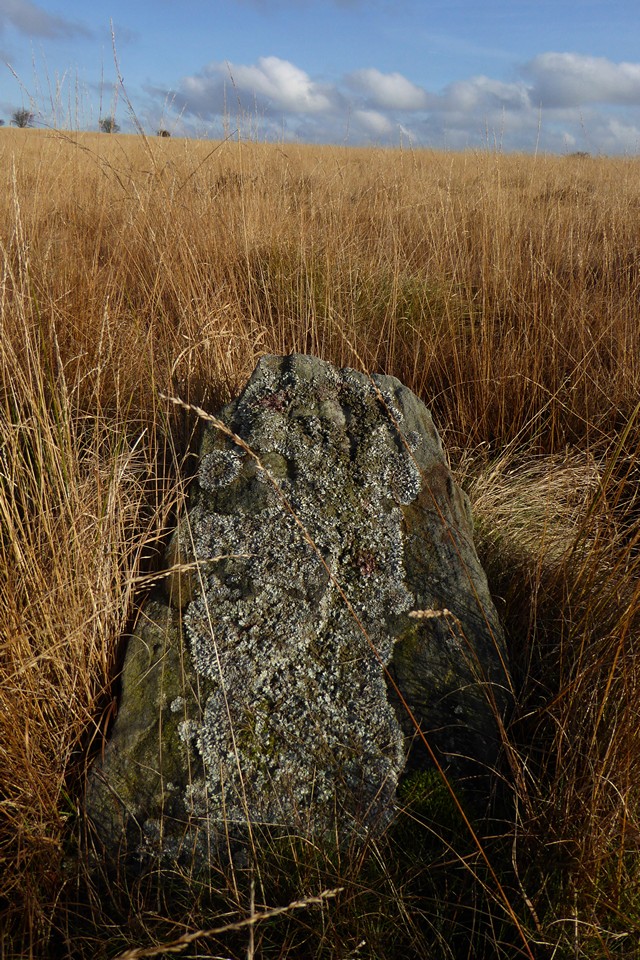
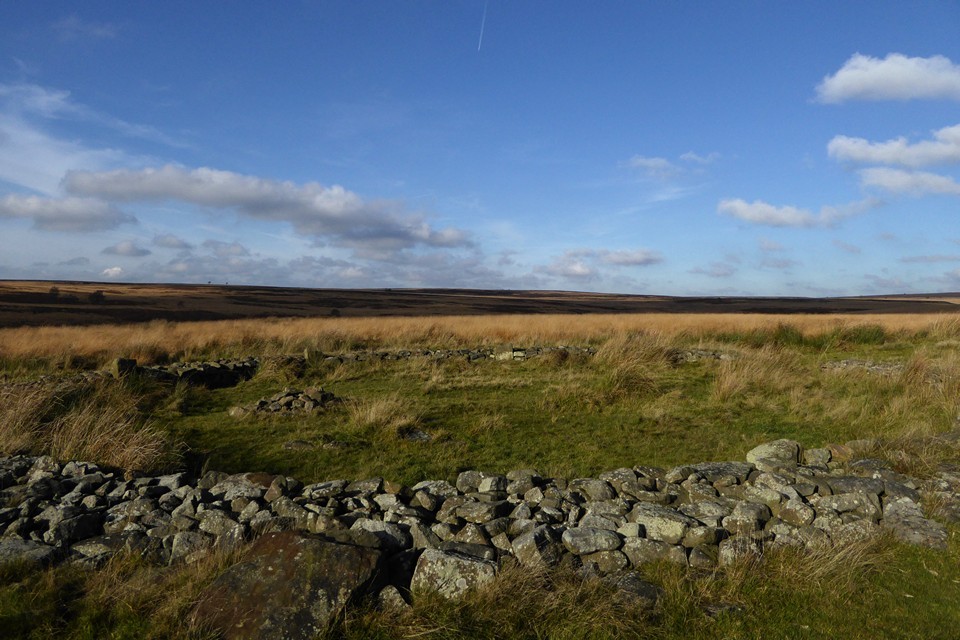
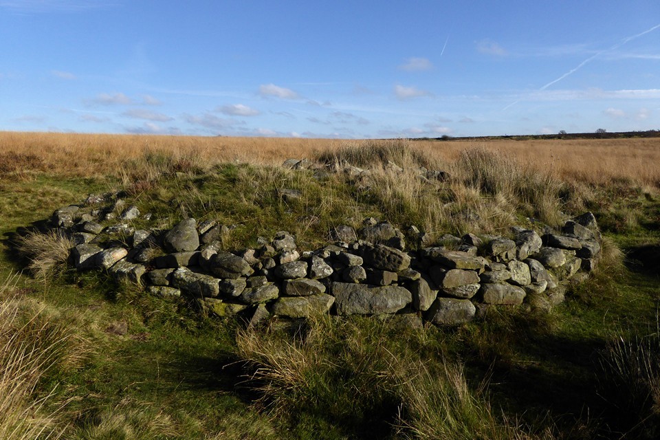
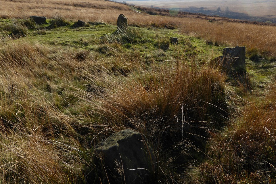
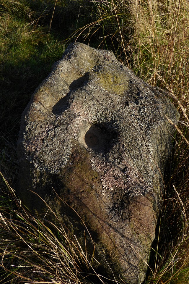
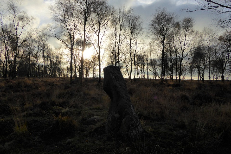
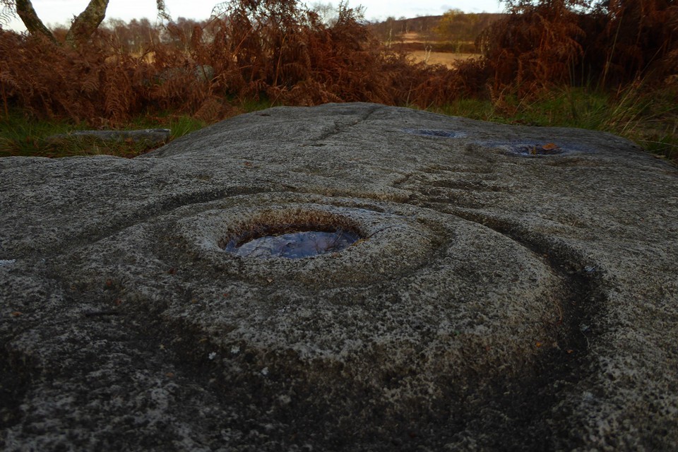
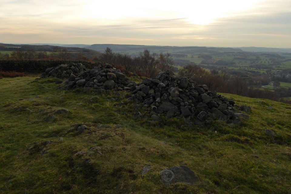
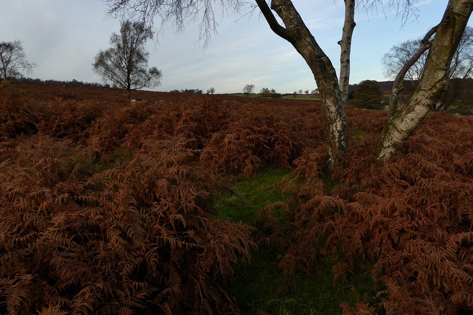
Raving on the Moors Part II – Eyam Moor 10 November 2016 |
Raving on the Moors Part II – Eyam Moor 10 November 2016There is an annual tradition, or perhaps folklore, that says it always rains or hails on 10 November. I try to dispute this but more often than not it turns out to be accurate, so it’s no great surprise to open the curtains to see a heavy shower to start the day. Today we’re going to Eyam Moor, to visit Wet Withens and a cup marked rock that have been on my imaginary visits list ever since we first started going to see prehistoric sites. There was an aborted attempt, round about 2000, when we went to Eyam but never made it beyond the outskirts as the weather closed in. I recall Eyam as a gloomy place, the omnipresent plague history coupled with the grey and damp conditions that day doing little to lift the spirits. We’re off to Grindleford, a small village in the picturesque Derwent Valley, perched just below the eastern edge of Eyam Moor. There’s an initial steep pull up the road out of the village, enlivened by a steadily unfolding view of the moors and edges to the east, now under blue sky and banks of cloud that still carry the threat or promise of more rain. To the northeast is Owler Tor and the prominent outcrop of Mother Cap Stone, to the east Stoke Flat with Big Moor rising beyond. I’m hoping we’ll get across that way the next day. Mother Cap Stone — Images13.11.16ce
The road levels off as it climbs on to relatively flat moorland, with the obvious landmark of the mast on Sir William Hill ahead of us. After a mile or so we arrive at a junction with a rough, stony track heading towards the summit, and finger posts for footpaths heading off northwest and northeast across the moor. We decide to follow the track west, to gain the last bit of height and hopefully take in an expansive view north and west from the summit ridge. Unfortunately, just as we cross the step stile onto the grassy slopes, the rain starts to spit and by the time we’ve reached the trig point it’s become a downpour. We take shelter in a little quarry scoop and don waterproofs. Once we’ve done so, the trailing edge of the shower is starting to pass, clearing the views but leaving a keen, chilly wind in its wake. The views to the west and north are far reaching now that the storm front has passed. The bulk of the Kinder plateau fills part of the skyline, and in front of it I’m pleased to see the familiar face of Mam Tor. There are no prehistoric remains on top of Sir William Hill, even though it would be an obvious place for a cairn or barrow. The summit ridge drops gently to the NNE, and at a modern marker cairn we head more steeply downhill to the northwest, along a clear, grassy path that cuts into and through a dark sea of heather and provides a nice aerial view of our first site of the day. Stanage — Fieldnotes27.11.16ceWhere the ground once again levels off, Stanage cairn sits to the east of the path, surrounded by heather but prominent enough to stand clear of it. It’s a flat-topped mound at least 15 metres across, with a rubble bank poking through the vegetation on its circumference. It enjoys a great view to the north, with Mam Tor just peaking over Abney Moor. The most striking landscape feature from here is Win Hill, which reminds me of the Sugarloaf/Pen y Fal in South Wales. A good cairn in a lovely spot, but the real gem here is the cup marked stone in the edge of the monument. I’ve been aware of this stone for the best part of two decades, simply because I bought a postcard of it in Bakewell bookshop a long time ago. Somehow I’ve never quite found the time to get here until now, but it’s even better in the flesh. The cupmarks are large and cover two sides of the stone, as well as its top. We stop here for a while, watching the wind push the rain clouds of earlier further east, before revealing one last gift, an incomplete rainbow hanging beautifully over Win Hill. There are moments when time stops and lets you breathe, completely at peace. This is one of those, fleetingly brief but eagerly snatched. Stanage — Images13.11.16ce
Carl Wark & Hathersage Moor — Images27.11.16ce
From here it’s a matter of picking a route through the knee deep heather as best we can. It’s slow progress, each open area of tussocky grass between the heather coming as a relief. Eventually we attain the high part of the moor, just as the rain is coming down again. There are a few prominent but misshapen cairns up here, one of which we crouch beside, seeking to bury ourselves and avoid the heavy tail-end of the shower. Once that clears and we can see our surroundings better, it’s clear that we’ve crossed the moor too far south and need to head slightly downhill towards the northern edge of the plateau. Wet Withens — Fieldnotes27.11.16ceAs the sun starts to come out, it picks out a light grey amongst the browns and reds, revealing the presence of the mutilated cairn next to Wet Withins. With that fixed, the eye then finds the darkly curving bank of the stone circle itself, with one larger stone standing out at its edge. Wet Withens is another Peaks site that has lived in my mind and on my imaginary list for a long time. A feature in Burl’s guide, apart from the one swiftly abandoned attempt so long ago it’s eluded me up until now. Rather like Gibbet Moor yesterday, some of the joy of coming here is undoubtedly borne from relief and satisfaction at actually getting here. But as well as that, it’s a terrific site. Bigger than I expected, the clearly defined bank and neatly placed stones make it a wonderful example of the ubiquitous Peak District embanked stone circle. Add to that the colours of the moor, freshly scrubbed from the recent soaking and illuminated by the sun against the dark backdrop of billowing clouds, and we’ve got a bit of a classic going on. Wet Withens — Images14.11.16ce
Eyam Moor Barrow — Fieldnotes27.11.16ceThe barrow is a mess, the shape all but gone, straggling and ragged at the edges. But there’s still a lot of stone here, indicating that the upheaval wasn’t about robbing for walls. And the setting is perfect, better than the circle itself as it’s that bit closer to the northern lip of the moor. The countryside drops to a patchwork of green fields in the Derwent valley, with Hathersage the obvious settlement below. Beyond and above, the hills rise again towards the high uplands above Edale, the moors of South Yorkshire and the edges around Higger Tor. Our rainbow makes its last appearance of the day, a welcome splash of colour against the grey. I should have come here years ago, but it’s still a sweet pleasure to come now. Eyam Moor Barrow — Images14.11.16ce
The folklore rang true, the tradition was duly enacted and the day dispensed a deluge as foretold. But it also provided a long-overdue visit to a wild and windy moor, to sites that have waited long in the mind and now persist in the memory, in a light display refracted through the prism of pouring rain. |
Posted by thesweetcheat 27th November 2016ce |
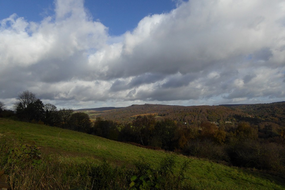
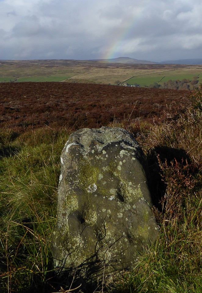
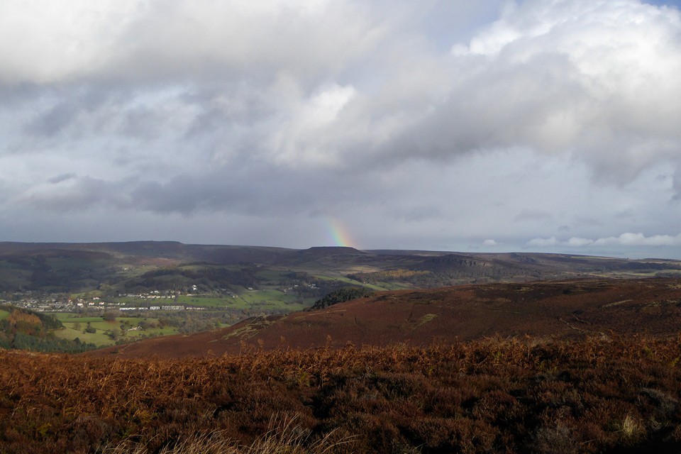
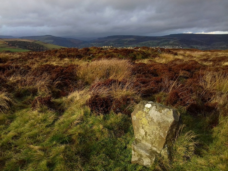
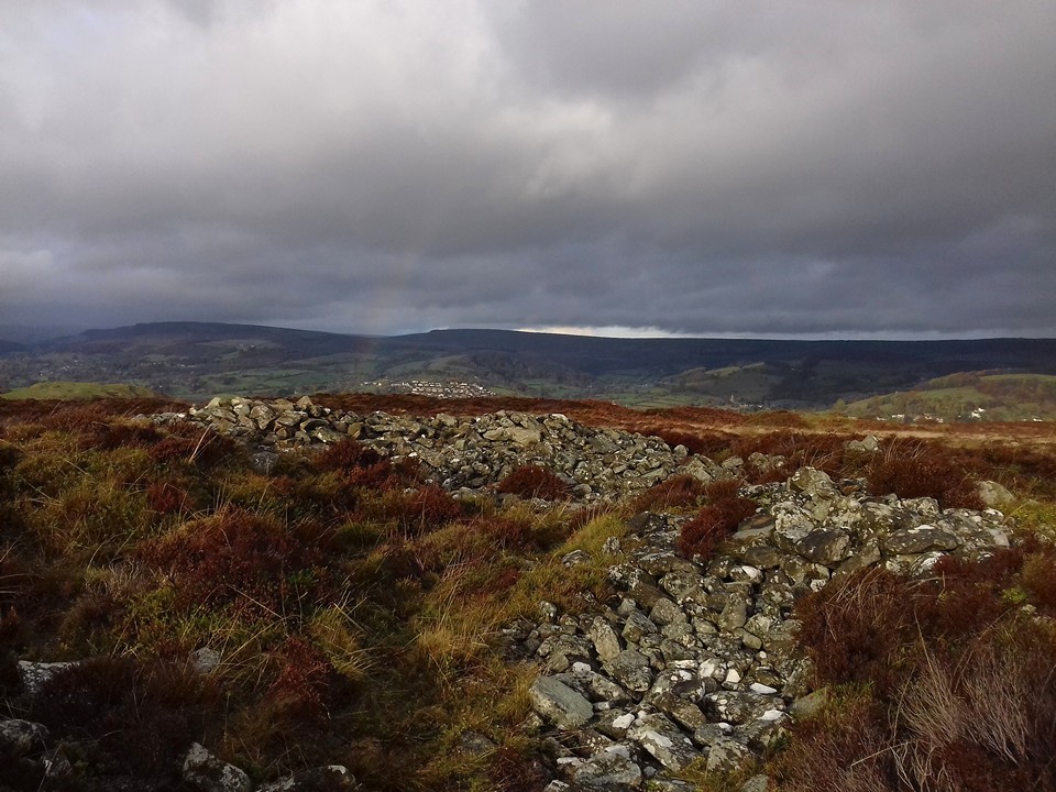
Raving on the Moors Part I – Gibbet Moor 9 November 2016 |
Raving on the Moors Part I – Gibbet Moor 9 November 2016The morning brings snow, the first of this season. It falls heavily on Bakewell, but doesn’t stick. Advice in the coffee shop suggests that if we want to see proper snow we should head northwest to the higher moors and sharper edges, but that comes with the risk of bus cancellations and a difficult journey back. Instead Gibbet Moor wins the right to be the first trip out of this Peak District break, a relatively low moor with an easy climb from the road to the north, perfect for legs reacclimatising themselves to the hills after absence. We start with a bit of a road slog under light drizzle that takes us past Stone Low, perched on the lip of valley to the north of the road. This cairn, once large and impressive, is now little more than a slight rim, a rise in the grass beside fieldwall and beneath trees. Nice position, but little else to see now. Better things await though, and we’re keen to get off the road and onto the moor. Stone Low — Images12.11.16ce
Gibbet Moor North — Fieldnotes23.11.16ceGibbet Moor is access land, and we make our way uphill, along a sturdy track running southwest from where the road crosses Umberley Brook. TMA shows all sorts of sites up here, but I only have eyes for the stone circle, three stones remaining of what might be a rare non-Scottish example of a “four poster”. I know the circle is somewhere about 500m to the southeast of the point where the track meets a drystone wall. From here the tussocky, reedy grass and patches of heather look decidedly unappealing and lacking in paths, but this is where we need to go. Setting off into the slight unknown, the vegetation isn’t as bad as it looked, low enough to step through without snagging ankles and feet. But it is wet, and within 20 yards of leaving the track my feet are soaked in my old boots. Nice. We wander around the gently sloping hillside looking for small stones in every reed clump and heather swell. There are plenty of stones, little stones, bigger stones, outcrops and individual rocks. But nothing resembling three stones of a circle. At one point I head towards an odd looking line of upright pallets, but nothing leaps out from the grasses. We’ve been going around in circles for about 40 minutes before I finally decide to look properly at the photos on TMA. The first couple are by Stubob, one showing the recognisable dark swell of East Moor, the next looking north across the valley towards a distinctive clump of trees on the opposite hillside. The conditions are different to our dull grey skies and distant snow, but the landmarks are unchanged. Getting to a position where both photos match the view from where we are involves heading into a particularly soggy patch of reedy grass, close to one of the pallets I noticed earlier. And suddenly, there they are: three stones, unmistakeably slim and upright, their heads barely poking above grasses. Without Stu’s photos we’d probably still be there now, so much gratitude is due to the Peaks pioneer. The lengthening grasses are threatening to drag the stones under, appearing quite a bit taller than in the previous photos. But despite the soggy setting and the even soggier feet, despite the small size of the stones and the absence of a fourth stone, I really like this site. Perhaps it’s partly the sense of relief and satisfaction at actually finding the circle, but it has a lot of charm. The views to the northwest and north are fine, across the valley and out to the distant edges. At this time of year the reedy grasses are a lovely shade of orange, which sadly the recalcitrant sun fails to properly light while we’re here. The stones are well chosen, shapely and lightly tapering. Whether this ever was a four stone circle, or just a three stone setting, I guess we’ll never know. But it’s well worth a visit, just wear something waterproof on your feet. Gibbet Moor North — Images12.11.16ce
Gibbet Moor and East Moor — Images13.11.16ce
Reaching the top of the moor, the views northwest open up to reveal a good coating of snow on the distant moors. The sky over us is closing in again, although there’s no sign of any rain or snow, just a dulling of the light giving the impression of dusk even at this early hour of the afternoon. The track edges southeast alongside estate wall and dense treeline, gradually climbing to the crest of the moor. The snow cover is a little thicker here, although you would be hard put to find enough to build a snow fairy. The next stop-off comes into view, heralded by a boggy bit of path and an information board. Hob Hurst's House — Fieldnotes23.11.16ceWe came to Hob Hurst’s House on our second Peak District holiday, pretty much exactly 18 years ago to the day. I remember a walk through the woods above Chatsworth, then crossing a boggy and wet moor under increasingly heavy rain. We were ill-dressed for open November moorland in the rain, and our first visit to a chambered tomb left both of us soggy and underwhelmed. Since then we’ve been to a lot more prehistoric sites, and I’ve wanted to return here for ages. Funny how your memory is both accurate in details and completely faulty in the broader picture. As soon as we get here, I instantly remember the shape, size and layout of the mound with its squared-off bank and ditch. But I don’t recall the exposed stones of the chamber at all. I also have a recollection of a fairly flat landscape, perhaps the rain and cloud condensed the world around us that day. Today the views to the south are extensive and sweeping, taking in the deep valley of Beeley Brook, with the sharp line of Harland Edge above, then onwards to rising ridges and long hillsides fading into grey. The unmistakeable feature on the skyline is Minninglow, for all that I’ve never been there. For the second time today Stubob’s presence in these hills is palpable. Eyup Stu. We stop here for a while and have a proper look at the chamber, noticing that the mound itself appears to be built at least partly of stone, another thing missed the first time. It’s too damp to sit and my wet feet are beginning to make me cold, and in any case there’s one more reacquaintance to be made today, so we head off downhill, following the line of the wood until we reach a field boundary. Hob Hurst's House — Images13.11.16ce
Minninglow — Images13.11.16ce
Park Gate Stone Circle — Fieldnotes23.11.16cePark Gate stone circle is not visible from the track, so it’s a matter of following the route until it starts to turn northwest, where another fainter path heads off north onto the moor again. There are a couple of stones in the circle that are big enough to stand above the reedy grasses, so it’s a lot easier to see than Gibbet Moor was earlier. This is the second revisit of the day, as we came here in 1998 on the same day as Hob Hurst’s House. At the time it was the fourth stone circle I’d been to, after Arbor Low, Nine Ladies and Nine Stones Close, three of the Peak District’s big hitters. So it’s probably not a great surprise that it felt a bit of a disappointment after those sites. Although there are at least ten stones in the circle, many of them are small and overwhelmed by the tufty, reedy grass that surrounds the site. The biggest stone, on the southwest of the circle, is leaning at an alarming angle over the top of a pit that threatens to swallow it whole if it ever goes the rest of the way. The most striking stone is the one on the east, a shapely upright with what appears to be at least one cupmark and some other dents that are apparently bullet holes and do have a ragged outline. This is the stone I remember from our first visit, and indeed the only one that I have a photo of. For all that, it’s actually a really good circle. In the 18 years since I last came, I’ve been to a lot of wrecked, dishevelled, uncared for, ploughed out, vandalised and generally unloved sites. So although there’s also been a lot of awe-inspiring, stop-you–dead-at-50 paces classics over the same period, my expectations are very different to how they were back then. Now, I see a fine circle in a good setting, looking towards Harland Edge particularly. It could do with a de-vegging, as the long grass is detracting from the sense of the whole site. Circle stones needn’t be enormous to make an impression, as anyone who’s had the pleasure of Cerrig Duon or Nant Tarw could attest. But they do need to be kept visible, and a judicious tidy up here would do it wonders. The only disappointment really is the terrible dullness of the day. It’s not even 2:30 but it feels like dusk, as though the sun has given up and set early, leaving a crepuscular greyness to the scene, even with the autumn colours of the moor. We head back to the track and head west. Park Gate Stone Circle — Images13.11.16ce
Beeley Moor — Fieldnotes23.11.16ceThe final site of the day is Beeley Moor ring cairn, an easy visit as it’s right next to the track. So near in fact that the track is slowly nibbling away at its northern arc. The monument itself is quite heavily overgrown with heather and scrubby grass on the circumference and bracken in the centre. Stones protrude from the bank here and there. It’s reasonably upstanding, but worth a stop off mainly for the excellent views down to the valley below. Beeley Moor — Images13.11.16ce
From here the path starts to descend more steeply – I have no memory of this being an uphill slog on our first visit, where we came from the opposite direction. At length we reach a step stile over the estate wall, and head into the lovely woodland of the Chatsworth Estate, eventually emerging into the park for the last walk into Baslow as dusk falls, for real this time. As well as the visit to Gibbet Moor, it’s been wonderful to return to Hob Hurst’s House and Park Gate after so long, the longest gap between visits of any sites we’ve been to. The intervening years have sharpened the interest, provided a lot more context and perhaps some better understanding. It feels rather like coming home. |
Posted by thesweetcheat 23rd November 2016ce |
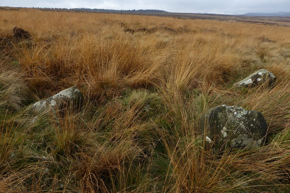
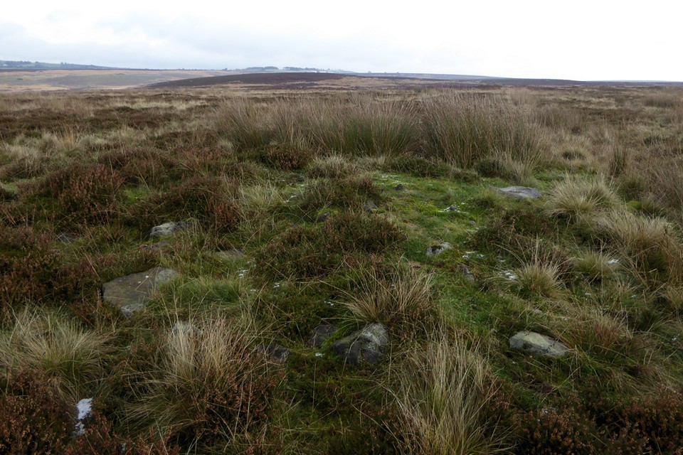
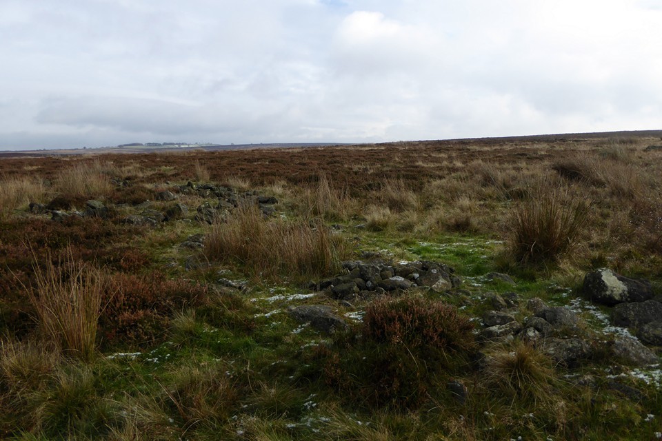
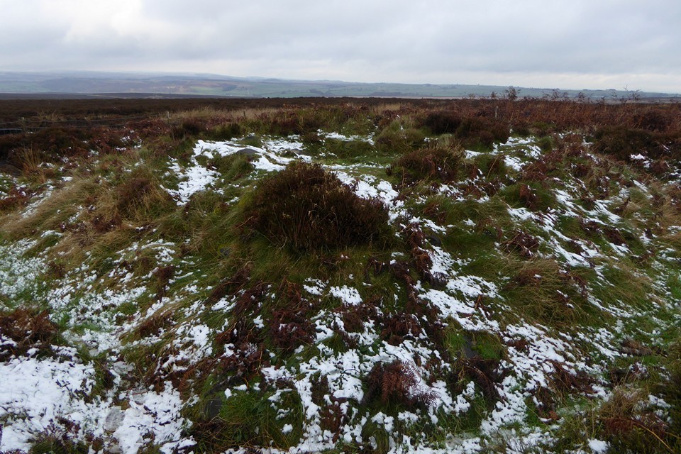
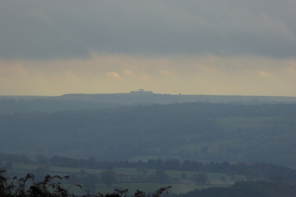
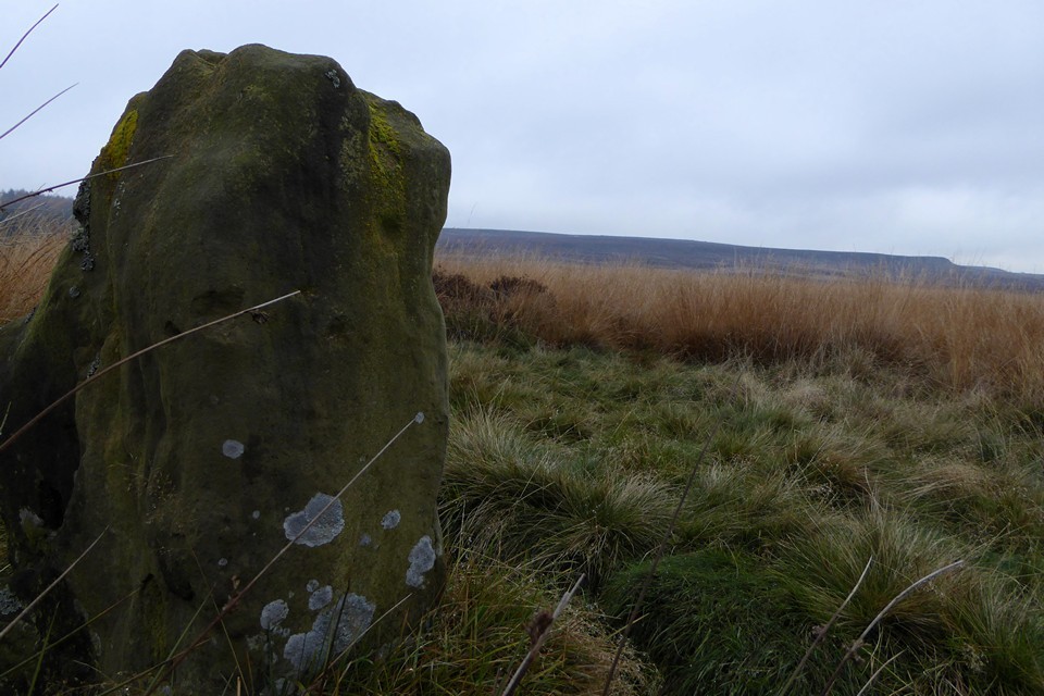
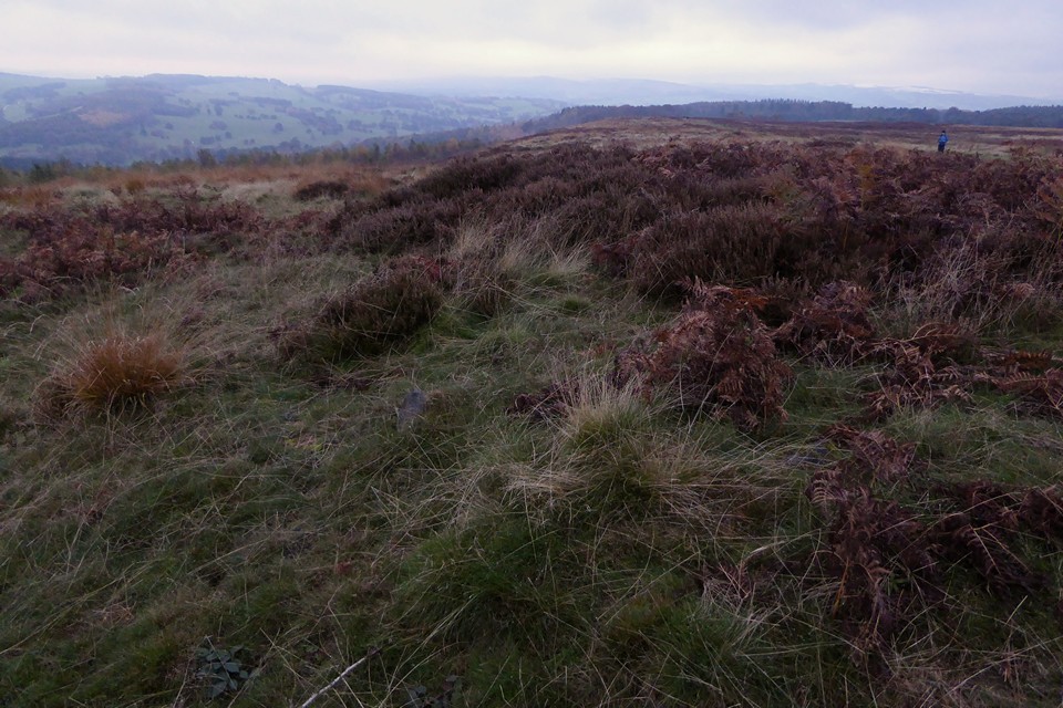
Showing 1-25 of 781 posts. Most recent first | Next 25