A Holyhead bloodbath
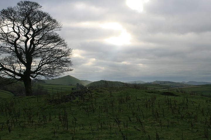
I've just been to the big white stones of Henblas cromlech, and was very disappointed to find the footpath overgrown and never used, but it still didn't take long to beat a path through the undergrowth, I very much enjoyed my time here, until I received a phone call asking if the kids and me wanted to go out for tea at the Plough, I said OK even though it meant a visit to Trefignath was not going to happen, but I was adamant that the burial chamber that no ones ever heard of near Holyhead would not escape my attention. I found the path back to the car more easily on the way back, aint it always the way.
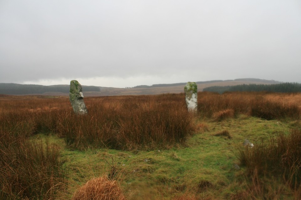
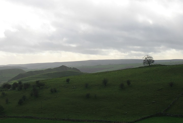
Back in the car I put my foot down and soon we were going the wrong way in the mental labyrinth that is Holyhead, god I hate this town, cant really say why, it just seems a hopelessly depressing place, the best thing about Holyhead is the road and ferry out of it. Sorry, perhaps its me, not you. Eventually after much cursing I found ourselves on the wrong side of the island and stuck behind the worlds most inconsiderate motor home driver, ever. I've only got a short time before we have to start back, I can feel my hackles getting up, but happily we parted company at the turning for Penrhos Feilw, which we passed by with no more than a glance. Once the two standing stones were out of view behind us I started looking for a suitable place to park.
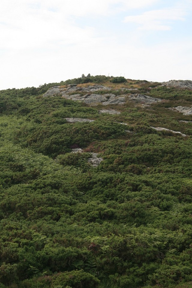
Having not found one I squeezed in at the side of the road by an opening for a horse paddock, as I wasn't going to be gone long I left daughter in the car with her I phone and two big horses for company. I jumped the gate and started off, over another fence and I was in the open countryside. I could see the upright stones on top of the hill, not far away, 300 yards if that. But getting there was proving difficult, walls of thick gorse blocked my route, and I had to weave a path of my own around and sometimes through, it hurts does gorse, I don't like it, not one bit. The going was hard and time was short, I got to a likely looking rocky outcrop from which to look over the sea of gorse to the site i'd come to see. Crap ! I'm not wading through that lot, I sat for a minute, then decided that I would actually wade through that lot, it's nearly a hundred miles from my house, am I really going to give up when I'm so very close......nope.
I sent a text telling them I would be a touch late for tea.
I actually found a good path through the vicious barbed gorse, it took me all the way to the foot of the Gorsedd, only to be faced with a twelve foot vertical rock climb, I don't like rock climbing, like football it all seems a bit unnecessary.
I struggled through the shaky legs and came out on top, just, I threw my hands up in the air and said out loud nature nil, postman 1.
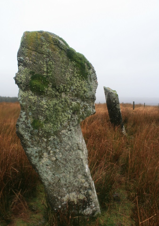
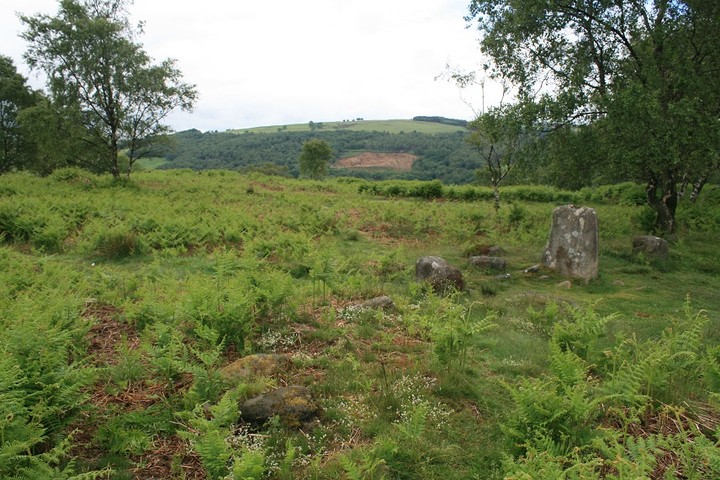
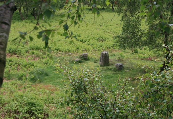
This site is not on any map, thanks be to coflein for pointing it out to me.
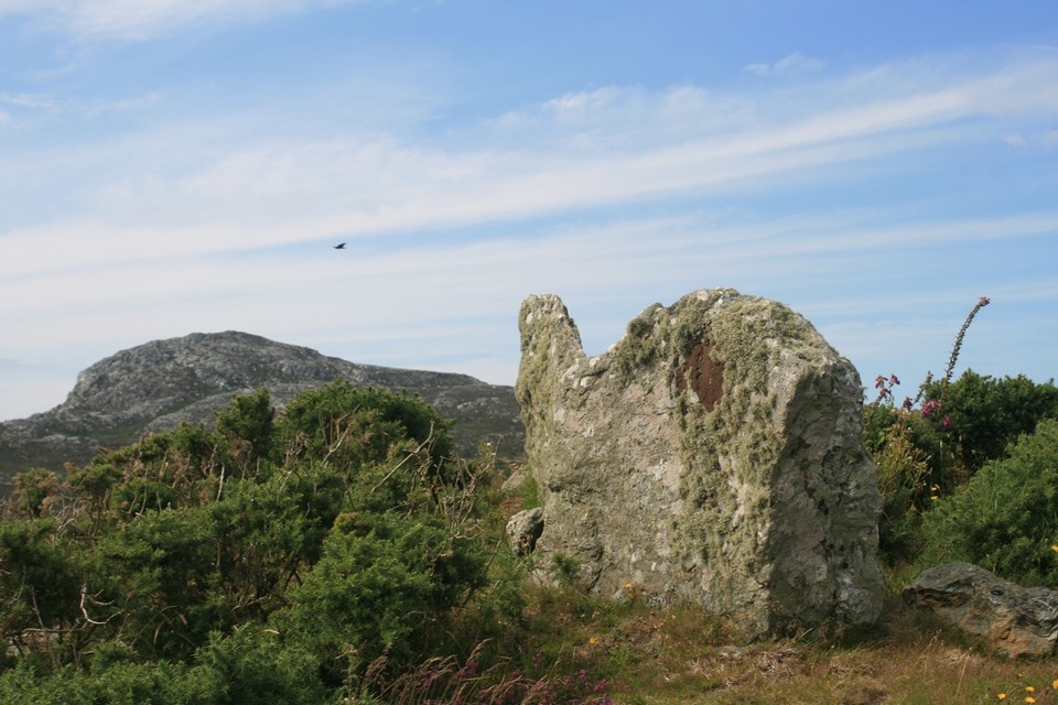
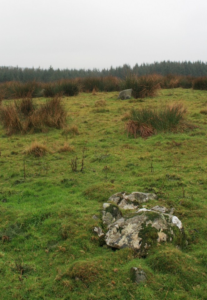
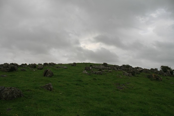
Only three stones remain standing of the chamber or large cist, and maybe a couple of kerb stones hiding among the gorse, by now I've decided not to call it gorse anymore, but by the more colourful
name of M*t**r - F*c**r, that's a bad swear word there.
All the time I was here a Buzzard circled me overhead screeching, if this was a western film it would soon be curtains for me.
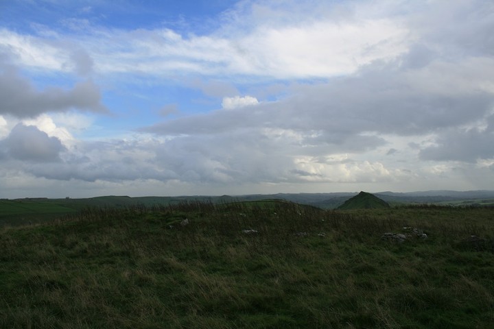
The view was terrific, north is the Holyhead hut circle group and the fort on the mountain, south is Angelsey giving way to distant Snowdonia, east and west is the Irish sea, and of course that little town.
But, all too soon I must go, I scrambled back down the cliff and followed the path back to where I got on it and then passed that place, only for the path to stop at a dead end, the grass was well trampled, sleeping horses, frolicking humans, or even a Bigfoot nest (they're everywhere you know ).
This is where my time in hell began, I could see no way out, there was nothing for it but to simply wade through the m****r - f***r. Growling, shouting and swearing at the top of my voice did nothing to stop the pain. I remember a wally from long ago saying he was impervious to m****r f****r pain, I didnt believe him then and now I know he was lying. It was like being attacked by a dozen Leprechauns with sharp swords. Every now and then brambles would grab my leg and threaten to pull me over, once when I did go down I lay there for a few seconds thinking "oh well, so this is where they find my body, if you're going to die in the countryside this isn't a bad place to buy it, my ghost wouldn't half laugh at the people who come to remove my body, but lieing down and dieing isn't the postal way, get up man, keep going.
I imagined myself as a soldier enduring some form of jungle warfare, only without the incredible pain in my legs.
Half way back now and i'm so very tired, I look at my hand and it's bleeding quite badly, the sweat pouring off my forehead tastes bloody, and I realise that I've been wiping my sweaty brow with my bloody hand, god I must look a right state. Sometimes it gets easier to move forward, sometimes I'm just stumped and don't know where to go. Continuous swearing seems to have done the trick, I'm nearing the end of my ordeal, my legs are really stinging, I'm dreading having a look at them. Only one barbed wire fence to go, it's covered in brambles, but by now the pain is becoming normal, I bash as much brambles out of the way as I could with my camera bag, lob it over and haul myself over.
I've done it, a plain and normal field to cross and I'm back at the road, what I really don't need now is some Welsh farmer telling me i'm on private property, and that's precisely what doesn't happen, a good job too, I think I might have done away with him.
Next was the priceless look on my daughters face, Dad ! your covered in blood whats happened, now is the time to have a look at my legs. Oh shit look at that, I took a picture of them because in time the scratches will be gone and all this will be a memory. What I really need now is medical attention of some sort, instead I think I'll drive a hundred miles to a posh pub for a well deserved pub meal. One of the good things about going out with my Ex wife and her mother is I can turn up stinking like a torture victim.
So, in summary.
This site is a good one, you will have the place to yourself, views are good, but for the love of god come from the north.
M****r f*****g gorse should be wiped out, extinctified, by flamethrower, bagsy first on that.
|
Walking with Owls in the rain at Drannandow
About three miles north west of Newton Stewart is the tiny village of Penninghame easily reached by following the A714, but the megalithic complex of Drannandow is across the River Cree and there is no bridge here. Either keep going to Clachaneasy and use the bridge there or start from leaving Newton Stewart by going to Minnigaff. Look for an eastern turning to the less than a mile away Drannandow Farm. We parked just the other side of the farm.
It was still persisting down so Eric decided to let me have a wander round the wilderness on my own, suited and booted in waterproofs from heaven I set off up the track at my briskest pace.
Several gates need to be opened and closed and after less than a mile turn right onto another track. On the highest ground immediately right of the farm track is the stone circle and cairn of Drumfern.
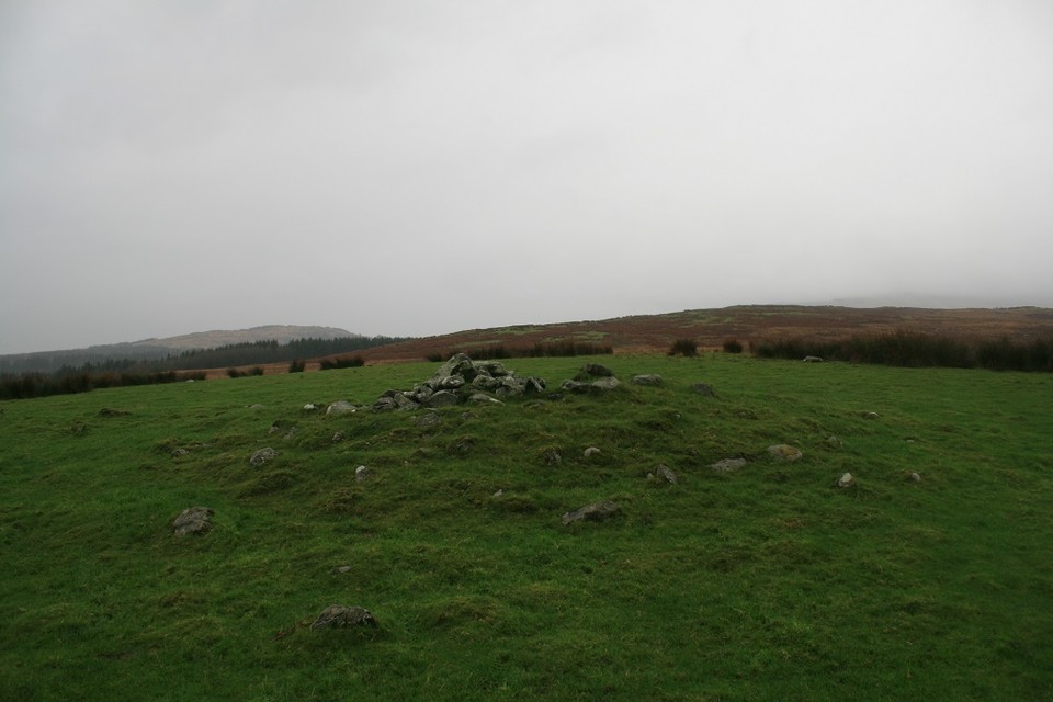
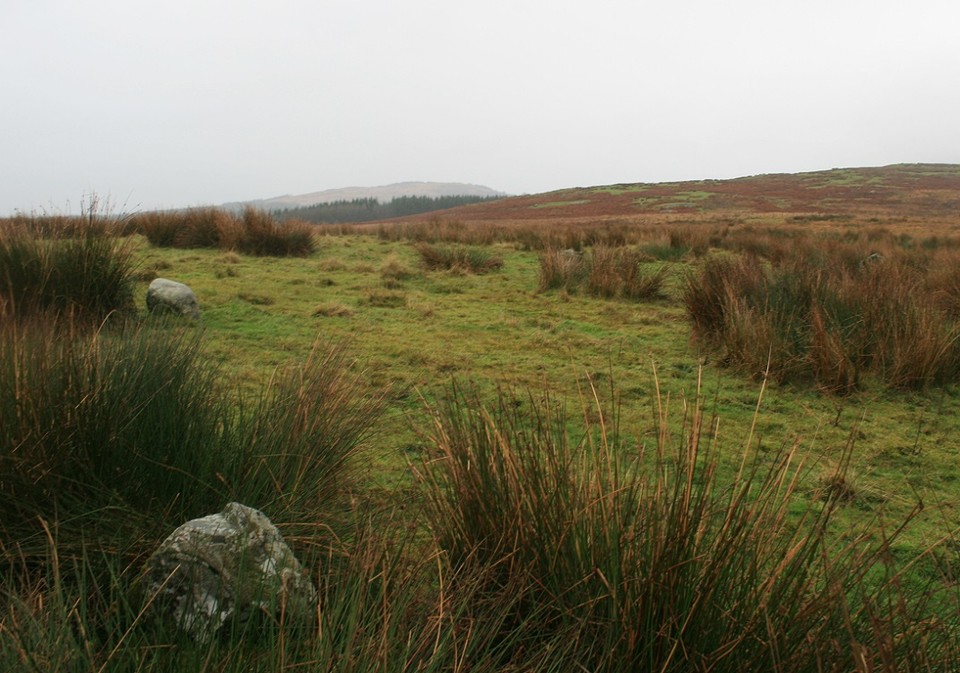
I was looking for the cairn first as it would be I hope, the easiest to spot. It was, the rain and poor visibility didn't add much to the atmosphere, the atmosphere could best be described as drizzly. About one meter high and occupying a good lookout position the cairns extremities have grassed over leaving the cairns high parts open to the air. My dad once said "seen one stone circle seen them all" I disagree strongly but with cairns he might have got away with it.
About fifty yards away going back to the track I eventually found the remnants of Drumfern stone circle. There are many stray small boulders that may or may not have once been part of the circle, this makes pinpointing the ring a touch less than easy. But it is there, Only three or four stones are still up standing, hiding amid the long reedy grassy bunches that like to hide circle stones. One rough stone is almost a meter high the other two or three are smaller smoother boulder like stones.
I quite liked it despite it's near destruction, finding the stones that describe the circle is a bit like putting an easy jigsaw together, or doing a child's crossword, maybe.
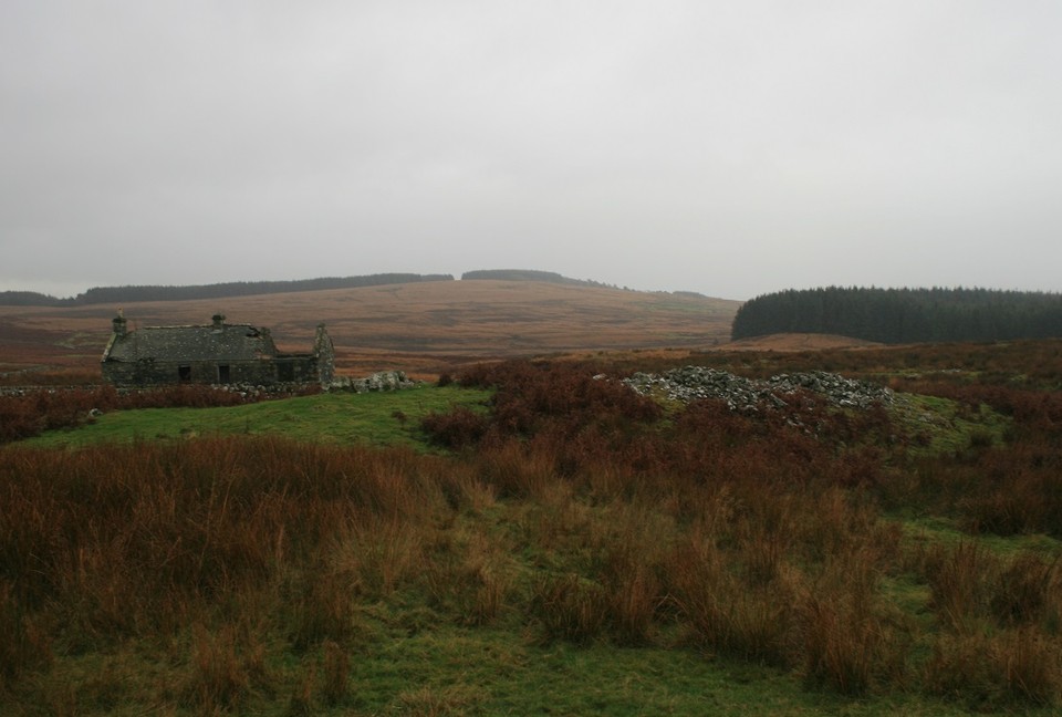
Seeing as I found the circle quick and easy enough I decided to try and see all that was here in this little complex. Heading further east along the farm track I enter the forestry part of the walk. Creepy places at the best of times, strange sounds followed me round, one time I thought I heard a car behind me but there was nothing there, creepy, at least the trees shaded me from the incessant rain. Coming out of the other side of the forestry block keeping to the track for another four hundred yards I came to Drannandow chambered cairn right next to a ruined cottage apparently called Nappers cottage.
This was the scene of my all time bestest nature moment, as I approached the cairn and the cottage a big white bird launched off the ruin and flew away, at first I thought it was a seagull, but then another one flew off, this time closer, I could clearly see that it was a Barn Owl, 45 years and ive only seen Barn Owls twice, now ive doubled my tally in a day. The spirit of Nutkins came over me and I walked over to the ruined cottage in a trance, looking through a window I decided it was too perilous to go in it so I walked round and looked through another window and there on a roof beam was another Barn Owl not ten feet away from me, it screeched at me as it flew away looking me in the eye as it went past, I have not been that close to a raptor outside of a falconry display. I reckoned it would not matter what stones I saw that day, that Owling moment would be the highlight. (Barn Owls are the quietest fliers, even their feathers have feathers).
One of the Owls perched on a nearby gatepost and watched me looking over the chambered cairn, oh yeah right, focus, stones.
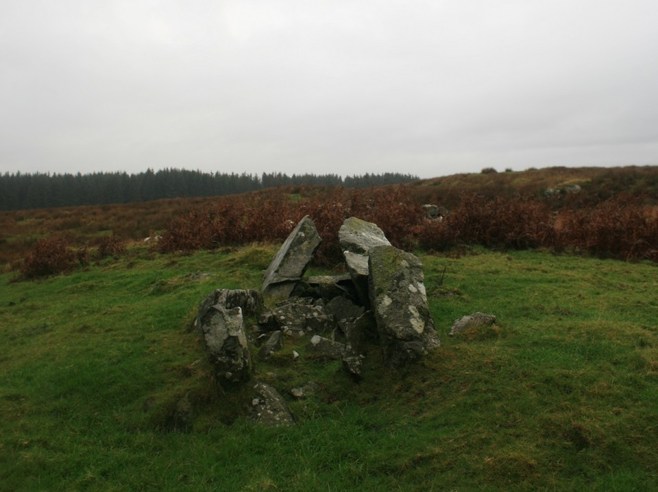
Five, yes five chambers there are in this cairn, the eastern chamber is the biggest, but it looks like it's been tacked onto the side of a roundish cairn and made it into a longish cairn. The north west chamber is pretty good too, but the other three are full of rubble and covered in ferns, making them hard to distinguish. The whole thing is on the large side and really quite impressive, long views south across the moor.
From here there are two other cairns on a south south west alignment, the furthest can just be seen on the tree line of the forestry block I just walked through, and the other is nearer to the cottage, but because of the crappy weather and time constraints I decided to let them go, which was a stupid shame because the middle cairn has a cist, still with it's capstone in place, I now wish I'd gone over for a nosy.
But at least there's still a couple of large standing stones to be seen, I'd glimpsed them as I came out of the trees, so I knew where to head for. But it didn't make getting there any easier, bogs, streams and springs all wanted to soak me or even break a leg.
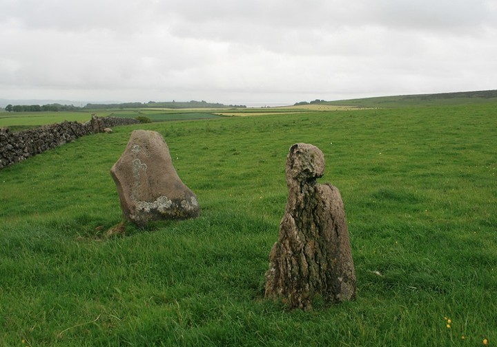
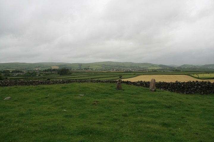
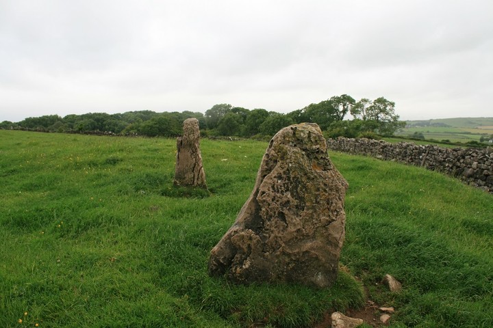
On approach to the stones they looked very dark, black almost against the moors light brown colour. Standing next to them they are both taller than me, 6ft 8' and 7ft 4', and covered in mosses and lichens. Big brown cattle eyed me suspiciously as I stumbled this way and that, I put on my best Scottish accent and told them not to worry I'm a Postman.
The Thieves they are called, it says so on the map very clearly, traditionally they're said to take their name from the fact that several free-booters were executed at them in the 14th century. Kill them all I say (what is free booting?)
Whilst I was there I could see a very clear rubble bank, like what you get on embanked stone circles, the two tall stones stand on this bank 14 feet apart, research later explained the bank away as modern, but, well, what could it be for? mysterious.
The two stones are very good menhirs, one of them is a very unlikely shape, I like unlikely shaped standing stones, they are so......unlikely.
But that is all the time I can spend at Drannandow, Eric, food, and Glenquicken await.
Owls are brilliant, but seeing them is better.
|
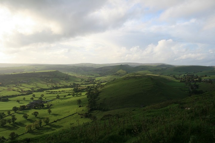
High ridges and deep caves.
An hours drive east of home is Buxton, one of the main towns of the Peak district. Ten minutes south of Buxton is a village called Earl Sterndale, it's two nearest neighbors are Glutton Bridge and Hollinsclough, it is to this area, with it's distinctive hills many cairns and archaeology rich caves that my mind and wheeled wagon has been turning.
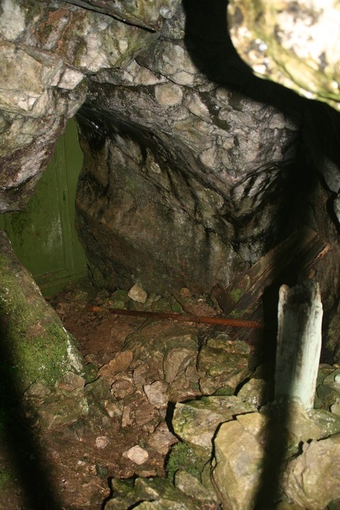
I first came here one drizzly morning seven years ago, principally to locate and explore Dowel cave. But not knowing it's exact whereabouts I blundered around looking here and there, scrambling up and down sheer cliffs, coming face to face with a fox and sheltering from the incessant showers, during these blunderings I came upon a small cave entrance, it wasn't the cave I was looking for, I had a poke at the metal shield that kept stuff out and it fell over, on it's own, it came off in me hand, so I went in.
The cave entrance has been deliberately blocked, in it's natural state you could just walk in, now you must crawl worm like down and through. It's bigger once you are in, there is a sign pointing to the back of the cave on it says Staffs L D W A Leek moors, I was taken a back that's for sure, the leek moors must be five to ten miles away, can this cave go that far. I didn't test this assertion. So I left.
Eventually I found the cave I was looking for, Dowel cave is more open than the other, you can walk straight through the ahem...vagina shaped opening, but the further you go the more you must crouch and in the end go on all fours. I didn't go further, my only light was the camera's flash.
That was my first time. The cave turned out to have a name it was Etches cave.
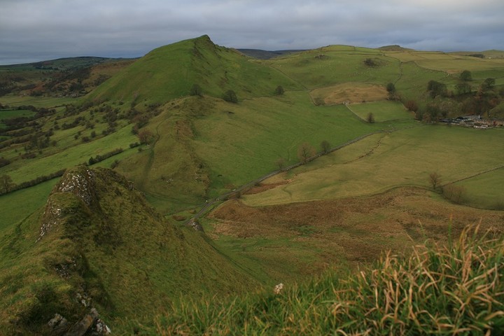
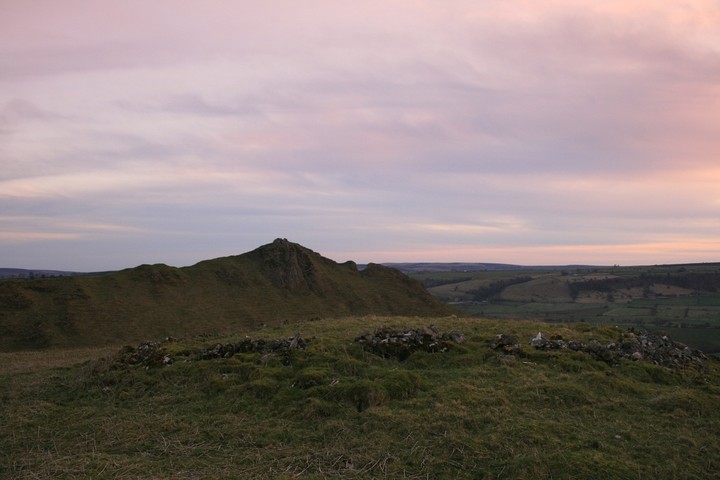
The next time I came the weather was much more conducive to climbing the two main hills here Parkhouse hill and Chrome hill. I started with the latter.
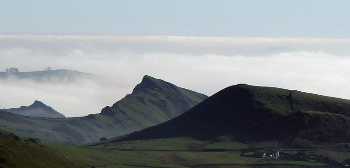
Chrome hill has had songs written in its honour, by a Norwegian jazz group no less. Map doesn't say how high it is, but it is Glastonbury tor sized or a little bigger, cut in half long ways, and right at the very top my legs shake and I must crawl around on hands and knees lest gravity pull me over the side. It's from here that I watch a perfect summer sunrise, the suns warm glow slowly filled the valley below me, across the valley I can pinpoint Etches cave. Turning north is the long side of Hollins hill with it's very obvious cairn on top, I make a mental note that it's imperative to climb it one day.
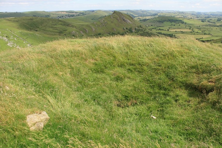
But not today, south from here is Parkhouse hill, a truly great and over sized giant whale breaking the surface of the sea of grass, this hill turns out to be harder to get up.
After some aborted attempts I find the easy way up, from the east. Although this raised ancient coral reef, is lower than the other, Chrome hill, for both are such, it is much more perilous, the narrow ridge that one must traverse is like a grassy mellowed out Crib Goch, certain death one way, presumed death the other. The summit is two rocky prominences, that I wedge myself between, lest gravity get it's way, the whole place no bigger than a small kitchen, I move about very carefully. From here the two main points in view are the very obvious cairn on the next hill over, and High Wheeldon and it's Fox hole cave, all places I must go to if i'm to know and understand this place better.
Too many years later,
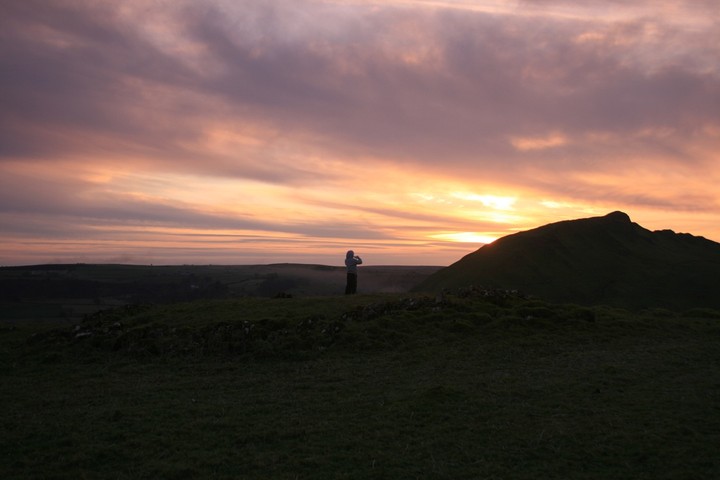
Eric and me are up at Hatch-a-way hill cairn, the next hill over from Parkhouse hill. It is a very good cairn, like a Llyn Brenig platform cairn, wide, high and much stone, but the view down to the valley below Chrome hill, as the sun sets and the nearest moon for a century rises behind us, is a site that words do no justice, if an over chatty nine year old is silenced it must have been pretty good.
A year later
Eric and his mate Luke accompany me up to the cairn on Hollins hill, a large grassy doughnut, with some stone showing through in the scooped out area. The sun was out but the wind was high, and with two energetic ten year olds this was never going to be a long hang out. Perhaps the two caves could hold there attention for a little longer. The two things I took from Hollins hill, was the good cairn, and the sensational view down to Chrome hill, and beyond it to Parkhouse hill.
Armed with torches and the go anywhere attitude of children sadly lacking in a sense of self preservation, we got back into Dowel and Etches, and went as far as we could without crawling on hands and knees, both caves undoubtedly went much further than I dared take my two carefree charges. Interesting to note is the list of the things freed from the soils in both caves......
From Dowel cave,
It had been used in the Mesolithic, Neolithic, Beaker, Bronze Age, Iron Age and Roman periods, but mostly used as a Neolithic burial-cave. Under these deposits was found Late Upper Palaeolithic material, which included flint tools, charcoal from a hearth, fragments of antler, and pieces of bone showing marks of cutting, radiocarbon dates from an Antler showed the cave was used around 9200 bc.
And from Etches cave,
Finds included three pieces of worked flint, sherds of a Bronze Age collared urn, two worked antler fragments in association with some animal bones, a range of faunal remains including bear, reindeer, hare and cat, and a bone point of possible Upper Palaeolithic date.
So both caves were important places in the past, all of the past apparently, especially Dowel cave. Also worthy of note, just a few tens of meters from Dowel cave entrance is the site of water pouring from a very small cave, a strange thing, water spontaneously gushing from the ground itself, a gift from the Mother.
Just a couple of months ago I took Eric and the dogs up High Wheeldon, it has a cave, barred to the public by iron gates and bricked up interior. Another Neolithic burial cave, with the oldest known bones from the White Peak, also used in the Paleolithic, plus much more. So another special place, one that was passed down through the generations, perhaps becoming more special over time. Barrows begin to be built on all the hill tops in the Bronze age, yes they are all on hill tops but they do have a view of a cave or Chrome and Parkhouse. From Pilsbury cairn High Wheeldon takes on a Pyramidal form, but from Cronkston Low the hill has it's side to us.
This last Thursday was my latest visit to the area, Harley Grange barrow had pointed itself out to me so I made a special trip there to see what was where.
The barrow itself is perhaps the largest in the area, it has an old wall crossing lowly over it's back, and many badger holes, I presume them to be badgers only because I've never heard of Red Deer digging burrows.
The positioning of this big barrow at first puzzled me, it occupies the end of a downward ridge, why wouldn't they put it at the top of the hill ? I wondered, so up I went to see if there was already something there, there wasn't.
Its positioning could only be reckoned from where it could be seen from or what could be seen by it, it was definitely projecting it's presence southwest to southeast, so that's from Fox hole cave to Chrome hill.
After the big barrow I decided I've enough time to re-climb Parkhouse hill, perfect parking and knowing the way propel me there quickly, and soon my legs are wobbling as I traverse the narrow way up. The summit has two rocky prominence's that I wedge myself between for safety, all in all it is a small place and down there wants you to come to it very quickly, I try to keep still.
From up here it all becomes clear, North is Chrome hill and looking over its shoulder is Hollins hill, not all of it just the bit with the cairn on it. Turning right we slow down over Stoup High edge cairn, over more still to Stoup High edge cairn more still to Upper edge cairn. Far below Upper edge cairn are the two deep caves of Etches and Dowel. Immediately north is Hatch-a-way cairn and above that Harley Grange cairn, East is Hitter hill with it's cairn that I haven't been to yet and beyond that High Wheeldon and Fox hole cave, near there barrows fade off into the distance for Arbor Low is just a couple of small hills away.
So why is this place special ?
Does it start in the Paleolithic, or the Neolithic when burials were taking place in caves that go on for ever, or the Bronze age when the barrows and cairns were going up.
Or is it the very distinctive almost alive hills they have here, the perfect dragons back of Parkhouse hill, the higher half dome of Chrome hill, the Pyramid of High Wheeldon. Or is it the water that magically flows through the valleys.
Or is it all these things.
It is most assuredly a special place.
|
I'll just take a quick picture of that.
It's been a long time coming has this trip, conceived of more than a year ago, everything has come together, like a Hannibal-plan, "well".
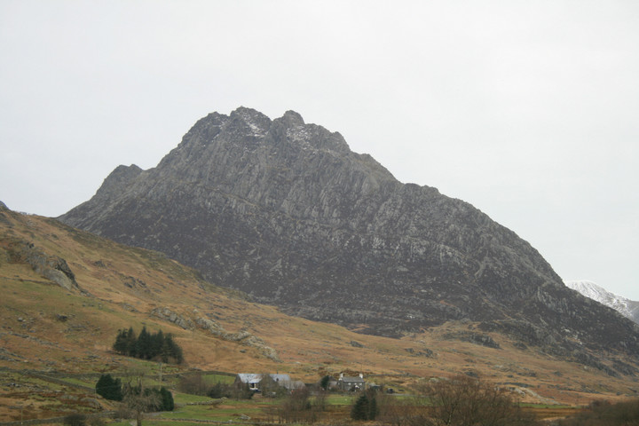
For weeks I've been envisaging the kind of weather I'd like to have whilst climbing Tryfan, warm, blue skies and small fluffy white clouds. How hard can it be ?
The weather reports and the drive along the A55 reveals the heat wave has indeed still got some legs in it, so we make hay while the sun shines because all too soon normal scheduling will be resumed.
The car park at Idwal cottage at the west end of Llyn Ogwen was full, but the first lay by down the road had many parking spaces. For the first time ever I'm preparing to climb a mountain in just a T shirt, there are trousers and boots too, to be sure, but it aint gonna rain or be too windy. Perfect, now wheres me camera ? ummmm, Oh yeah right it's in the hall at home just feet from the front door, presumably where I wouldn't forget it.
Absolute and complete consternation .
The walk starts up some well laid steps, but soon fades away into grassy oblivion. This part proves to be the hardest part of the walk, no clear path over uneven ground, leaping over streams, it's well hot, and still loads left yet. We head for a big high waterfall and luckily meet up with the main path, another well laid affair, this path takes us up to llyn Bochlwyd. A vaguely kidney shaped beautifully reflective lake, slowly being heated by the over enthusiastic Sun. The views from here are wonderous, east is our companion for the day rocky Tryfan, south is the massive rock wall that is the north face of the Glyderau, west is Y Garn, Elidir Fawr and Carnedd y Filiast, also made of rock, and north is Pen yr Ole Wen and the Carneddau, strangely more rock there too. This is the home of the Rock Gods. Plus two low flying screaming Hawk jets flew through the valley, at the same height as us, you don't get that at an air show.
From Llyn Bochlwyd we can see the path wending it's way up to Bwlch Tryfan, it's from there that the walk starts to get interesting, with added interest.
The walk from the lake was a good one, easier, and it's good to be able to see where the path goes and where it ends.
Had I a camera I'd take a picture about now, several maybe.
Sooner rather than later we reach the wall that separates east and west Bwlch Tryfan follow the wall south and your in a world of hurt, Bristly ridge to be exact and it wears its name well. North and the wall goes up to a Tryfan subsidiary peak, far south peak to be more exact. We follow the wall north but skirt around the bottom of south peak. As we approach the start of the climb up to the Adam and Eve central peak a group of walkers are just getting to the bottom of it, surely they have got turned round somehow, they are coming down what looks definitely like the hard way, we move on and find the right way, it looks like the easy way, steep but exhilarating, tiring but a good cardiovascular workout, beautiful but with no camera I feel like a buffoon, a prize banana. Look hard, and remember.
A very good scramble ensues, I'm sticking to the rock like spider-man, probably because the sun is melting the rubber souls of my boots, not really, but I am feeling confidant, like I already have the freedom of the mountain , without doing the idiots leap.
I climb quicker and quicker, desperate almost to get to the top, the scenery changes subtly every time we turn round, I'm hungry for the final explosive view from the very top, a full 360 degree dream come true. But this isn't the very top, we can see it, its close, from where we sit and eat butties we watch intrepid walkers and crazed climbers doing the jump from Adam to Eve, or Eve to Adam. There are school parties up here, no balloons and such, but kids much in abundance, boys Erics age and girls Phils age, two things occur to me, firstly could I get my kids up here ? doubtful, secondly, and I thought how cool am I for getting up here, and there are school kids up here, how hard can it be ? not that hard at all really as it turns out.
Butties consumed, we wait for the summit to clear somewhat and were on our way up, it's now I remember my cell phone has a camera, it's a crap one for sure, but better than nothing, click.
Right at the very top we share the summit with at least a dozen other people, some stay only five minutes some linger longer, some do the jump but others just sit and watch. A lone seagull flies round and round waiting for a dropped crust, I get really dizzy watching it.
The view is as you'd expect, adequate to say the least, proportional to the energy expended in getting here, so good that one could almost launch oneself off the side if they didn't have a camera, almost everyone up here is taking a picture. I make out that I do this all the time and have no need for appliances. Cell phone cam, click.
Adam and eve stand almost right on the edge of the eastern edge of the summit, flat topped and two to three feet distant. From the summit a truly giants cairn must be climbed to get to the seemingly small stones, but from the other side there are no boulders, and you can see that one stone is firmly planted in the ground and over ten feet tall, the other stone just rests on another rock, neatly fitting together like some Inca temple. I am tempted to do the jump, but honestly, I couldnt even get up without soiling my self never mind stand up on it and then jump off. Not today.
We notice that time has gotten away from us, if we plan to carry on with the planned walk we need to go, and quickly. One more miserable phone cam click and were outta there. I've never been as sad to leave a mountain top, they've all meant something more than just getting to the top, but this one is truly special, but, I leave nonetheless, bye stones.
We get down easy enough, I find it easier coming down than going up, as the dizzies only occur whilst i'm looking up. Back at Bwlch Tryfan we have to amend the plan, theyre always open to reinterpretation, we end the mountain part of the plan here, vowing to get back soon to enjoy the Glyderau from upon them.
Its a little bit cooler now, we are a little bit cooler now too, cool enough to give the Fonz a run for his money, but not too far 'cause my legs are just a bit wobbly right now.
Back in the car and round the block, through Betws Y Coed to llanwrst, up a very determined mountain road and we park up for some afters. Hafodygors wen, or even Hafod y Gors wen, Coflein calls it a cairn, but notes the four stones set into it resembling a Scottish four poster. Its a firm favorite of mine and I jump at the chance to get someone else to see it. But after our mountaineering, the walk in the hot afternoon sun was longer than Its ever been, drier, but further.
My removal of Gorse bushes in the last couple of years are nicely covering up, the four poster, I cant be swayed from seeing it otherwise, has never looked better. Alken seemed to like it a lot, and the surroundings.
A great way to end an epic day.
Camera camera camera ! ! !
|
From Lake to Peak
The original plan was for a sunrise up at Brats hill with its neighboring circles, then off to Copt Howe.
But a last minute change in plans had me putting it off for a day. The weather report wasn't saying favourable things (rain everywhere) but they aren't always up to scratch so I went for it anyway.
The day begins at 2.00am, whilst loading the car, it is, as predicted, raining, I almost go back to bed. It rains on and off all the way up the M6 too, by the time I reach junction 36 it's just light enough for the day to reveal itself as decidedly miserable. So contingency plan-F swings into action, I head for Ulverston.
I have a bit of a thing for sites with Druid or Druids in the name and it's been nigh on ten years since my one and only time here, so it will be good to get reacquainted, and see how the stones fared against the red paint that some brainless moron slapped upon them, gone, faded or otherwise.
I park in the big obvious car parking place that is not more than a hundred yards from the circle, but, unnervingly, there is half a dozen less than new motor homes enjoying an adhoc camping trip here too. I'm hoping the throng at the ring wont be too big.
Waterproofed, more against the dew than the rain which has by now mercifully eased off, I head off along the grassy path, sooner than I'd anticipated the stones come into view, and Kalookalaylee, there's no one there, I have the Druids circle to my self, or so I thought.
Firstly I inspect the stones for red paint, one stone, the biggest one still has the gory stuff on it , but it is fading and lichen is growing over it. After bemoaning the current state of humanity I take a few low light pictures, and start to cut away some nettles that are overcoming one of the stones. Then I walk round the circle and stop at an overflowing bag of rubbish, I swear out loud and and give it an experimental tap with my foot. This elicits a loud and piercing bark from an unseen dog, then from the other side of a clump of ferns a large plastic sheet moves about.
Crap ! someone has slept here overnight.
I make my way over to the other side of the circle and take a few nervous pictures, a crusty dread-locked head peers at me over the ferns and says "Good morning"
I return his salutation and take a pew upon a relevant stone, turning my back upon his crustiness. Perhaps now he's up he'll have somewhere else to go. He sits upon the stone next to me, Alsatian at his feet and says " no sun today, can you crash me a fag", I realise, he's been here all night, this is his somewhere else. Sadly I didn't have a fag for him but I did roll one of his for him, his hands were too cold and wet. We both sit staring off across Bardsea and Morecambe bay.
I can take but a few minutes of this before I have to excuse my self and go for a wander, up here, round there, back in the car and away.
To Great Urswick.
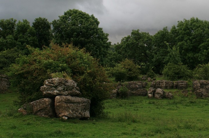
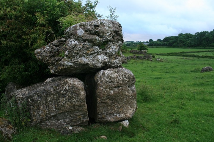
It has been a similar ten years since I was last here as well. It wasn't a place high on my re-visit list but seeing as its so close and en route between the Druids circle and Copt Howe, via the Giants Grave, I more or less had to go have another look. I'm very glad I did too.
My biggest memory of it is not being sure of it's authenticity, sure it's a big a stone resting on two other stones, but it's not obviously a burial chamber.
Visible from the road, once you know what and where it is, it is but a five minute stroll across a field over a stile and up hill a hundred yards. Some cows were close by but they hadn't even got up yet so they just watched me from there small dry patches. I sat amid the low branches of the Hawthorn inspecting the rear of the big three stones, there are many more big stones under the tree, can we safely presume they are from the chamber and not just dumped there by the farming dude. I take a good look around the Limestone outcropping as well, always looking back at the stones, from the east on the limestone rocks the chamber is hidden by the Hawthorn. The Cows are getting up now and one even mooed at me, my change of socks are already soaked through, boots stopped being waterproof months ago, so I bid a fond farewell to Great Urswick burial chamber, and leave with a new found appreciation of this under valued site.
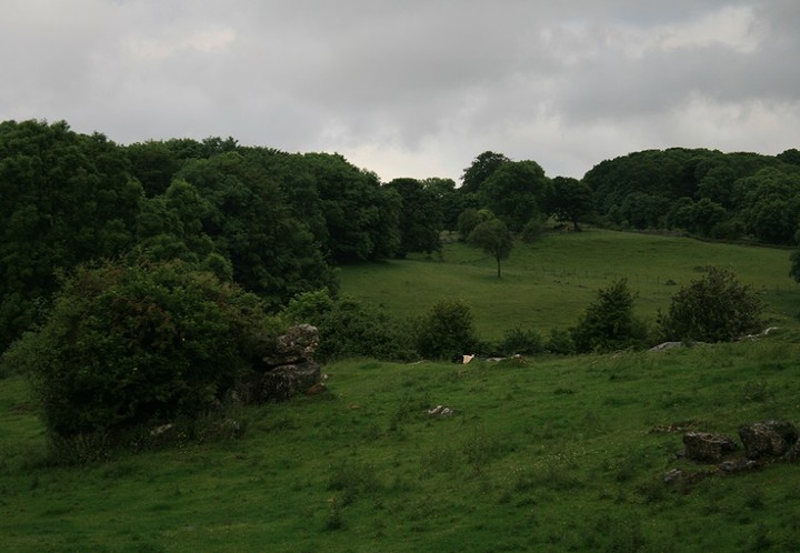
Really close by is Great Urswick hill fort and a too close to ignore tumulus, so I decide to have but a quick look round before I go off to find The Giants Grave which we so spectacularly failed to find for a second time last year.
I park/dump the car by a footpath sign north of the fort and follow the wall in the appropriate direction, the path is on the other side of the wall but so are a herd of still seated bovinators, so at the top of the field I have to jump a wall, just twenty yards east is the tumulus, I tell it i'm just going up to the fort then I'll come back for a good look, it has stones on top.
The ramparts are not well preserved, they are very worn down, but the large limestone outcrops still guard its western edge. In clearer conditions good views are to be seen all round, but todays conditions are anything but clear. I start the walk back down to the tumulus with stones on top when I get a text on me phone, it's my daughter, shes encountered a childminding malfunction and I have to return home at once.
I promise to do so straight away, and continue down to the barrow, swearing as I go, the kind of swearing one does when there is no-one to hear you. No Giants Grave, no Copt Howe, what a bummer.
The tumulus turns out to be a long barrow, not a particularly long individual, but to make up for a lack of length it has two small standing stones on it's eastern end. One stone is so gnarled it appears to be a tree stump at first but a closer look reveals it's stoney nature, the other stone is wider.
I cannot give it the time it deserves, I have to go.
But as I leave I hatch a plan, to get home as quick as possible, pick up my no longer little girl and without missing a beat drive off to the Peak District, before I'm even back on the M6 I've decided that a return to Stoke Flat stone circle upon Froggatts Edge is what the day needs to be rescued.
Everything goes according to plan, the only thing I didnt take into account is the frailty of the human body, I was so tired that when we parked up at the little parking area near Froggatts edge I fell swiftly asleep. After Phil listens to six songs on her MP3 I awaken to bright sunshine, jumping to life we exit the vehicle and take the pleasant walk along the edge to the circle.
As usual for this time of year the circle is busy getting buried and choked by the infernal bracken, Phil sits around impersonating a teenager that isn't bovvered whilst I take my little shears to the ferns. The big main stone in the circle has many solstice offerings on it's basin like top, a silvery bracelet, some small change, woven twigs, a wax effigy and so on. I reveal as much of the ring as my back can take then begin to photograph the circle. Phil used to be very camera friendly always posing with a sweat smile ,but now she cant bear to be even in the photo, how those times a change. When the inevitable "can we go now" comes I climb a couple of trees monkey boy like to get a more aerial view, without much success it has to be said.
But it really is time to go now, the solstice is definitely over for this year. Now I've got to get Phil to her friends, pick Eric up from his Mum's, and sleep for England on the sofa, interrupted only by microwave related questions and the information that some one is sleeping at Lukes. I was, as they say, not with it.
|
|
After visiting literally thousands ancient places and driving between fifteen to twenty thousand miles every year I can only conclude that I'm obsessed with these places, and finding this website ten years ago only compounded that obsession, at least I'm not alone anymore.
My favourite places are:
Ring of Brodgar
Callanish
Balnauran of Clava
Torhouskie
Swinside
Nine stones close
Bryn Celli Ddu
The Druids circle (penmaenmawr)
HafodyGors Wen
Gwal y Filiast
Grey Wethers
Boscawen Un
La Roche au Fees
Drombeg
Uragh
Talati De Dalt
and these are only the ones that immediatly spring to mind, so many stones and not enough lifetimes.
|