|
  
|
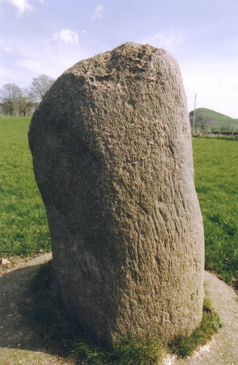
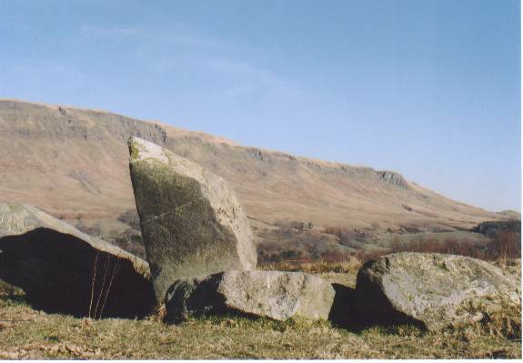
You know how some stones just get you and some stones just don't? This is the latter.
It has been secured into the ground with a neat ring of concrete and exhibits itself more like a farm implement than a stone of wonder.
How sad!
Great location though, with the the ridge of the Campsie Fells creating its northern horizon.
|
|
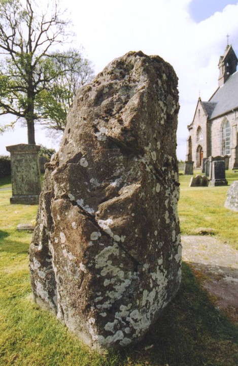
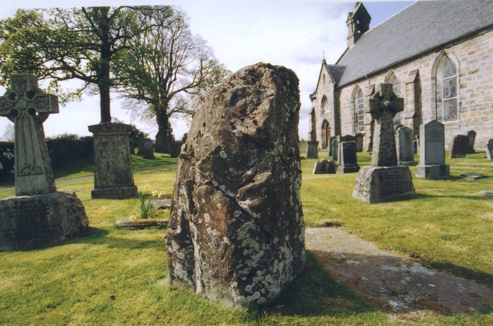
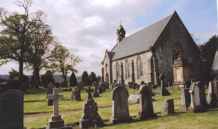
A three foot high stone in a sea of three foot high stones (it's in a churchyard). Quite comical, really. Walked around the graveyard twice before I could find it. Probably says more about me than the stone, that!
|
Brief description of Allt Chrysal from the Barra webpage.
|
Travel east from Castlebay for about 5-10 mins climbing upward on the A888. You will pass a group of trees and bushes on your right, about 300 metres after these the road bends quite sharp and you have a good view of the bay on your right. Park here, any where you can (off the road). Look back towards Ben Heaval behind you. The standing Stones are on the rise between you and the mountain. You wont see them until you climb to the top of the rise.This will take you about 5 minutes (me, about 15) There is a very uncongrous modern utility building situated next to them.
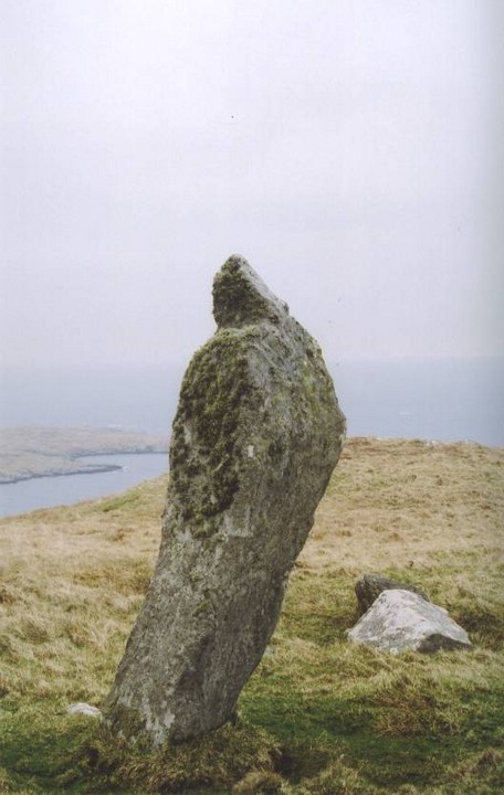
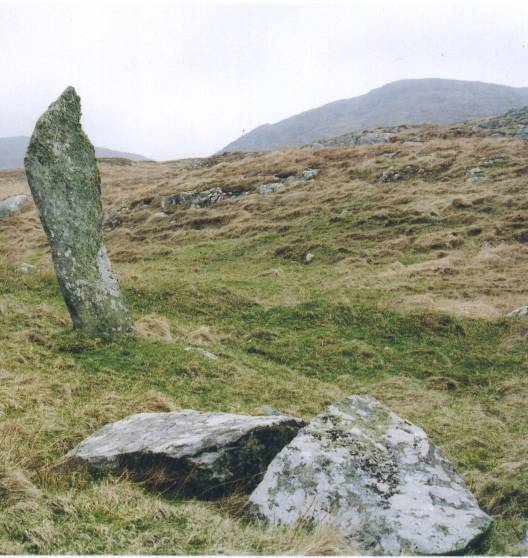
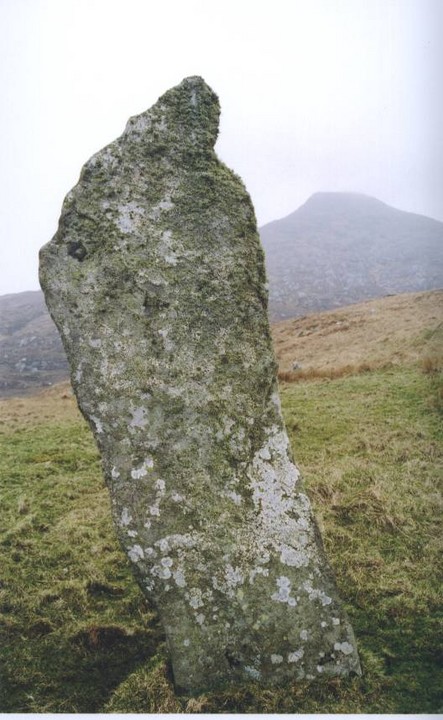
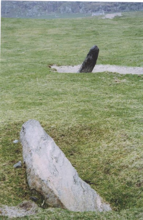
Remember that there are two stones here, the lovely curving pointing one and its sad twin lying broken on the ground a few feet away.
The view from these stones is one of the most elevated that I have come across from a standing stone monument. So try and visit on a clear day to get the best from this location.
|
As I sat on top of Barpa Langass wondering just what was the probability of it collapsing, after standing for countless millenia, onto poor old me, I was treated to the magnificent sight of a Hen harrier as it cruised low and silent over the moor, like a Great White Shark of the air, searching for it's unsuspecting prey.
Ah, wonderful!!
|
 
|

|

|
|
Not very much left to see of this Dun, but some great views out to sea.
|

|
|
The SEARCH (field archaeology) team will be at Allt Chrysal between June 15th and 3rd July '05. I believe that all are welcome to pop along and have a look at what they are doing
|
The archaeological monuments at Allt Chrysall (Allt Easdale), Bentangaval, were discovered in 1990 during the archaeological survey which preceded the building of the Vatersay causeway and its approach road. Excavations have revealed at least six phases of human occupation of this 'preferred site' overlooking the sound of Vatersay, beginning about 4500 years ago.
source: A Short Visitors Guide To Allt Chrysal, Barra.
|

|
  
|
  
|
Situated on the left, on the machair, traveling north on the A888, just past the signed turning to Borgh.
A small black (dis)coloured stone about 3ft high. There is a larger fallen stone several feet away lying on its side. This one is a lighter colour and seems about 7ft.
The sheep must use both stones for scratching as all the plants and grasses around both stones are worn away. Surrounding them both with a ring of the brilliant white Barra sand.
Near to them runs a track through the machair to a field of the dead on the promontory by the ocean. There there are two other stones that are used as boundary markers for the track. Don't know if they are associated with this group though.
|
I turned off the A888 signposted for the Black Shieling/Dubharaidh and followed the road to the farmsteads and continued along the track in the direction to where MUS(eum)was indicated on the Landranger map. Although the track looked pretty rough I was in a cheap-battered-scratched-island-hire-car so thought ... well .... nothing ventured etc' ..... surely it can't be that bad ?? afterall, it IS the track to a museum. BIG BIG MISTAKE. I thought, 'it can't get any worse.' IT DID. Definately only a track for Landrovers or JCBs.
Never got to visit either cairn as I decided retreat was the better form of valour. Worse scenario being a puncture, then missing my return flight to Glasgow.
I'll look for Greywethers track next time, although I can't find it on any map.
My bumpy journey back to the main (?) road was
mocked all the way by a raven tumbling and diving. CROKK! CROKK!
|
  
|
|
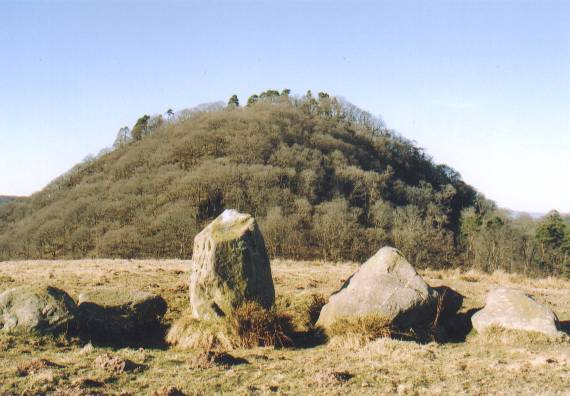
Legend has it that these two stones (and another now missing) formed a tripod that was used to support a giant cooking pot that provided feasts for heroes.
|
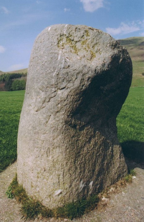
Below Knock Hill there is a lovely little stone circle, just off the road on the right hand side, a hundred yards before the Cairnpapple pullover/parking.
This is of the postmodernolithic era and was constructed in 1998 as a birthday present to the farmer from his son.
I often see visitors earnestly pouring over maps and guide books trying to figure out just what and/or where this is.
Don't be duped... like I was.
|
Visited on a glorious summer's day in August 04.
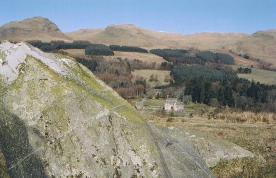
The view is awesome, the site curator gave me a loan of his fieldglasses with which I could clearly make out the Wallace monument in Stirling, almost 20 miles away, and see the coastline of Fife with the continuous stream of traffic snaking over the Forth road bridge 10 miles, or so, over to the east.
While I was there an 'alternative type' group turned up, armed with compass' and crystals. They sought out one of the large stones to the west of the cairn which was duly identified, by means of a compass, as a lodestone or magnetic stone. Once identified, they brought out their cargo of crystals and placed them on this stone to presumabley charge them with its power.
|
As far as I'm aware, legend says, that the Stone of Destiny a.k.a The Stone of Scone, Jacob's Pillow was brought to Ireland by the Gaels from Galicia having been previously acquired by the Gaels in their travels through Egypt.
This Stone was subsequently taken by the rulers of Tara, the Kings of Ireland (the sons of Niall) to their new power base in Scotland.
And so on via Edward I (boo hiss etc)... but it now resides in Edinburgh Castle with a caveat from the present monarchy that it should be returned to Westminster Abbey for the royal arse to be sat on for any subsequent coronation ceremonies.
So if the Stone of Destiny is in Edinburgh Castle what is the Lia Fail?
This is also a Stone of Destiny - for it's clear that throughout the ages this stone has had almost divine attributes for both the people and their rulers - so when clan Niall claimed that they took their Stone with them to Scotland it would only be expected that the Irish kings would put in a counter claim that the original Stone was still in Ireland-
Just as the Scots did when Edward I (boo hiss) took the stone from Scone to Westminster. Who's right? Who knows!
If anyone has any other info on these two stones, such as their geological/geographical origins I'd love to hear about it.
Addendum
Above 'muirchertach' states that the name Scotland comes from the celtic word for incomer or raider. Personally, I prefer the legend that the name Scotland comes from the name of an Egyptian Pharoah's daughter... Scota... yes, the one who found Moses and married Niall....yes, he who was the legendary founder of the clan Niall. And if you want to stretch the legend even further the man who shares his name with the vast river that flows through Egypt.
And this brings us back to where the Stone of Destiny was acquired in the first place.
|
Oldest continuous inhabited village nearby.
Brief summary of archaeological finds at Dreghorn, a village only a mile from Stanepark.
|

|

|
 
|
The British Camp in The Malvern Hills is another one of our stunning 'world hills'. The view from the top is absolutely awesome. I remember once having scrambled to the top with the kids in a blue sky, crisp, clear, autumn day and looking down onto Jet Fighters as they boomed over the fields below.
What would our ancestors have thought of that?
Anyway, not only Elgar tramped this hillside, but also JRR Tolkien. The following is an extract from the cover notes of a recording of Tolkien, written by George Sayer.
'He and I tramped the Malvern Hills which he had often seen during his boyhood in Birmingham or from his brother's house on the other side of the Severn River Valley. He lived the book as we walked, for instance, sometimes comparing parts of the hills with the White Mountains of Gondor'.
I wonder if they ever bumbed into each other, Elgar whistling away and Tolkien deep in his elvish thoughts.
|
One of the more 'objective' sites relating to Doon Hill.
|
There is enough folklore here to fill many pages or make a Hollywood movie.
A seventh son of a seventh son.
Clandestine meetings with sprites and fairies.
A 'man of the cloth' communing with nature spirits.
Murder, mystery and possible elfin abduction.
And a true life tale of 'publish and be damned'? Literally.
The past and present, fact and fable all combine to make Doon Hill a very, very special place.
If you are interested, do a search on
Doon Hill - Aberfoyle - Reverend Robert Kirk - The Secret Commonwealth -
....that should kill a few hours!
|
From an archaeological point of view Doon Hill is still very much a blank sheet, but from its prominant and strategic position and from its shape it is very likely to conceal an ancient monument.
As far as I'm aware there has never been any kind of field study carried out to ascertain it's origins. However, walk around and up to it's summit and the hand of man can be clearly felt.
|
  
|
The Witching Stone was pointed out to me by an elderly relative on the occassion of scattering the ashes of my mother in law over her favourite childhood beach.
He told me that as children playing nearby they would always take a wide berth to avoid this stone as it had a sinister and frightening aspect.
I can find no listing of this stone in my OS disc nor of the name of the adjoing beach known by him as Curragh Beach, therefore the OS location given is only a questimate.
|
This is a sad and solitary little stone situated in a farmers field on your right hand side, between the road and the seashore, travelling south on the A77 about 1km past the seaweed(alginates) factory.
As it is quite small it may, or may not, be of human design.
|
This is one of the very few ancient sites of interest in Ayrshire.
Having been born and raised in this area I have always wondered why there is such a lack of ancient sites in this county, afterall, its low lying plains are extremley rich and fertile, and to this day it is one of Scotland's most arable counties, and bounded by the Firth of Clyde to the west, where there are a multitude of estuaries rich in shellfish and widfowl, it would have been a heaven to our ancestors.
A clue to this conundrum may lie a few Kms southish of the Stane Park monolith in the shape of Dundonald hill, with the tower of Royal Dundonald Castle commanding the local countryside on top.
Recent excavations at this site have shown that this fortress was an important power base, with almost constant usage going back to the stone age.
Could it be that as ecological conditions remained suitable for our ancestors to thrive in this area that the ancient monuments were not abandoned as else where but underwent a succession of changes on the same site and to this day lie waiting to be discovered
beneath the forts and farms of Ayrshire?
|

From Irvine follow the B7081 to Dreghorn. At the cross (traffic lights) turn right and follow the road B730 about 2Kms to Drybridge. Turn right in the village and the Stone is in the farmers field on your left hand side.
It stands alone in the area, at 9-10 ft tall and is very chunky, almost square.
|
|
|