The Modern Antiquarian. Stone Circles, Ancient Sites, Neolithic Monuments, Ancient Monuments, Prehistoric Sites, Megalithic MysteriesThe Modern Antiquarian

Get the TMA Images feed
sam's Latest Posts

Latest Posts
Previous 50 | Showing 101-150 of 152 posts. Most recent first | Next 50

D45 Emmen (Emmerdennen) (Hunebed) — Images (click to view fullsize)

<b>D45 Emmen (Emmerdennen)</b>Posted by sam

Bronheulog (Chambered Cairn) — Images

<b>Bronheulog</b>Posted by sam<b>Bronheulog</b>Posted by sam

Bronheulog (Chambered Cairn) — Fieldnotes

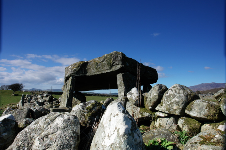
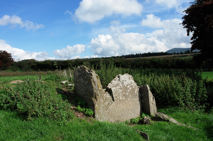
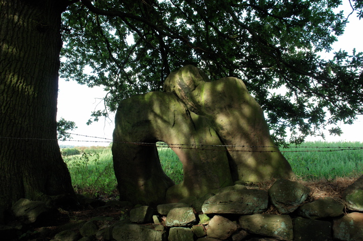
Marked on the OS map as a burial chamber, this ruined chambered cairn is 700 metres southwest of Tan-y-Muriau, and 1.5km south of Rhiw axe factory.

By ruined, I mean it is a pile of stones, with rows of holes visible on the capstone where someone has tried to split it.

Ystumcegid (Dolmen / Quoit / Cromlech) — Images

<b>Ystumcegid</b>Posted by sam<b>Ystumcegid</b>Posted by sam<b>Ystumcegid</b>Posted by sam

Penllech Coetan Arthur (Dolmen / Quoit / Cromlech) — Images

<b>Penllech Coetan Arthur</b>Posted by sam<b>Penllech Coetan Arthur</b>Posted by sam

Cefn Isaf (Dolmen / Quoit / Cromlech) — Images

<b>Cefn Isaf</b>Posted by sam

Tan-y-Muriau (Chambered Cairn) — Images

<b>Tan-y-Muriau</b>Posted by sam<b>Tan-y-Muriau</b>Posted by sam<b>Tan-y-Muriau</b>Posted by sam<b>Tan-y-Muriau</b>Posted by sam

Y Ffor (Burial Chamber) — Fieldnotes

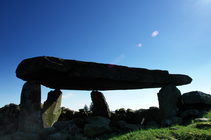
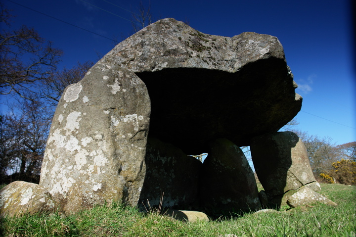
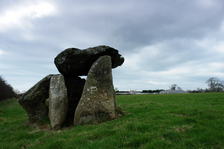
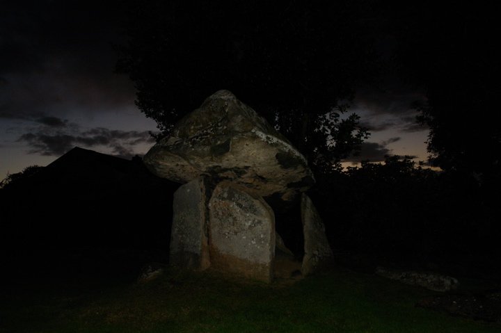
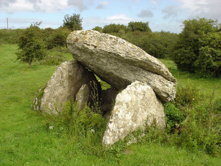
Four Crosses is a portal dolmen, with three uprights supporting its capstone. It was restored by the landowner in the 1930s, who seems to have accidentally restored one of the uprights as the capstone.

Don't try to find the footpath marked on the OS map, as it is no longer there (it's now under a nursery). Instead, park in the layby opposite the nursery, and walk down to the farm turning (named Cromlech, handily). Down the lane, and turn right through the gate opposite the farm buildings.

Y Ffor (Burial Chamber) — Images

<b>Y Ffor</b>Posted by sam<b>Y Ffor</b>Posted by sam

Kinderlow (Cairn(s)) — Images

<b>Kinderlow</b>Posted by sam<b>Kinderlow</b>Posted by sam

Kinderlow (Cairn(s)) — Fieldnotes

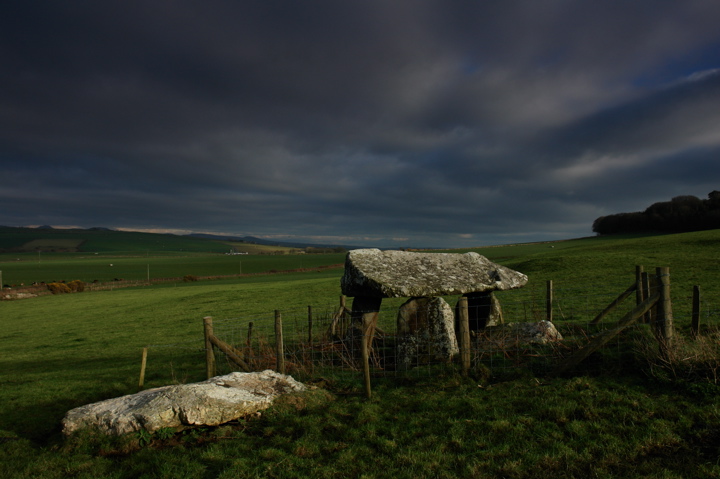
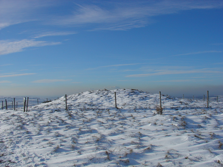
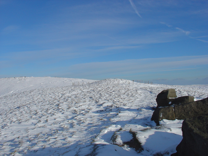
Fantastic views, particularly in the snow.

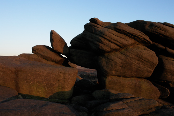
From Magic: The monument is a bowl barrow located at the summit of Kinderlow in the western gritstone moorlands of Derbyshire. It includes a steep-sided sub-circular mound measuring 17.5m by 15m and standing c.2m high. A gritstone kerb is visible in the edges of the mound and there is a modern walker's cairn on the summit. The monument has not been excavated and so cannot be precisely dated, but its form and hilltop location assign it to the Bronze Age.

It is currently being restored by NT/Peak District National Park Authority to repair erosion damage.

Ffostyll (Long Barrow) — Images

<b>Ffostyll</b>Posted by sam

Parc Le Breos (Long Cairn) — Images

<b>Parc Le Breos</b>Posted by sam

The Devil's Ring and Finger (Standing Stones) — Images

<b>The Devil's Ring and Finger</b>Posted by sam

Carreg Coetan Arthur (Dolmen / Quoit / Cromlech) — Images

<b>Carreg Coetan Arthur</b>Posted by sam

Pentre Ifan (Dolmen / Quoit / Cromlech) — Images

<b>Pentre Ifan</b>Posted by sam

Paviland Cave (Cave / Rock Shelter) — News

Druid campaign for sacred sites


A retired engineer from Swansea is campaigning for ancient burial sites to be considered sacred ground.

http://news.bbc.co.uk/1/hi/wales/south_west/5372598.stm

Carreg Samson (Dolmen / Quoit / Cromlech) — Images

<b>Carreg Samson</b>Posted by sam

The Hellstone (Dolmen / Quoit / Cromlech) — Images

<b>The Hellstone</b>Posted by sam

Rombald's Moor — News

Ilkley Moor - Legendary Moor may lose its name


http://news.bbc.co.uk/1/hi/england/west_yorkshire/5098334.stm

Stonehenge and its Environs — News

New glacier theory on Stonehenge


http://news.bbc.co.uk/1/hi/wales/south_west/5072664.stm

Minninglow (Burial Chamber) — Images

<b>Minninglow</b>Posted by sam<b>Minninglow</b>Posted by sam

Carl Wark & Hathersage Moor — Images

<b>Carl Wark & Hathersage Moor</b>Posted by sam

Park Gate Stone Circle — Images

<b>Park Gate Stone Circle</b>Posted by sam<b>Park Gate Stone Circle</b>Posted by sam

Carl Wark & Hathersage Moor — Images

<b>Carl Wark & Hathersage Moor</b>Posted by sam<b>Carl Wark & Hathersage Moor</b>Posted by sam

Ring of Brodgar (Circle henge) — Images

<b>Ring of Brodgar</b>Posted by sam<b>Ring of Brodgar</b>Posted by sam<b>Ring of Brodgar</b>Posted by sam

Cown Edge (Round Cairn) — Fieldnotes

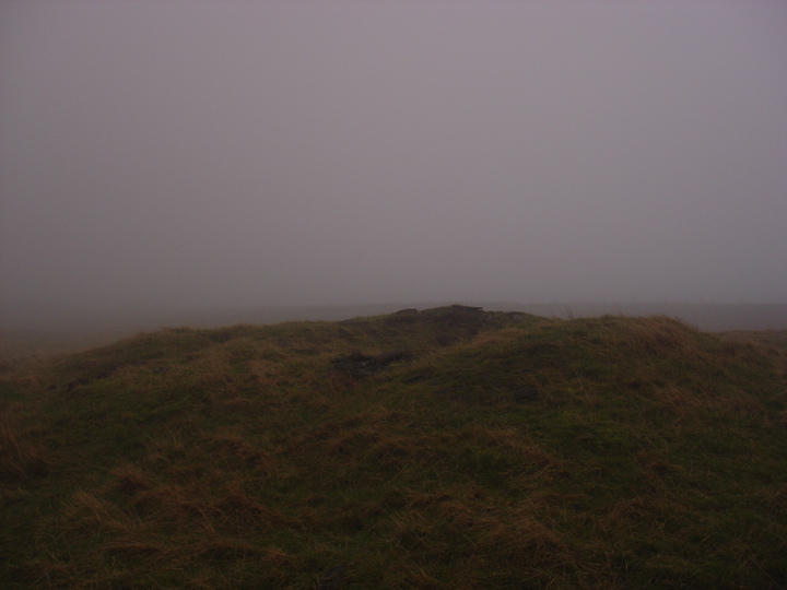
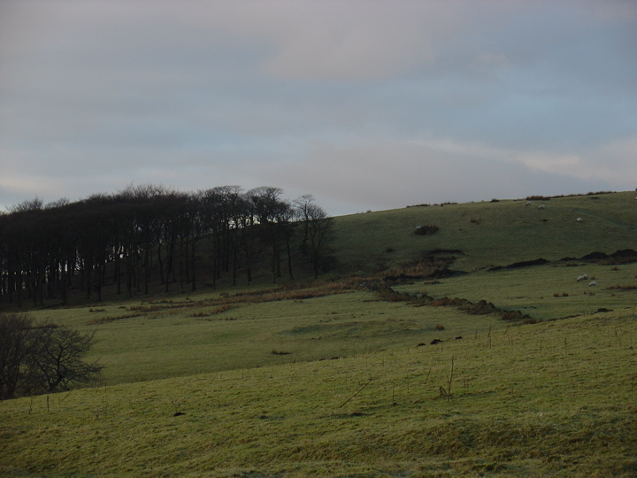
A gritstone cairn some 13m x 10m, and about 1.5m high, which has suffered some surface disturbance due to the activities of Enclosure period stone-getters, according to the SMR.

We visited on a particularly damp and misty day, hence the spooky picture.

To be honest, not worth a special trip, though Cown Edge Rocks are pretty cool.

Cown Edge (Round Cairn) — Images

<b>Cown Edge</b>Posted by sam

Green Low (Ring Cairn) — Images

<b>Green Low</b>Posted by sam

Bryn-yr-Ellyllon (Round Barrow(s)) — News

Bronze Age gold cape returns home


A priceless 4,000-year-old gold cape is to return to north-east Wales for the first time since it was discovered there in 1833.

http://news.bbc.co.uk/1/hi/wales/north_east/4682865.stm

Tor Dike (Dyke) — Fieldnotes

Tor Dike is a 2km linear earthwork, consisting of a ditch cut into the limestone, and an earth and stone rampart. According to the SMR there are Iron Age type enclosures and hut circles abutting the rampart. Couldn't spot them myself, but you can't really miss the ditch and banks. Would have been quite defensible if it wasn't for the fact that you could just walk round the western end.

Tor Dike (Dyke) — Images

<b>Tor Dike</b>Posted by sam

Windmill Hill (Causewayed Enclosure) — Images

<b>Windmill Hill</b>Posted by sam

West Kennett (Long Barrow) — Images

<b>West Kennett</b>Posted by sam

Pant-y-Saer (Burial Chamber) — Images

<b>Pant-y-Saer</b>Posted by sam

Werthyr (Standing Stone / Menhir) — Images

<b>Werthyr</b>Posted by sam
Previous 50 | Showing 101-150 of 152 posts. Most recent first | Next 50

My TMA Content: