|
This massive cairn site consists of 134 cairns most of which are small circular platforms linked by lines of stones forming rectilinear alignments.
|
|
Across the neck of the promontory is a low stone rampart of the cliff fort.
|
|
A line of at least four cairns along the crest of the hill.
|
|
Accessible on foot from St Martins at low tide. At least five cairns and an entrance grave
|
|
A ruined entrance grave incorporating a massive outcrop of natural rock. 50ft in diameter with a chamber 12ft in length. Glass, amber and faience beads found in 1912.
|
|
11 Iron Age cists in this cemetry with another 5 nearby. Bronze brooches found
|
|
An Iron Age cliff fort with four ramps and ditches. Finds include pottery dated to 300 bce.
|
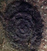
Often blind to things on our own doorstep, I revisited our local mystery with a view to seeking opinions from TMA. The Devil's Hoofprint is carved in clunch (a soft chalky rock) and located in the south porch of St Michael's, Bishops Stortford. What is it?
Like other churches dedicated to the warrior saint, St Michael's is a hilltop church built on a pagan site. The church guide is coy about the carving and describes it as "possibly pagan". Other views maintain that it is the result of someone sharpening their arrows in the porch! Now, I am not one to see vulvas in every megalithic nook and cranny, but this one look pretty explicit to me. Given the church's pagan association, could it be a fertility symbol? Ignored and unnoticed - I'd love to bring it out of the closet and would welcome your thoughts.
|
|
The twin barrows of Trevelgue were where it all began for me. I've been tump hunting ever since.
|
|
An impressive hillfort with complex defences second only to Maiden Castle. Occupied from the 6th century to the Roman occupation. I have only seen it from the A5, but its at the top of my "must visits". Surprised the site is not already covered on TMA.
|
This stone is not on the map so may be modern, but there are no less than four early settlements on this tiny island with numerous hut circles and a promontory fort. RSPB reserve with access by launch from Martins Haven.
I cannot quite remember the exact location as I photographed it while running from a ferocious thunderstorm. Some of the early settlements may be monastic. Local name for this stone is "John's" stone. Perhaps it is just a cattle scratchpost.
|
|
There are four entrance graves on the rocky summit of South Hill with a dozen or more on the North Hill. The two hills of Samson ar very similar to the Paps of Jura in Scotland and the Paps of Anu in Ireland.
|
|
This excellent entrance grave is in a mound 26ft in diameter. The entrance passage is no less than 18ft and is roofed with five capstones. Well signposted on the circular footpath around St Mary's and impossible to miss.
|
|
An angled passage of about 16ft leads to the chamber. Two of the six capstones have collapsed leaving the site in a delightfully unrestored state. Excavations revealed a male skeleton, ashes and twelve inverted urns.
|
This is the largest barrow in Britain and very few people know of it. This Romano-British site at Bartlow is on the Essex/Cambridgeshire border at TL 586453. Originally the largest group in Europe when there were seven enormous barrows here. Then the now disused railway came through and flattened four of them! The largest survivor is 45 feet high and the highest in Britain. The wooden staicase gives access to the top without causing erosion. You can then look down on the other two giants. Many suberb artefacts have been recovered and are now in Colchester Museum (Bartlow was formerly in Essex).
Access is via a footpath, but it is not well marked. Bartlow is a small crossroads hamlet with few houses. Look for the "Three Hills" pub and the path is beyond the entrance to the big house next door. It seems incredible that this magnifent and enormous site is so little valued locally. The largest barrrow is second only in size to Silbury Hill (excluding mottes and castle mounds) and if Bartlow were in Wilts rather than Cambs there would be hundreds of visitors every day. Go there and be amazed!
|
|
This stone looks like a palaeolithic venus figure to me and I wonder if it hasn't been partly shaped by man. Situated opposite the church and at the head of the lane leading to a deep ford, it is garlanded on May Day when the villagers commence a procession and hold their fete in the main street. Very good show every year and worth a visit.
|
This is my local hillfort, but it is almost impossible to get a decent photograph of it! Situated on a spur overlooking the River Stort, two banks and ditches enclose 12.5 hectares. The ramparts are still over two metres high, but absent where the steep drop to the waterlogged land by the river is a natural defence and still impassable. The fort is huge and must have been a very important defence of the Trinovantes as the territory of the Catuvellauni began across the river.
In private hands as a residential property called "Wallbury Dells", access is limited.
|
|
Very impressive especially as late summer turns to early autumn. This plateau fort is situated on high ground overlooking the Lea Valley. It encloses 4.5 hectares and is watered by a stream which rises inside the fort. The main bank is still more than 2 metres high and the ditch was originally 3 metres deep and nearly 7 metres wide. There are several entrances, but only the one in the west side is original.
|
|
Located above the Halangy Downs courtyard house settlement and about 1500 years older, Bants Carn is a round cairn surrounded by a low wall. The entrance passage is 14ft long leading past two portal stones to the central chamber. Very easy to find from the cliff top footpath from Hugh Town.
|
|
Located on a steep slope below Bants Carn and overlooking the sea, this settlement is very similar to that at Chysauster. There is one courtyard house and other interconnected oval houses with a likely occupation period of 500 years. Romano British and so much younger than the nearby tomb of Bants Carn. Interesting to speculate on how the residents related to that ancient tomb.
|
|
|
|