Showing 1-5 of 35 posts. Most recent first | Next 5 
Cornwall 0710
Cornwall bound -13th October
We took an early-ish start (6:00am) and after filling up with fuel, opted for the motorway route: A40/M40/M25/M4/M5. We stopped for breakfast at a Little Chef near the bottom end of the M5.
On the A30, once the Tamar had been crossed, we took the turn-off for Altarnun. The Holy Well here has suffered from recent neglect. The well compound is completely overgrown and inaccessible - the gate could not be opened due to the logs dumped there, and the steps down to the well were completely hidden in the undergrowth.
We had planned to stop off at Castilly Henge, but the new section of the A30 starts here, and I missed the turn, so we continued on to Penzance.
Sunday Stroll 14th October
I had arranged to meet Mark (Mr Hamhead) and Chris (Scubi63) from TMA for a walk from the Men an Tol studios.
Our first stop was at the Men an Tol itself, where I spotted a buried object next to one of the stones. I left this for later extraction by CASPN - see http://www.cornishancientsites.com/damage-report.htm for details of the finds.
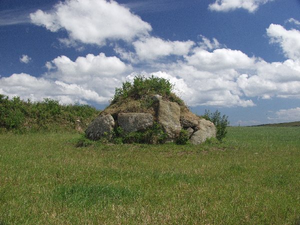
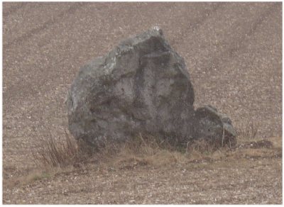
We then moved on to Men Scryfa, with cows in the field. Mark went up to the stone and took some photos, but Chris and I declined to join him. We then tried to find the Venton Bebibell well, but without success in the thick bracken. The well is by a thorn tree, but we had three to choose from – I'll try to get better directions for a different time of year. We continued on to the Four Parish Stone, then headed up the hill to the Boskednan Cairn, with the quartz veined stone.
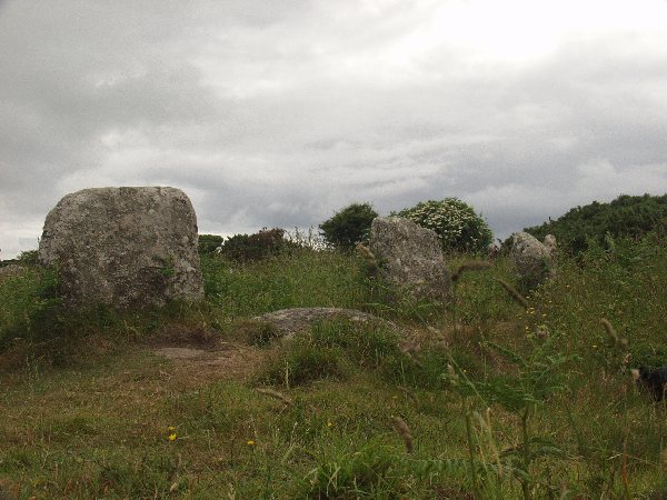
Next was the Nine Maidens circle, and the sun came out as we approached the circle.
We continued on, and Mark pointed out a banked cairn that I wasn't aware of as we approached Ding Dong Mine.
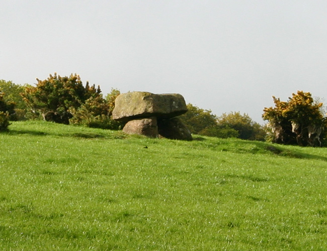
In return, I showed off Bosilliack Barrow, a Scillonian Entrance style tomb. We then headed back to the car for the short drive back to Lanyon Quoit, after which I left the others as they decided to head over to the coastal path for an exploration.
Monday's Long Run 15th October
Today we decided to take the 'long run', across to Liskeard, so we headed back up the A30, taking the turnoff for St Austell. The target here was the Menear Longstone, but I had to be content with a long range view, as the field was in crop.
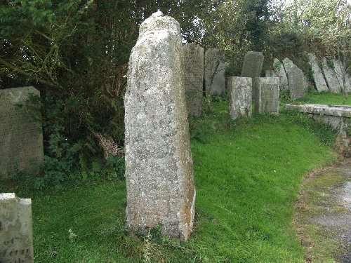
We then stopped for a comfort break in Lostwithiel, where I took the opportunity to spot the lantern cross in the churchyard, MC62 along with another ancient inscribed stone. Near to the church is an old Tudor bridge across the Fowey. This was a side of Lostwithiel I've not seen before when passing through on the A390.
Continuing on the road, we fought our way through the roadworks on the A38 at Dobwalls to get to Liskeard. I had a very quick look around Liskeard Museum, which had very little in the way of early archaeological exhibits. Just a few arrow heads and a partial mace axe head. I wasn't too impressed.
Back along the A38, we next headed up to St Neot where I took a look inside the church before heading off for the (Victorian Restored) Holy Well. We then had a very pleasant sandwich lunch in the pub next to the church, which set us up for the rest of the day.
A short distance northeast of St Neot is the Mutton Down stone. I'd researched this stone before the visit, noting that it lies within a small parcel of land subject to the CROW act. I'd parked up and entered the scrubland through the unlocked gate, and was just starting to take photos when a farmer drew up in a van and challenged me. He asked what I was doing and after I'd explained insisted that the land belonged to his son, and that I should have asked for permission before entering. I told him that as far as I'd researched, the land was CROW land, and therefore permission should not be required, and anyway, how was I to now who the land belonged to? He repeated that it belonged to his son, who lived two miles down the road. Again, I repeated that I couldn't be expected to know that, that CROW land meant that I had the 'right to roam' and that I always observed the country code and reported any damage to the due authorities. He insisted that they'd "had some trouble" with people at the site but wouldn't go into detail, and asked again that I leave, which I did reluctantly.
Tuesday socializing 16th October
Today a very grey and drizzly day, so was spent doing some much needed shopping, before taking a short drive around Penwith to meet with a friend in St Buryan. We had a very pleasant lunch in the Lamorna Wink, after which I briefly visited the Boscawen-Un circle.
Wednesday Crafting 17th October
Today was mainly Mikki's day, as we started with a pasty breakfast in Hayle before heading for Cambourne and Porthleven for some craft shopping.
I did manage to fit in a stroll up the hill from St Just to Tregeseal though, which looked in fine fettle, with no sign at all of the gorse burning that I'd seen some time ago here.
Quiet Thursday 18th October
With slight back pain today, I didn't feel like driving too far. The Trewern Stone is not too far from the holiday village where we're staying, so that was the first stop. We approached from the north, which gave a good view of the farm and surrounding fields. I couldn't see the stone in the field marked on the map (and as seen on Google Earth), and the farmyard seemed deserted except for some dogs, so I decided not to try a closer approach.
We drove into St Just, but the café and bookshop were not yet open, so we continued down to Cape Cornwall, where I looked around the old Oratory there. By the time we returned to St Just, we were able to partake of some delicious soup and bought a couple of books into the bargain.
Heading back round to the A30, we stopped at the entrance to Boscawen Noon Farm. There is a large stone on the approach to the farm, and another just a couple of fields away which I tried to see, but cows in the field stopped my attempt. I really must get over my fear of bovines! At least I finally know where this stone is now…
Final Friday 19th October
We took a final drive around the Penwith peninsula, taking in the Pipers and the Merry Maidens, where I checked quickly for any more possible damage, thankfully without success.
From St Just, we followed the north coast road, passing the ruins of Carn Galver Mine, before heading back round to St Ives.
We then drove across to Helston to the Blue Anchor for a pleasant lunch.
Heading Home 20th October
An early start saw us arrive at Castilly Henge just as the sun was rising. Unfortunately, there was absolutely nothing to see as the site is hidden from the road by a huge embankment. This will need an exploring visit when time is on our hands, unlike today.
We did take a short diversion off the A30 though, to see several crosses at Reperry, Lesquite and Carminow, before finally heading for home.
|
Well Cross in Kernow (1)
21/05/05
Another week in Cornwall, and this time round the focus was to be on Wells and Crosses, also to fill in some gaps...
An early start from London as usual saw us make good time, and we approached Dartmoor around 7:30am. The first scheduled stop was Meacombe Farm and the Cleave burial chamber.
Visited 21/5/5. Noted elsewhere as 'Meacombe Cist'.
Parking is difficult. Best places seem to be the next gate up to the north, or a bit further to the south, by the farm entrance.
I couldn't get close to the actual chamber without trespassing into a field full of a quantity of bovine population with young, so I chickened out and contented myself with the long view through the herd.
We continued onto Dartmoor itself and my second target: Grimspound.
Visited 21/5/5
What a fantastic place! From the layby, walk up the steps then keep up the hill till the stream is heard. Keep the stream on the right until a 'stone path' is seen. Follow the path to the settlement - the path continues on up to Hookney Tor.
There's a real sense of loss here – it's easy to imagine the bustling community that once existed within the encircling wall with its three entrances.
Continuing round Challacombe Down to rejoin the B3212, I spotted the Soussons Common Cairn Circle on the right and skidded to a halt!
Visited 21/5/5
This is a neat little 'fairy' circle on the edge of the plantation with a stone cist in the centre. Plonkers had lit a fire within the cist. FFS why?
With time moving on, after a brief stop in Postbridge we continued the journey toward Cornwall.
The next scheduled stop was Kit Hill, and having driven up to the peak, there is just so much industrial archaeology here, mostly dated from the WW1 Tin Mine that it was difficult to identify the much earlier earthworks we were hoping to see. They were not marked on the information boards either, so we continued on, heading northwards back to the A30 and Lewannick.
Close by to the church (down past the village pub), is Blaunder's Well, an old sacred spring, but despite asking a local farmer, I failed to locate it this time round.
Although there were a few more sites in the area I wanted to see, Mikki called a halt and we drove directly on into Penzance. We've got all week!
22/05/05
Up early the next day, Try was the first target for the day
Visited 21/5/5
I parked the car at Chysauster car park and walked along the road to the footpath at SW465347. The woman at the house next to the footpath advised me to avoid the horses in the field as they can become a 'bit too friendly'. Following the footpath across the first stile (into a roped off corner of the horse's field), this was easily done by jinking into the next field through a gate (horses in field), and returning at the far corner by dodging under the fence which appears to have been designed for exactly that purpose.
After the second stile, the footpath is poorly defined, but I headed straight across the meadow as depicted on the map to a stile hidden in the undergrowth of the hedge. After this third stile, the stone can be seen on the far side of the second field on the left. I couldn't find a way into this field (the footpath carries on up to Try Farm, but is very poorly defined from here).
Sadly, in the evening I found that the photos I'd taken had mysteriously disappeared from the camera! This meant I had to return later in the week, when it was much dryer than the 8am dew flood I'd encountered this time round.  |
A major bugbear of mine is that I've never managed to locate the stone at Carfury, so that was our next scheduled stop. However, once again I was to be foiled! A heavy downpour (and I mean heavy) prevented much exploration as the stream had overflowed onto the footpath, making it almost impassable. To be honest, I'm not even certain I was in the right place, as the vegetation prevented use of my GPS. This will stay on the list for next time…
As the weather was inclement, we decided to drive around for a while, up around Bodrifty Mine, then down toward Lamorna.
Stopping at the Pipers, I noticed that a sign that had been placed on one of the stones last year (saying 'do not remove' and not covering anything obvious!) was no longer present. What was all that about then? Another 'mystery of the stones'…
A quick stop off to take a look at the St Buryan churchyard crosses, then it was into St Just and the 'Cook Book'. I can't recommend this place highly enough. A combination café and bookshop with wonderful home-made soups and a really friendly welcome.
As the weather broke, I decided to whizz quickly up to the Tregeseal circle to check on last year's fire damage.
Visited 22/5/5
It's a stiff old walk up from the bottom of the village, but just over a year on from the unintentional scorching the stones received (see News), they appear to be healing well. Most of the burnt lichen has been removed, and the stones look in good condition. I didn't notice any obvious cracking on the stones I inspected closely.
The afternoon was booked for retail therapy in Truro, but I took the liberty of grabbing a couple of sites from tomorrow's itinerary: The Ignioc Stone at St Clements, and the 'Noti' Stone at St Hilary's, squeezing in a cream tea at the Handy Shop in Sithney on the way!
The churchyard at St Hilary was incredibly poorly tended and very overgrown. Luckily, the inscribed stone and crosses lay either side of the path up to the church and are in plain view.
(more to follow in part 2)
|
Solstice in the South West
Saturday
A last minute decision to spend Solstice weekend in West Penwith, led to a 4am start on the Saturday. M4, M5, A30 meant we were in Cornwall by 10am. It would have been sooner, but the Little Chef we stopped at near Okehampton was unbelievable slow in serving (and they no longer provide free newspapers, Scandalous!)
We had hoped to stop in Redruth, but the town centre was closed for a parade (Murdoch Day?) so we headed down to Porthleven to spend some money there instead. Suitably broke, we made for Sithney where the Handy Shop provides the best cream teas in the world. If you're in the area, you simply have to try them. Just follow the signs from the A394 just NW of Helston.
Fully stuffed with fresh cream and scones, it was time for West Penwith. We had arranged accommodation for two nights in Trewellard, just north of St Just and on the borders of Pendeen, in a small B&B opposite the Trewellard Hotel. Nice and clean, and very friendly, although Hilary, the landlady was suffering from an abscess and not feeling too well.
We dropped the bags off, she went back to bed, and we hit the road in glorious sunshine for the afternoon. First stop was Brane chambered tomb. I followed the footpath on the map that looked as if it led to it, but could only get within a field and a half of the tomb, due to crops in the fields. Slightly disappointed, we drove on to Carn Euny with no sight of anyone around Brane Farm, which I remembered Moth said provided the access to the tomb.
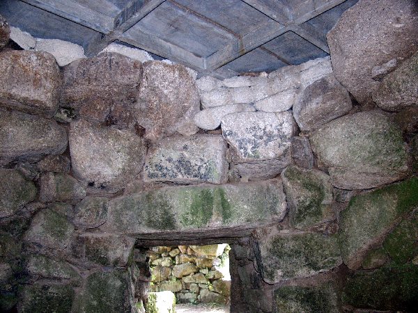
I had Carn Euny to myself. Last time I was here, the fogou was 6 inches deep in floodwater, and I couldn't access the beehive room. This time it was bone dry.
I was surprised to see the same phosphorescent moss here that I've seen previously at Sancreed Well, brought on by high Radon levels. Attempts at photographing this were in vain, as the light levels within the fogou demanded either a tripod or flash. I had no tripod with me, and flash would have lost the fine details of the phosphorensence.
Another nearby site I'd not seen before was St Euny's Well, so I headed off in that direction for a couple of shots, and also found the nearby cloutie tree, although battling through the undergrowth on the path was difficult.
Back to Mikki waiting patiently in the car, then we headed back through Brane to the A30, where, as luck would have it, the farmer's son was waxing his car. A quick word with him, and I had permission to head off through the farm to see the chambered tomb.
It's possible (and easy) to gain access via Brane Farm. I was lucky in that someone was around to ask, I had no problem in getting permission, and the cows were safely locked away.
There is a path from the cowshed (obviously used by our bovine friends) down to the gate in the adjoining field, and again to the third field where the chamber lies.
From this direction, the first view is of the rear of the chamber (see photo), which consists of some large stones.
The actual chamber was quite overgrown with weeds and small shrubs on my visit, and I suspect some root damage may occur, as several smaller stones which had obviously come from the chamber were spread about near the entrance.
A word of warning: even if a cow pat looks set hard and dry, don't step on it! I did, and had to spend 5 minutes cleaning my boots before returning to the car. But I got to see the tomb and take some photos, so that was two new sites under my belt already!
We drove around aimlessly for a while, and tried to access Tregiffian Vean chambered cairn, but the owner of the campsite wouldn't let us park and suggested we try to get to it from the opposite direction. Cheers pal!
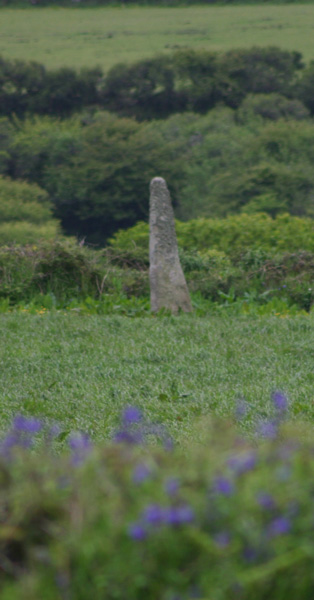
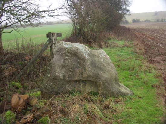
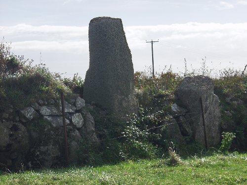
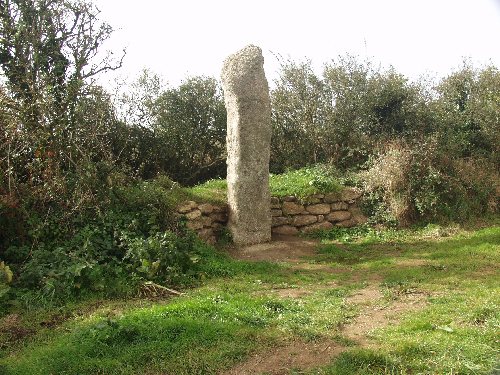
On the way back to Trewellard we took the Woon Gumpus road and stopped to look at the Wheal Buller Menhir. (Re)erected comparatively recently into the field wall, this 8 foot high monster is covered in ivy, and lies near the junction with the B3071 Penzance to St Just road.
Sunday
After an early night last night, we started the day with a leisurely breakfast, and didn't hit the road till gone 10am. Tregiffian Vean was the first stop, mainly because I was annoyed at the camp owner's attitude yesterday.
We turned off the A30 at SW371270, and headed for Tregiffian Hotel (as marked on the map, it's actually holiday let cottages). At the end of the road, as well as the cottages, is a farm barn, from where the tomb can be seen, up on the hill. Two stiles later and I was heading up the hill, alongside a field of young corn, with planes buzzing overhead practising circuits at St Just's airport. I managed to get within a hundred feet or so of the tomb, but as I'm not in the habit of trampling crops, couldn't get any closer. One for a winter visit possibly, although the tomb looks pretty wrecked out, with not much remaining.
The weather closed in at this point (we'd had heavy overnight rain), so it was more aimless driving while I decided where to go next. Tregeseal, Chun, Mulfra? In the end, we didn't get to any of them, heading instead for Penzance for a bite to eat and to clear the WH Smiths out of their latest magazine stock…
I'd decided Bodrifty was as good a destination as any, but I always find it difficult to get to. We spotted the turn-off for Boswarthen Chapel (as we must now get used to calling Madron Chapel, apparently), and I tried to get up to see the Boswarthen stone, but the 'Private Property' signs put me off the idea, and I returned to the car. Mikki was fine, so I headed off to see the well and chapel one more time.
Driving up past Lanyon to get to the coast road, I thought about finding West Lanyon Quoit for the first time, but the presence of cows in the fields and the general dampness put me off. So we continued up to Gurnards Head, and doubled back past Treen Common and Mulfra Hill before heading in to Bodrifty.
We had the place to ourselves. The only sounds were birdsong, and a very occasional light aircraft circling round. Oh, and the cows! I'd crossed the main settlement at Bodrifty, as I wanted to see if the reconstruction roundhouse was still there. 'Follow the yellow signs' said the signpost. Ok, there's one over there, leading to the next field. No sooner had I entered the field (no gate at the boundary) than I saw three large bullocks staring at me. One was sniffing the air tentatively, but another was openly snorting. I backed away out of their sight behind the hedge. There was no way I could cross the field with them in it. I looked back as I headed toward the car, and all three were now blocking the gap in the field boundary, as if daring me to try. A fourth was joining them, trotting down the hill, and this bugger had horns! I'm not ashamed to say that I ran, until I'd mounted the stile at the bottom of the settlement. Shades of my Cork trip last year! Ah well, another time. That's the nice thing about Cornwall, I know I'll be back, and it won't be too long (September is mentally booked for our next trip here).
I next tried to find the Carfury Menhir, but despite finding the footpath and stream marked on the map, I just couldn't locate the stone. It looks a most unlikely setting, on an overgrown hillside. I've tried unsuccessfully to locate this stone in the past. No doubt I'll try again.
After a petrol stop, it was back to the B&B, via Boscawen-Un. Our plan for the morning was to get down here for sun-rise. Last month, the circle was carpeted in bluebells. Today, the ferns on the path down to the circle were shoulder high, and the ferns in the circle itself were waist high. The gorse around the circle was so high and thick that we'd probably end up waiting an hour or more after sunrise before it actually hit the circle, so we'll have to have an overnight rethink.
Early night tonight, for an early start, and a long drive home tomorrow.
Monday, Midsummer's Day
4am, and up with the lark. After yesterday's early rain, it looked as if we were in for a nice day. We took a slow drive south to Land's End, then East towards Boleigh and the Merry Maidens. There was one other car parked by the gate as we arrived, with less than 10 minutes to go before sunrise. A local couple from St Buryan, and their two dogs thundering up and down the field, were to be our companions for the Solstice Sunrise.
Some locals had obviously visited the circle the previous evening, as a wreath of flowers with tealights lay in the centre of the circle, and various flowers, wreaths and pine cones sat atop some of the stones.
Slowly, majestically, as clouds moved in from the north, the sun rose, casting its glow over the circle. All too soon it was over, and the day had begun. Whilst the other couple began their own private ritual at the site, Mikki and I returned to the car for a final circuit across West Penwith, back to the B&B for a hearty breakfast before heading back to London.
|
Old and New Friends in Wiltshire
The last trip of the year, and the first since our trip to Cornwall in October.
I was seriously in need of a recharge, so Wiltshire was chosen as the destination, taking in some old and new (to me) sites.
Leaving London at 7am, and after our traditional breakfast stopover on the motorway, we were approaching Marlborough by 9am. To start the day, I diverted to Ogbourne St Andrew to take a look at the Round Barrow in the churchyard.
Brooding.
The weather was wet. Raining and misty all at the same time. We parked outside the church, and like a div, I still hadn't spotted the barrow.
When I did spot it, looming large next to the church, covered in trees, it was like , Wow!
It's big, and the immediate impression I got was of darkness, as if it resented the church being there. Maybe that's why the children mentioned in Rhiannon's Folklore entry avoided the place?
Next on the list was the Devil's Den, but the idiots driving at high speed in poor conditions on the A4 meant that I'd passed the Clatford Farm turn-off without spotting anywhere safe to park. So I continued on to say hello to the Sanctuary and Seorfon Barrows at the start of the Ridgeway before turning to park by the start of the West Kennet Avenue.
My target was Falkner's Circle.
I was amazed I'd not seen this before given how close it actually is to the road. On return to the car, I found that the remaining stone of the circle can actually be seen from the road. I'd expected it to be much further up the hill toward the Ridgeway for some reason.
I'd parked at the end of West Kennet Avenue and just followed the new signpost to "Falkner's Circle 1/4 mile".
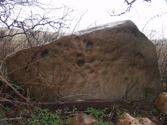
On the way I saw the hedgerow stone pictured by stubob, but devoid of the vegetation in his photo (see my picture). Oh, and there was a crop circle just to the south, but it looked a bit 'amateurish' to my eye, kind of incomplete...
Backtracking, I crossed the road, and followed the footpath signs in the opposite direct, up Waden Hill, from where I could see both Silbury Hill and West Kennet Long Barrow
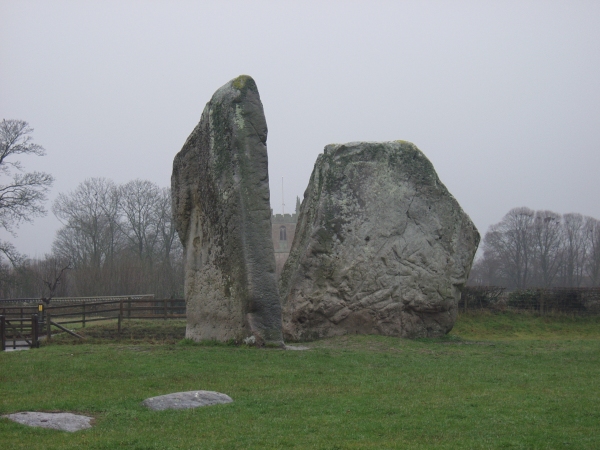
We then went into Avebury itself, where we failed singularly to spend any money in the Henge Shop, and I got back in touch with the stones - it's been far too long! It was a shame to see so much erosion on the banks, but they are now roped off to allow the grass time to recover, so here's hoping more drastic measures aren't required.
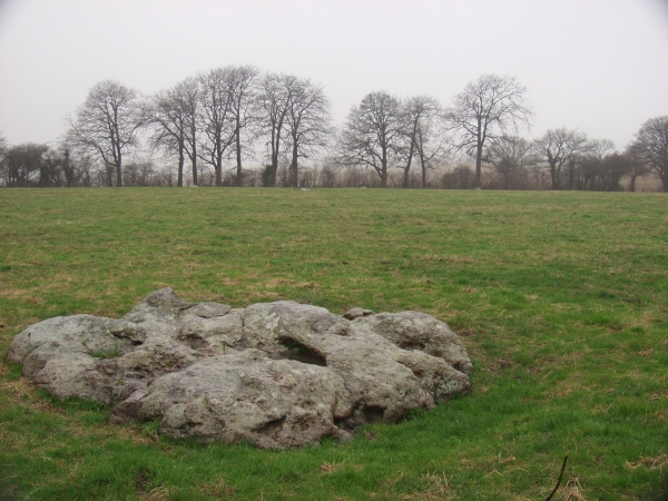
Next on the list was another new site for me: Winterbourne Basset circle.
Easily found, following the map, and the NW outlier at the junction tells you you've arrived. We pulled into the No Through Road on the left, and parked on the verge (the pull-in that Moth mentioned was gated, and very muddy).
A real mystery, this one. I scaled the ladder stile and entered the field, to find 5 stones in a parabola, suggesting an ovoid 'circle'. And unusually, a central stone. Plus of course, the two outliers. None still standing, and the possibility that this wasn't the original location of the stones anyway. Lots of questions and very few answers. I could get no real feeling of what was what, so had to leave somewhat unsatisfied.
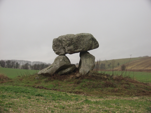
Returning back through Avebury, I decided to give the Devil's Den another try, but still couldn't find a safe parking place off the A4 at Clatford. Quickly referring to the map, we spotted a car park marked at Manton House, with a footpath/bridleway which led around to the Den. This did the job, and I'd completed my list for the day despite the weather, and it was still only 2:30pm!
Unlike just about everyone else on TMA, I declined to park on the A4 verge due to the madness of various daredevil drivers. Instead, we headed for the car park at SU159699, and I took a longer, leisurely walk along the bridleway at the opposite corner to the entrance to the car park.
The bridleway is bounded on the left by a white topped, electrified fence. I didn't test to see if it was on, but after about 500 yards or so, the Den appeared on the near horizon. It seemed a long way away, and following the fence, I wasn't sure if I'd actually be able to get access, but the fence and bridleway headed left eventually, and down into the dale. A gate at the bottom of the hill led to the overgrown footpath, about 500 yards away from the barbed wire 'stile' near the stones. This last stretch was muddy, and I'd imagine could be quite overgrown in high season, unlike the lush grass track I'd taken thus far. The round trip took me an hour, and I'm not as fit as Moth, so it's probably a comparable distance, with no difficulty parking.
The location itself is stunning, but I kept asking myself, 'why here?' Surrounded by hills on all sides, there is no obvious view or alignment for the 'barrow'. The stones lie on a distintive mound, but I suspect most of this is field clearance, as the restoration is is quite obvious, and the concrete was, for me, quite off-putting. I'll be back though, if only for the views from the approach.  |
But the Polisher will have to wait for another day!
|
What we did on our holidays...
Cornwall October 2003
03.10.03
A 4:00am start saw us pass the first planned stop of the day in the pitch dark. Popham Beacons were totally invisible at 5:30, so we continued on via Salisbury, down through the mist and fog toward Dorchester.
The first site of the holiday was therefore The Nine Stones of Winterbourne Abbas, after a break for breakfast at the local Little Chef.
Visited 3rd October 2003
Even at 7:30 in the morning, the A35 is a damn dangerous place! Parking on the wrong side of the road in the 'makeshift layby', I precariously made my way the 50 yards along the road to the small concrete bridge across the ditch to the oasis of calm that is the stones. Despite laying only feet from the roar of the traffic, I was surprised at how little it intruded upon the stones.
A ritual had obviously been performed here the previous evening, as a clear swept circle of leaves remained in the middle of the stones. Unfortunately, the light was all wrong for photographs, and I encountered the same difficulties in taking pictures that I had when trying to photograph the Hoar Stone at Enstone. All were out of focus, with a strong colour cast, despite using a monpod.
Access: Dodgy, even for the fully fit, due to the traffic hazard.
Continuing along the A35 we passed through the Winterbourne Poor Lot barrow cemetery, but missed the lay-by that contains the Broad Stone. We did stop to take a look at the Helstone though, shrouded in the mist alone in its field.
A couple of hours later, we pulled into Chagford for a comfort stop, and to check the maps to find the way to Fernworthy Forest.
Visited 3rd October 2003
Like Martin, we drove as far as possible along the approach road, past the official car park. The forest track heads off to the left from this point (don't follow the footpath immediately ahead). The track rises steadily for a way (took me what felt like about 5-10 minutes, but with no watch it's hard to say). Suddenly the clearing appeared to the right. Two large stones proclaimed the entrance, but I think they're there to stop possible vehicles (which obviously use the track) from progressing further. The site opened up from this point on, everything being nicely laid out before me.
There was no fire damage evident within the circle, although there was a fire pit just outside of it. What was obvious to me, was the slant of the circle, with taller stones on the south progressing down to smaller ones on the northern side. I'd seen this effect before, during our trip to Ireland earlier this year. I don't recall seeing this in other circles in this country, but then I don't remember what I had for breakfast this morning!
Later: I saw this Frith photo which shows the site in 1907 - quite a difference!
Access: A fair uphill trek to get to the area of the sites. I wouldn't want to push a wheelchair up here - it's quite a bumpy path.  |
3rd October 2003
From the access track, several very low stones, barely poking above the earth were evident. Also apparent were several moss covered tree stumps, which confused the picture somewhat, as it was necessary to determine which were stones and which were stumps. It was quite tricky to make out the stone row, which didn't seem that straight to me. 3rd October 2003
Lying to one side, in a cleared area parallel with the forest track, the cairn sadly had a significant fire pit on top of the mound. Despite the low number of stones, the circle can clearly be seen. 3rd October 2003
The northern row gave me slightly less difficulty that the southern row, but many of the stones are extremely low indeed. The blocking stone stands a foot or so high and was the most recognisable to me, the grass being fairly rough and high during my visit.
Having already been on the road for several hours, and still a long way to go, I decided to forgo trekking out to the Greywethers on this occasion. We failed to spot the Heath Stone either whilst approaching or leaving the forest, but there are a lot of stones, random bumps 'n lumps and the remains of old field walls to choose from.
As the mist was finally lifting, and the sun broke through as we crossed over Dartmoor, I took the opportunity to revisit the Merrivale complex as my previous visit had been somewhat damp.
3rd October 2003
Last time I was here, it was typically Dartmoor damp. This morning, it was typical Dartmoor sunshine, a glorious day!
I took my time walking the rows, circumnavigating the circle and outlier and I actually found the cracked cist this time - I'd totally missed it last time round.
An excellent place to stop on the moor whatever the weather.
Stopping briefly in Liskeard for a late lunch, we eventually arrived in West Penwith some 320 miles and 13 hours after leaving home.
04.10.03
Despite copious lists, and piles of printouts, I'd planned nothing particular for today, so we drove into Redruth, and did some retail therapy. From there, we approached Carwynnen, where I viewed the quoit from the road, rather than clamber over the field boundary and trespass. We then drove down to Porthleven for lunch before heading back toward Penzance. Travelling along the A30, I was heading for St Just's airport when Boscawen-un slipped past. I quickly pulled over into the small lay-by and headed down the path to the circle.
4th October 2003
I adore this place - I want to have its babies. The bracken was chest high, and I wasn't sure how much I'd see of the circle today, but I needn't have worried as the centre stone was easily viewed from the approach. When I was last here at this time last year, the stones were almost completely covered by the bracken, but some care has been taken this year to keep them clear. The sun shone, and the stones were all quite warm, apart from the large quartz stone, which was icy cold to the touch. Its magic worked on me once again, and I found it very difficult to leave. I daren't look back as I finally left, in case I felt impelled to return.
Access: Difficult even in good conditions -it's a tricky (though not long) walk from the road whichever direction you approach from. I'd suggest able bodied access only.
Returning to the car, we continued on to the airport (where I booked my ticket for the Scillies for next Friday). Travelling through St Just (one day, we want to live here) I'd hoped to revisit the Tregeseal Dancing Stones and to find the holed stones close by, but I missed the turning.
We therefore continued on to Men an Tol studio, where I'd hoped to pick up some books, but the studio was closed for the winter. Rather than walk up to the Men an Tol today, I consoled myself by stopping at Lanyon Quoit and took some photos there.
We continued back to Penzance and the A30, past Madron Well, which I noted is no longer signposted simply as 'Madron Well', but as 'Boswarthen celtic chapel and well'.
The final stop of the day was the Fairy Well at Lelant.
4th October 2003
This place is seriously out of the way! Thanks are due to Goffik for his directions which led me straight there. This is not somewhere that someone who has a problem with heights (like me!) should go. Goffik's directions state 'take the left fork'. As the path clings limpet like to the side of a very high cliff, the only way I could see a left fork taking me was straight down. Luckily, the main path forked right and up, and the left fork consisted of just a few steps down to the well itself. There's not much more than a thin covering of foliage stopping anyone falling off the cliff though, so I wouldn't suggest visiting here in wet or windy weather.
Access: Not for the faint-hearted!
05.10.03
We started the day at a Boot Sale in Hayle, hunting in vain for bargains. No archaeo books to be seen.
After a quick and noisy breakfast in Tesco's, we headed along the Zennor coast road, heading inland for the Men an Tol. I decided to take the walk this time, and managed to get some good photos.
5th October 2003
Having read the Cornwall Archaeological report from 1993 last night, I'm more convinced that this was a circle at some point in the past. On previous visits, I'd not noticed the buried stones, and the approach path from the track has what could possibly be a fallen (and now semi-buried) outlier across it. To me, this only adds weight to the theories.
We headed south toward Tregeseal, but the track I'd hoped to take (at SW372324) proved impassable in the car, and with time passing, we continued on. Tregeseal will have to wait.
Continuing around on the coast road, we came to Sennen.
5th October 2003
From opposite Sennen Church (with its couple of fine old crosses), a private road runs back toward the farm buildings. The footpath is shown as going up to the shed, but I'm not sure where it goes from there. I ventured over the locked gate, and around the back of the shed, startling a large fox in the process.
The stone, visible from the road when the foliage is low, is built into the field boundary wall, is covered in lichen, and I'd guess stands approx 3-4 metres tall. Being on private land, permission should really be sought, but there was no-one around during my brief visit, other than a herd of cows in the neighbouring field.
Alsia Holy Well was next on today's list, so we headed inland toward St Buryan.
5th October 2003
After a false start, confused a little by the directions here, I found the stile easily enough. Park by the Alsia Farm entrance drive, and walk down (West) past the Mill. The stile is on the left, opposite what would be a parking place if not blocked off by stones. Climb up the stile steps and a totally unexpected view awaits. A pleasant meadow with a large informational sign leads to the far field boundary, where another small sign points to the (private) footpath leading to the well. Down the hill, the bracken and brambles open up on the right, and turning right into the brambles again reveals the rusty gate by the well.
Access: The initial stile is quite high, but the walk is reasonable across grassland. The return trip is uphill, and the stile can be tricky to return down to the road.
Passing through St Buryan, and saying a quick hello to the ancient cross outside the church, we carried on up to the A30, to Drift, then NW past the reservoir to Sancreed and the Holy Well.
5th October 2003
I took the approach from the telephone box opposite Sancreed Church, which had a sign advising that an alternative path was available 300yds up the road. The approach was long and narrow - no room for a wheelchair here. The path is quite clearly delineated, except for one point where stiles appear both in front, and to the right. I chose right, which was right! A short incline, and the well appeared in front of me. The first thing I saw was the ugly modern cross that's been erected here. Climbing down into the well, I spotted the phosphorescence straight away, but it proved difficult to photograph. Sitting in the cracks on the far walls, it gave the impression of minute fairy grottoes, complete with lighting!
After 10 minutes or so, I began to feel uneasy, and had the start of a headache, so decided to leave. But before finally leaving I took a quick look at the remains of the small chapel just above the well. Only part of the walls remain, similar to, but in a worse condition than the chapel at Madron Well.
Leaving via the continuation of the footpath, after a short climb a stile led to the road, just around the corner from my starting point.  |
Deciding to miss the rest of the day's list, we returned to Hayle to prepare for the evening's entertainment: The Old Rope String Band were playing at Praa Sands. An excellent evening's fun - this is the fourth time I've seen them in 10 years, and I always leave in pain from laughing so hard! Well recommended.
06.10.03
After last night's excitement, today was to be a gentler day. A trip into Truro proved expensive. I saw a copy of Barnatt's Sacred Wells of Cornwall for sale in a flea market for £75! I was sorely tempted, it being a limited, signed edition, but finally managed to resist, rationalising that I could spend that amount on books about stones (my primary interest), whilst wells are only a secondary interest. In fact, I spent that, and more during a visit to the museum, lusting over the Neolithic finds and geological displays, then picking up an armful of books in the museum shop. This was followed by a visit to an antiquarian bookshop (another 25 quid), then Mikki kindly purchased a copy of 'Megaliths' by David and Lai Ngan Corio - a large format coffee table book containing wonderful b/w photos of some of the most famous landmarks around the country. An early Yule present. She is wonderful!
On the way back, we headed for Falmouth, and diverted off to take a look at a couple of sites: Mabe Church, Eathorne Menhir and Trewardreva Fogou (Piskey Hall). We didn't find the Eathorne Menhir, which isn't shown on the OS map, but the others were easily located.
6th October 2003
There's a car park right next to the church, and a 30yd or so gated path down to the church. The stone is just past the entrance door to the church.
I didn't notice when I was there, but from the photos I took, it looks as if a smaller stone has been perched on top of the main stone, which stands on a slight mound next to the path.
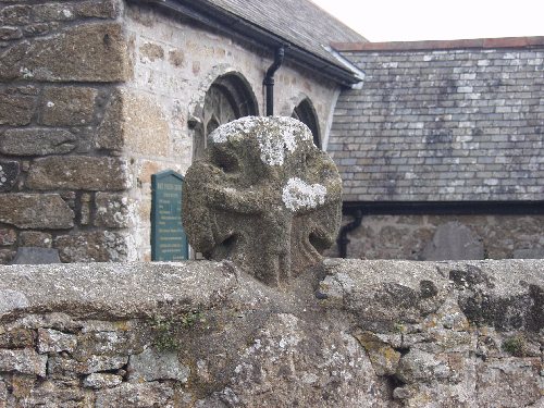
An old cross stands on the opposite side of the path (W Cornwall 69). This cross was first recorded in the 1890s, located in the vicarage grounds. It had moved to its current location by the 1920s.   |
6th October 2003
The fogou is actually in sight of the road, opposite the entrance gate to Trewardreva House itself. A herd of cows in the adjoining field made me slightly nervous, as they all charged toward the gate as I entered the field. I wasn't sure if they could get into the field containing the fogou…
Andy Norfolk described this as a "cosy, cuddly fogou" on the Stones Mailing List, and I'd have to agree with him. I didn't descend all the way in, partly because of my bovine nerves, but it looks as if the main passageway may open out to the right at the end. Craig Wetherill in Cornovia refutes this stating that "it was once thought a branch passage may have run southwards…this is now considered unlikely".
Daylight pervades the far end of the fogou, where the covering stones have shifted somewhat, but this didn't detract from the cuddliness for me.
Tracking between the sites, we spotted (and photographed) a couple of wayside crosses at SW754320 and SW 729304.
We must have also passed by the Tolven Holed Stone without realising it on the way back to Hayle, via Helston and an early finish to the day.
07.10.03
I had only two things planned for today: a walk across Treen Common, hopefully to Bosporthennis, and a walk up to Tregaseal Holed Stones. We arose early from our slumbers, had a quick breakfast and hit the road. Unfortunately, the weather was against us, and as we passed through St Ives to the coast road, it closed in substantially. Crossing Rosewall Hill, we couldn't even see the coast to our right.
Making a quick change of plan, I stopped in Zennor to take a look at the church, and the Zennor Mermaid carving inside. Quite an intricate carving, but the tourist gumph alluded to the comparison between some Israeli woodworker being semi-divine, and the mermaid being semi-aquatic. I didn't get it… There were a few old celtic crosses outside the church though. And I saw the Rev. Borlase's grave, which was nice.
We continued on to Porthmeor (Treen) Common, but it was not to be. The fog and mist had descended and we could barely make out the side of the road from the car. It would have been foolish to go tramping across the common in such conditions.
Instead, we continued on the road, through Mulfra and Newmill to Gulval to take a look at the Bleu Bridge Inscribed Stone:
From Gulval Post Office, we headed north up Trevarrack Road (Green Lane Hill is on the left). As the main road bears round to the right, bear left (signposted as a cul-de-sac). Then as it starts uphill, park by the houses on the left, just past a path that looks too small for a car (it isn't!). Walk down the path for 30 yards or so, and the road comes to an end. The stone is across the stream, bridged just ahead of you. It is possible to get a car down here almost to the bridge, which looks wide enough to take a wheelchair if necessary. I didn't risk it, because I've a lousy turning circle on my car.
The stone is against the wall, and a small marble plaque alongside it identifies the inscription and dates it as circa 6th Century.
We then stopped briefly in Penzance to look at some vastly overpriced pamphlets in the bookshop there. 20-odd typed and xeroxed pages from a 1967 survey of monuments in Penwith, cover price 50p, priced at £12.50? I don't think so, matey!
With the day's plan shot, but the weather seeming to lift somewhat, we went on a wander down towards Newlyn, and I decided to look for the Sheffield Menhir. Sadly, I didn't locate it this time round.
Just down the road though, was the Merry Maidens landscape: first Boleigh Fogou (we didn't have permission so didn't even try to get access), then the Pipers, the Nun Careg stone cross, the holed gatepost, the Merry Maidens, Gun Rith, and Tregiffian.
7th October 2003
I spent quite a while at the Maidens today, and had the place to myself for a change. The wind was blowing a gale, but at least the fog had lifted by the time we got here. I managed to take some nice photos, but nothing that isn't on TMA already, though I may try to stitch a panorama together at a later date. 7th October 2003
Nice to see that Gun Rith has been re-erected, complete with original (or near as dammit) lean. The base has been placed into concrete this time, and the field wall has been reconstructed around it, so hopefully it won't fall again in a hurry.
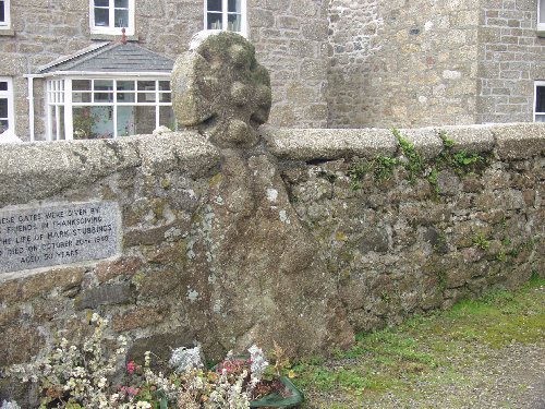
Finally, turning around and making our way home, we made a slight detour to take a look at the Paul Celtic Cross.
7th October 2003
The way this has been 'restored' onto the church boundary wall, makes it look like one with the large (probably originally standing) stone underneath it. I don't think this is the case though. Andrew Langdon in 'Stone Crosses of West Penwith' states that "the shaft and base no longer exist".
08.10.03
Today was a bit of a mess of day, with no distinct plan. I've seen most of the 'attractive' Cornwall sites during previous visits. I did have a list of sites I wanted to see though, so we drove over to St Austell to check out some things in that direction.
We started at Menacuddle Well and the Druids Chair. A quick check of the map showed that the Menear Longstone wasn't too distant. so that was next.
We then headed over towards Fowey, to look at the Tristan Longstone, Castle Dore and the Golant Well.
I had hoped to get across to Duloe, but we didn't get that far, returning instead via Trago Mills and some more retail therapy. I'd also thought to revisit Trevethy Quoit, but again missed out this time round, although we did drive via Carnglaze Caverns and Golitha Falls before getting as close as Doniert's Stone before turning for home.
Passing through Cambourne, we took the opportunity to stop and look at Maen Cadoar. A long day.
09.10.03
A quiet day today, conserving myself for tomorrow's trip to St Mary's. We drove around the Lizard, past St Ruan's Well, and then up to Goonhilly. I found the Dry Tree Menhir without any difficulty.
9th October 2003
No problems here. Turn off the road just south of the Goonhilly Visitor Centre, into the old RAF centre, which is now in use as a car park. Take the path that leads back to the Earth Centre. And follow the path round to the left. When the fence disappears to the right, follow it around, keeping the fence on your left at all times. After a couple of corners, the Dry Tree is in front of you. Watch out for adders in season, apparently!
This is a big old stone, and as others have said before me, affords lots of photographic opportunities with the modern comms dishes in the background. It was re-raised early in the 20thC, supposedly not too far from its original position.
After lunch in Falmouth, we took a slow drive home, and stopped briefly at Tolven (no-one was home, so I contented myself with peering over the fence at the stone).
We finished the day with a stop at Phillack Church to see the crosses and inscribed stone there.
The inscribed stone was discovered built into the fabric of the church during renovation work in 1856. It now rests against an out-house to the east of the church, alongside the rather battered remains of the Wheal Alfred cross. The stone looks similar to, but is less moss-covered than the Bleu Bridge Inscribed Stone, and is likely to be of a similar age. I couldn't make out the writing on the stone itself.
10.10.03
I had an early start today, leaving Mikki behind (aerophobiac that she is!) for a trip to St Mary's in the Scillies. I had an 8:55 flight from St Just's, which left slightly early, and I was in St Mary's by 9:15.
Having pored over the maps beforehand, I'd decided on a clockwise route around the island, being totally dependent on this trip on Shankie's Pony. It looked a long way on the map, but I was pleasantly surprised by how quickly I reached Hugh Town. A slight misread on the map meant that I took the wrong path for Buzza Hill, but that was quickly corrected, and I stood on the hill, with the Western peninsula of the island spread before me, and the ruined carn overlooking Porth Cressa. There is supposed to be a second carn up here, but I couldn't see it.
Coming down off the hill, there was time to make a quick "I'm here safely" call to Mikki - be warned, mobile coverage is patchy/non-existant on the island - before moving back through Hugh Town and the coast path that leads to Harry's Walls and the Mount Flagon menhir.
A very pleasant stroll ensued, partly on tarmaced paths, and latterly a struggle on a deep sandy path, alongside the golf course, up to Bant's Carn and Halangy Down village. It was now 11am.
The carn is most impressive and sits 50 yards or so uphill from the village remains. There really is too much here to make sense of at ground level. Lots of rocks, several houses (some with separate chambers) and some field layout too! It really does look best from the air, if you're lucky enough to take that route on the way back to the mainland. Later in the day I was that lucky, but was unable to take any photos.
Continuing along the coastal path, it dips inland and becomes a gravel path again, past some old quarry workings. From here, Innisidgen is well signposted, but before that is the path to Long Rock, in the shadow of the radio mast which dominates the north of the island.
Returning to the coastal path, with spectacular views in all directions, the path turned to a soft loamy soil, with a lot of 'bounce' to it, which made for very easy walking. Turning a corner, Innisidgen Lower Carn came into view. Somewhat ruined, but the form can still be made out. The Upper Innisidgen Carn is in much better condition, and I'd reached it with minutes to spare for my midday target time.
Leaving the coast path at Windmill Cove, I headed inland to continue the journey by road. 'Twitchers' were everywhere, carrying large tripods with large lenses attached, and radios squawking. I've never understood the attracting of 'ticking' birds, but then I look at big old rocks, so who am I to argue?
A short while after passing the Pellistry Bay tea rooms (which I'm told are very good, but I didn't stop), I saw the sign pointing back to the coast and the Porth Hellick Down tombs.
10th October 2003
There are apparently 8 tombs in total here. The main one is well signposted, and has been restored by EH. I managed to find two of the others in the thick heather, as well as a strangely sculpted rock that looked like two IKEA armchairs, before the rain finally started. The landscape is difficult to make out, the various lumps and bumps looking like a lunar landscape hidden in the plush heather.
With the rain getting heavier, I headed inland across the Higher Moors Nature Trail to rejoin the road close to the entry to the airport.
I'd now seen all the sites I'd intended, and it was only 14:15. My flight was scheduled for 16:40, so I had a couple of hours to kill. Not enough to get anywhere interesting, so I headed for the nearest pub in the Old Town, 10-15 minutes from the airport, for some welcome refreshment and a quick (but expensive!) meal.
I was told that next week, over 4000 birdwatchers would be converging on the island. It made me glad I was there this week! The island is beautiful, with wonderful views across to many of the other islands in the complex. I was surprised that none of the tombs I'd visited had any obvious visible alignments. The trip cost me just £60 on a day-return special. I understand the usual price is closer to £80.
11.10.03
Stiff and sore from yesterday's exertions - I've not done that much walking for quite a while - we decided to just drive around some of the villages I've not seen before, including Mount Hawke, St Agnes, Porthtowan and Gwithian. So it was very much a stoneless day to finish the holiday with.
12.10.03
And so to home. No planned stops, but we passed many sites of interest, including the Four Burrows, then closer to home, the Stonehenge landscape.
|
Showing 1-5 of 35 posts. Most recent first | Next 5 |
An ex-Londoner based in West Cornwall, any sites on the wrong side of the Tamar are now effectively out of reach as time marches on for me.
I was usually accompanied on trips by my partner and soulmate Mikki, who is disabled and unable to walk far. I'm indebted to her for her patience and understanding.
Favourite place? Cornwall without a doubt. West Penwith in particular, Trencrom Hill as a prime example. The peninsular is so rich in sites and has an amazing atmosphere. Every trip there is like going home... Avebury currently comes a close second, but is starting to go the way of Stonehenge (see below) and Glastonbury for me - over-used and over-rated.
Most overrated? Stonehenge - I can't understand the excitement that this totally spoiled site induces in people. I first went there in the 1960's with school and have been back several times since. Each was an anti-climax.
|