Return to the Land of the RSC - Day Four (& Five).
Day Four.
Due to other commitments, day four of my trip would be a shorter one – more like half a day. So I returned to where I left off yesterday – around about Dunnideer, and of course the all-encompassing Bennachie.
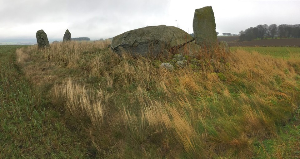
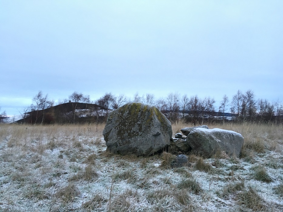
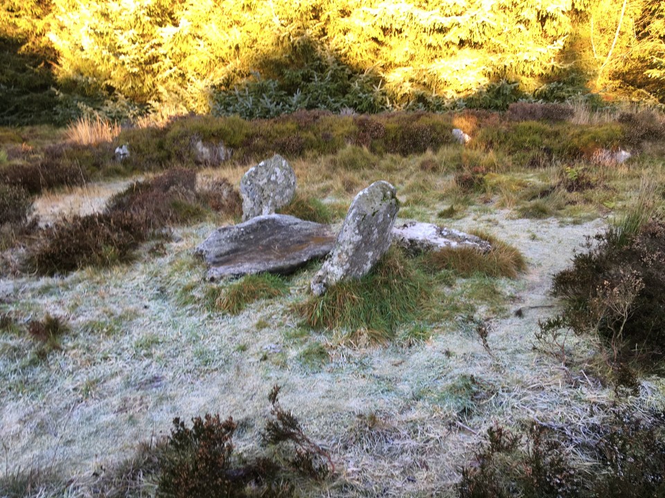
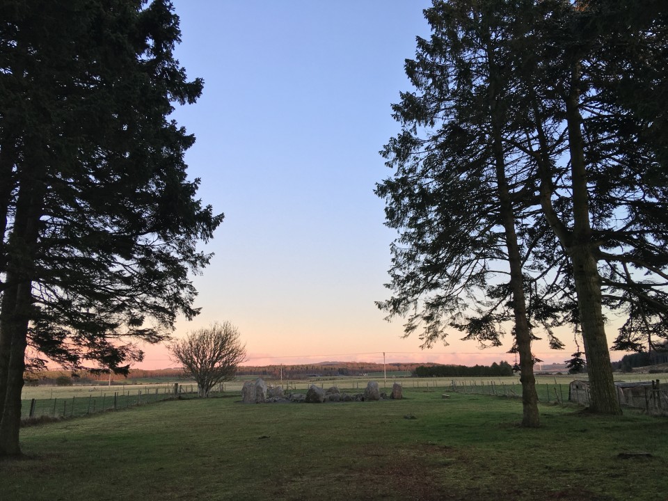
I headed off early, so much so that by the time I got to OLD RAYNE it was really still too dark to get a good view of anything. The light today wouldn’t get that much better as the day went on. After sitting there for a while, looking at my map(s) by the light inside the car, managing to block up a passing place, I finally left the warmth of the car and took the short stroll over the muddy field to the circle. One upright left, and a collection of big stones making up the recumbent and flankers, which sadly lay about. Finally this week, the weather turned wet and gloomy, not allowing any views over to those surrounding great hills, and I felt no urge to stay here much longer today.
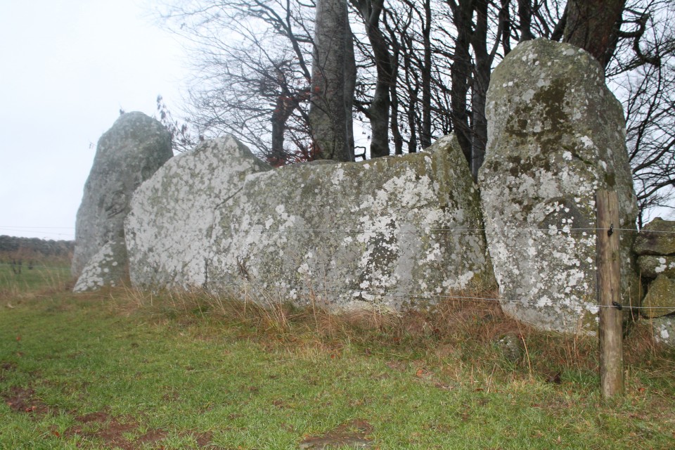
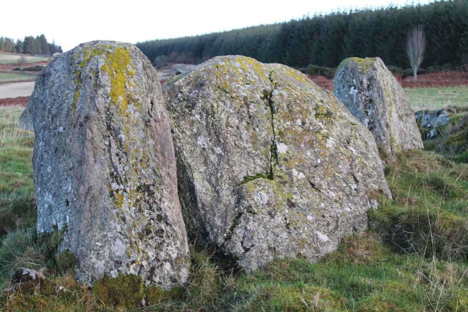
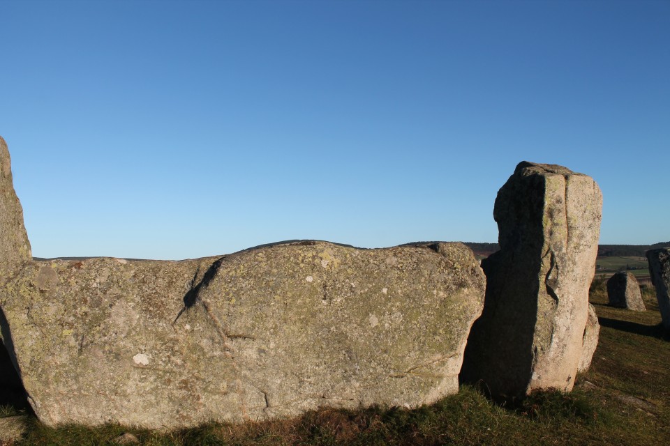
My inadequate little hire car dived through an increasing amount of puddles, as I sped over towards Daviot, first stopping off at NEW CRAIG, and a short hop over the gate and up to the impressive stones stuck in the wall. The recumbent and flankers look as imposing close up as they did from driving along the road towards them. I really like the remains of this RSC, and I’m really glad I saw New Craig this time. I had forgotten them (how?!), on a visit to Loanhead of Daviot years before.
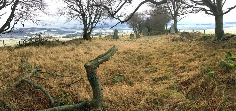
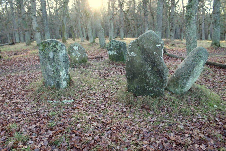
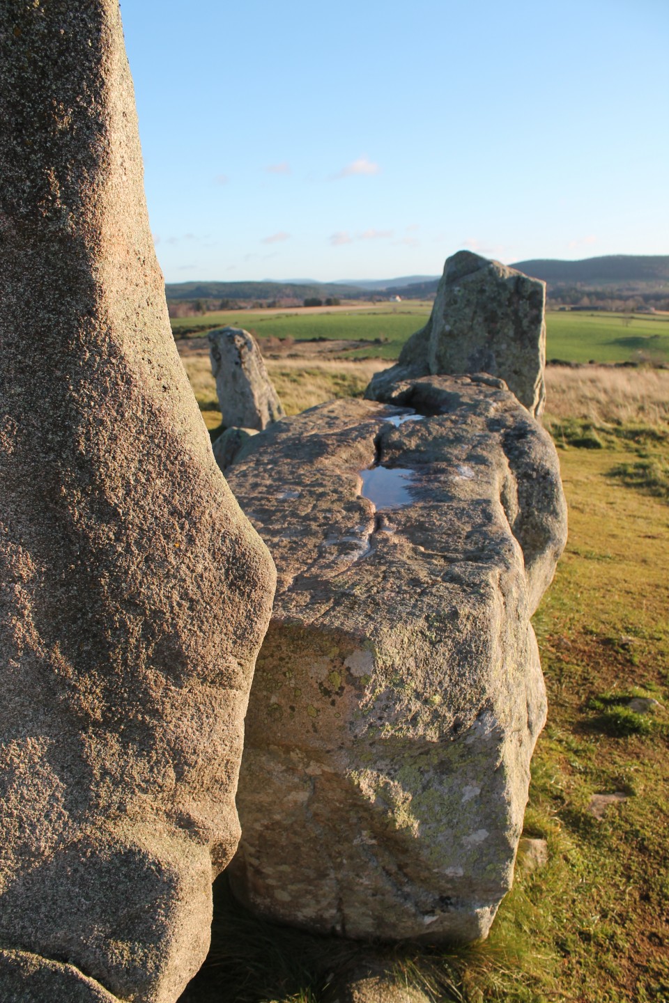
For some reason I remembered the walk through the wood up to LOANHEAD OF DAVIOT, as being a bit of a trek – it’s literally only about 30 seconds! Anyway, I headed off to the circle, as another visitor followed a little way behind. An elderly cyclist appeared just behind me at the circle –he said he lived quite nearby and had never visited the circle until today. Whether I scared him off, or he was just fed up by the weather or underwhelmed I don’t know, but (luckily) he left almost immediately. I feel horribly selfish when I arrive at any site, but really I just vant(sic) to be alone. Loanhead is a good as I remember it to be. It’s easy to be dismissive of this show site, and take it for granted just because it is so easy to get to.
Thought I’d go a bit more north, aiming for Kirkton of Bourtie, and ended up spotting HILLHEAD OF BARRA. I pulled in next to HAWK LAW, seeing various stones scattered about amongst the trees (though stupidly took no photos?).
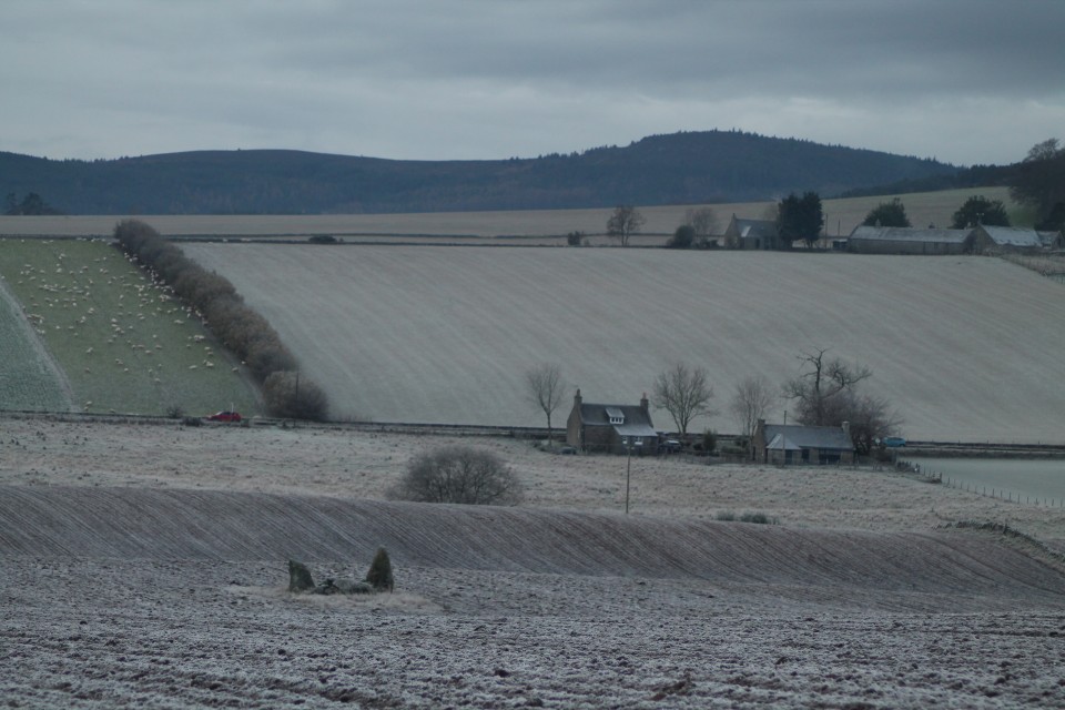
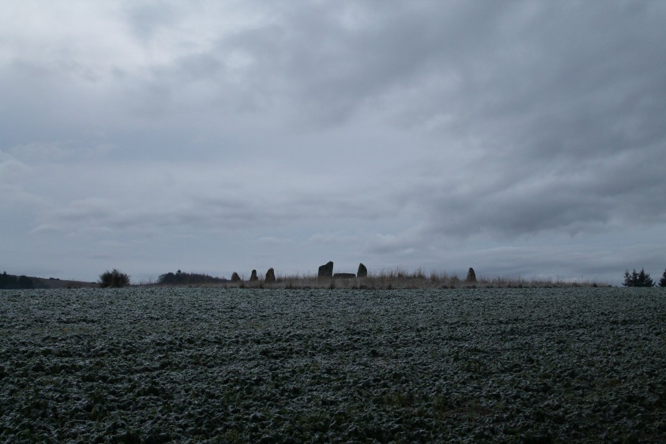
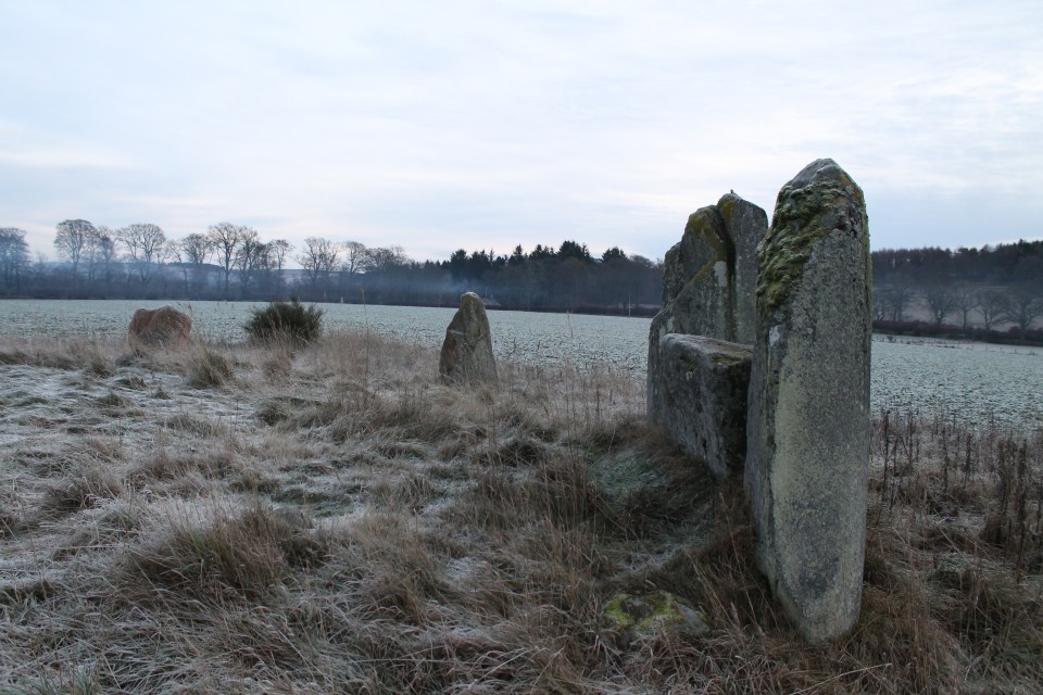
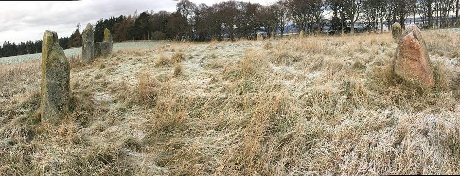
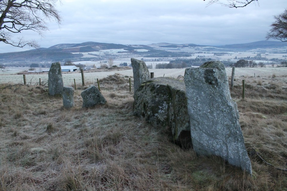
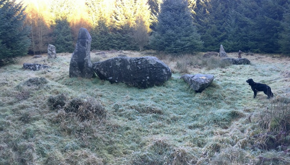
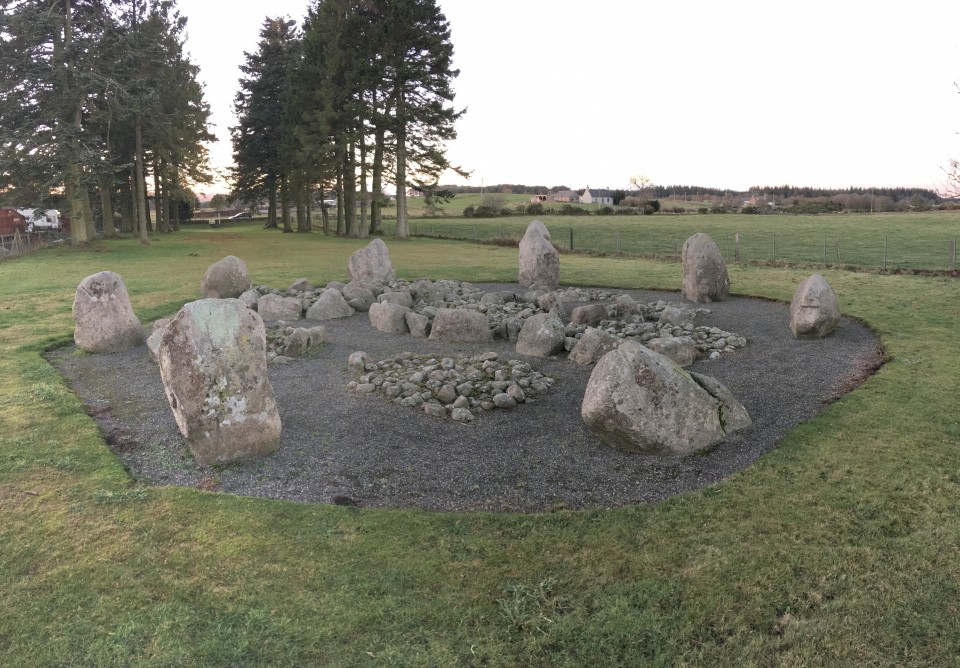
Shortly afterwards I came upon KIRKTON OF BOURTIE. Again the low cloud and rain offered no views, but the circle glistened nicely in the wet, and had my full attention. It was a slightly more together version of Old Rayne, which I had left a few hours ago. Again, these are big stones, set a bit higher up than the field on a rise. Spent as long here as I could – partly as the weather was starting to clear a bit – but then drove on.
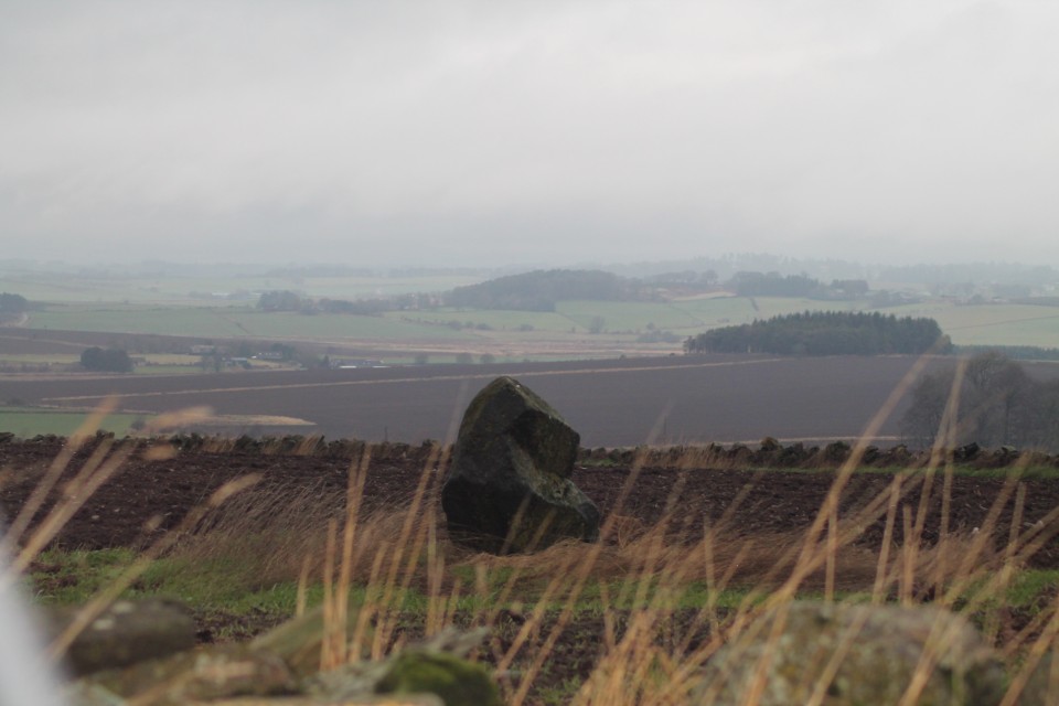
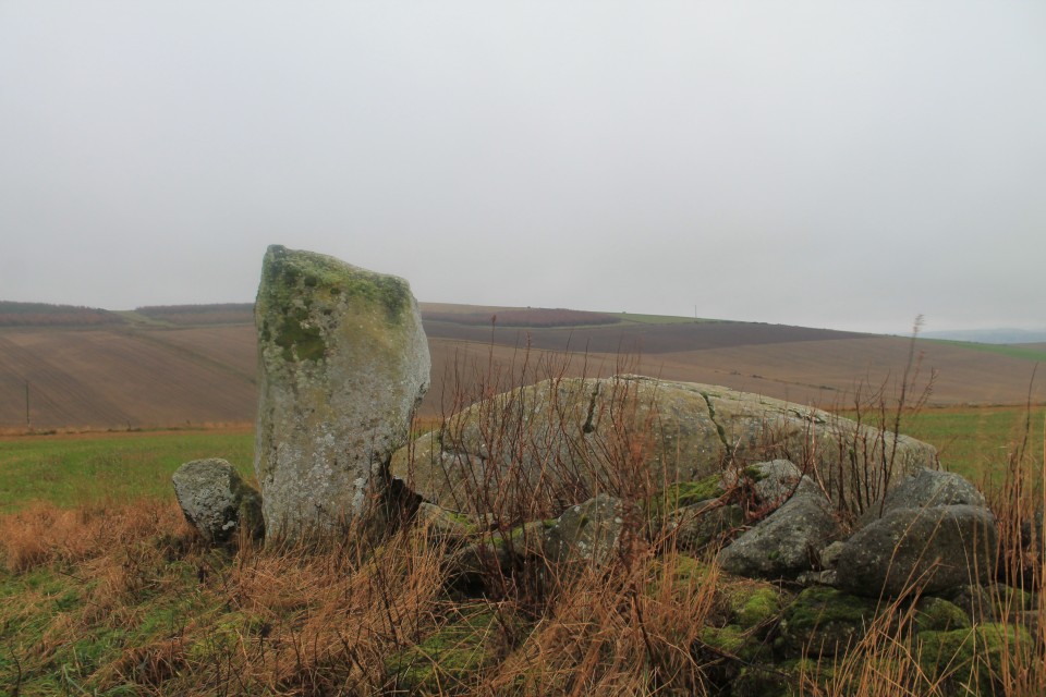
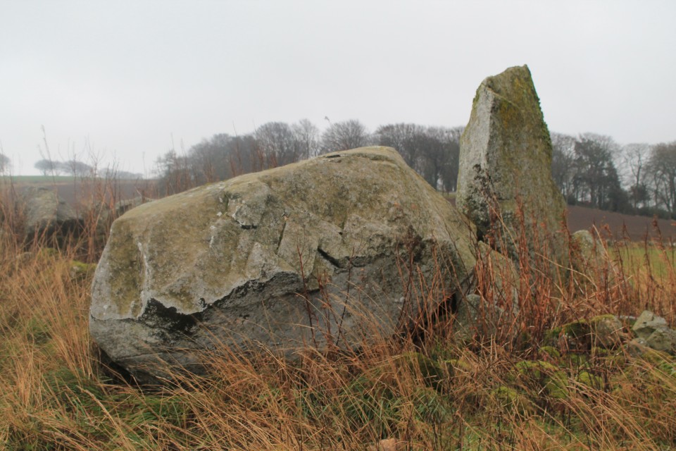
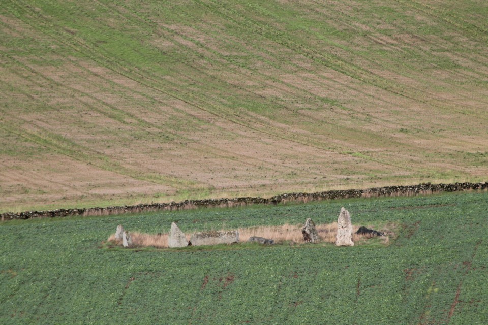
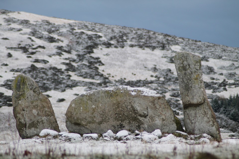
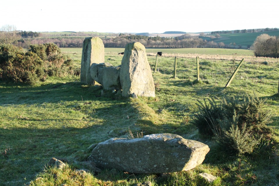
I was unable to gain access to SHEILDON, sitting up on its hill, and so carried on further to SOUTH YTHSIE. A nice easy site to reach (signposted all the way), and a neat little circle of six even and equal stones, raised up on a small mound. It has got a four-poster vibe about it.
Time was running out on me now, as I headed back through Inverurie. I had one last site to visit – Easter Aquhorthies. Well, actually I skipped past BALQUHAIN, and stopped for a picture or two. I regret not wandering down the hill to it, as it looked like it was quite easily accessible today. But as I say, time pressed on.
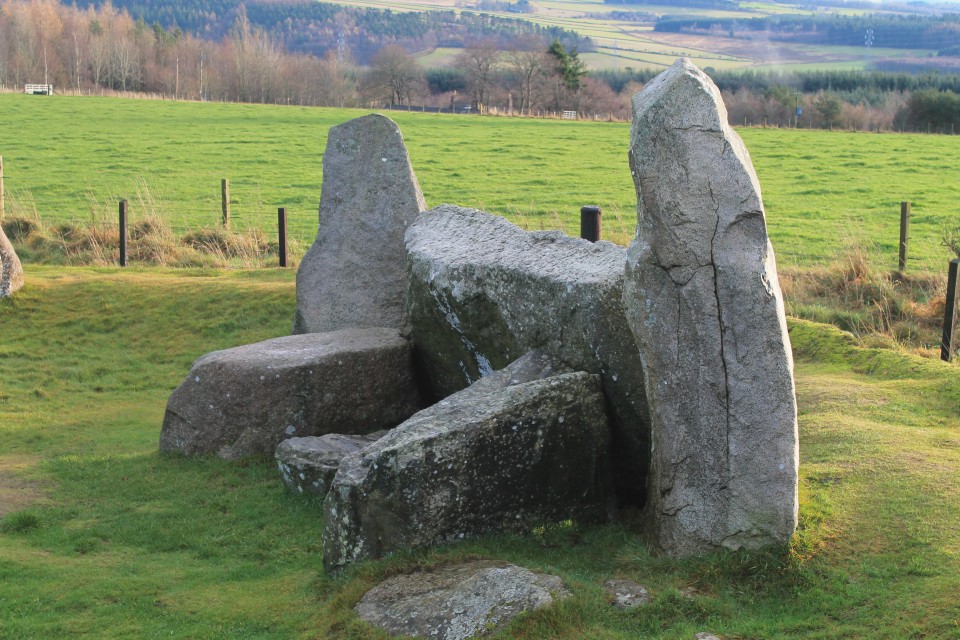
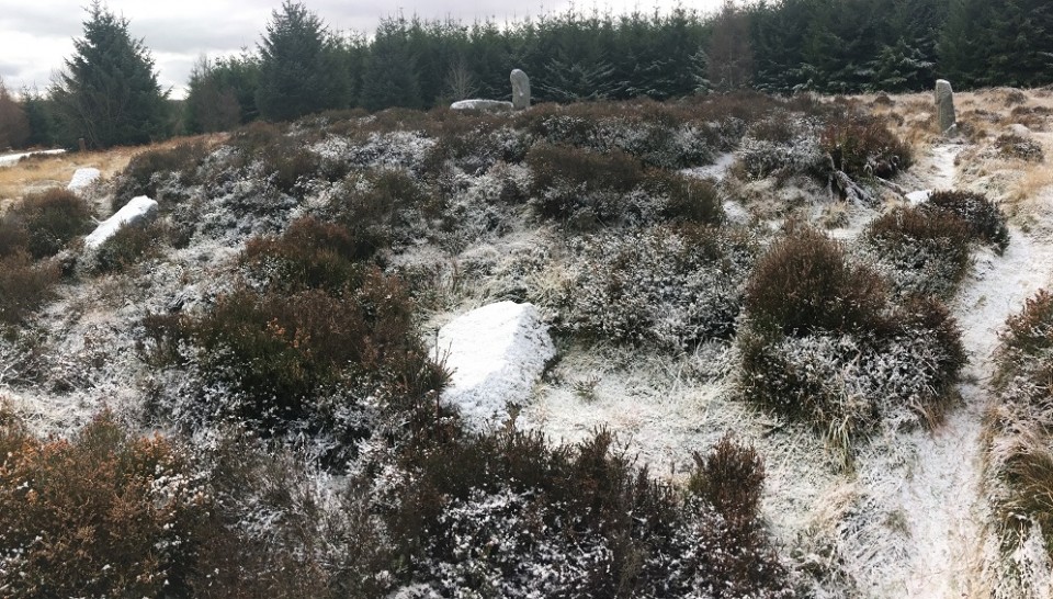
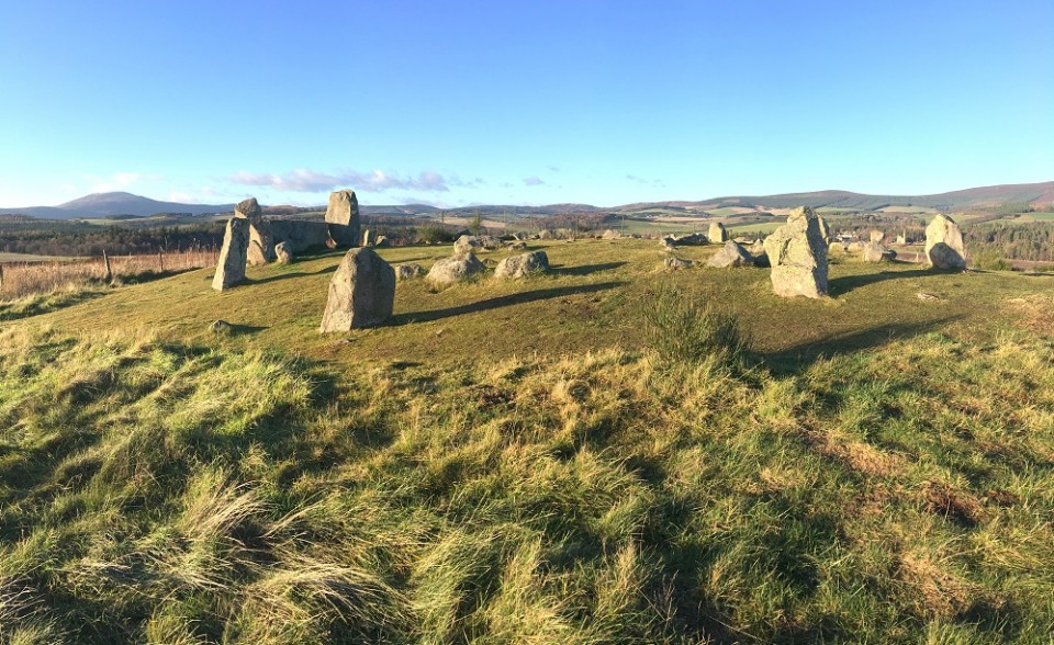
EASTER AQUHORTHIES was the first stone circle I ever visited over 20 years ago. Where it ‘all’ started. I thought I’d round off this wonderful trip to Aberdeenshire with a visit here. By now the clouds had passed, and the sun was coming out. Perfect omen. This circle felt like ‘coming home’ in a weird way. When I got into the circle I was suddenly only then aware of a banging/ringing noise seemingly coming from somewhere in the valley – one of the nearby farms? I sounded exactly like a heartbeat. It wasn’t easily placed as to what it was, and as I became totally distracted by this, something in me imagined that the noise was magical; that it was coming from the earth. It felt so right. Last time I was here the weather was appalling and visibility was zilch, so it was a bit of a shock for me to see that Mither Tap looked so close, peering over the hill.
A beautiful way to finish.
Day Five.
..Ah, yes…..
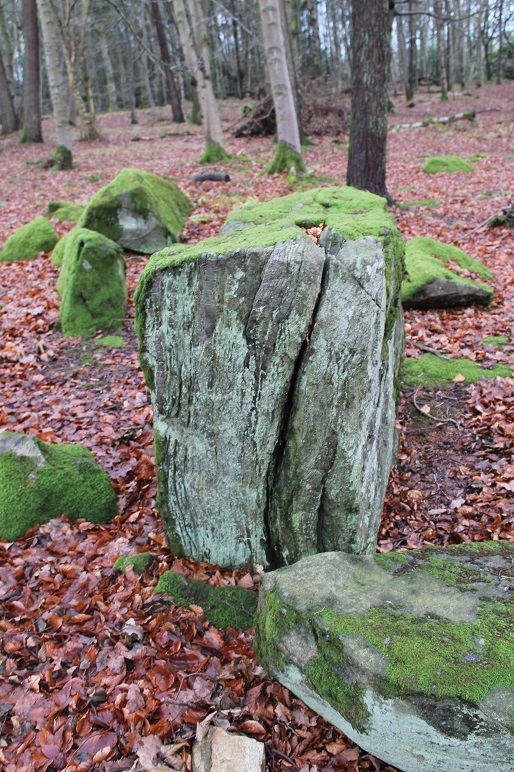
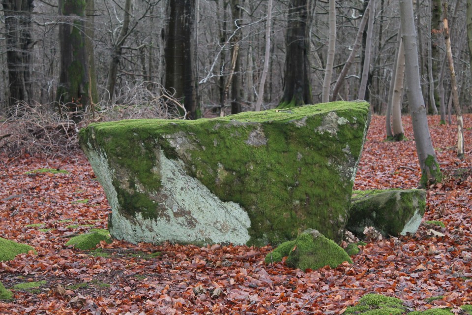
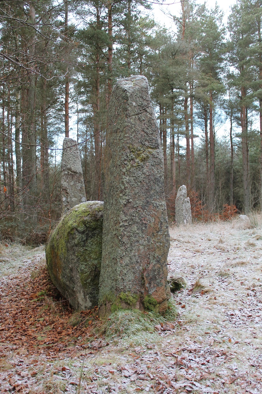
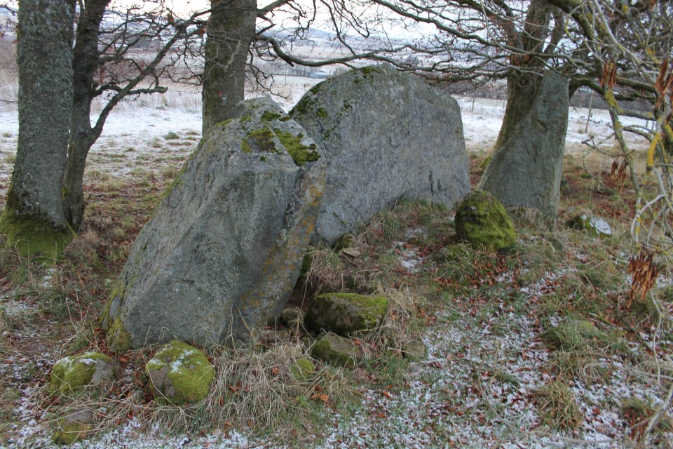
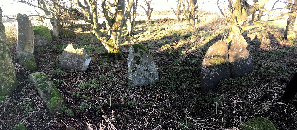
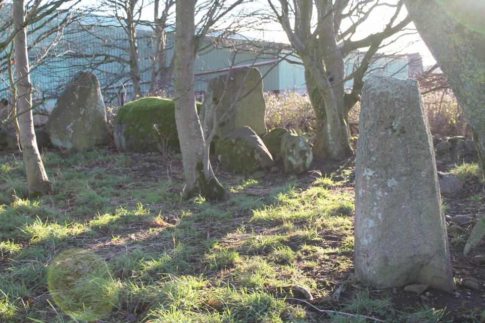
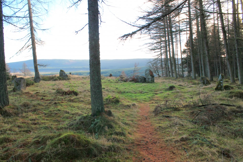
I had a few hours before I had to pick my wife up and we were to head to the airport, and then home. I had considered a quick trip to Tyrebagger on the way to Dyce, but instead I found myself in the vicinity of BINGHILL, which had caught my curiosity for some reason. Like others, I parked at the start of the row of houses back on the street, and walked back up to the corner, where the track headed off in the woods. By the first few properties there were lots of people around, and one homeowner awkwardly asked me what I was doing. Looking for the stone circle I replied casually – “oh” (no real opinion expressed). Anyway, the circle was surprisingly not as far in as I thought, and easily spotted. I really enjoyed this one – the stones glowing green/grey against the brown floor. Also it was more complete than I’d expected. The recumbent is a great little quadrilateral, reminding me of a block of charcoal, with its side ridges. Very different from other RSCs I’d seen, and a nice one to end on (Tyrebagger would have to wait until next time).
|
Return to the Land of the RSC - Day Three.
My third day in Aberdeenshire began with its coldest morning so far. -5 still didn’t feel so bad though, as the wind was kind, and the landscape just had a glorious monochromatic vibe.
Today’s target area was the A944 corridor running up from Dunecht to Alford, taking in the Dunnideer area of sites. More than enough to keep me busy!
I aimed for Balgorkar being first on my list, and as I travelled out that way I passed by the standing stones of SPRINGHILL, and had actually forgotten all about NETHER CORSKIE. I didn’t head down from the road, over the field to the remaining recumbent and flankers, instead I was satisfied with just a longview via the camera.
BALGORKAR itself is one I’ve wanted to see for a long while, since having visited Castle Fraser many years ago (pre-megalithic obsession years). At this halfway point in my week, I was aware of how lucky I was to have this chance to explore so many sites in one go, but also about wanting to actually take in each moment properly. It is not about ‘collecting’ numbers of sites, but more about having a number of experiences, and I reminded myself to soak up my time among these stones. In another life (my job), I get to teach mindfulness, and I was aware that this approach is something that easily marries up with each visit. Enjoy it, don’t rush it. At this point, a call from my daughter at University, made me spend a longer time here, and although equally focussing on her, I also had time to study the circle more. The mist hung low over the field with the two outliers nearby, and apart from some horses nearby nothing stirred in this frozen valley this morning. Balgorkar felt stark and ancient, and commanded my attention.
By the time I got to DEER PARK the sun was coming out, and this collection of three stones felt somehow warmer in every way, compared with Balgorkar. I parked in the cul-de-sac, just down from the big red gate on the corner. I walked down to the corner of the astro-turfed pitch, where a big chunk of fencing is lifted, leading onto a path down to the stream, which in turn leads down to the river. From here, you turn left along the bank, until in a few seconds you are about to leave the cover of trees, and then must turn left and head back up the hill towards the road. A pretty little spot.
Next up was a bit of a trek (20 mins each way) up the lightly snow-dusted forestry track that led to TILLYFOURIE. ‘Whitehills’ indeed. The snow covering the fallen stones really helped define the circle amongst the grass and heather. Although I felt away from everything, there were lots of footprints in the snow around and through the circle already this morning. Easy to find, and easy on the eye.
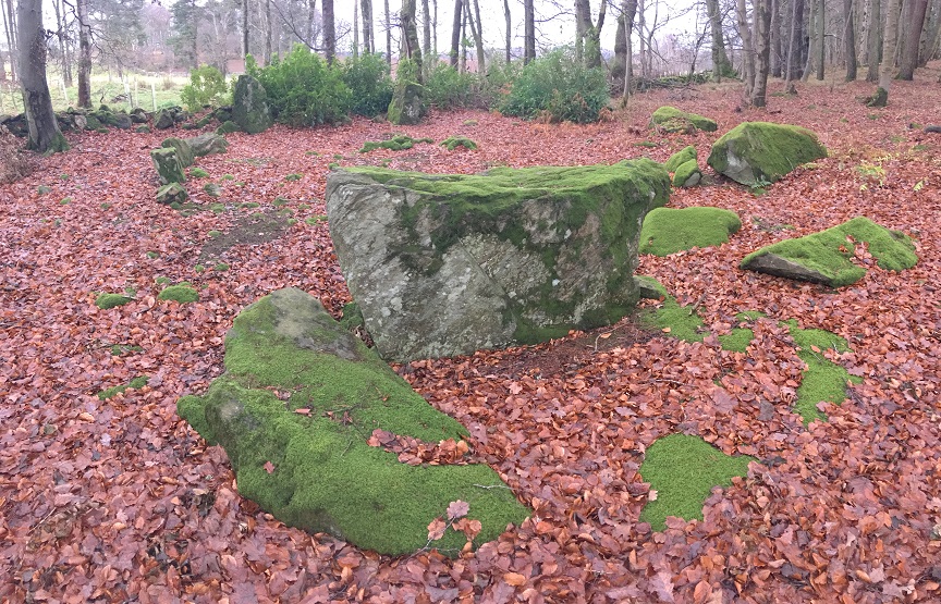
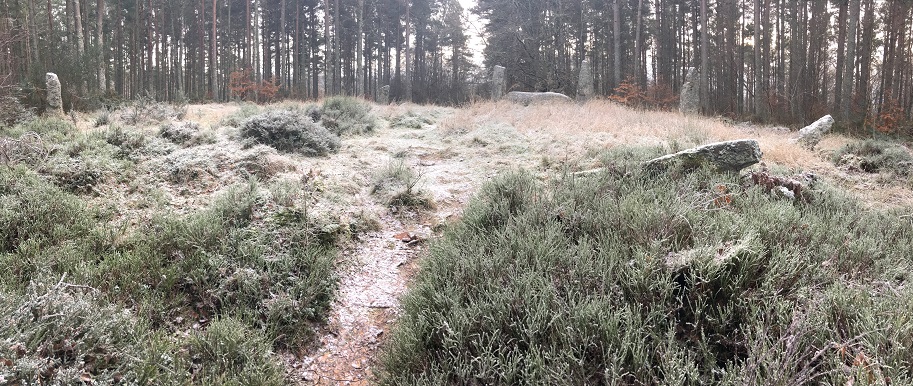
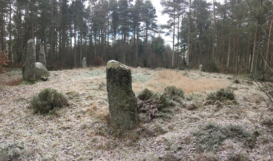
After leaving here, I managed to completely miss the road up to North Strone RSC, and after a long time spent at Tillyfourie, I decided that trying to get back on track (and a long-ish trek up to North Strone) would take too much time. So I pushed on, stupidly missing Druidsfield & Druidstones, and ended up in Keig. First I went east to COTHIEMUIR WOOD, following signs to the empty car park for the burial ground there. After a short walk into the trees, a path snakes off to the left, and you are soon into a clearing. Well…I suspected this one would be good, but Cothiemuir Wood RSC is just stunning. With just the clearing being frozen – the trees beyond sheltering the orange/green floor beneath – the site appeared like some holy relic. Like a cathedral of the forest. Beautifully graceful uprights, with sharp, balanced flankers gripping a massive slab of a recumbent. Winter suits this grey circle.
Probably the high point of my week, and shooting up my list of favourites. I really wanted to stay there for as long as possible, and found it hard to leave.
Still on a bit of a high, I made the short drive up to OLD KEIG, which provided a bit of a double whammy after Cothiemuir. Another fantastic RSC, albeit more trashed in part. The walk through the line of trees is all about the drama of expectation; leading you down the hill until big Old Keig greets you, like an old king in his branch-strewn throneroom. Although kept in its pen, and protected by trees, Old Keig sort of expands out into the landscape, down the valley and up to the distant rolling hills. This huge recumbent and accompanying stones have a truly timeless quality. Again, I could have stayed happily transfixed by here and nearby Cothiemuir Wood for as long as necessary. But, the afternoon was moving on…
On reaching ARDLAIR I had a change of heart – possibly feeling not encouraged by the lack of any “to stone circle” sign, which I expected to find.
I pressed on, wanting to get closer to Dunnideer. Took a quick stop at STONEHEAD, which is a beautifully placed monster. Feels an iconic RSC kinda feel here, looking perfect in the snow.
Wish I would’ve stayed longer here, but moved along to DUNNYDEER FARM, where I barely had space to park up, before following the many dog walkers up the hill, through the trees (bit like the reverse of Old Keig). As the path swept ‘round I first saw the top of Dunnideer, with its ruined arch, before reaching the small group of trees which hang messily about the last remaining stones. It’s a great spot, though not the greatest looking recumbent and flankers. Probably looks stunning in the summer, but feels wrecked in December.
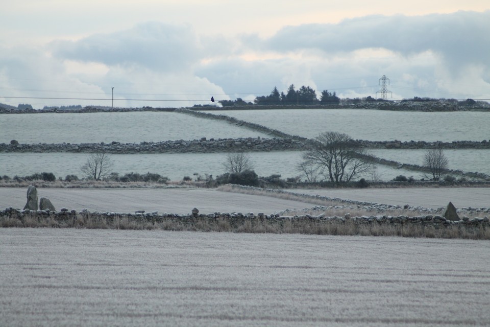
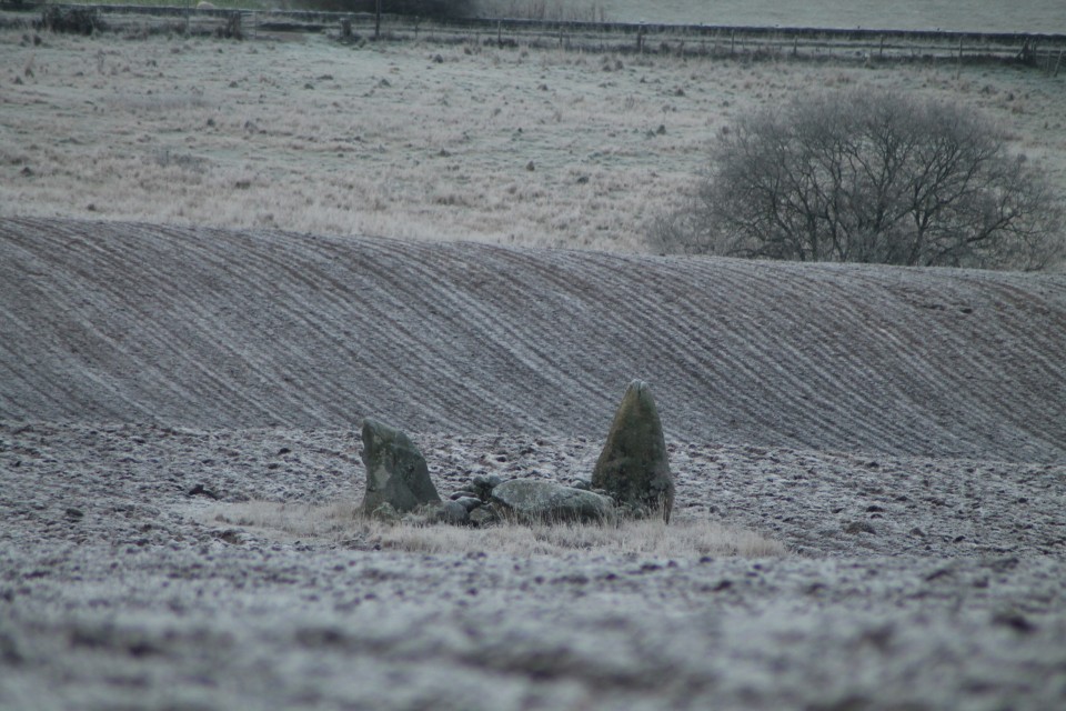
Time to go home, as the light was disappearing quickly, I thought. However, I realised I was coming down right near WANTONWELLS, so made a quick detour up the road to the deserted little field, with its snowy bundle of rocks. Great view back across to Dunnideer once more.
Now the light really was gone.
|
Return to the Land of the RSC - Day Two.
Today’s targeted area was the north east of Aberdeenshire; my guide – drewbhoy. We made sure we got an early start, and along with Bess the dog for a companion, we headed out eastwards.
Although it was an icy morning, there was no bitter northerly wind to chill the bones, and a nice dry, sunny day of looking at stones awaited.
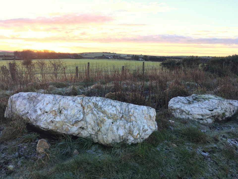
First stop was the remains of AUCHMALIDDIE – just a quick walk up the field-side track from the road. These two remaining stones glow so bright in the frosty morning sunrise. With the surrounding white ground, they resembled two melting snowmen, pushed over and at that stage when the snow looks dirty as it shrinks. The white quartz seems so different from anything else in the area, and reminded me of the circle way down in Duloe.
AIKEY BRAE is one of those big, ‘famous’ circles which I had been desperate to include in this trip, and visiting it confirmed why. As others have mentioned, the walk through the trees to the circle, following the pebble-edged path, adds much to the moment. The great reveal reminding me also of my visit to Clune Wood 24 hrs ago. Another big recumbent, vaguely resembling a boat (or something altogether more phallic), laying between two relatively small-looking flankers (one fallen). The evenly-spaced west side uprights remain, unlike the east side casualties.
For the next site I thanked the Lord that I had Drew to shed some light on the mystery of LOUDON WOOD. Whilst preparing for this trip, I had been dreading the search for the circle, and had another plan for getting quite close to the wood, which thankfully I didn’t have to put into action. Drew’s invaluable knowledge led us right up to the near vicinity of the path through the wood to the circle. Initially we slightly skewed off to the side, and went into the trees too far, backtracking a couple of times before taking a direct route off the path in a presumed general direction. This led us out into a frost-white clearing, where the circle sat, looking forgotten by the world. It was difficult underfoot to notice any bank or wall-ring typical of the Buchan rings, but honestly I was just glad to finally be here. It is a magical spot.
NETHERTON was very different from Loudon Wood; access was quicker(!), being easily reached at the back of the farm. As Drew asked permission, we crunched through the cracking mud puddles up the track to find the complete (?) RSC that is Netherton. I really liked this one. The trees within the circle block any decent camera view, but within the messy ‘forest’ the circle is clearer than initially thought. The recumbent and flanker stones are quite undramatic, being fairly shapeless boulders, with an abundance of other stones shoved up next to them, but it feels a sturdy little group which isn’t going anywhere.
BERRYBRAE, also has a recumbent/flanker set up similar in look and feel to Netherton, and being away from any farm buildings/machinery should appeal more than the previous site we had been to, but somehow Berrybrae underwhelmed me a little in comparison. Its setting is a little scrappy and overgrown, but its ring-bank is clearer. Still, it’s easy to get to, and let’s face it – it is still pretty wonderful to be here and appreciate what is here. Drew tells me enough horror stories, during our travels, of cairn and circles destroyed nearby.
After a short detour to the astounding MEMSIE, we get lunch sorted, and talk music, politics and of course, all things megalithic, sitting at the parking spot near Strichen. Refreshed, we let Bess lead the way up to STRICHEN. By now the sky is bright, and shows this reconstruction off to its best. Although one orthostat lays flattened (by cattle apparently), this ring stands proud, looking uniformed and balanced on the hillside. Great views all around also help to make this a must visit site.
And finally, Drew took us back to WHITE COW WOOD, for more walking along empty forestry tracks. Bess was loving it, and my weak, old legs were pretending to as well. I hadn’t necessarily planned to visit here before linking up with Drew, but glad I did, as it’s a decent cairn. With its fallen mini-dolmen-like cist in the centre, it is a fair sized ring.
With the light fading, we left this corner of Aberdeenshire, and as I thanked Drew for his amazing help today and said my goodbyes to Bess the dog, I drove back to the City, already starting to work through tomorrow’s itinerary, but still trying to process all of today’s marvels. Superb.
|
Return to the Land of the RSC - Day One.
I had not been to Aberdeenshire for many years now, having been twice in the distant past. Those trips had been whistlestop visits, where I had perhaps only had a chance to see a few of the obvious sites around the outskirts of Aberdeen.
A few months ago my wife said that she had an opportunity for a 5 day work trip to Aberdeen in December, and we agreed I would tag along. 5 days!….That’s a lot of potential for hunting down sites right there.
So I have been planning this trip for a while now; trying to work out how I could possible do justice to so many Recumbent Stone Circles, which over the years had become a bit of an obsession from afar. I don’t know why I have this strong attachment to the region – I live in Suffolk! Other than my best friend from childhood living in Aberdeen, and my wife’s irregular work jaunts there, I do have a link also in that my maternal grandfather’s family were from Peterhead. But it feels something beyond that; like I have been here before somehow.
Anyway; that’s the background, let’s get going with these stones…
Day One:
I had roughly sectioned off Aberdeenshire into 5 areas for the 5 days ahead; SouthWest Aberdeen (inc. Aboyne area), South of Dunnideer, North of Dunnideer, between Huntly and Turriff, & the north east (Fraserborough/Peterhead way). I had a target to cover as many RSCs as possible – maybe around the 50+ mark even! I realise now that was pretty ambitious.
I thought I would start close to Aberdeen, with a few huddled together sites, to quickly get some successes under my belt. So I headed off in my hire car with the dry, frosty weather on my side, looking for CLUNE HILL (Clune Wood). After a few wrong turns around Durris forest. I found the car park and headed off up the path, remembering just how unfit I really am these days. After a short 15 walk uphill, I veered off left through the trees, before coming out into the circle’s peaceful clearing overlooking the valley. The rust-coloured bracken attempted to hide the fallen stones of the circle, but with enough still standing, the rough circle can be easily seen.
The warm glow from the low early morning sun really made the colours come alive here, and indeed at one point the glare played tricks as I turned to look back at the circle believing a figure was standing there, quickly to my relief realising it was one of the lifeless orthostats. But it would be wrong to call this RSC lifeless, it is full of character and feeling, and a perfect benchmark was set for the rest of the day.
Onwards to the NINE STANES, which are reached within seconds from the road. Quite a low, similar-sized set of stones, including a big boulder of a recumbent and its flankers (one fallen). Orange/brown pine needles covered any flat surface of stone, noticeably giving the recumbent and fallen flanker an eye-catching look. An open aspect, and vista looking across the circle to the south gives this wooded glade a wide, spacious, relaxed feel.
Just around the corner from the Nine Stanes, are the Eslies. First up is ESSLIE THE GREATER. Sitting there, exposed to the elements, in the middle of its field, it looks a big ‘ol jumble of rubbly rocks and tufts of grass, raised on a platform. Approaching from the road, passing through the busted gate, over to the rough trapezoid-shaped platform, and up into the low-stoned circle.
ESSLIE THE LESSER had to make due with just a flying visit, as I headed off to Glassel next. En route I was called by Drewbhoy. We had made contact just before my trip to Aberdeen, and Drew had kindly offered to be my guide on one of my days here, so we finalised plans for tomorrow, and I parked up near Glassel house, and headed into the woods. GLASSEL always looked as if it was going to be difficult, and it delivered on that front. The ‘track’ soon faded, but I reached a wall, which I knew would act as a guide onwards. Without any GPS,etc I was never likely to find it though. I reached the brook, and headed left and right, but could not find any clues (even without a print out of advice from the TMA’s previous entries). Everywhere I just saw tree stumps or the dark stone-like silhouettes of up-ended root balls of fallen trees, leading me further into nowhere. I even texted Drew in my frustration for any hints, but I made the decision to leave my search as I had wasted too much time. Of course, I’m sure I was yards from it at one point.
Next to Aboyne, and the easier woodland wander to reach IMAGE WOOD. Possibly Image Wood would make more of an impact on a different day, in a different season, but it left me a little underwhelmed. 5 little stumps huddling together in their cold, winter woodland setting, as the numerous dog walkers passed by.
Leaving Aboyne, I headed out towards Tarland and TOMNAVERIE.
Whilst driving up from Coull towards Tarland, I was suddenly taken aback by the sight of Tomnaverie perched high on a hilltop, looking like a golden crown in the sunlight. I hadn’t expected that to be my first view, and regret now that I didn’t stop for a picture from there.
There’s ample parking up the short track from the road, and only a few minutes’ walk up the hill to the stones. What an incredible site this is – lovely views of course, but just a delightful circle to keep the attention back onto itself. I was reminded of the far away Torhouskie for some reason. The restoration here feels just right, and definitely must have changed quite a bit from the previously almost wrecked location next to the quarry (what quarry?!).
Whilst looking across the recumbent I was amazed to find the line of hills matched the surface of the stone facing both ways! Soon after this my phone died whilst standing centre circle taking pictures (but on return to the car, it displayed as having plenty of power).
As the light began to go, and the chill factor set in, I decided to return towards Aberdeen, taking in the double whammy of Midmar Kirk and Sunhoney. I had visited both of these over a decade ago, but felt is silly to ignore such beauties, by taking them for granted. MIDMAR KIRK always seems a cold, but quiet and obviously respectful place. I feel the ancient stones seem quite ‘natural’ being here in a way. They feel protected, and bring an even more peaceful stillness to the graveyard. They seem to renew the links from the past ancestors, to our more recent ones.
The walk up to Sunhoney was very muddy (Mudhoney?), but I soon reached the well-kept pathway that leads up to the grove of trees and stones. SUNHONEY always feels such a special, contained space; shut off from our world. Despite the cold, it gave me a warmer feeling than on a previous long ago visit. The grass was lower this time, and the large circle was more visible. I’d forgotten just how long that recumbent is. From standing outside the circle, looking back across the recumbent and flankers, the nearby hill (Barmekin?) was glowing bright orange in the last of the afternoon sun, whilst everywhere else was shade. Sun honey indeed.
On the return journey back to Aberdeen, I passed so close to CULLERIE that I thought I’d just nip there, expecting that I would confirm my feelings about it relating to a previous visit here. But, I have to say that it wasn’t nearly as bad as I’d thought. The gorgeously clear afternoon gave the avenue of trees a grand feel, as if they were rich stage curtains pulled back to reveal the encore act for my day of stone hunting. The framing effect built as I walked towards this pretty little circle, which didn’t give me the artificial, centre-of-a-roundabout vibes I had expected. If it had a recumbent it wouldn’t seem all that different from Loanhead of Daviot really, in terms of reconstructed presentation. Bit of an undervalued site methinks.
|
|
ruskus hasn't added a profile
|