|
Visited: June 22, 2021
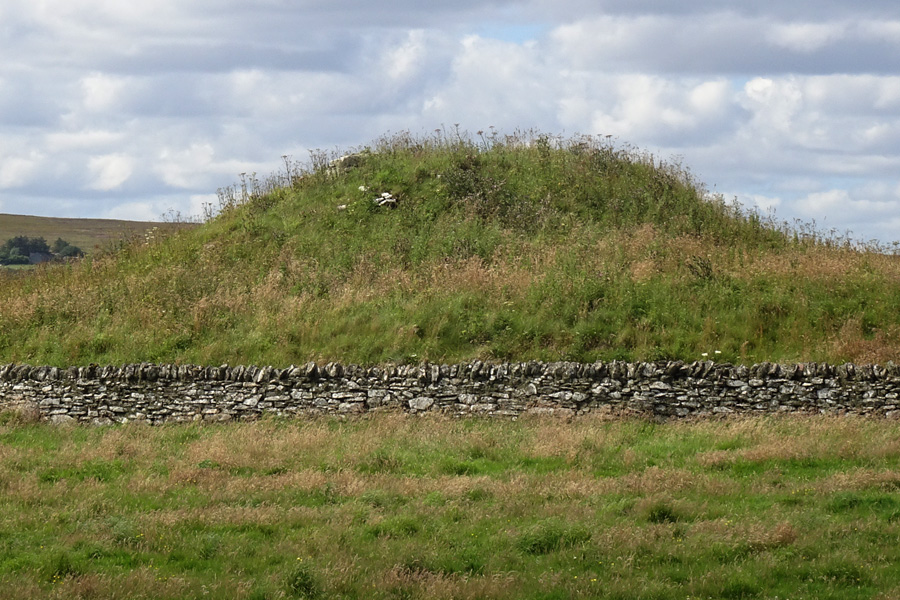
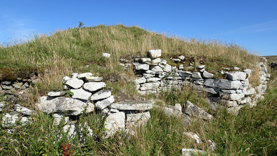
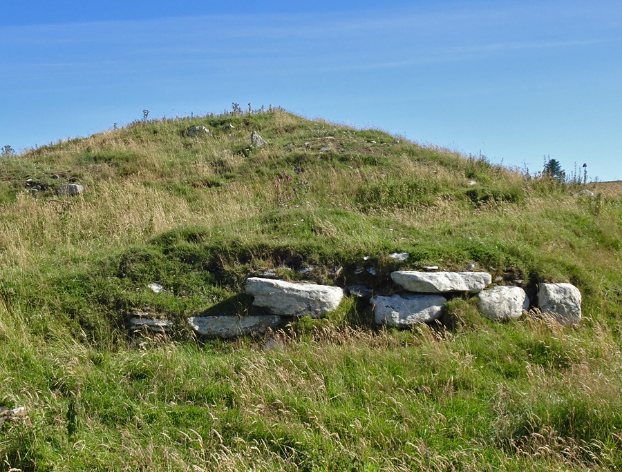
Ousdale Burn Broch is now beautifully consolidated, thanks to the efforts of the Caithness Broch Project over the past five years.
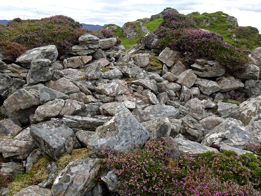
The central court, which previously sported a 70 year old rowan tree and was generally overrun by vegetation, has been cleared and covered with geotextile (to prevent the regrowth of vegetation) and gravel.
The broch wall, which had tumbled badly in the region of the entrance passage, has been carefully consolidated by stonemasons and the previously blocked entrance passage cleared of debris. It is now possible to walk into the broch through this entranceway, although you will have to stoop somewhat. The large guard cell leading off the entrance passage has been repaired and its corbelled roof restored. The collapsed wall recess (aumbry) has been restored with permission from Historic Environment Scotland, and at present contains a rather unusual bust.
The Caithness Broch Project website contains details of all the work that has been done at Ousdale Burn Broch, profusely illustrated with 'before-and-after' photographs of the salient features.
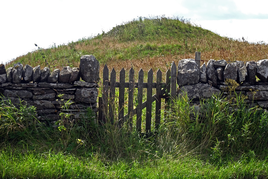
Access to the broch is now via a purpose-built path which starts from a new car park that has been created a short distance along the disused loop of the 'old A9' at ND 061 189, exactly one kilometre (0.6 mile) north of the "Welcome to Caithness" sign, on the right hand side as you drive north along the A9. The route to the broch starts at a gate opposite this car park, and entails a walk of almost a kilometre down a well constructed gravel path. Along the way are sited no fewer than five interpretation panels—all different—which detail the broch itself as well as the geology, history and archaeology of the area.
Read more about the project in this John O'Groat Journal and Caithness Courier report from December 2020.
|
Visited: May 25, 2021
Five miles south of Broadford, on the A851 road to Armadale, is the Forestry Commission's Leitir Fura woodland (signed from the roadside), which provides an enjoyable two mile walk to the ruins of a township that was deserted in the early 18th century. On the coast, due south of the township and about 200 metres west of Rubha Guail on the Sound of Sleat—flanked by shingle beaches—stands a rugged headland atop which can be found the remains of Leitir Fura Promontory Fort. To reach the fort, start from the car park close to Kinloch Lodge (blue marker on the map below) and follow the path marked "Leitir Fura Historic Township". The path is circular so you have two options, the low path which is flanked by woodland all the way (white line on map) or the upper path (yellow line), signed "Drover's Path", which climbs above the tree-line and gives superb vistas across the Sound of Sleat to Glenelg and Knoydart. Either way, you end up at the Township (green marker).

Immediately south of the zig-zag path that leads down from the township is a large cleared turning area for Forestry vehicles. It is from here that you make the push for the fort. The terrain I crossed commenced with a thickly vegetated area of bracken and brambles which leads to birch woodland towards the right: in summer, reinforcments of bracken render the way all but impenetrable! Since the fort cannot be seen from here, a compass is a useful aid to reaching the fort (red marker), which stands due south of the turning area.
The going was hard until I came across a rough path at half distance, which eased my route to the trees. Once amongst the trees the walking is easy. Bear right through the woodland until you reach a stream (the Allt Achadh an t-Sabhail), and cross it. Although the terrain here slopes easily down to the coast (which is easily accessed), you will soon see the formidable vertical cliffs of the Promontory ahead. Carry on till you reach the neck of the promontory, by which time you will see the northeast wall of Leitir Fura Fort on the cliff top ahead. The promontory is choked by rampant birch scrub so a direct ascent is not possible, but I found I could outflank this by keeping close to the cliff edge.
An easy alrernative is to make your way down to the shingle beach northeast of the fort from where there is an easy rising path to the summit that follows close to the cliffs.
Of the fort itself, little remains apart from a significant stretch of slightly curving wall face on its northwest. The wall is well built, measures three metres in width by two metres in height and rises to six or seven courses. And that's about all there is of note. Canmore states that: "At the E end of this terrace, a massively constructed entrance can be seen, measuring about 2m in width by 3.7m in length and approached by ramp leading up from the beach on the NE and providing the only easy access to the top of the promontory".
Although I easily found my way up the "ramp leading up from the beach", I saw no evidence of the "massively constructed entrance". Maybe I'll return another day and check this out!
Possible easier route
After leaving the fort and returning to the car park by the lower path, I noted, just a few metres along, a rough track entering the woodland and apparently following the aforementioned stream. If it is possible to follow the stream from this point, you would have to cover relatively easy wooded terrain all the way to the fort. I may investigate in future.
|
          
|

|

|
Minera
Images and fieldnotes for this broch, which is actually called 'Minera', can be viewed on TMA's dedicated Minera page.
|
   
|
 
|
Visited: August 31, 2020
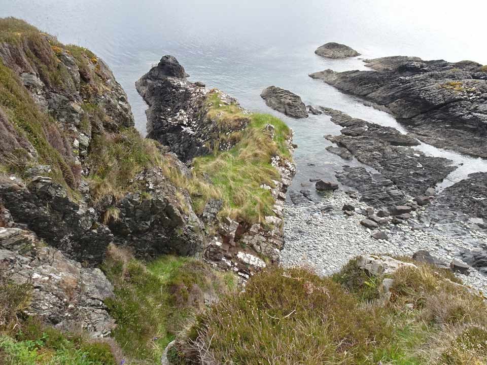
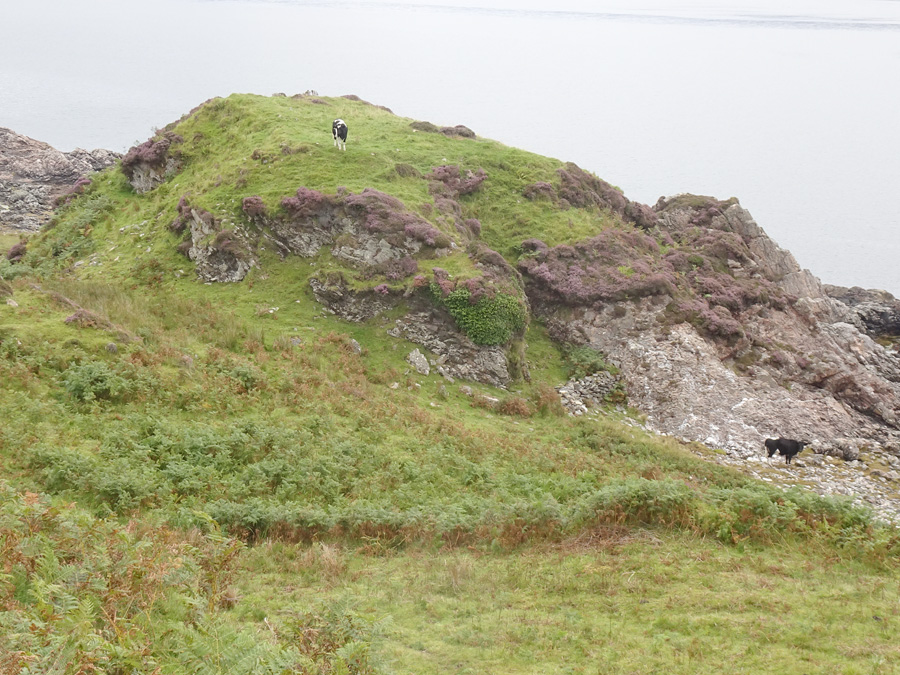
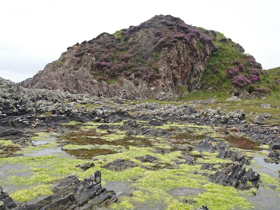
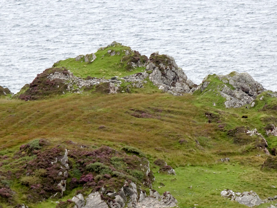
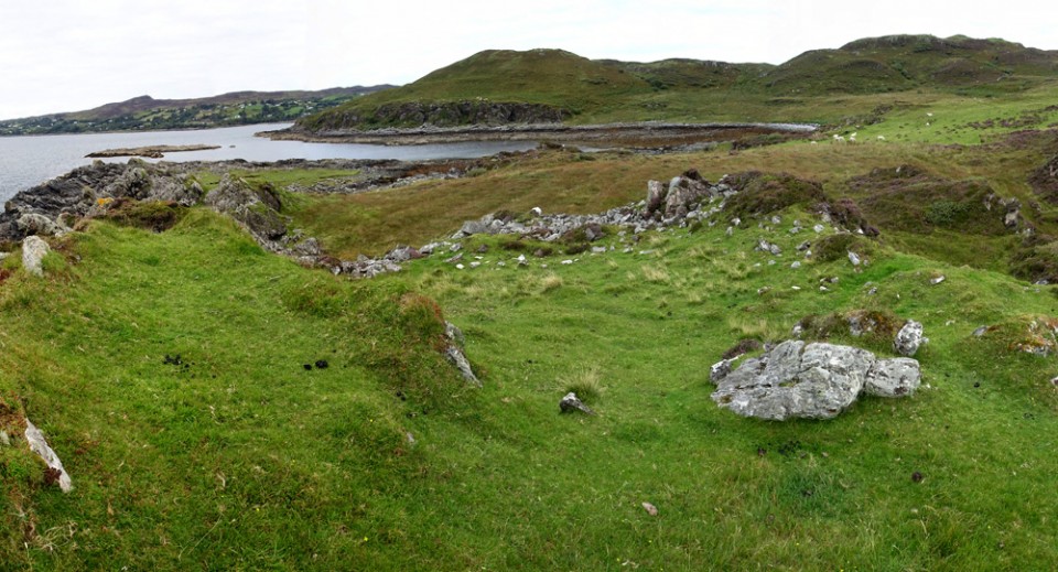
Dùn Ban is a coastal dùn, hidden from general view on a small rocky headland just south of the community of Camuscross, on Skye. As far as I can tell it is only visible to those who actively seek it out.
To visit this dun you have to venture to the end of the minor road (signed 'Camuscross ¾ mile') that heads south from Isle Oronsay on Skye's south coast. Where the metalled road ends at the south of Camuscross Bay, a private road continues across the stream (Allt na Bèiste) to several houses. Between the 3rd and 4th of these houses, a secluded grassy track heads towards a gate and stile.
Cross this stile and follow the path beyond as it curves round to the left, bringing you to a gate in the fence to the left. Beyond this gate, a rough path heads upwards to the summit of a low hill (Ard Snaoiseaig Cnoc an Fhùdair). From the top, continue seawards and downhill to the dùn, which is now obvious.
On the day of my visit the summit of the dùn was guarded by a large cow (with calves browsing near the coast), rendering it unwise to approach the structure more closely. It will still be there next time I visit Skye!
|
  
|
Visited: August 31, 2020
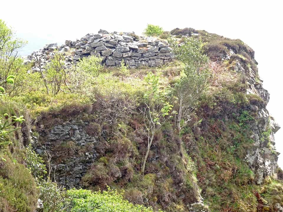
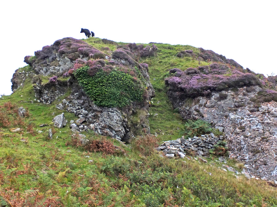
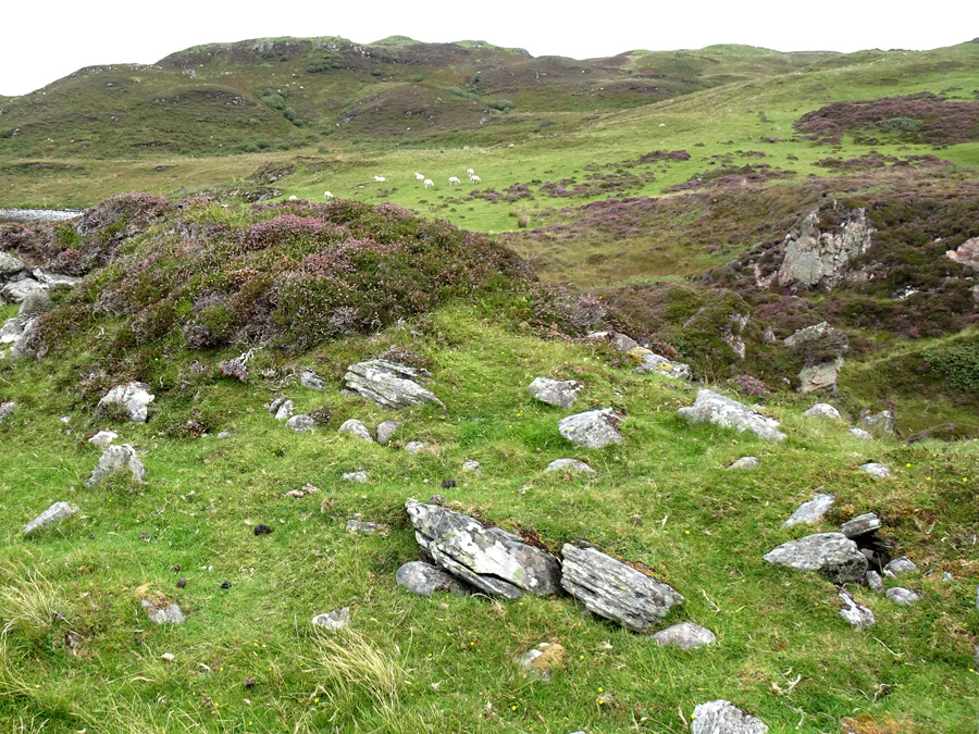
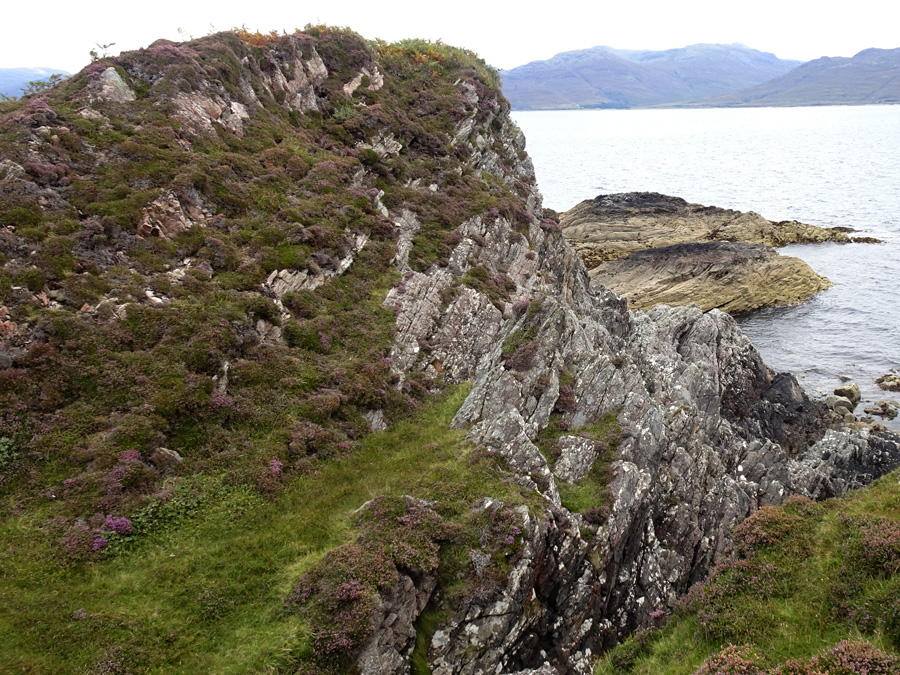
Dunan Choinnich, which Canmore considers may well be the remains of a broch, must surely be one of the most difficult features of its kind to visit on the entire Isle of Skye.
From the road at Torabhaig Distillery in Teangue, the distance to Dunan Choinnich is exactly one kilometre. But the rugged coastline is not an option: there is no direct path. To reach the dun, start at the distillery where a rough farm track heads off to the right and circles around the Torabhaig buildings before crossing the Allt Ghleann Thorabhaig (a stream). Immedaitely ahead, the path is gated, and an arrow board points to the right where a walkers' path follows the stream to the coast. Ahead is a ruined building with a rusted-red roof; pass this and ascend the grassy slope below the ruins of Knock Castle where you should spot a trodden path heading left (east) to a fence.
Straddle this fence and pick up a good walkers' path that hugs the fenceline of the field to the left. This peters out after about 500 metres, at which point you must descend the shallow valley carrying the Allt Gairistin Neill burn and ascend the prominent 60 metre high hill opposite.
The slopes are bracken covered in summer but there are plentiful grassy tongues which ease the way. From the summit of the hill, you see Dunan Choinnich sitting at the neck of a rocky peninsula. Descent is through somewhat denser vegetation, but there are grassy tongues and sheep paths to ease you down. It took me a full hour to reach Dunan Choinnich from Knock Castle!
Good strong walking boots are an absolute necessity!
Dunan Choinnich is extremely ruinous, though its grassy central court is evident from afar, surrounded by a vegetated rampart to the east and the tumbled, featureless residue of a wall that originally marked its landward boundary. There are only the scantiest remnants of structural detail remaining of a construction that is most definitely a target only for the determined connaisseur!
|
       
|
Visited: August 9, 2020
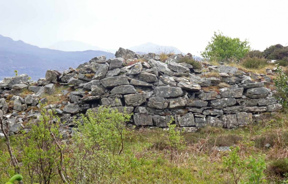
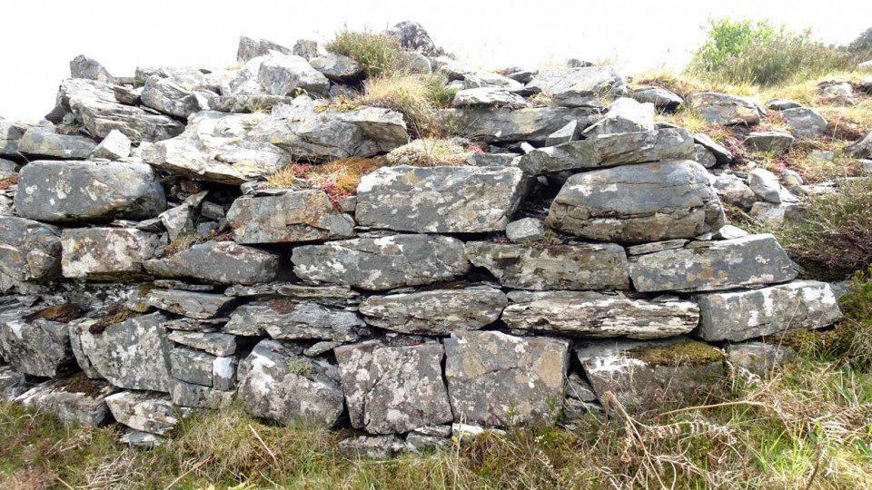
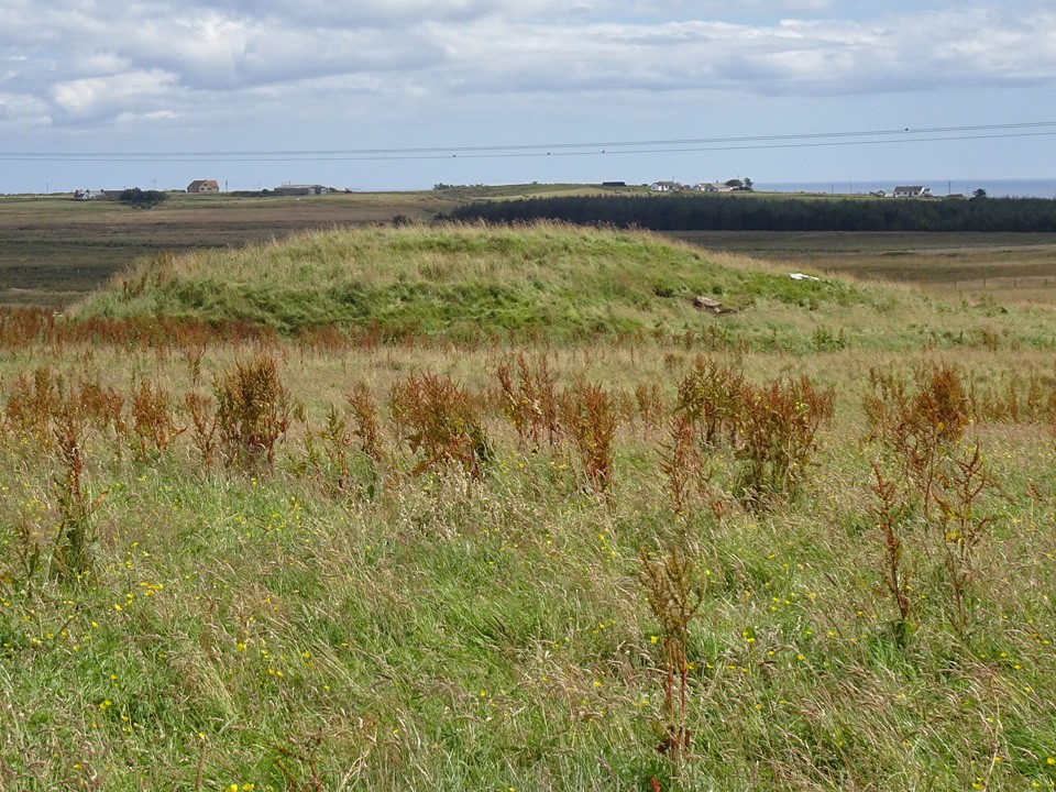
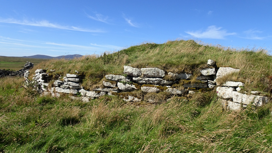
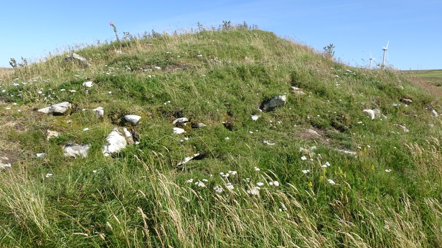
Only a few hundred metres north of the Minera site, but on the opposite side of the road, are the prominent ruins of Tiantulloch croft house and associated outbuildings: the mound of Tiantulloch broch stands tight against these, rising to a height of some three metres. The remains of this broch are altogether more interesting than Minera and the approach from the road on a clear sunny day is impressive with the distant Caithness mountains framing the site.
So similar is the stonework of the croft buildings with the remaining outer walling courses of the broch that it is difficult to dispel the notion that the broch has been plundered in centuries past to provide their masonry. Notwithstanding, there remains a significant stretch of original exterior broch walling on its eastern side, in many places six and more courses deep.
To visit the site, follow the instructions for Minera but drive up to the Buolfruich Windfarm where verge parking is possible. The field containing the broch is guarded by a barbed wire fence, but if you walk up the road to its northern corner, you will find the final stretch free of barbs to assist access. A short walk over mainly springy turf brings you to the broch.
|
     
|
    
|
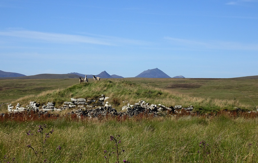
Visited: August 9, 2020
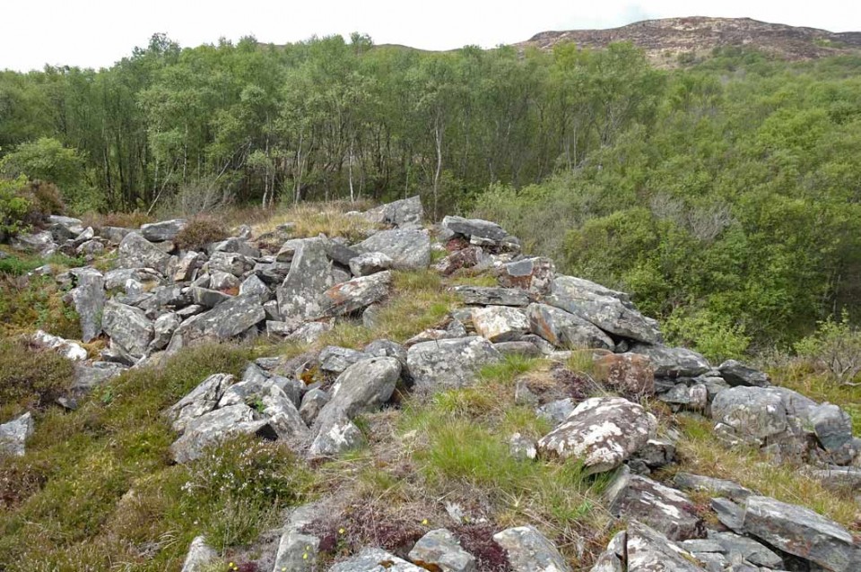
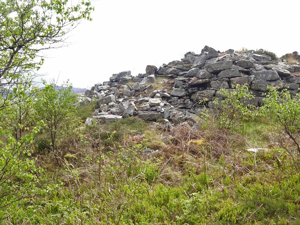
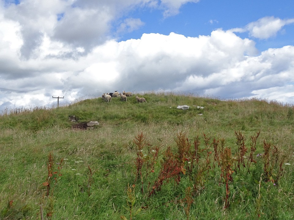
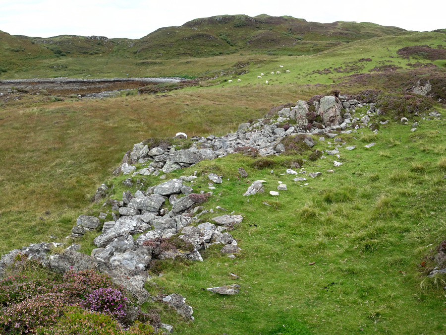
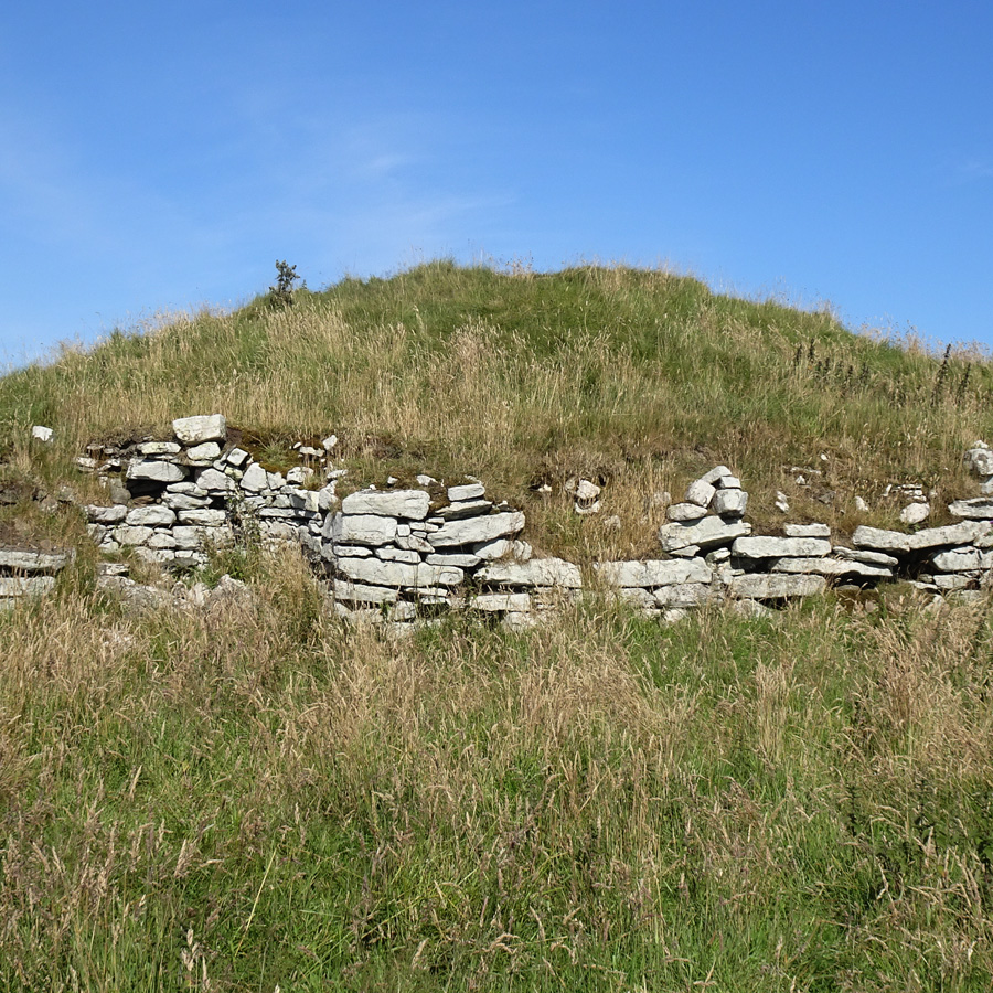
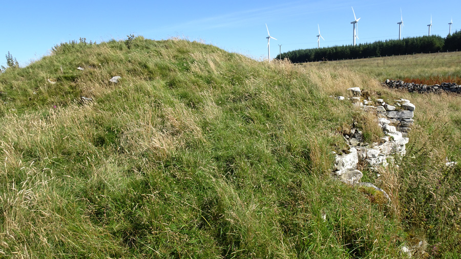
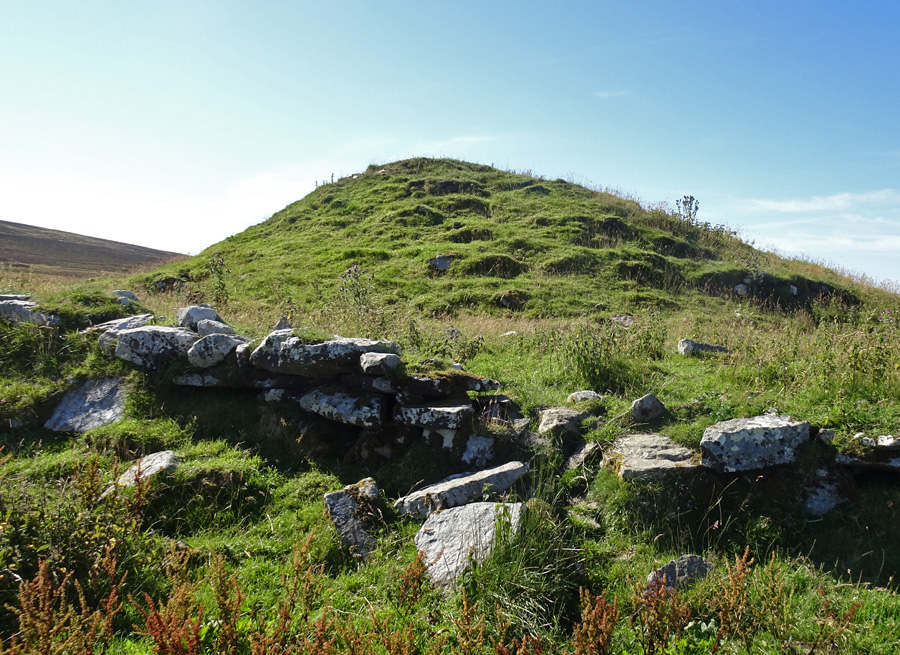
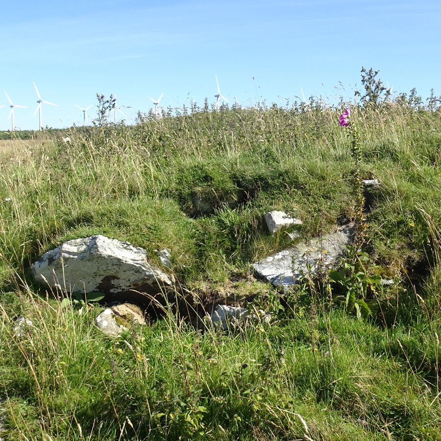
Minera is a largely grassy mound some 3.5 metres tall which Canmore rates as one of the best preserved broch mounds in Caithness. The belief is that the structure contains "substantial structural remains and a largely untouched stratigraphy."
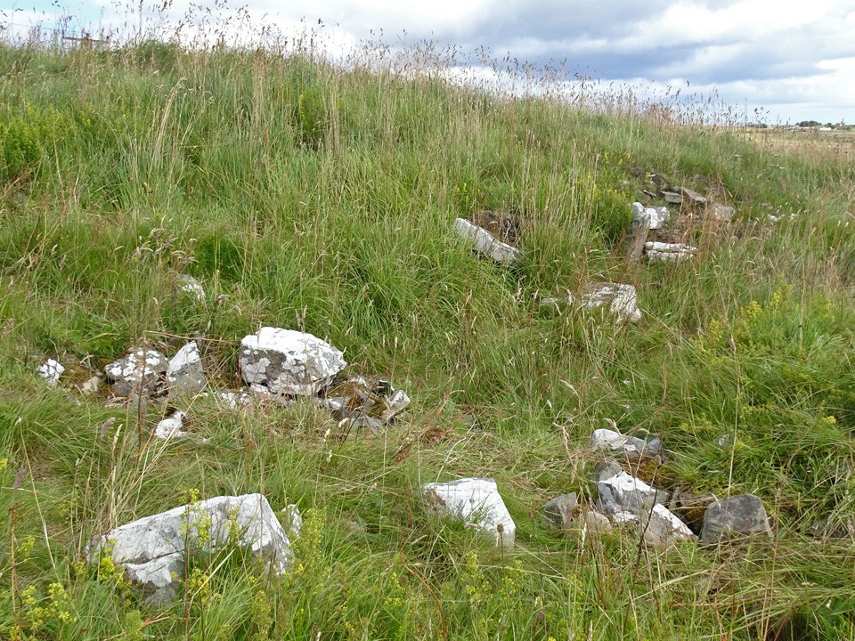
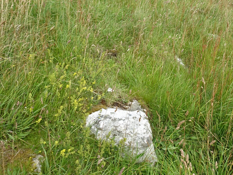
Minera is surrounded by a well-built wall which doubtless consists of stones that were originally exterior walling courses of the broch itself. Nevertheless, there are a considerable number of stones peeking out from the undergrowth and a short stretch where somewhat dilapidated walling is visible. There is a depression running into the mound from the west which contains two large stones which Canmore suggests could have been part of the entrance passage.
To reach Minera, follow the road signed "Houstry 3 miles", a little over quarter of a mile northeast of Dunbeath on the A9, for the full 3 miles till you see the turbines of Buolfruich Windfarm. A short distance before the windfarm, a road branches to the right and there is room to park. Minera is just 200 metres from this junction, probably hidden by the farm outbuildings on the right. To visit, walk about 50 metres up the side road to a field gate, beyond which a well walked path heads past the outbuildings directly to the broch.
Just a few hundred metres farther on is another broch mound, Tiantulloch.
|
Visited: August 8, 2020
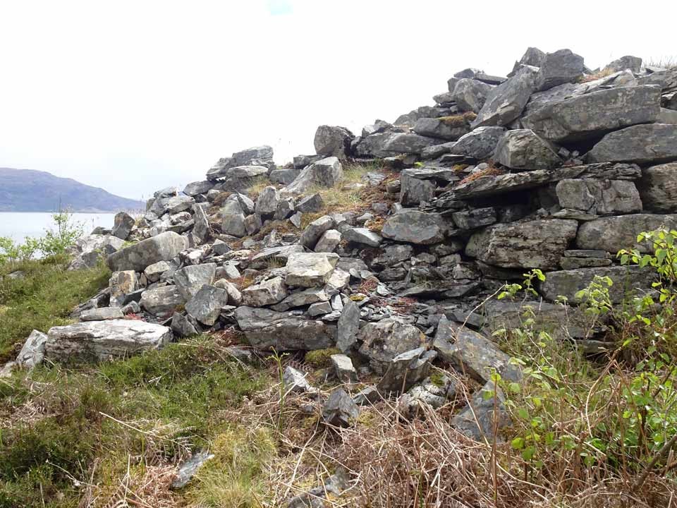
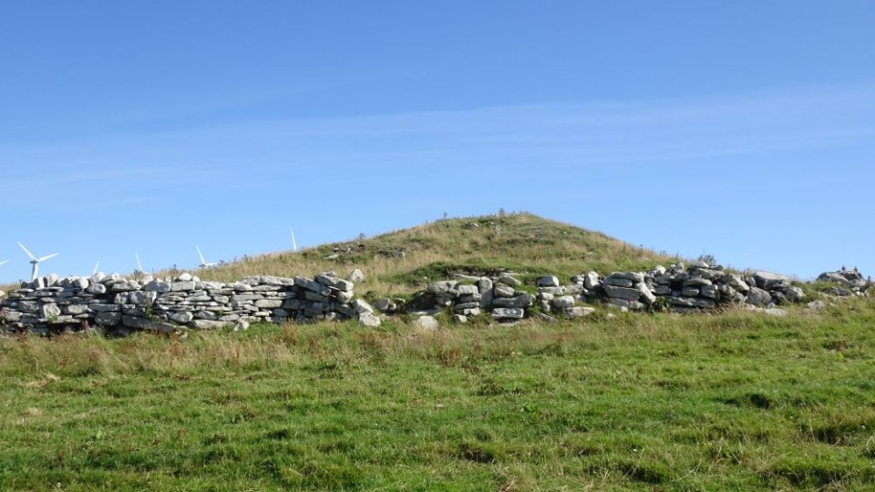
Watenan is most famed for the neolithic chambered cairn of Cairn O'Get (Garrywhin), and rightly so. But approximately half-way along the waymarked path to the cairn, a low hill rises on the right. It's an easy walk over grass to its 110 metre summit where stand the remains of a broch, Watenan South.
Canmore describes this as a complex site with a circular central earthwork surrounded by linear grassy depressions that might be intra-mural galleries. Two large isolated stones on the east may be related to an entrance passage, and there is evidence of outer defence banks and ditches on the west and south.
On the west of the broch is a stretch of walling courses, and the bank to the south has a number of internal facing stones peeping through the grass.
Not a great site, but it is well worth making your way to the top for the view across the loch.
|
A keen hillwalker most of my life, my interest was restricted when the need arose to care for an ageing parent.
With limited opportunities to travel far from home, I 'discovered' the world of stone circles, mainly in my native Aberdeenshire.
This provided the ideal opportunity for short walks of just a few hours duration, and resulted in me visiting many places of interest that I had never considered previously.
Website:
Stone Circles of NE Scotland
Here you will find both Google and Bing maps displaying more than 100 sites of stone circles, the majority in my native Aberdeenshire. The markers on the maps are clickable, to reveal a photo of the stone circle and a link to their Canmore Site Record.
A menu at the side of the maps allows you to zoom in to any individual circle, viewing its environs as a zoomable aerial photograph (Google) or an OS Map (Bing).
Hunebedden
I've since extended my interest to the megalithic remains in The Netherlands, where there are some magnificent passage graves known as hunebedden (giant's beds). Despite the fact that The Netherlands is essentially flat and sandy, these 5000 year old monuments from the Funnel Beaker Culture are often found in exquisite woodland settings, nearly all of them in the province of Drenthe. There are almost limitless opportunities for delightful walks between small villages, taking in a diversion to a hunebed here and there.
|
|