|
Back To The Old House
Back over on Arran and back in the old cottage at Merkland.
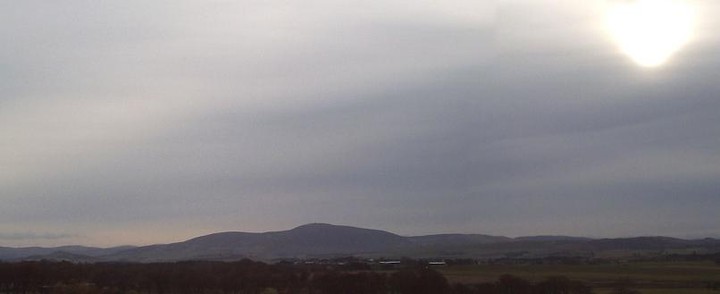
Left the OH and the Young Digger knocking balls around Bilsland's Crazy Golf on the front at Brodick. I coaxed Old Piney into fourth gear and trundled out past Cladach and the stinky old harbour below Brodick Castle. Two seals were basking out on the rocks at Merkland Point. Piney reversed into the the layby/ boat ramp almost by herself and even thoughtfully stalled as soon as she was tucked in position.
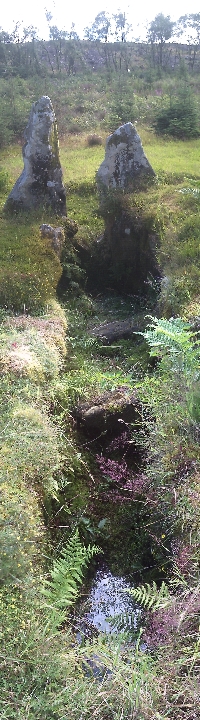
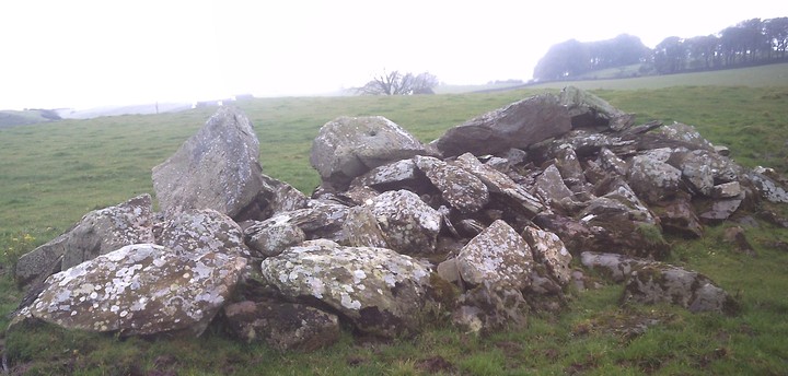
I'd had a fair old struggle locating this cist until a few years back and I've still never seen any sign of anyone else having visited the place. It is incredibly close to the road and I decided to time myself getting to the cist from closing the car door.
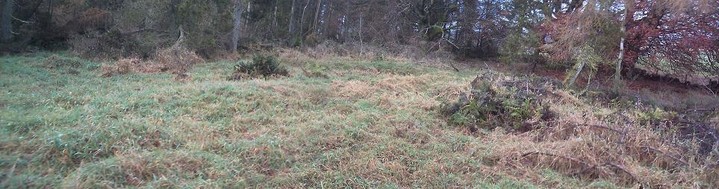
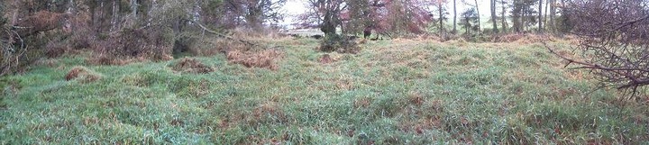
The old Merkland cart track which also serves as a part-time burn was even more overgrown than last year (and the year before). Long trailing Brambles and sprouting Hogweed conspired with ankle deep slimy mud and curtains of Willow to obstruct my progress. But only 2 minutes and 45 seconds after slamming the car door shut and setting out, I was gazing down at the mossy old cist of Merkland Wood. I heard two cyclists on the road chatting as they pedalled by (this site is THAT close to the road).
The moss looked deeper than before, with little seedlings of the Willow and Rhododendron sprouting on the thick, moist green carpet on the capstone. The erosion below the cist (just above the burn) has slightly worsened but the earth and bank immediately around the cist seem fairly well consolidated.
The deep undergrowth does mean a very high midge count even during the hottest and sunniest of days. After a few minutes taking in the quiet of this site I'd fired off enough photos and lost enough blood to the skeeters - I fled and staggered back down through the mud and thorns.
Old Piney grumbled into fourth gear and trundled the couple of miles back into Brodick. Young Digger and his mum were only on the 10th hole. I'd been away for a bit less than 30 minutes - but they weren't your regular minutes I don't think.
|

|

|
September 2013
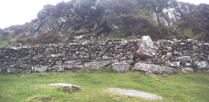
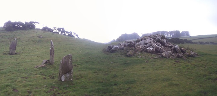
This is a difficult walk in whatever point you start from and these particular Galloway Hills are an unforgiving bunch. Our route took us in from the car park at Kirriereoch, a good march into the hinterland on former forestry tracks, then out onto the great long whaleback of Kirriereoch Hill via a series of ever diminishing and deteriorating sheep paths. About 1800 feet up Kirriereoch a tremendous stone wall begins. The stones are enormous. We saw one which was the size of a small car. Story says the wall was meant to delineate the old Ayrshire - Galloway county border and the wall appears to be of some great age. After the superhuman effort put into its construction it is a pity so few people have ever seen it. After topping Kirriereoch Hill we took a steep descent following a much smaller wall which wound us down 1500 feet to the tiny lochan of Loch Twachtan (careful now!). Twachtan's population of trout have been completely isolated since the last Ice Age by a few steep waterfalls.
Time limits meant we only had twenty minutes to catch the allotted number of specimens for a Fishery Research Project we've been involved in for a number of years. We hit the fishy target at 19 minutes paused for breath, a five minute breather, a sandwich and some juice. Then with our work done we pressed on to the social part of the journey, we were going to visit on The Grey Man of Merrick.
Progress across the morass between Twachtan, Munshalloch and the Howe of The Cauldron was very slow. Legs plunged deep into peat bog and despite clinging to the winding stone wall for guidance, low cloud sometime erased all views, the weather closed in and at times we thought we were past the crag we wanted to see. But we needed to hit Loch Enoch first. Loch Enoch had its own distinctive and unique family of trout until the end of the 19th Century when Victorian-Era Acid Rain killed the loch (and many other Galloway Lochs). This loch was restocked over the latter half of the 20th Century and has recovered well.
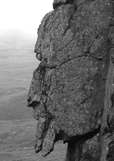
After edging round the shining gravel shores of Enoch we hit another wall and struck off towards the Grey Man. After a few hundred yards we took the small path off to the right and our target drew into sight.
The Grey Man is a spectacular feature. It works from both sides and its scale is spectacular. Return took us down past Loch Neldricken and Loch Valley to Loch Trool and the second car. Oops did I mention you'd need to do a 2-car job to take this one in? You don't actually need to... but it is advisable. Good luck y'all!
|
 
|
   
|

|

|

|
  
|
  
|
Ascent of Bienn an Oir, Jura.
|

|

|

|

|
NG 6018 2337 On the summit of Beinn na Caillich, the conspicuous hill rising to a height of 2403' about 2 1/2 miles west of Broadford, is a cairn of stones measuring some 50' in diameter. The body of the cairn measures 8' in height, but seems to have been originally higher, as the top is surmounted by a cone of stones rising another 6' in height, doubtless of late construction. Although local tradition says that it was erected over the grave of a Norwegian Princess, without excavation it is impossible to say if it is a prehistoric monument. Hill top cairns of large dimensions and at considerable altitudes are found in many parts of Scotland.
RCAHMS 1928.
A cairn as described by RCAHMS.
Visited by OS (A C) 27 June 1961.
|
 
|
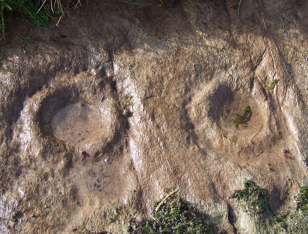
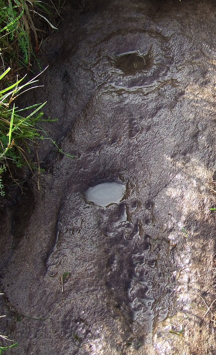
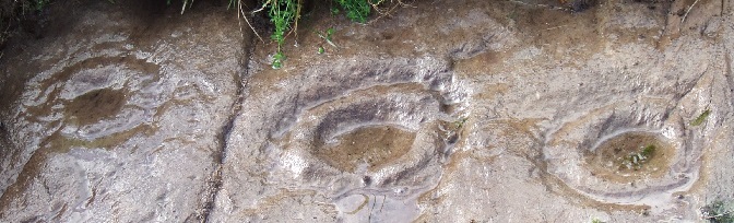
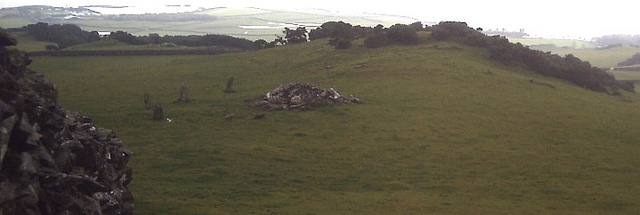
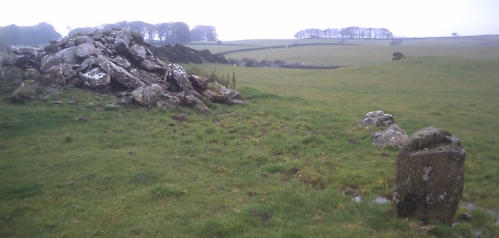
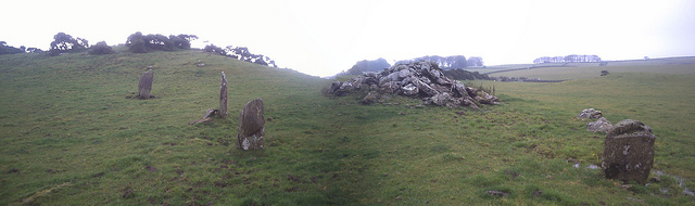
Stronach Wood
I had added this strange little news item a week or son ago but it has disappeared. Perhaps it was thought to be of little interest, but I feel this is important.
This appears to be a personal excavation by Brian Robertson (no Thin Lizzy connection) on a site covered by Historic Scotland and RCAHMS. The excavation does not appear to have been carried out by either of these organisations. This is a rock art site of national importance. From the picture the turf appears to have been stripped back substantially and from the text appears to have involved weeks of "digging"... mibbe with a spade?
I am sure if a local well-meaning individual decided to strip back the turf on Priddy Henges or Stonehenge we would all be reading about it here. Especially if they found that people had been burying treasure "caches" there in recent years.
http://www.arranbanner.co.uk/2012/11/16/mairis-treasure-unearthed-near-brodick
Mairi’s treasure unearthed near Brodick
on November 16th,2012
Brian Robertson of Brodick has unearthed an interesting little treasure cache just outside the village. For some weeks he has been clearing a prehistoric Neolithic cup and ring site in Stronach Wood and has found some buried treasure no more than seven years old.
He said:‘ On the fourth day I came across this small plastic box. ‘When I took it home and opened it I found nine coins,one of each denomination and the newest being dated 2005.
‘There was also a small decorative dolphin,a piece of agate and a heart-shaped stone,plus a small card with red ink writing. ‘It was addressed to ‘Miss Mairi Dare,with bunches of love’,and said inside:‘Well done Mairi! You’ve found the treasure. Now give your Mum and Dad a kiss. Much love from Great Aunty Fiona xxx’.’
Do you know who Great Aunty Fiona or Mairi? Read the full story in the Arran Banner edition of November 17 2012,or on line at www.arranbanner.co.uk/digital and let us know if you know who these people are.
http://www.arranbanner.co.uk/2012/11/16/mairis-treasure-unearthed-near-brodick
|

|
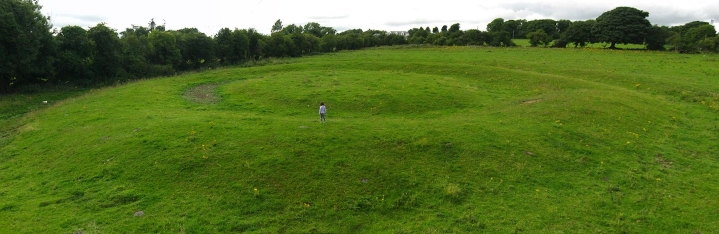
Grey Weather at Calla
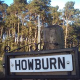
This site has long intrigued me. A broch... here in the dark badlands of South Lanarkshire? Well... why not? After all... on my short twenty minute journey to the site of Calla Broch I drove past a henge, a Norman Motte, the oldest roofed building in Scotland, the late Upper Paleolithic site at Howburn, an important roman crossroads, a roman fortlet and a field with two emus in it.
The broch site is just that... just a site, A stump.. but it is a beautifully elevated platform with stunning views to Tinto, Quothquan Law and within sight of the massive roman complex at Castledykes by Ravenstruther. It is thought that the legions had a hand in bringing this mighty structure crashing down at the end of the first century.
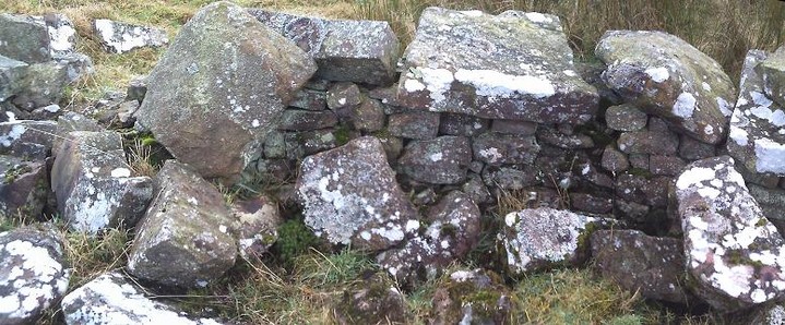
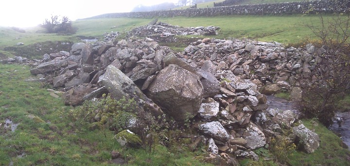
The broch was known locally as "the quarry" for centuries and has provided the drystane dykes for many of the fields here. The site itself has intact walling most of the way round, but it is just well concealed under turf, deep undergrowth and fallen trees.
A quiet site with little to catch your eye. There are some large blocks of worked and hewn masonry scattered at the edge of the platform and here and there where you can find the curtain wall's edge, it is robust and stands quite a few courses in height.
The site has never really been excavated. Chatting with a local archaeologist about it a few years back, he described the broch as having been toppled into itself. The resultant heap was then quarried over centuries and then the area around the broch heap was planted with conifers and Beech. Many of these old trees have blown down around the edges of the broch platform and remain uncleared. It would take an army to clear this place in order to let any excavation take place. A very limited dig some years ago uncovered a couple of pieces of cannel coal.
|
  
|

|
    
|
High Auchenlarie - October 2012 - Notes in Grey Weather.
Three days and nights of unrelenting rain have rendered what is normally a well-drained, steeply-sloping pleasant field of springy upland pasture into a flowing quagmire of muddy goo. My climbing boots skite left and right as I clamber up like a novice ice-skater. The possible "cairn" lies uphill, in the top right corner of the first field above High Auchenlarie Farm (best park at the wide point below the farm road-end where the Auchenlarie Burn flows under the Laggan Outdoor Centre B-road). Follow the track up from the minor road and turn left through a metal gate just before the farm.
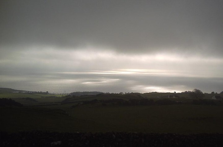
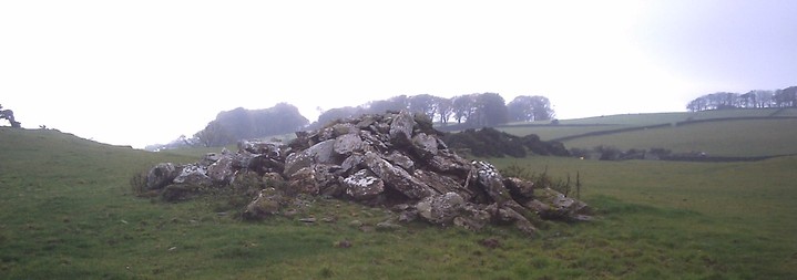
The “cairn” is disappointing, being formed of a number of large slabs and boulders dumped on top of a low mound of smaller stones. It is not quite a metre high now. The whole thing looks exactly like a low pile of field clearance and the fields around here are full of such field clearance cairns – some much larger. The views down over the roofs of the static caravans at Mossyard and out over Fleet Bay to Wigtown Bay and beyond are spectacular. The view hung like an apocalyptic storm-scene as painted by a depressed Turner, nursing the mother of all hangovers. I have seen this site in beautiful summer and autumn weathers many times and the views out to the Isle of Man are spectacular. The walk over from Cambret over Cairnharrow and Barholm Hill via Cauldside takes in a few sites well off the track and worth of a few hours stiff walking. Half a mile or so above the disputed cairn in unimproved hill-sheep land is a spectacular cairn, quite undisturbed and standing over 10 feet high proud and confident of what it is. Not this place though. Without excavation I think it must remain a site of disputed antiquity – albeit one surrounded by authentic sites and with an outlook worthy of Galloway’s best.
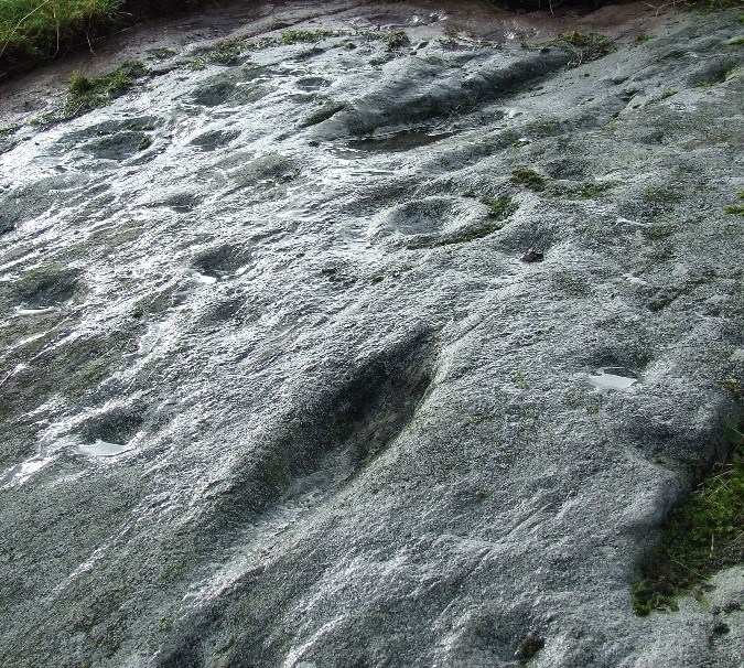
The cup and ring marked outcrop 15 yards SW is well turfed up and once the deluge started again I quit and slithered back down the hill to my car. I'll take my trowel the next dry day I am up there!
|

|
| |